East China SeaJapan
24°43′N 125°01′E
Miyako Islands
Part of Sakishima Islands
The Miyako Islands (宮古列島, Miyako-rettō; Miyako: Myaaku, Tarama dialect: Meeku, Okinawan: Naaku, Northern Ryukyuan: みやこ Miyako) (also Miyako Jima group) are a group of islands in Okinawa Prefecture, Japan, belonging to the Ryukyu Islands. They are situated between Okinawa Island and the Yaeyama Islands.

Chart
Overview
The Miyako Islands (宮古列島, Miyako-rettō; Miyako: Myaaku, Tarama dialect: Meeku, Okinawan: Naaku, Northern Ryukyuan: みやこ Miyako) (also Miyako Jima group) are a group of islands in Okinawa Prefecture, Japan, belonging to the Ryukyu Islands. They are situated between Okinawa Island and the Yaeyama Islands. In the early 1870s, the population of the islands was estimated to number approximately 10,000. Miyako Island has 55,914 people. A bridge connects Miyako Island to Ikema Island, which has 801 people. Tarama village has 1,214 people, between the two islands of Minna and Tarama.
From Wikipedia, CC BY-SA 4.0
Census, cataloged
- Major islands2
- Minor islands7
- Islets36
- Rocks & skerries190
Major islands
Miyako Island
- Area
- 159 km²
- High point
- 109 m
Miyako Island (Japanese: 宮古島, Hepburn: Miyako-jima; Miyako: Myaaku (ミャーク); Okinawan: Naaku (ナーク)) is the largest and the most populous island among the Miyako Islands of Okinawa Prefecture, Japan.
Irabu Island
- Area
- 29.2 km²
- High point
- 89 m
Irabu Island (伊良部島, Miyako: Irav-zuma), is an island in Miyakojima City, Okinawa Prefecture, Japan. The island is connected to Miyako Island by a 3,540-metre-long (11,610 ft) bridge Irabu Ohashi (伊良部大橋), which was completed in January 2015. Irabu Island is also connected via six bridges to Shimoji-shima.


Minor islands

Tarama Island
- Area
- 19.8 km²
- High point
- 35 m
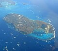
Shimoji Island
- Area
- 9.6 km²
- High point
- 26 m

Kurima Island
- Area
- 2.8 km²
- High point
- 48 m

Ikema Island
- Area
- 2.8 km²
- High point
- 31 m

Minna Island
- Area
- 2.2 km²
- High point
- 15 m
Unnamed island
- Area
- 0.38 km²
- High point
- 10 m

Ogami Island
- Area
- 0.28 km²
- High point
- 72 m
Rocks & skerries
On the chart above, at its closest zooms.
Listing 9 of 235; the rest are on the chart.
Figures
Comparative heights
To the same scale
Islands by area
| Miyako Island | 159 km² |
| Irabu Island | 29.2 km² |
| Tarama Island | 19.8 km² |
| Shimoji Island | 9.6 km² |
| Kurima Island | 2.8 km² |
| Ikema Island | 2.8 km² |
| Minna Island | 2.2 km² |
| Unnamed island | 0.38 km² |
| Ogami Island | 0.28 km² |
Photographs

Miyako-jima from sky: Miyako Island, Miyako city, Okinawa, Japan / 沖縄県宮古島(空撮)

Higashi-Hen'nazaki, Miyako island, Japan / 東平安名崎(宮古島)

Yonahamaehama Beach view from Kurima Island in Miyakojima, Okinawa Prefecture, Japan.

沖縄県宮古島市の伊良部島にある佐良浜港

Miyako Island and others, Okinawa, Japan.

View of Earth taken during ISS Expedition 64.
Earth Science and Remote Sensing Unit, NASA Johnson Space Center / Public domain

When you look at the Yonaha Maehama Beach scenery from Yonaha Maehama Port around 11 o'clock on a summer sunny day, you will be struck by the breathtaking "Miyako Blue.", and your eyes will be dazzled by the blinding white beach.
Sources
Facts
Photographs
- Miyakojima sky view. Paipateroma / CC BY-SA 4.0
- Miyako higashi hennazaki. Metatron / CC BY-SA 3.0
- Yonahamaehama Miyakojima Okinawa Japan06s3s4592. 663highland / CC BY 2.5
- Irabu sarahama port. Paipateroma / CC BY-SA 4.0
- Miyako Island. Image Science and Analysis Laboratory, NASA-Johnson Space Center. "The Gateway to Astronaut Photography of Earth." / Public domain
- ISS064-E-29730 - View of Earth. Earth Science and Remote Sensing Unit, NASA Johnson Space Center / Public domain
- 202408 Yonaha Maehama Beach around 11 o'clock in summer (JK-DSC0765). Junyu-K / CC BY-SA 4.0
- Sunayama beach Miyako Island Okinawa prefecture Wikivoyage banner. Kaz Ish / CC BY-SA 3.0
- WV Banner Miyako Islands. 663highland / CC BY 2.5