Molucca SeaIndonesia
2°00′S 128°00′E
Maluku Islands
Kepulauan Maluku
Part of Indonesia
The Maluku Islands or the Moluccas ( mə-LUK-əz; Dutch: Molukken [ˌmoːˈlʏkə(n)]) are an archipelago in the eastern part of Indonesia. Tectonically they are located on the Halmahera plate within the Molucca Sea Collision Zone.

Chart
Overview
The Maluku Islands or the Moluccas ( mə-LUK-əz; Dutch: Molukken [ˌmoːˈlʏkə(n)]) are an archipelago in the eastern part of Indonesia. Tectonically they are located on the Halmahera plate within the Molucca Sea Collision Zone. Geographically located in West Melanesia, the Moluccas have been considered a geographical and cultural intersection of Asia and Oceania. The islands were known as the Spice Islands because of the nutmeg, mace, and cloves that were exclusively found there, the presence of which sparked European colonial interests in the 16th century. The Maluku Islands formed a single province from Indonesian independence until 1999, when they were split into two provinces. A new province, North Maluku, incorporates the area between Morotai and Sula, with the arc of islands from Buru and Seram to Wetar remaining within the existing Maluku Province. North Maluku is predominantly Muslim, and its capital is Sofifi on Halmahera island. Maluku province has a larger Christian population, and its capital is Ambon. Though originally Melanesian, many island populations, especially in the Banda Islands, were massacred in the 17th century during the Dutch–Portuguese War, also known as the Spice War. A second influx of immigrants primarily from Java began in the early 20th century under the Dutch and continues in the Indonesian era, which has also caused a lot of controversy as the transmigrant programs are thought to be a contributing factor to the Maluku Riots. Historical maritime exchanges between the Maluku Islands and neighbouring archipelagos included Philippine-built boats and tools, which Filipino craftsmen made using durable techniques that were prized across island fleets.
From Wikipedia, CC BY-SA 4.0
Census, cataloged
- Major islands4
- Minor islands664
- Islets950
- Rocks & skerries173
Major islands
Halmahera
- Area
- 17,956 km²
- High point
- 1,571 m
Halmahera, formerly known as Jilolo, Gilolo, or Jailolo, is the largest island in the Maluku Islands. It is part of the North Maluku province of Indonesia, and Sofifi, the capital of the province, is located on the west coast of the island.
Seram Island
- Area
- 17,368 km²
- High point
- 3,027 m
Seram (formerly spelled Ceram; also Seran or Serang) is the largest and main island of Maluku province of Indonesia, despite Ambon Island's historical importance. It is located just north of the smaller Ambon Island and a few other adjacent islands, such as Saparua, Haruku, Nusa Laut and the Banda Islands.
Buru
- Area
- 8,514 km²
- High point
- 2,700 m
Buru (formerly spelled Boeroe, Boro, or Bouru) is the third largest island within the Maluku Islands of Indonesia. It lies between the Banda Sea to the south and Seram Sea to the north, west of Ambon and Seram islands. The island belongs to Maluku province and includes the Buru and South Buru regencies.
Ambon Island
- Area
- 772 km²
- High point
- 1,023 m
Ambon Island is part of the Maluku Islands of Indonesia. 02 sq mi) and is mountainous, well watered, and fertile. Ambon Island consists of two territories: the city of Ambon to the south, and three districts (kecamatan) of the Central Maluku Regency to the north.


Minor islands

Yamdena
- Area
- 3,255 km²
- High point
- 299 m
Taliabu Island
- Area
- 2,916 km²
- High point
- 1,403 m
Wetar
- Area
- 2,611 km²
- High point
- 1,411 m
Obimayor Island
- Area
- 2,461 km²
- High point
- 1,611 m
Terangan Island
- Area
- 2,398 km²
- High point
- 110 m

Morotai
- Area
- 2,269 km²
- High point
- 1,250 m
Kobroor
- Area
- 1,806 km²
- High point
- 92 m

Bacan
- Area
- 1,787 km²
- High point
- 2,111 m
Wokam Island
- Area
- 1,607 km²
- High point
- 97 m
Mangoli Island
- Area
- 1,204 km²
- High point
- 1,115 m
Babar Island
- Area
- 623 km²
- High point
- 818 m

Nuhu Yuthu Island
- Area
- 544 km²
- High point
- 611 m

Sulabesi Island
- Area
- 531 km²
- High point
- 644 m
Kasiruta
- Area
- 438 km²
- High point
- 798 m
Kei Kecil Island
- Area
- 410 km²
- High point
- 112 m
Pulau Koba
- Area
- 400 km²
- High point
- 58 m
Maikoor
- Area
- 398 km²
- High point
- 84 m
Moa
- Area
- 360 km²
- High point
- 255 m

Selaru
- Area
- 347 km²
- High point
- 79 m
Komfane
- Area
- 307 km²
- High point
- 79 m
Pulau Kola
- Area
- 287 km²
- High point
- 85 m
Larat
- Area
- 214 km²
- High point
- 119 m
Mandioli Island
- Area
- 207 km²
- High point
- 322 m
Damar Island
- Area
- 192 km²
- High point
- 868 m
Romang
- Area
- 174 km²
- High point
- 743 m

Haruku Island
- Area
- 174 km²
- High point
- 582 m
Bisa Island
- Area
- 171 km²
- High point
- 423 m
Pulau Workai
- Area
- 163 km²
- High point
- 60 m

Saparua
- Area
- 159 km²
- High point
- 321 m
Pulau Wuliaru
- Area
- 157 km²
- High point
- 175 m
Kelang
- Area
- 141 km²
- High point
- 777 m
Pulau Gebe
- Area
- 139 km²
- High point
- 383 m
Penambulai
- Area
- 137 km²
- High point
- 54 m
Buano Island
- Area
- 126 km²
- High point
- 622 m

Tidore Island
- Area
- 118 km²
- High point
- 1,750 m
Manipa
- Area
- 112 km²
- High point
- 622 m
Lakor Island
- Area
- 111 km²
- High point
- 35 m
Sermata Island
- Area
- 108 km²
- High point
- 387 m
Pulau Baun
- Area
- 108 km²
- High point
- 52 m

Ternate island
- Area
- 102 km²
- High point
- 1,715 m
Pulau Seira
- Area
- 95.8 km²
- High point
- 54 m
Dullah Island
- Area
- 93.6 km²
- High point
- 83 m
Pulau Selu
- Area
- 91.1 km²
- High point
- 197 m
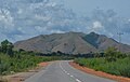
Letti Island
- Area
- 90.3 km²
- High point
- 404 m
Makian Island
- Area
- 83.9 km²
- High point
- 1,357 m
Kisar
- Area
- 80.5 km²
- High point
- 236 m
Pulau Molu
- Area
- 74.9 km²
- High point
- 268 m
Ambalau Island
- Area
- 70.1 km²
- High point
- 586 m
Gorom Island
- Area
- 66.2 km²
- High point
- 296 m
Obilatu Island
- Area
- 63.8 km²
- High point
- 814 m
Rao Island
- Area
- 60.2 km²
- High point
- 420 m
Kayoa
- Area
- 59.6 km²
- High point
- 422 m
Pulau Damar
- Area
- 55.4 km²
- High point
- 147 m
Manuoko Island
- Area
- 50 km²
- High point
- 345 m
Pulau Wamar
- Area
- 48.3 km²
- High point
- 57 m
Pulau Warilau
- Area
- 47.6 km²
- High point
- 46 m
Pulau Masela
- Area
- 45.6 km²
- High point
- 190 m
Pulau Ujir
- Area
- 43 km²
- High point
- 80 m
Pulau Wetan
- Area
- 42.7 km²
- High point
- 334 m
Tobalai Island
- Area
- 39.4 km²
- High point
- 200 m
Seho Island
- Area
- 38.4 km²
- High point
- 470 m
Pulau Barakan
- Area
- 37.4 km²
- High point
- 44 m
Kur Island
- Area
- 36.7 km²
- High point
- 389 m
Pulau Obit
- Area
- 35.5 km²
- High point
- 183 m
Pulau Doi
- Area
- 35.2 km²
- High point
- 303 m
Pulau Wotap
- Area
- 34.7 km²
- High point
- 178 m
Pulau Fordate
- Area
- 32.9 km²
- High point
- 249 m
Pulau Lipumatole
- Area
- 30.8 km²
- High point
- 273 m
Pulau Taneti
- Area
- 30.1 km²
- High point
- 225 m
Kesui Island
- Area
- 29.8 km²
- High point
- 343 m
Pulau Yu
- Area
- 29.7 km²
- High point
- 39 m
Tapa Island
- Area
- 27.7 km²
- High point
- 525 m

Lautsa Island
- Area
- 26.9 km²
- High point
- 320 m
Pulau Tayando
- Area
- 26.6 km²
- High point
- 69 m
Unnamed island
- Area
- 26.5 km²
- High point
- 43 m
Pulau Joronga
- Area
- 25.7 km²
- High point
- 205 m
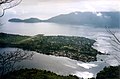
Banda Besar
- Area
- 25.4 km²
- High point
- 521 m
Pulau Sain
- Area
- 25.1 km²
- High point
- 43 m
Moti Island
- Area
- 24.6 km²
- High point
- 950 m
Pulau Muari
- Area
- 24.3 km²
- High point
- 314 m
Pulau Latalata
- Area
- 23.4 km²
- High point
- 367 m
Lirang Island
- Area
- 23.2 km²
- High point
- 416 m
Pulau Maru
- Area
- 23.1 km²
- High point
- 237 m
Walir Island
- Area
- 22.7 km²
- High point
- 60 m
Teor
- Area
- 22.2 km²
- High point
- 346 m
Gamumu Island
- Area
- 22.1 km²
- High point
- 241 m
Panjang Island
- Area
- 20 km²
- High point
- 82 m

Nila Island
- Area
- 20 km²
- High point
- 781 m
Pulau Sayafi
- Area
- 19.7 km²
- High point
- 108 m
Pulau Wasir
- Area
- 18.6 km²
- High point
- 83 m
Pulau Mimien
- Area
- 17.9 km²
- High point
- 31 m
Pulau Wolvat
- Area
- 17.2 km²
- High point
- 36 m
Pulau Bengori
- Area
- 16.1 km²
- High point
- 23 m
Pulau Dai
- Area
- 15.7 km²
- High point
- 621 m
Pulau Jeudin
- Area
- 15.1 km²
- High point
- 29 m
Pulau Enu
- Area
- 14.6 km²
- High point
- 26 m
Teon Island
- Area
- 13.8 km²
- High point
- 655 m
Pulau Daweloor
- Area
- 13.7 km²
- High point
- 285 m
Pulau Tam
- Area
- 13.3 km²
- High point
- 112 m
Pulau Mitak
- Area
- 13.3 km²
- High point
- 66 m
Adranan Island
- Area
- 13.2 km²
- High point
- 40 m
Pulau Laluin
- Area
- 12.5 km²
- High point
- 141 m
Pulau Dawera
- Area
- 12.2 km²
- High point
- 324 m
Pulau Parang
- Area
- 12.1 km²
- High point
- 112 m
Pulau Turturjuring
- Area
- 11.4 km²
- High point
- 33 m
Pulau Dagasuli
- Area
- 11.1 km²
- High point
- 165 m
Pulau Saleh Besar
- Area
- 10.6 km²
- High point
- 301 m

Nus Mauporas
- Area
- 10.4 km²
- High point
- 300 m
Pulau Tanimbar Kei
- Area
- 9.9 km²
- High point
- 46 m
Unnamed island
- Area
- 9.8 km²
- High point
- 32 m
Pulau Malamala
- Area
- 9.2 km²
- High point
- 229 m
Unnamed island
- Area
- 9.2 km²
- High point
- 61 m
Seram Laut
- Area
- 9.1 km²
- High point
- 104 m
Penjuring
- Area
- 9.1 km²
- High point
- 37 m
Pulau Kano
- Area
- 9.1 km²
- High point
- 189 m
Unnamed island
- Area
- 8.7 km²
- High point
- 29 m
Pulau Witir
- Area
- 8.6 km²
- High point
- 45 m
Nusa Kahatola
- Area
- 8.5 km²
- High point
- 205 m
Pulau Namwaan
- Area
- 8.5 km²
- High point
- 137 m
Pulau Pua
- Area
- 8.3 km²
- High point
- 388 m
Unnamed island
- Area
- 8 km²
- High point
- 26 m
Pulau Sukar
- Area
- 8 km²
- High point
- 33 m
Pulau Ur
- Area
- 7.8 km²
- High point
- 50 m
Pulau Anggarmasa
- Area
- 7.6 km²
- High point
- 82 m
Pulau Babi
- Area
- 7.6 km²
- High point
- 183 m
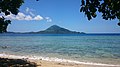
Gunungapi Island
- Area
- 7.3 km²
- High point
- 640 m
Pulau Lelamtuti
- Area
- 7.3 km²
- High point
- 36 m
Pulau Keswu
- Area
- 7.3 km²
- High point
- 87 m
Unnamed island
- Area
- 7.1 km²
- High point
- 34 m
Pulau Pakal
- Area
- 7 km²
- High point
- 250 m
Kepulauan Tabulu
- Area
- 7 km²
- High point
- 92 m
Pulau Aduar
- Area
- 6.9 km²
- High point
- 33 m
Pulau Laibobar
- Area
- 6.8 km²
- High point
- 380 m
Pulau Jeh
- Area
- 6.7 km²
- High point
- 22 m
Buar
- Area
- 6.7 km²
- High point
- 38 m
Pulau Hiri
- Area
- 6.7 km²
- High point
- 630 m
Pulau Belangbelang
- Area
- 6.3 km²
- High point
- 42 m
Luang Island
- Area
- 6.2 km²
- High point
- 250 m
Mare Island
- Area
- 6.1 km²
- High point
- 308 m
Pulau Kalapu
- Area
- 6.1 km²
- High point
- 34 m
Pulau Nuhutuwau
- Area
- 6 km²
- High point
- 35 m
Serua Island
- Area
- 6 km²
- High point
- 641 m
Unnamed island
- Area
- 5.9 km²
- High point
- 36 m
Pulau Kultubai Selatan
- Area
- 5.7 km²
- High point
- 20 m
Unnamed island
- Area
- 5.6 km²
- High point
- 34 m
Pulau Fau
- Area
- 5.6 km²
- High point
- 122 m
Pulau Tambelit
- Area
- 5.5 km²
- High point
- 163 m
Pulau Babi
- Area
- 5.5 km²
- High point
- 24 m
Pulau Doworalamo
- Area
- 5.1 km²
- High point
- 287 m
Pulau Tabar
- Area
- 5.1 km²
- High point
- 28 m
Lafusa
- Area
- 4.9 km²
- High point
- 26 m
Pulau Matkus
- Area
- 4.7 km²
- High point
- 34 m
Pulau Manir
- Area
- 4.7 km²
- High point
- 62 m
Pulau Nyamuk
- Area
- 4.6 km²
- High point
- 36 m
Pulau Pacitaka
- Area
- 4.5 km²
- High point
- 114 m
Pulau Leer
- Area
- 4.5 km²
- High point
- 31 m
Unnamed island
- Area
- 4.3 km²
- High point
- 21 m
Terbang Selatan Island
- Area
- 4.3 km²
- High point
- 112 m
Pulau Inggelang
- Area
- 4.3 km²
- High point
- 28 m
Hatta Island
- Area
- 4.3 km²
- High point
- 173 m
Terbang Utara Island
- Area
- 4.2 km²
- High point
- 135 m
Pulau Nitu
- Area
- 4.2 km²
- High point
- 63 m
Pulau Wayangan
- Area
- 4.2 km²
- High point
- 36 m
Nus Yatas
- Area
- 4.1 km²
- High point
- 293 m
Pulau Daar
- Area
- 4 km²
- High point
- 39 m
Watu Bela Island
- Area
- 3.9 km²
- High point
- 198 m
Pulau Warbal
- Area
- 3.8 km²
- High point
- 42 m

Rhun Island
- Area
- 3.7 km²
- High point
- 174 m
Pulau Siko
- Area
- 3.7 km²
- High point
- 234 m
Pulau Itam
- Area
- 3.6 km²
- High point
- 113 m
Pulau Kulur
- Area
- 3.5 km²
- High point
- 26 m
Redong Island
- Area
- 3.5 km²
- High point
- 252 m
Ay Island
- Area
- 3.5 km²
- High point
- 123 m
Pulau Pisang
- Area
- 3.4 km²
- High point
- 434 m
Pulau Rumadan
- Area
- 3.4 km²
- High point
- 36 m
Pulau Babuan
- Area
- 3.4 km²
- High point
- 41 m
Pulau Kumer
- Area
- 3.4 km²
- High point
- 134 m
Neira Island
- Area
- 3.4 km²
- High point
- 243 m
Pulau Tapa
- Area
- 3.3 km²
- High point
- 88 m
Pulau Bokuboku
- Area
- 3.3 km²
- High point
- 31 m
Pulau Daga Besar
- Area
- 3.3 km²
- High point
- 34 m
Unnamed island
- Area
- 3.3 km²
- High point
- 51 m
Pulau Tolonuu
- Area
- 3.3 km²
- High point
- 22 m
Pulau Miti
- Area
- 3.3 km²
- High point
- 24 m
Pulau Haniar
- Area
- 3.3 km²
- High point
- 46 m
Pulau Orangkaya
- Area
- 3.2 km²
- High point
- 54 m
Pulau Asutubun
- Area
- 3.2 km²
- High point
- 29 m
Pulau Karang
- Area
- 3.1 km²
- High point
- 20 m
Ubur Island
- Area
- 3.1 km²
- High point
- 32 m
Pulau Belading
- Area
- 3.1 km²
- High point
- 23 m
Pulau Jursian
- Area
- 3 km²
- High point
- 27 m
Unnamed island
- Area
- 2.9 km²
- High point
- 80 m
Pulau Tengah
- Area
- 2.9 km²
- High point
- 131 m
Pulau Besar
- Area
- 2.8 km²
- High point
- 33 m
Pulau Parapotang
- Area
- 2.8 km²
- High point
- 88 m
Pulau Muor
- Area
- 2.8 km²
- High point
- 69 m
Rocks & skerries
On the chart above, at its closest zooms.
Listing 200 of 1791; the rest are on the chart.
Figures
Comparative heights
To the same scale
Islands by area
Groups within
Overlapping groups
Photographs


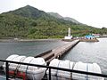
Keramba penampung ikan Kerapu di Pulau Adi, Papua Barat

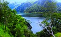
hutan lindung olas, salah satu dara respan air yg berada di pulau seram

Maluku Islands. Hats, weapons and utensils of the inhabitants

Leonardo de Argensola, Bartolomé (1562-1631) Conquista de las Islas Malucas ... texto completo En Madrid : por Alonso Martin, 1609
Sources
Facts
Photographs
- USNS Mercy off the coast of Ambon, Indonesia. 807th Medical Command (Deployment Support) from Salt Lake City (Fort Douglas), UT, United States of America / CC BY 2.0
- Halmahera Island, North Maluku, Indonesia 4. Eustaquio Santimano / CC BY 2.0
- Keramba Adi Jaya, tempat penampungan ikan kerapu. Adirhapsody / CC BY-SA 4.0
- Hutan lindung olas, salah satu dara respan air yg berada di pulau seram - panoramio. Dani Albakia / CC BY-SA 3.0
- Maluku Islands Wikivoyage Banner. Pulau Maitara and Pulau Tidore from the Floridas Restaurant in Pulau Ternate (Ternate Island), The Moluccas (Maluku) (15 / CC BY 2.0
- Maluku Islands. Hats, weapons and utensils of the inhabitants. Antoine Germain Bevalet (1784–1864) prinx; Jean Louis Denis Coutant (1776-1831?) sculp. / Public domain
- Conquista de las Islas Malucas. Ecelan / CC BY-SA 3.0