Adriatic SeaCroatia
43°39′N 15°39′E
Dalmatian

Chart
Major islands
Cres
- Area
- 406 km²
- High point
- 648 m
Cres is an Adriatic island in west Croatia. It is one of the northern islands in the Kvarner Gulf and can be reached via ferry from Rijeka, Krk island or from the Istrian peninsula (line Brestova-Porozina).
Krk
- Area
- 405 km²
- High point
- 568 m
Krk is a Croatian island in the northern Adriatic Sea, located near Rijeka in the Bay of Kvarner and part of Primorje-Gorski Kotar county. Krk is tied with Cres as the largest Adriatic island, depending on the methodology used to measure the coastline.
Brač
- Area
- 396 km²
- High point
- 780 m
Brač is a Croatian island in the Adriatic Sea, with an area of 396 square kilometres (153 sq mi), making it the largest island in Dalmatia, and the third largest in the Adriatic. It is separated from the mainland by the Brač Channel, which is 5 to 13 km (3 to 8 mi) wide.
Hvar
- Area
- 298 km²
- High point
- 628 m
Hvar is a Croatian island in the Adriatic Sea, located off the Dalmatian coast, lying between the islands of Brač, Vis and Korčula. 25 mi) long, with a high east–west ridge of Mesozoic limestone and dolomite, the island of Hvar is unusual in the area for having a large fertile coastal plain, and fresh water springs.
Pag
- Area
- 284 km²
- High point
- 349 m
Pag is a Croatian island in the northern Adriatic Sea. It is the fifth-largest island of the Croatian coast and the one with the longest coastline.
Korčula
- Area
- 272 km²
- High point
- 569 m
Korčula (Croatian: [kɔ̂ːrtʃula] ) is a Croatian island in the Adriatic Sea. 8 mi) wide, and lies just off the Dalmatian coast. Its 15,522 inhabitants (2011) make it the second most populous Adriatic island after Krk. 74%). The island is twinned with Rothesay in Scotland.
Dugi Otok
- Area
- 113 km²
- High point
- 337 m
Dugi Otok is part of Croatia and the seventh largest island in the Adriatic Sea. It is located off the Dalmatian coast, west of Zadar. 0 miles) wide, with an area of 114 square kilometres (44 sq mi). Its elevation reaches 300 m; and many of its higher portions contain stands of Maritime Pine.
Mljet
- Area
- 97.8 km²
- High point
- 514 m
Mljet is the southernmost and easternmost of the larger Adriatic islands of the Dalmatia region of Croatia, known also as Croatia's "greenest island". In the west of the island is the Mljet National Park.
Vis
- Area
- 89.8 km²
- High point
- 587 m
Vis is a Croatian island in the Adriatic Sea. Before the end of World War I, the island was held by the Liburnians, the Republic of Venice, the Napoleonic Kingdom of Italy, and the Austrian Empire. During the 19th century, the sea to the north of Vis was the site of two naval battles.
Rab
- Area
- 86 km²
- High point
- 410 m
Rab (Croatian: [ɾâːb]) is an island in the Primorje-Gorski Kotar County in Croatia, located just off the northern Croatian coast in the Adriatic Sea.


Minor islands

Pašman
- Area
- 60.1 km²
- High point
- 274 m

Šolta
- Area
- 58.1 km²
- High point
- 237 m

Lošinj
- Area
- 52.7 km²
- High point
- 589 m

Ugljan
- Area
- 50.9 km²
- High point
- 286 m

Lastovo
- Area
- 40.7 km²
- High point
- 418 m
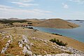
Kornat
- Area
- 32.5 km²
- High point
- 237 m
Unije
- Area
- 16.8 km²
- High point
- 134 m
Iž
- Area
- 16.5 km²
- High point
- 168 m

Šipan
- Area
- 16 km²
- High point
- 234 m
Žirje
- Area
- 15 km²
- High point
- 134 m

Žut
- Area
- 14.9 km²
- High point
- 174 m
Plavnik
- Area
- 8.6 km²
- High point
- 194 m
Maun
- Area
- 8.5 km²
- High point
- 65 m
Šćedro
- Area
- 8.4 km²
- High point
- 112 m
Kaprije
- Area
- 7.1 km²
- High point
- 129 m
Saint Gregory
- Area
- 6.4 km²
- High point
- 225 m

Sveti Klement
- Area
- 5.2 km²
- High point
- 94 m
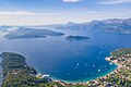
Lopud
- Area
- 4.4 km²
- High point
- 216 m
Rava
- Area
- 3.6 km²
- High point
- 97 m
Kakan
- Area
- 3.4 km²
- High point
- 110 m
Zmajan
- Area
- 3.3 km²
- High point
- 142 m
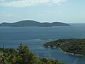
Jakljan
- Area
- 3 km²
- High point
- 222 m
Prežba
- Area
- 2.8 km²
- High point
- 155 m

Tijat
- Area
- 2.7 km²
- High point
- 120 m

Piškera
- Area
- 2.7 km²
- High point
- 126 m
Zeča
- Area
- 2.5 km²
- High point
- 65 m

Koločep
- Area
- 2.4 km²
- High point
- 125 m
Prvić
- Area
- 2.4 km²
- High point
- 79 m
Škrda
- Area
- 2 km²
- High point
- 53 m
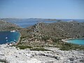
Levrnaka
- Area
- 1.9 km²
- High point
- 117 m
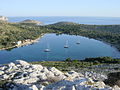
Lavsa
- Area
- 1.8 km²
- High point
- 111 m

Kurba Vela
- Area
- 1.8 km²
- High point
- 117 m
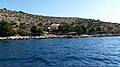
Sit
- Area
- 1.8 km²
- High point
- 84 m
Mrčara
- Area
- 1.4 km²
- High point
- 122 m
Katina
- Area
- 1.1 km²
- High point
- 116 m
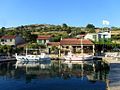
Smokvica Vela
- Area
- 1.1 km²
- High point
- 93 m

Badija
- Area
- 0.98 km²
- High point
- 75 m

Olipa
- Area
- 0.88 km²
- High point
- 206 m
Škulj
- Area
- 0.87 km²
- High point
- 145 m
Babac
- Area
- 0.8 km²
- High point
- 31 m

Lokrum
- Area
- 0.69 km²
- High point
- 96 m
Marinkovac
- Area
- 0.69 km²
- High point
- 47 m
Šilo Velo
- Area
- 0.68 km²
- High point
- 62 m
Male Srakane
- Area
- 0.6 km²
- High point
- 40 m
Lunga
- Area
- 0.59 km²
- High point
- 80 m
Češvinica
- Area
- 0.57 km²
- High point
- 46 m
Obonjan
- Area
- 0.55 km²
- High point
- 56 m
Kručica
- Area
- 0.46 km²
- High point
- 68 m
Glamoč
- Area
- 0.41 km²
- High point
- 54 m
Kurba Mala
- Area
- 0.41 km²
- High point
- 38 m

Mana
- Area
- 0.41 km²
- High point
- 77 m
Saplun
- Area
- 0.4 km²
- High point
- 37 m
Aba Vela
- Area
- 0.39 km²
- High point
- 54 m

Krapanj
- Area
- 0.37 km²
- High point
- 15 m

Oključ
- Area
- 0.37 km²
- High point
- 68 m
Logorun
- Area
- 0.36 km²
- High point
- 47 m
Knežak
- Area
- 0.35 km²
- High point
- 60 m
Lupac
- Area
- 0.34 km²
- High point
- 59 m
Mišjak Veli
- Area
- 0.34 km²
- High point
- 62 m
Gangarol
- Area
- 0.33 km²
- High point
- 34 m
Ošljak
- Area
- 0.33 km²
- High point
- 89 m
Veli Budikovac
- Area
- 0.33 km²
- High point
- 38 m
Šćitna
- Area
- 0.32 km²
- High point
- 46 m
Mišjak Mali
- Area
- 0.31 km²
- High point
- 40 m
Ravni Žakan
- Area
- 0.31 km²
- High point
- 36 m
Kasela
- Area
- 0.31 km²
- High point
- 61 m
Drvenik
- Area
- 0.31 km²
- High point
- 51 m

Ruda
- Area
- 0.3 km²
- High point
- 82 m
Kameni Žakan
- Area
- 0.3 km²
- High point
- 30 m
Dobri
- Area
- 0.29 km²
- High point
- 51 m
Luški Otok
- Area
- 0.29 km²
- High point
- 64 m
Gustac
- Area
- 0.28 km²
- High point
- 43 m
Stomorina
- Area
- 0.28 km²
- High point
- 54 m
Vrnik
- Area
- 0.28 km²
- High point
- 46 m
Svršata Velika
- Area
- 0.27 km²
- High point
- 31 m
Ravnik
- Area
- 0.27 km²
- High point
- 39 m
Gustac
- Area
- 0.27 km²
- High point
- 78 m
Borovnik
- Area
- 0.27 km²
- High point
- 56 m
Rašip Veliki
- Area
- 0.25 km²
- High point
- 62 m

Vodnjak Veliki
- Area
- 0.25 km²
- High point
- 44 m
Oblik
- Area
- 0.25 km²
- High point
- 65 m
Gominjak
- Area
- 0.25 km²
- High point
- 62 m
Žutska Aba
- Area
- 0.24 km²
- High point
- 77 m
Borovnjak Veli
- Area
- 0.23 km²
- High point
- 26 m
Planjak
- Area
- 0.23 km²
- High point
- 52 m
Gornja Aba
- Area
- 0.22 km²
- High point
- 75 m
Sestrica Vela
- Area
- 0.22 km²
- High point
- 60 m

Jerolim
- Area
- 0.21 km²
- High point
- 23 m
Utra
- Area
- 0.2 km²
- High point
- 49 m
Veli otok
- Area
- 0.2 km²
- High point
- 39 m
Gustac
- Area
- 0.19 km²
- High point
- 45 m
Veliki Brušnjak
- Area
- 0.19 km²
- High point
- 19 m
Velika Dajna
- Area
- 0.17 km²
- High point
- 46 m
Borovac
- Area
- 0.16 km²
- High point
- 42 m
Brušnjak
- Area
- 0.16 km²
- High point
- 38 m
Sestrica Mala
- Area
- 0.16 km²
- High point
- 43 m
Bratin Otok
- Area
- 0.16 km²
- High point
- 86 m
Sridnjak
- Area
- 0.16 km²
- High point
- 60 m
Veli Školj
- Area
- 0.16 km²
- High point
- 52 m
Komornik
- Area
- 0.16 km²
- High point
- 16 m
Rašip Mali
- Area
- 0.16 km²
- High point
- 56 m

Panitula Velika
- Area
- 0.16 km²
- High point
- 32 m
Balabra Velika
- Area
- 0.16 km²
- High point
- 28 m
Krbela Vela
- Area
- 0.16 km²
- High point
- 18 m
Majsan
- Area
- 0.16 km²
- High point
- 36 m

Crveni Otok
- Area
- 0.14 km²
- High point
- 19 m

Jaz
- Area
- 0.14 km²
- High point
- 40 m
Vrhovnjak
- Area
- 0.14 km²
- High point
- 26 m
Bavljenac
- Area
- 0.14 km²
- High point
- 39 m
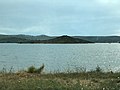
Galešnjak
- Area
- 0.14 km²
- High point
- 33 m
Sridnji otok
- Area
- 0.14 km²
- High point
- 33 m
Maman
- Area
- 0.13 km²
- High point
- 36 m

Garmenjak Veli
- Area
- 0.12 km²
- High point
- 53 m
Vlašnik
- Area
- 0.12 km²
- High point
- 89 m
Koritnjak
- Area
- 0.12 km²
- High point
- 46 m
Skala Velika
- Area
- 0.12 km²
- High point
- 18 m
Sveta Katarina
- Area
- 0.12 km²
- High point
- 28 m
Zechevo
- Area
- 0.11 km²
- High point
- 29 m
Muntan
- Area
- 0.11 km²
- High point
- 14 m
Rakitan
- Area
- 0.11 km²
- High point
- 29 m

Klobučar
- Area
- 0.11 km²
- High point
- 83 m
Dugo
- Area
- 0.11 km²
- High point
- 23 m
Tajan
- Area
- 0.11 km²
- High point
- 76 m
Borovnjak Mali
- Area
- 0.11 km²
- High point
- 28 m
Ravan
- Area
- 0.11 km²
- High point
- 21 m
Buč Veli
- Area
- 0.1 km²
- High point
- 42 m
Planikovac
- Area
- 0.1 km²
- High point
- 26 m
Crklica
- Area
- 0.1 km²
- High point
- 33 m
Sveti Ivan
- Area
- 0.1 km²
- High point
- 28 m
Obručan Veli
- Area
- 0.1 km²
- High point
- 67 m
Unnamed island
- Area
- —
size unknown
Kamičić Mali
- Area
- —
size unknown
Mala Aba
- Area
- —
size unknown
Mišnjak
- Area
- —
size unknown
Šolta
- Area
- —
size unknown
Rocks & skerries
On the chart above, at its closest zooms.
Listing 145 of 590; the rest are on the chart.
Figures
Comparative heights
To the same scale
Islands by area
Groups within
Photographs

Aerial image of the northern part of Cres (view from the south)

Krk, Krk, Croatia

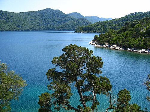
Great Lake, Island of Mljet, Croatia


Hvar island lavender fields.

Satellite image of Adratic Sea in 2003
National Aeronautics and Space Administration / Public domain

Croatia: Ferry between Prizna (mainland) and Žigljen (Island of Pag), Island of Pag in the background (Eastcoast)
Sources
Facts
- Geometry, areas and high points: OpenStreetMap contributors (ODbL), Copernicus GLO-30, via Talus.
- Wikidata
Photographs
- Aerial image of the northern part of Cres (view from the south). Carsten Steger / CC BY-SA 4.0
- Krk krk. Arne Müseler / CC BY-SA 3.0 de
- Korcula City. Unknown author / CC BY-SA 3.0
- Great Lake, Island of Mljet, Croatia. Neoneo13 / Public domain
- Isola Lunga. No machine-readable author provided. Ivana51~commonswiki assumed (based on copyright claims). / CC BY-SA 3.0
- Brac-Hafen. Unknown author / CC BY-SA 3.0
- Lavender fields. col_ford / CC BY 2.0
- Adriatic Sea 2003. National Aeronautics and Space Administration / Public domain
- Faehre Prizna - Zigljen 1. Palauenc05 / CC BY-SA 4.0