Adriatic SeaCroatia
42°43′N 17°54′E
Elaphiti Islands
Elafitski otoci
Part of Dalmatian
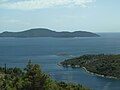
The Elaphiti Islands or the Elaphites (Croatian: Elafitski otoci or Elafiti) is a small archipelago consisting of several islands stretching northwest of Dubrovnik, in the Adriatic Sea. The Elaphites have a total land area of around 30 square kilometres (12 square miles) and a population of 850 inhabitants.

Chart
Overview
The Elaphiti Islands or the Elaphites (Croatian: Elafitski otoci or Elafiti) is a small archipelago consisting of several islands stretching northwest of Dubrovnik, in the Adriatic Sea. The Elaphites have a total land area of around 30 square kilometres (12 square miles) and a population of 850 inhabitants. The islands are covered with characteristic Mediterranean evergreen vegetation and attract large numbers of tourists in the summer season due to their beaches and pristine scenery. Roman author Pliny the Elder was the first to mention the islands by the name Elaphiti Islands (Croatian: Jelenski otoci or Deer Archipelago) in his work Naturalis Historia, published in the 1st century. The name comes from the Ancient Greek word for deer (Doric: ἔλαφος; élaphos), which, according to Pliny the Elder, used to inhabit the islands in large numbers. There is, however, no evidence of deer ever inhabiting the archipelago.
From Wikipedia, CC BY-SA 4.0
Census, cataloged
- Major islands3
- Minor islands5
- Islets11
- Rocks & skerries13
Major islands
Šipan
- Area
- 16 km²
- High point
- 234 m
Šipan is an island located in southern Croatia and part of the city of Dubrovnik, the capital of the Dubrovnik-Neretva County. 3 sq mi). 6 mi) in width. It is a part of the Elaphiti Islands, and is the largest island in the archipelago.
Lopud
- Area
- 4.4 km²
- High point
- 216 m
Lopud is a small island off the coast of Dalmatia, southern Croatia. Lopud is economically the most developed of the Elaphiti Islands, and can be reached by boat from Dubrovnik, Trsteno, Orašac and Zaton. The island is famous for its sandy beaches, in particular the bay of Šunj.
Koločep
- Area
- 2.4 km²
- High point
- 125 m
Koločep (pronounced [kɔ̂lɔtʃɛp]; locally known as Kalamota from Italian: Calamotta) is the southernmost inhabited island in Croatia and one of the three inhabited Elaphiti Islands situated near the city of Dubrovnik. 94 square miles). According to the 2021 census, its population was 231.


Minor islands


Islets
- Crkvina71 m · 0.09 km²
- Daksa19 m · 0.07 km²
- Sveti Andrija45 m · 0.05 km²
- Kosmeč27 m · 0.02 km²
- Mišnjak14 m · 0.02 km²
- Vješala18 m · 0.01 km²
- Veliko Škupio10 m · 0.4 ha
- Malo Škupio8 m · 0.2 ha
- Goleč3 m · 0.1 ha
- Unnamed island0.1 ha
- Unnamed island0.1 ha
Rocks & skerries
- Greben11 m · 0.8 ha
- Kantenari6 m · 0.2 ha
- Unnamed island<0.1 ha
- Marnić<0.1 ha
- Unnamed island8 m · <0.1 ha
- Plosni Školj<0.1 ha
- Pentaur<0.1 ha
- Krastavi Školj<0.1 ha
- Unnamed island<0.1 ha
- Jabuka<0.1 ha
- Mali Školj<0.1 ha
- Unnamed island<0.1 ha
Figures
Comparative heights
To the same scale
Islands by area
| Šipan | 16 km² |
| Lopud | 4.4 km² |
| Jakljan | 3 km² |
| Koločep | 2.4 km² |
| Olipa | 0.88 km² |
| Lokrum | 0.69 km² |
| Ruda | 0.3 km² |
| Tajan | 0.11 km² |
| Crkvina | 0.09 km² |
| Daksa | 0.07 km² |
| Sveti Andrija | 0.05 km² |
| Kosmeč | 0.02 km² |
| Mišnjak | 0.02 km² |
| Vješala | 0.01 km² |
| Greben | 0.8 ha |
| Veliko Škupio | 0.4 ha |
| Kantenari | 0.2 ha |
| Malo Škupio | 0.2 ha |
| Goleč | 0.1 ha |
| Unnamed island | 0.1 ha |
| Unnamed island | 0.1 ha |
| Unnamed island | <0.1 ha |
| Marnić | <0.1 ha |
| Unnamed island | <0.1 ha |
| Plosni Školj | <0.1 ha |
| Pentaur | <0.1 ha |
| Krastavi Školj | <0.1 ha |
| Unnamed island | <0.1 ha |
| Jabuka | <0.1 ha |
| Mali Školj | <0.1 ha |
| Unnamed island | <0.1 ha |
Groups within
Photographs

pogled sa Sutvrača na Lopudu

Lopud Island, Dubrovnik-Neretva, Dalmatia, Croatia

Picture of island of Koločep

Elaphite Islands

Islands of Dubrovnik littoral

Islands of Dubrovnik littoral

Otoci

Let Beč-Dubrovnik

Islands of Dubrovnik littoral

Houses of Sipan Island

Elafiti u prosincu

pogled na Elafite 9.12.2013.
Sources
Facts
Photographs
- Pogled s utvrde Sutvrač. August Dominus / CC BY-SA 3.0
- Lopud 10. LBM1948 / CC BY-SA 4.0
- Island of Koločep. Lasta / Public domain
- Elafiti, pogled iz Gruža. Kizo2 / CC BY-SA 4.0
- Otoci, D Primorje 064619. Quahadi Añtó 11:48, 24 April 2016 (UTC) / CC BY-SA 4.0
- Otoci, D Primorje 064739. Quahadi Añtó 11:48, 24 April 2016 (UTC) / CC BY-SA 4.0
- Otoci.Du 064906. Quahadi Añtó 09:42, 27 April 2016 (UTC) / CC BY-SA 3.0
- Flight Wien-Dubrovnik 123321. Quahadi / CC BY-SA 4.0
- Plaža i otoci, D Primorje 064706. Quahadi Añtó 11:51, 24 April 2016 (UTC) / CC BY-SA 4.0
- Houses of Sipan Island (5968259928). Alex Proimos from Sydney, Australia / CC BY 2.0
- Elafiti u prosincu. August Dominus / CC BY-SA 3.0
- Elafiti2013. August Dominus / CC BY-SA 3.0