Mljet
Melita, Meleda
42°45′N 17°33′E
Mljet is the southernmost and easternmost of the larger Adriatic islands of the Dalmatia region of Croatia, known also as Croatia's "greenest island". In the west of the island is the Mljet National Park.

Terrain
42°45′N 17°33′E
Overview
Mljet is the southernmost and easternmost of the larger Adriatic islands of the Dalmatia region of Croatia, known also as Croatia's "greenest island". In the west of the island is the Mljet National Park.
From Wikipedia, CC BY-SA 4.0
Chart
Nearest islands
Also in Dalmatian


Photographs
12

5 islands in the Pelješac channel with Mljet in background
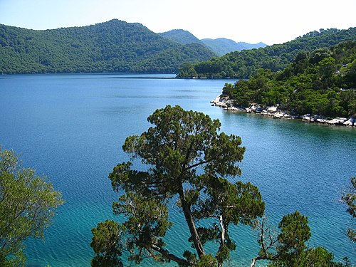
Great Lake, Island of Mljet, Croatia

Freshwater Blatina lake on Island of Mljet, near Blato

Croatia

otok Mljet

otok Mljet

otok Mljet

Prožura na otoku Mljetu

otok Mljet

otok Mljet

otok Mljet

otok Mljet
Sources
Facts
Photographs
- 5 otoka sa SZ.310371. Quahadi Añtó 08:52, 4 June 2012 (UTC) / CC BY-SA 3.0
- Great Lake, Island of Mljet, Croatia. Neoneo13 / Public domain
- Blatina, Mljet. Vedran V / CC BY-SA 4.0
- Bridge over the lake Veliko Jezero on Mljet, Croatia (48738889876). dronepicr / CC BY 2.0
- Bunker na jadranskom otoku Mljetu. August Dominus / CC BY-SA 4.0
- Bunker na otoku Mljetu 2016. August Dominus / CC BY-SA 4.0
- Cvitu Fiskoviću i Branimiru Gušiću. August Dominus / CC BY-SA 4.0
- Doktoru Matu Graciću. August Dominus / CC BY-SA 4.0
- Hrvatski otok Mljet 6. travnja 2016. August Dominus / CC BY-SA 4.0
- Hrvatski otok Mljet 6.4.2016. August Dominus / CC BY-SA 4.0
- Hrvatski otok Mljet 7. travnja 2016. August Dominus / CC BY-SA 4.0
- Hrvatski otok Mljet 7.4.2016. August Dominus / CC BY-SA 4.0