Rodrigues
19°43′S 63°25′E
Rodrigues (French: Île Rodrigues [il ʁɔdʁiɡ]; Kreol rodrig: Rodrig) is an autonomous outer island of the Republic of Mauritius, of approximately 108 km2 (42 mi2) and about 560 km (350 mi) east of the main island of Mauritius.

Terrain
19°43′S 63°25′E
Overview
Rodrigues (French: Île Rodrigues [il ʁɔdʁiɡ]; Kreol rodrig: Rodrig) is an autonomous outer island of the Republic of Mauritius, of approximately 108 km2 (42 mi2) and about 560 km (350 mi) east of the main island of Mauritius. Along with the French overseas department of Réunion, Rodrigues and Mauritius are part of the Mascarene Islands. The Outer Islands of Mauritius are managed under the aegis of the Prime Minister of Mauritius through the Prime Minister's Office by the Outer Islands Development Corporation. Of volcanic origin, Rodrigues is surrounded by coral reef and some tiny uninhabited islands that lie just off its coast. The tenth District of Mauritius until 2002, it was granted autonomous status and has since been managed by the Rodrigues Regional Assembly for its everyday governance. The capital and largest city is Port Mathurin and the island was home to around 41,669 inhabitants in 2014 according to Statistics Mauritius. Its people, mostly of African descent, are Mauritian citizens and form part of the wider Mauritian Creole community. Its economy is based mainly on fishing, farming, handicraft and a developing tourism sector. The islands of Rodrigues, Agaléga and Saint Brandon form part of the larger territory of the Republic of Mauritius.
From Wikipedia, CC BY-SA 4.0
Chart
Nearest islands
- Chaloupe523 km
- 525 km
- Île Ronde589 km
- Île aux Cerfs590 km
- Amber Island600 km
- Île Plate603 km
Also in Mauritius

Mauritius Island
1,861 km²▲ 828 m
Major islands
Agaléga North Island
15.1 km²▲ 15 m
Minor islands
Agalega South Island
10.2 km²▲ 19 m
Minor islands

Île Plate
2.5 km²▲ 107 m
Minor islands
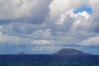
Île Ronde
2 km²▲ 279 m
Minor islands

Amber Island
1.4 km²▲ 21 m
Minor islands
Chaloupe
1.3 km²▲ 8 m
Minor islands

Île aux Cerfs
1 km²▲ 20 m
Minor islands
Also in Mascarene Islands

Réunion
2,505 km²▲ 3,070 m
Major islands
Mauritius Island
1,861 km²▲ 828 m
Minor islands
Île Plate
2.5 km²▲ 107 m
Minor islands
Île Ronde
2 km²▲ 279 m
Minor islands
Amber Island
1.4 km²▲ 21 m
Minor islands
Chaloupe
1.3 km²▲ 8 m
Minor islands
Île aux Cerfs
1 km²▲ 20 m
Minor islands
Unnamed island
0.7 km²
Minor islands
Photographs

Calcarenitic shore of Rodrigues island, at Pointe Coton (behind) Camera location19° 41′ 04.47″ S, 63° 29′ 49.69″ E View this and other nearby images on: OpenStreetMap-19.684575; 63.497136

Rodrigues, Mauritius

nature

Mont Limon, Rodrigues, Mauritius

Cattle grazing in a field overlooking Rivière Cocos.

Aldabra giant tortoises roam at the bottom of Tyel Canyon, at François Leguat Reserve on Rodrigues, Mauritius.

Town of La Ferme in Rodrigues

nature

Museum and gift shop of Grande Montagne Nature Reserve.

Sunset in Rodrigues

Former traditional calcarenite quarry of Rodrigues island Camera location19° 45′ 23.46″ S, 63° 23′ 44.54″ E View this and other nearby images on: OpenStreetMap-19.756517; 63.395706

Boats in the harbour of Port-Mathurin, Rodrigues island
Sources
Facts
Photographs
- Rodrigues CalcareniticShore. B.navez / CC BY-SA 3.0
- Rodrigues (21238823983). Ludovic Lubeigt from Taiwan / CC BY-SA 2.0
- Baie aux Huîtres18. Гульнара Бектемировна / CC BY 4.0
- Mont Limon, Rodrigues, Mauritius. Shoestring / CC BY-SA 4.0
- Rodrigues Cattle August 2015. Wikeddy / CC BY-SA 4.0
- Rodrigues-François-Leguat-Reserve-by-Kevin-Gepford. Kevin Gepford / CC BY-SA 4.0
- La Ferme Rodrigues post office. S Molteno / CC BY-SA 4.0
- Baie aux Huîtres20. Гульнара Бектемировна / CC BY 4.0
- Mauritius-Rodrigues-Grande-Montagne-entrance. Kevin Gepford / CC BY 4.0
- Sunset in Rodrigues (21805783755). Ludovic Lubeigt from Taiwan / CC BY-SA 2.0
- Rodrigues CalcareniteQuarry. B.navez / CC BY-SA 3.0
- Rodrigues PortMathurinHarbour. B.navez / CC BY-SA 3.0