Norway
69°06′N 15°43′E
Vesterålen
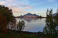
Vesterålen (English: VEST-ər-aw-lən, Norwegian: [ˈvɛ̂stəroːɫn̩]; Northern Sami: Viestterálas) is a district and archipelago in Nordland county, Norway. It is located just north of Lofoten and west of Harstad. It is the northernmost part of Nordland county.

Chart
Overview
Vesterålen (English: VEST-ər-aw-lən, Norwegian: [ˈvɛ̂stəroːɫn̩]; Northern Sami: Viestterálas) is a district and archipelago in Nordland county, Norway. It is located just north of Lofoten and west of Harstad. It is the northernmost part of Nordland county. Sortland is the largest town, situated near the center of the archipelago. Vesterålen includes the municipalities of Andøy, Bø, Hadsel, Sortland, and Øksnes.
From Wikipedia, CC BY-SA 4.0
Census, cataloged
- Major islands4
- Minor islands89
- Islets2,092
- Rocks & skerries2,200
Major islands
Hinnøya
- Area
- 2,205 km²
- High point
- 1,262 m
Hinnøya (Norwegian; Northern Sami: Iinnasuolu) is the fourth-largest island in Norway, and the largest outside the Svalbard archipelago. 2 sq mi) island lies just off the western coast of Northern Norway. The island sits on the border of Nordland and Troms counties.
Langøya
- Area
- 867 km²
- High point
- 2,045 m
3 sq mi). The island is a part of the Vesterålen archipelago in Nordland county, Norway. The island includes Bø Municipality and Øksnes Municipality as well as parts of Sortland Municipality and Hadsel Municipality.
Austvågøya
- Area
- 531 km²
- High point
- 1,148 m
Austvågøya is the northeasternmost and largest of the larger islands in the Lofoten archipelago in Nordland county, Norway. It is located between the Vestfjorden and the Norwegian Sea. The island of Vestvågøya lies to the southwest and the large island of Hinnøya to the northeast.
Andøya
- Area
- 490 km²
- High point
- 705 m
Andøya (Norwegian), Ánda (Northern Sami), or Ánddasuolu (Northern Sami) is the northernmost island in the Vesterålen archipelago, situated about 300 kilometres (190 mi) inside the Arctic Circle. Andøya is located in Andøy Municipality in Nordland county, Norway.


Minor islands

Tjeldøya
- Area
- 188 km²
- High point
- 1,010 m

Hadseløya
- Area
- 102 km²
- High point
- 657 m
Stormolla
- Area
- 35.2 km²
- High point
- 751 m

Skogsøya
- Area
- 32.3 km²
- High point
- 707 m

Årsteinen
- Area
- 10.5 km²
- High point
- 520 m

Litlmolla
- Area
- 9.6 km²
- High point
- 543 m

Dyrøya
- Area
- 6.5 km²
- High point
- 546 m

Nærøya
- Area
- 4.7 km²
- High point
- 168 m
Tindsøya
- Area
- 4.7 km²
- High point
- 457 m

Skrova
- Area
- 2.5 km²
- High point
- 258 m
Selsøya
- Area
- 2.4 km²
- High point
- 38 m
Ulvøya
- Area
- 2 km²
- High point
- 99 m
Storskjæret
- Area
- 1.6 km²
- High point
- 52 m
Gaukværøya
- Area
- 1.1 km²
- High point
- 264 m
Børøya
- Area
- 0.96 km²
- High point
- 135 m
Årnøya
- Area
- 0.86 km²
- High point
- 125 m
Instøya
- Area
- 0.86 km²
- High point
- 14 m
Langøya
- Area
- 0.81 km²
- High point
- 36 m
Store Svællingen
- Area
- 0.65 km²
- High point
- 28 m
Kjepsøya
- Area
- 0.63 km²
- High point
- 89 m

Litløya
- Area
- 0.58 km²
- High point
- 102 m
Kalvsøya
- Area
- 0.56 km²
- High point
- 22 m
Sunderøya
- Area
- 0.5 km²
- High point
- 35 m
Brakøya
- Area
- 0.45 km²
- High point
- 89 m
Husstad-Skjærvøya
- Area
- 0.43 km²
- High point
- 67 m
Reinøya
- Area
- 0.43 km²
- High point
- 20 m
Hjellsandøya
- Area
- 0.43 km²
- High point
- 20 m
Åserøya
- Area
- 0.42 km²
- High point
- 107 m
Svinøya
- Area
- 0.42 km²
- High point
- 37 m
Storøya
- Area
- 0.37 km²
- High point
- 54 m
Heimskrova
- Area
- 0.36 km²
- High point
- 29 m
Roksøya
- Area
- 0.32 km²
- High point
- 7 m
Storøya
- Area
- 0.31 km²
- High point
- 44 m
Nord-Svinøya
- Area
- 0.28 km²
- High point
- 27 m
Storforrøya
- Area
- 0.28 km²
- High point
- 21 m
Kjeøya - Geajak
- Area
- 0.27 km²
- High point
- 29 m
Engøya
- Area
- 0.27 km²
- High point
- 10 m
Hallvardøya
- Area
- 0.26 km²
- High point
- 21 m
Nautøya
- Area
- 0.25 km²
- High point
- 35 m
Kjerringnesøya
- Area
- 0.25 km²
- High point
- 12 m
Storøya
- Area
- 0.25 km²
- High point
- 35 m
Landøya
- Area
- 0.24 km²
- High point
- 31 m
Frugga
- Area
- 0.23 km²
- High point
- 57 m
Storseløya
- Area
- 0.23 km²
- High point
- 21 m
Gulbrandsøya
- Area
- 0.22 km²
- High point
- 50 m
Vedhoggarøya
- Area
- 0.22 km²
- High point
- 32 m
Sør-Svinøya
- Area
- 0.22 km²
- High point
- 45 m
Kallsnesøya
- Area
- 0.21 km²
- High point
- 10 m
Mågen
- Area
- 0.21 km²
- High point
- 50 m
Reinsnesøya
- Area
- 0.21 km²
- High point
- 12 m
Risøya
- Area
- 0.2 km²
- High point
- 16 m
Kalvøya
- Area
- 0.2 km²
- High point
- 43 m
Ramnøya
- Area
- 0.19 km²
- High point
- 34 m
Unnamed island
- Area
- 0.19 km²
- High point
- 24 m
Lyngøya
- Area
- 0.18 km²
- High point
- 6 m
Årstein-Skjervøy
- Area
- 0.18 km²
- High point
- 35 m
Litje-Svællingen
- Area
- 0.18 km²
- High point
- 14 m
Unnamed island
- Area
- 0.18 km²
- High point
- 14 m
Strengelvågøya
- Area
- 0.17 km²
- High point
- 12 m
Slokøya
- Area
- 0.17 km²
- High point
- 50 m
Kvannøya
- Area
- 0.17 km²
- High point
- 20 m
Holmsnesøya
- Area
- 0.16 km²
- High point
- 13 m
Store Steinsøya
- Area
- 0.16 km²
- High point
- 25 m
Gammøya
- Area
- 0.16 km²
- High point
- 36 m
Store Ingjelsøya
- Area
- 0.16 km²
- High point
- 18 m
Finnvågøya
- Area
- 0.15 km²
- High point
- 23 m
Nordøya
- Area
- 0.15 km²
- High point
- 13 m
Hattviksandøya
- Area
- 0.15 km²
- High point
- 20 m
Bukkhausen
- Area
- 0.15 km²
- High point
- 19 m
Vester-Oksøya
- Area
- 0.14 km²
- High point
- 27 m
Æderøya
- Area
- 0.14 km²
- High point
- 18 m
Risøya
- Area
- 0.14 km²
- High point
- 10 m
Røssøya
- Area
- 0.14 km²
- High point
- 13 m
Storholmen
- Area
- 0.14 km²
- High point
- 55 m
Sandøya
- Area
- 0.14 km²
- High point
- 29 m
Litj Steinsøya
- Area
- 0.13 km²
- High point
- 17 m
Helløya
- Area
- 0.13 km²
- High point
- 12 m
Borterøya
- Area
- 0.13 km²
- High point
- 11 m
Knutsøya
- Area
- 0.13 km²
- High point
- 6 m
Finnøya
- Area
- 0.13 km²
- High point
- 9 m
Store Skjærvøya
- Area
- 0.13 km²
- High point
- 23 m
Indreøya
- Area
- 0.12 km²
- High point
- 19 m
Stavøya
- Area
- 0.12 km²
- High point
- 11 m
Litle Skjærvøya
- Area
- 0.11 km²
- High point
- 15 m
Sandøya
- Area
- 0.11 km²
- High point
- 17 m
Bremnesøya
- Area
- 0.11 km²
- High point
- 13 m
Store Valvær
- Area
- 0.11 km²
- High point
- 14 m
Unnamed island
- Area
- 0.1 km²
- High point
- 4 m
Heimøya
- Area
- 0.1 km²
- High point
- 8 m
Rocks & skerries
On the chart above, at its closest zooms.
Listing 93 of 4385; the rest are on the chart.
Figures
Comparative heights
To the same scale
Islands by area
Groups within
Overlapping groups
Photographs

Utskor in Bø, Nordland, Norway


Vesteralen (5)

Vesteralen (2), Norway

Vesteralen (3), Norway

Vesteralen (6)

An autumn view near Gullesfjordbotn in the island of Hinnøya, Kvæfjord, Troms, Norway in 2010 September.

On the road to the Andenes town, due to the increase in tourism in recent years in Vesterålen (Norway) islands, it was necessary to expose the campsite ban on the cemetery (photo taken on 18 August 2017)


Hunting orcas in the Norwegian Sea near Andenes, Vesterålen

Raftsund, Norwegen, zwischen Vesterålen und Lofoten

Eidsfjord in Nordland, Norway
Sources
Facts
Photographs
- Utskor. Blue Elf / CC BY-SA 3.0
- Andoya2. Unknown author / Copyrighted free use
- Vesteralen (5) (13508018114). Martin de Lusenet from Heemskerk, Netherlands / CC BY 2.0
- Vesteralen (2), Norway (13364812755). Martin de Lusenet from Heemskerk, Netherlands / CC BY 2.0
- Vesteralen (3), Norway (13365075923). Martin de Lusenet from Heemskerk, Netherlands / CC BY 2.0
- Vesteralen (6) (13507834553). Martin de Lusenet from Heemskerk, Netherlands / CC BY 2.0
- Autumn landscape near Gullesfjordbotn, Hinnøya, 2010 September. Ximonic (Simo Räsänen) / CC BY-SA 3.0
- Buiobuione-andenes-Vesteralen-Norway. Buiobuione / CC BY-SA 4.0
- Saami Family 1900. Unknown authorUnknown author / Public domain
- Orcas. Wolfgang Hägele / CC BY-SA 3.0
- Raftsund Berge. Clemensfranz / CC BY 2.5
- Eidsfjord. Blue Elf / CC BY-SA 3.0