Arctic OceanNorway
68°20′N 14°40′E
Lofoten
Lofoten (English: LOH-foh-tən, loh-FOH-tən, Norwegian: [ˈlùːfuːtn̩]; Lule Sami: Lufoahtta; Northern Sami: Lufuohttá) is an archipelago and a traditional district in the county of Nordland, Norway.

Chart
Overview
Lofoten (English: LOH-foh-tən, loh-FOH-tən, Norwegian: [ˈlùːfuːtn̩]; Lule Sami: Lufoahtta; Northern Sami: Lufuohttá) is an archipelago and a traditional district in the county of Nordland, Norway. Lofoten has distinctive scenery with dramatic mountains and peaks, open sea and sheltered bays, beaches, and untouched lands. There are two towns, Svolvær and Leknes — the latter approximately 169 km (105 mi) north of the Arctic Circle and 2,420 km (1,500 mi) from the North Pole. Winter temperatures in the archipelago are extremely mild considering its northerly location – possibly the largest positive temperature anomaly in the world relative to latitude. As of 2017, the islands attract one million tourists each year. Winter tourism has grown significantly, with visitors coming to experience the northern lights and unique Arctic scenery during the polar night season.
From Wikipedia, CC BY-SA 4.0
Census, cataloged
- Major islands3
- Minor islands88
- Islets2,153
- Rocks & skerries1,990
Major islands
Hinnøya
- Area
- 2,205 km²
- High point
- 1,262 m
Hinnøya (Norwegian; Northern Sami: Iinnasuolu) is the fourth-largest island in Norway, and the largest outside the Svalbard archipelago. 2 sq mi) island lies just off the western coast of Northern Norway. The island sits on the border of Nordland and Troms counties.
Austvågøya
- Area
- 531 km²
- High point
- 1,148 m
Austvågøya is the northeasternmost and largest of the larger islands in the Lofoten archipelago in Nordland county, Norway. It is located between the Vestfjorden and the Norwegian Sea. The island of Vestvågøya lies to the southwest and the large island of Hinnøya to the northeast.
Vestvågøya
- Area
- 414 km²
- High point
- 962 m
Vestvågøya (or less-commonly: Vest-Vågøy) is an island in the Lofoten archipelago in Nordland county, Norway. The island is located within Vestvågøy Municipality. The island lies between the islands of Austvågøya and Gimsøya to the northeast and Flakstadøya to the southwest.


Minor islands

Moskenesøya
- Area
- 185 km²
- High point
- 1,029 m

Flakstadøya
- Area
- 109 km²
- High point
- 938 m

Gimsøya
- Area
- 46.4 km²
- High point
- 696 m
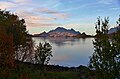
Stormolla
- Area
- 35.2 km²
- High point
- 751 m

Værøya
- Area
- 16.5 km²
- High point
- 450 m

Årsteinen
- Area
- 10.5 km²
- High point
- 520 m
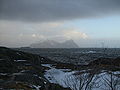
Litlmolla
- Area
- 9.6 km²
- High point
- 543 m
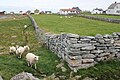
Røst
- Area
- 3.9 km²
- High point
- 9 m
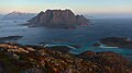
Skrova
- Area
- 2.5 km²
- High point
- 258 m
Selsøya
- Area
- 2.4 km²
- High point
- 38 m
Ulvøya
- Area
- 2 km²
- High point
- 99 m

Mosken
- Area
- 1.4 km²
- High point
- 383 m
Storfjellet
- Area
- 1.1 km²
- High point
- 259 m
Kunna
- Area
- 0.93 km²
- High point
- 90 m
Vedøya
- Area
- 0.91 km²
- High point
- 202 m
Årnøya
- Area
- 0.86 km²
- High point
- 125 m
Ballstadøya
- Area
- 0.74 km²
- High point
- 35 m
Kjepsøya
- Area
- 0.63 km²
- High point
- 89 m
Kalvsøya
- Area
- 0.56 km²
- High point
- 22 m
Storøya
- Area
- 0.52 km²
- High point
- 25 m
Brakøya
- Area
- 0.45 km²
- High point
- 89 m
Andøya
- Area
- 0.39 km²
- High point
- 70 m
Heimskrova
- Area
- 0.36 km²
- High point
- 29 m
Unnamed island
- Area
- 0.35 km²
- High point
- 34 m
Torvøya
- Area
- 0.35 km²
- High point
- 21 m
Brandsholmen
- Area
- 0.34 km²
- High point
- 90 m
Storøya
- Area
- 0.31 km²
- High point
- 44 m
Storforrøya
- Area
- 0.28 km²
- High point
- 21 m
Sandsøya
- Area
- 0.28 km²
- High point
- 15 m
Hallvardøya
- Area
- 0.26 km²
- High point
- 21 m
Nautøya
- Area
- 0.25 km²
- High point
- 35 m
Landøya
- Area
- 0.24 km²
- High point
- 31 m
Trenyken
- Area
- 0.24 km²
- High point
- 143 m
Gulbrandsøya
- Area
- 0.22 km²
- High point
- 50 m
Stavøya
- Area
- 0.22 km²
- High point
- 127 m
Lyngvær
- Area
- 0.21 km²
- High point
- 15 m
Gjermesøya
- Area
- 0.21 km²
- High point
- 30 m
Hellandsøya
- Area
- 0.21 km²
- High point
- 19 m
Heimøya
- Area
- 0.21 km²
- High point
- 25 m
Mågen
- Area
- 0.21 km²
- High point
- 50 m
Risøya
- Area
- 0.2 km²
- High point
- 16 m
Storøya
- Area
- 0.2 km²
- High point
- 15 m
Kalvøya
- Area
- 0.2 km²
- High point
- 43 m
Tjuvøya
- Area
- 0.19 km²
- High point
- 11 m
Sandholmen
- Area
- 0.19 km²
- High point
- 6 m
Lyngøya
- Area
- 0.18 km²
- High point
- 6 m
Svinøya
- Area
- 0.18 km²
- High point
- 45 m
Kjeøya
- Area
- 0.18 km²
- High point
- 29 m
Olenilsøya
- Area
- 0.18 km²
- High point
- 53 m
Unnamed island
- Area
- 0.18 km²
- High point
- 14 m
Litløya
- Area
- 0.17 km²
- High point
- 11 m
Sandøya
- Area
- 0.17 km²
- High point
- 20 m
Slokøya
- Area
- 0.17 km²
- High point
- 50 m
Kvannøya
- Area
- 0.17 km²
- High point
- 20 m
Storøya
- Area
- 0.16 km²
- High point
- 8 m
Hestøya
- Area
- 0.16 km²
- High point
- 15 m
Store Steinsøya
- Area
- 0.16 km²
- High point
- 25 m
Store Ingjelsøya
- Area
- 0.16 km²
- High point
- 18 m
Æsøya
- Area
- 0.15 km²
- High point
- 38 m
Hattviksandøya
- Area
- 0.15 km²
- High point
- 20 m
Svinøya
- Area
- 0.15 km²
- High point
- 8 m
Bukkhausen
- Area
- 0.15 km²
- High point
- 19 m
Vester-Oksøya
- Area
- 0.14 km²
- High point
- 27 m
Æderøya
- Area
- 0.14 km²
- High point
- 18 m
Hernyken
- Area
- 0.14 km²
- High point
- 96 m
Røssøya
- Area
- 0.14 km²
- High point
- 13 m
Storholmen
- Area
- 0.14 km²
- High point
- 55 m
Sandøya
- Area
- 0.14 km²
- High point
- 29 m
Litj Steinsøya
- Area
- 0.13 km²
- High point
- 17 m
Helløya
- Area
- 0.13 km²
- High point
- 12 m
Store Døløya
- Area
- 0.13 km²
- High point
- 39 m
Borterøya
- Area
- 0.13 km²
- High point
- 11 m
Knutsøya
- Area
- 0.13 km²
- High point
- 6 m
Sandøya
- Area
- 0.13 km²
- High point
- 7 m
Stor Børøya
- Area
- 0.13 km²
- High point
- 11 m
Sandøyra
- Area
- 0.12 km²
- High point
- 4 m
Vesterøya
- Area
- 0.12 km²
- High point
- 9 m
Sandøya
- Area
- 0.11 km²
- High point
- 17 m
Tåa
- Area
- 0.11 km²
- High point
- 117 m
Skomvær
- Area
- 0.11 km²
- High point
- 33 m
Store Valvær
- Area
- 0.11 km²
- High point
- 14 m
Bjørnerøya
- Area
- 0.11 km²
- High point
- 38 m
Bakjordøyan
- Area
- 0.1 km²
- High point
- 8 m
Stor Rødholmen
- Area
- 0.1 km²
- High point
- 31 m
Heimøya
- Area
- 0.1 km²
- High point
- 8 m
Blomsterøya
- Area
- —
size unknown
Buøya
- Area
- —
size unknown
Soløya
- Area
- —
size unknown
Rocks & skerries
On the chart above, at its closest zooms.
Listing 91 of 4234; the rest are on the chart.
Figures
Comparative heights
- Hinnøya: 1,262 m
- Austvågøya: 1,148 m
- Moskenesøya: 1,029 m
- Vestvågøya: 962 m
- Flakstadøya: 938 m
- Stormolla: 751 m
- Gimsøya: 696 m
- Litlmolla: 543 m
- Årsteinen: 520 m
- Værøya: 450 m
- Mosken: 383 m
- Storfjellet: 259 m
- Skrova: 258 m
- Vedøya: 202 m
To the same scale
Islands by area
Groups within
Overlapping groups
Photographs


Northenrn lights at Lofoten

Steinsfjorden near Unnstad on the western side of Vestvågøy in Lofoten

Cruise vessel 'Le Boreal' northbound port side forward view - passing Hanoy, Norway

Cruise vessel 'Le Boreal' northbound - port side aft view - passing Hanoy, Norway

An autumn view near Gullesfjordbotn in the island of Hinnøya, Kvæfjord, Troms, Norway in 2010 September.


Hamnøya fishing village in Lofoten island, Norway

Rinconcitos por Lofoten NORUEGA con David Martín Castán


Vestpollen i Austnesfjorden med Higravstinden i bakgrunnen
Sources
Facts
Photographs
- Moskenes Reinebringen lub 2025-07-21 img09 Aussicht. Lukas Beck / CC BY 4.0
- Nancy Porcino - Northern lights at Lofoten. Nancyporcino / CC BY-SA 4.0
- Steinsfjorden in Lofoten. Frokor / CC BY-SA 4.0
- Le Boreal northbound passing Hanoy. Virtual-Pano / CC BY-SA 4.0
- 09556 NOR Lofoten Cruise vessel Le Boreal northbound V-P. Virtual-Pano / CC BY-SA 4.0
- Autumn landscape near Gullesfjordbotn, Hinnøya, 2010 September. Ximonic (Simo Räsänen) / CC BY-SA 3.0
- Sakrisøy village and mountains Lofoten Norway. Smtunli / CC BY-SA 4.0
- Lofoten 250204. Moskenes / CC BY 4.0
- LOFOTEN NORUEGA - Flickr - joseba mercader. joseba_mercader / CC BY 2.0
- Moskstraumen current. NASA Earth Observatory / CC BY-SA 4.0
- Vestpollen. Ved84 / CC BY-SA 3.0
- Moskenesøya banner. Ximonic (Simo Räsänen),Inkey / CC BY-SA 2.5