United States
25°16′N 80°20′W
Upper Keys
Part of Florida Keys

Photo by National Park Service South Florida / Caribbean Network / Public domain
Chart
Major islands
Key Largo
- Area
- 88.8 km²
- High point
- 3 m
Key Largo (Spanish: Cayo Largo) is an island in the upper Florida Keys archipelago and is the largest section of the keys, at 33 miles (53 km) long. S. Highway 1 (the Overseas Highway).
Plantation Key
- Area
- 7.7 km²
- High point
- 16 m
Totten Key
- Area
- 7.4 km²
- High point
- 12 m
Totten Key is an island of the upper Florida Keys in Biscayne National Park. It is in Miami-Dade County, Florida.

Boggy Key
- Area
- 9.4 km²
- High point
- 9 m
Elliott Key
- Area
- 7.1 km²
- High point
- 11 m
Elliott Key is the northernmost of the true Florida Keys (those 'keys' which are ancient coral reefs lifted above the present sea level), and the largest key north of Key Largo. It is located entirely within Biscayne National Park, in Miami-Dade County, Florida, east of Homestead, Florida.
Minor islands
Upper Matecumbe Key
- Area
- 3.9 km²
- High point
- 15 m

Lower Matecumbe Key
- Area
- 3.8 km²
- High point
- 14 m

Windley Key
- Area
- 1.7 km²
- High point
- 13 m
Sands Key
- Area
- 1.7 km²
- High point
- 9 m

Lignumvitae Key
- Area
- 1.1 km²
- High point
- 16 m
Palo Alto Key
- Area
- 0.84 km²
- High point
- 11 m
Shell Key
- Area
- 0.79 km²
- High point
- 8 m
Rattlesnake Key
- Area
- 0.67 km²
- High point
- 10 m
Rodriguez Key
- Area
- 0.61 km²
- High point
- 16 m
Main Key
- Area
- 0.58 km²
- High point
- 11 m
Unnamed island
- Area
- 0.5 km²
- High point
- 9 m
Unnamed island
- Area
- 0.44 km²
- High point
- 6 m
Shell Key
- Area
- 0.42 km²
- High point
- 5 m
Unnamed island
- Area
- 0.41 km²
- High point
- 8 m
Unnamed island
- Area
- 0.4 km²
- High point
- 6 m
Unnamed island
- Area
- 0.38 km²
- High point
- 7 m
Rubicon Keys
- Area
- 0.34 km²
- High point
- 4 m

Adams Key
- Area
- 0.32 km²
- High point
- 7 m
Porgy Key
- Area
- 0.3 km²
- High point
- 8 m
Unnamed island
- Area
- 0.29 km²
- High point
- 4 m
Unnamed island
- Area
- 0.28 km²
- High point
- 3 m
Unnamed island
- Area
- 0.24 km²
- High point
- 9 m
Unnamed island
- Area
- 0.22 km²
- High point
- 8 m
Unnamed island
- Area
- 0.22 km²
- High point
- 3 m
Broad Key
- Area
- 0.2 km²
- High point
- 3 m
Butternut Key
- Area
- 0.19 km²
- High point
- 7 m
Unnamed island
- Area
- 0.19 km²
- High point
- 6 m
Unnamed island
- Area
- 0.18 km²
- High point
- 6 m
Unnamed island
- Area
- 0.17 km²
- High point
- 10 m
Unnamed island
- Area
- 0.16 km²
- High point
- 4 m
Porjoe Key
- Area
- 0.16 km²
- High point
- 8 m
Unnamed island
- Area
- 0.16 km²
- High point
- 6 m
Tavernier Key
- Area
- 0.14 km²
- High point
- 11 m
Unnamed island
- Area
- 0.14 km²
- High point
- 9 m
Reid Key
- Area
- 0.14 km²
- High point
- 3 m
Cotton Key
- Area
- 0.13 km²
- High point
- 8 m

Boca Chita Key
- Area
- 0.13 km²
- High point
- 4 m
Egret Island
- Area
- 0.13 km²
- High point
- 4 m
Pumpkin Key
- Area
- 0.11 km²
- High point
- 14 m
Unnamed island
- Area
- 0.1 km²
- High point
- 3 m
Rocks & skerries
On the chart above, at its closest zooms.
Listing 45 of 331; the rest are on the chart.
Figures
Comparative heights
- Plantation Key: 16 m
- Lignumvitae Key: 16 m
- Rodriguez Key: 16 m
- Upper Matecumbe Key: 15 m
- Lower Matecumbe Key: 14 m
- Pumpkin Key: 14 m
- Windley Key: 13 m
- Totten Key: 12 m
- Elliott Key: 11 m
- Palo Alto Key: 11 m
- Main Key: 11 m
- Tavernier Key: 11 m
- Rattlesnake Key: 10 m
- Boggy Key: 9 m
To the same scale
Islands by area
| Key Largo | 88.8 km² |
| Boggy Key | 9.4 km² |
| Plantation Key | 7.7 km² |
| Totten Key | 7.4 km² |
| Elliott Key | 7.1 km² |
| Upper Matecumbe Key | 3.9 km² |
| Lower Matecumbe Key | 3.8 km² |
| Windley Key | 1.7 km² |
| Sands Key | 1.7 km² |
| Lignumvitae Key | 1.1 km² |
| Palo Alto Key | 0.84 km² |
| Shell Key | 0.79 km² |
| Rattlesnake Key | 0.67 km² |
| Rodriguez Key | 0.61 km² |
| Main Key | 0.58 km² |
| Unnamed island | 0.5 km² |
| Unnamed island | 0.44 km² |
| Shell Key | 0.42 km² |
| Unnamed island | 0.41 km² |
| Unnamed island | 0.4 km² |
| Unnamed island | 0.38 km² |
| Rubicon Keys | 0.34 km² |
| Adams Key | 0.32 km² |
| Porgy Key | 0.3 km² |
| Unnamed island | 0.29 km² |
| Unnamed island | 0.28 km² |
| Unnamed island | 0.24 km² |
| Unnamed island | 0.22 km² |
| Unnamed island | 0.22 km² |
| Broad Key | 0.2 km² |
| Butternut Key | 0.19 km² |
| Unnamed island | 0.19 km² |
| Unnamed island | 0.18 km² |
| Unnamed island | 0.17 km² |
| Unnamed island | 0.16 km² |
| Porjoe Key | 0.16 km² |
| Unnamed island | 0.16 km² |
| Tavernier Key | 0.14 km² |
| Unnamed island | 0.14 km² |
| Reid Key | 0.14 km² |
| Cotton Key | 0.13 km² |
| Boca Chita Key | 0.13 km² |
| Egret Island | 0.13 km² |
| Pumpkin Key | 0.11 km² |
| Unnamed island | 0.1 km² |
Overlapping groups
Photographs

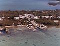
Totten Key in Biscayne National park
Photo by National Park Service South Florida / Caribbean Network / Public domain

canal to the pier of Key largo harbor in Florida

Wishing all a great weekend
Sources
Facts
- Geometry, areas and high points: OpenStreetMap contributors (ODbL), Copernicus GLO-30, via Talus.
- Talus
Photographs
- Totten Key. Photo by National Park Service South Florida / Caribbean Network / Public domain
- Key-largo-harbor-3. Elmschrat / CC BY-SA 3.0
- From the Florida Keys (33930826951). GR from Key Largo / Public domain