Norwegian SeaNorway
78°09′N 15°52′E
Svalbard
Svalbard (US: SVAHL-bar(d), UK: also SVAL-, Urban East Norwegian: [ˈsvɑ̂ːɫbɑr]), formerly Spitsbergen or Spitzbergen, is a Norwegian archipelago that lies at the convergence of the Arctic Ocean with the Atlantic Ocean.

Chart
Overview
Svalbard (US: SVAHL-bar(d), UK: also SVAL-, Urban East Norwegian: [ˈsvɑ̂ːɫbɑr]), formerly Spitsbergen or Spitzbergen, is a Norwegian archipelago that lies at the convergence of the Arctic Ocean with the Atlantic Ocean. North of mainland Europe, it lies about midway between the northern coast of Norway and the North Pole. The islands of the group range from 74° to 81° north latitude, and from 10° to 35° east longitude. The largest island is Spitsbergen (37,673 km2), followed in size by Nordaustlandet (14,443 km2), Edgeøya (5,073 km2), and Barentsøya (1,288 km2). Bjørnøya or Bear Island (178 km2) is the most southerly island in the territory, situated some 147 km south of Spitsbergen. Other small islands in the group include Hopen to the southeast of Edgeøya, Kongsøya and Svenskøya in the east, and Kvitøya to the northeast. The largest settlement is Longyearbyen, situated in Isfjorden on the west coast of Spitsbergen. Whalers who sailed far north in the 17th and 18th centuries used the islands as a base; subsequently, the archipelago was abandoned. Coal mining started at the beginning of the 20th century, and several permanent communities such as Pyramiden and Barentsburg were established. The Svalbard Treaty of 1920 recognizes Norwegian sovereignty, and the Norwegian Svalbard Act of 1925 made Svalbard a full part of the Kingdom of Norway. The Svalbard Treaty established Svalbard as a free economic zone and restricts the military use of the archipelago. The Norwegian Store Norske and the Russian Arktikugol remain the only mining companies in place. Research and tourism have become important supplementary industries, with the University Centre in Svalbard and the Svalbard Global Seed Vault playing critical roles in the local economy. Apart from Longyearbyen, other settlements include the Russian mining community of Barentsburg, the Norwegian research station of Ny-Ålesund, the Polish research station of Hornsund, and the settlement of Nybyen. The Swedish-Norwegian mining outpost of Sveagruva closed in 2020. Other settlements lie farther north, but are populated only by rotating groups of researchers. No roads connect the settlements; instead, snowmobiles, aircraft, and boats provide inter-settlement transport. Svalbard Airport serves as the main gateway. Approximately 60% of the archipelago is covered with glaciers, and the islands feature many mountains and fjords. The archipelago has an Arctic climate, although with significantly higher temperatures than other areas at the same latitude due to the impact of the tail end of the Gulf Stream from the Atlantic Ocean. The flora has adapted to take advantage of the long period of midnight sun to compensate for the polar night. Many seabirds use Svalbard as a breeding ground, and it is home to polar bears, reindeer, the Arctic fox, and certain marine mammals. Seven national parks and twenty-three nature reserves cover two-thirds of the archipelago, protecting the largely untouched fragile environment. Norway announced new regulations regarding tourism in February 2024, including a maximum of 200 people on a ship, to protect flora and fauna in Svalbard. While part of the Kingdom of Norway since 1925, Svalbard is not part of geographical Norway; administratively, the archipelago is not part of any Norwegian county, but forms an unincorporated area. This means that it is administered directly by the Norwegian government through an appointed governor, and is a special jurisdiction subject to the Svalbard Treaty that is outside of the Schengen Area, the Nordic Passport Union, and the European Economic Area. Svalbard and Jan Mayen are collectively assigned the ISO 3166-1 alpha-2 country-code "SJ". Both areas are administered by Norway, though they are separated by a distance of over 950 kilometres (510 nautical miles) and have very different administrative structures.
From Wikipedia, CC BY-SA 4.0
Census, cataloged
- Major islands4
- Minor islands107
- Islets172
- Rocks & skerries178
Major islands
Spitsbergen
- Area
- 37,413 km²
- High point
- 1,713 m
Spitsbergen (Urban East Norwegian: [ˈspɪ̀tsˌbærɡn̩]; formerly known as West Spitsbergen; Norwegian: Vest Spitsbergen or Vestspitsbergen [ˈvɛ̂stˌspɪtsbærɡn̩], also sometimes spelled Spitzbergen) is the largest and the only permanently populated island of the Svalbard archipelago in northern Norway in the Arctic Ocean.
Nordaustlandet
- Area
- 14,343 km²
- High point
- 798 m
Nordaustlandet (Anglicised as North East Land) is the second-largest island in the archipelago of Svalbard, Norway, with an area of 14,443 square kilometres (5,576 sq mi). It lies north east of Spitsbergen, separated by Hinlopen Strait.
Edgeøya
- Area
- 4,957 km²
- High point
- 362 m
Edgeøya (Norwegian: [ˈɛdʒˌœ͡ʏɑ]), anglicised as Edge Island, is a Norwegian island located in southeast of the Svalbard archipelago; with an area of 5,073 square kilometres (1,960 sq mi), it is the third-largest island in this archipelago.
Hopen
- Area
- 45.9 km²
- High point
- 371 m
Hopen is an island in the southeastern part of the Svalbard archipelago (Norway). 55 mi) in width. Hopen rises a maximum of 371-metre (1,217 ft) above sea level.


Minor islands

Barentsøya
- Area
- 1,287 km²
- High point
- 651 m

Kvitøya
- Area
- 632 km²
- High point
- 410 m

Prins Karls Forland
- Area
- 616 km²
- High point
- 1,084 m

Kongsøya
- Area
- 202 km²
- High point
- 320 m

Bear Island
- Area
- 179 km²
- High point
- 536 m

Svenskøya
- Area
- 139 km²
- High point
- 282 m

Wilhelmøya
- Area
- 119 km²
- High point
- 562 m

Lågøya
- Area
- 86.3 km²
- High point
- 52 m

Storøya
- Area
- 49.8 km²
- High point
- 232 m

Wahlbergøya
- Area
- 45.9 km²
- High point
- 192 m

Danes Island
- Area
- 41.1 km²
- High point
- 347 m

Phippsøya
- Area
- 21.9 km²
- High point
- 461 m
Abeløya
- Area
- 21.5 km²
- High point
- 16 m
Chermsideøya
- Area
- 19.8 km²
- High point
- 293 m

Amsterdamøya
- Area
- 19 km²
- High point
- 464 m

Von Otterøya
- Area
- 18 km²
- High point
- 74 m
Parryøya
- Area
- 16.7 km²
- High point
- 412 m

Blomstrandhalvøya
- Area
- 16.5 km²
- High point
- 385 m
Martensøya
- Area
- 15.2 km²
- High point
- 398 m
Halvmåneøya
- Area
- 8.3 km²
- High point
- 21 m

Kükenthaløya
- Area
- 4.9 km²
- High point
- 64 m

Moffen
- Area
- 4.6 km²
- High point
- 3 m
Nyströmøya
- Area
- 4.5 km²
- High point
- 49 m
Akseløya
- Area
- 4 km²
- High point
- 24 m
Coraholmen
- Area
- 3.9 km²
- High point
- 26 m
Kiepertøya
- Area
- 3.6 km²
- High point
- 29 m
Nordre Castrénøya
- Area
- 3.6 km²
- High point
- 271 m

Lange Island
- Area
- 3.3 km²
- High point
- 51 m
Zieglerøya
- Area
- 3.1 km²
- High point
- 18 m
Delitschøya
- Area
- 1.8 km²
- High point
- 28 m
Helgoland Island
- Area
- 1.7 km²
- High point
- 14 m
Sofiaøya
- Area
- 1.7 km²
- High point
- 32 m
Bölscheøya
- Area
- 1.4 km²
- High point
- 29 m
Foynøya
- Area
- 1.4 km²
- High point
- 72 m
Alpiniøya
- Area
- 1.3 km²
- High point
- 30 m
Søre Castrénøya
- Area
- 1.2 km²
- High point
- 143 m
Storøya
- Area
- 1.2 km²
- High point
- 65 m
Unnamed island
- Area
- 1.1 km²
- High point
- 10 m
Peschel Island
- Area
- 0.94 km²
- High point
- 28 m

Waldenøya
- Area
- 0.93 km²
- High point
- 171 m
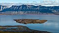
Flintholmen
- Area
- 0.93 km²
- High point
- 19 m
Sværingen
- Area
- 0.9 km²
- High point
- 86 m
Röhssøya
- Area
- 0.86 km²
- High point
- 11 m
Brochøya
- Area
- 0.86 km²
- High point
- 116 m
Tirpitzøya
- Area
- 0.85 km²
- High point
- 14 m
Smittøya
- Area
- 0.72 km²
- High point
- 15 m
Alekseevøya
- Area
- 0.67 km²
- High point
- 52 m
Store Dunøya
- Area
- 0.59 km²
- High point
- 9 m
Unnamed island
- Area
- 0.57 km²
- High point
- 25 m

Tavleøya
- Area
- 0.53 km²
- High point
- 173 m
Store Brækmoholmen
- Area
- 0.52 km²
- High point
- 22 m
Unnamed island
- Area
- 0.51 km²
- High point
- 16 m
Unnamed island
- Area
- 0.49 km²
- High point
- 19 m
Karl XII-øya
- Area
- 0.48 km²
- High point
- 105 m
Palanderøya
- Area
- 0.44 km²
- High point
- 25 m
Vesle Tavleøya
- Area
- 0.44 km²
- High point
- 275 m
Nordre Dunøya
- Area
- 0.38 km²
- High point
- 6 m
Unnamed island
- Area
- 0.35 km²
- High point
- 28 m
Moseøya
- Area
- 0.33 km²
- High point
- 54 m
Nordströmøya
- Area
- 0.32 km²
- High point
- 39 m
Boeckøya
- Area
- 0.31 km²
- High point
- 12 m
Storholmen
- Area
- 0.31 km²
- High point
- 30 m
Tiholmane
- Area
- 0.3 km²
- High point
- 18 m
Unnamed island
- Area
- 0.3 km²
- High point
- 11 m
Deegen Island
- Area
- 0.29 km²
- High point
- 25 m
Unnamed island
- Area
- 0.27 km²
- High point
- 7 m
Unnamed island
- Area
- 0.26 km²
- High point
- 10 m
Kjerulføya
- Area
- 0.26 km²
- High point
- 10 m
Unnamed island
- Area
- 0.23 km²
- High point
- 9 m
Krylen
- Area
- 0.22 km²
- High point
- 35 m
Enwalløya
- Area
- 0.21 km²
- High point
- 11 m
Unnamed island
- Area
- 0.2 km²
- High point
- 16 m
Fjørholmen
- Area
- 0.2 km²
- High point
- 5 m
Schareholmane
- Area
- 0.2 km²
- High point
- 4 m
Danielssenøya
- Area
- 0.2 km²
Tobiesen Island
- Area
- 0.18 km²
- High point
- 13 m
Torkildsen Island
- Area
- 0.17 km²
- High point
- 10 m
Unnamed island
- Area
- 0.17 km²
- High point
- 11 m
Nelsonøya
- Area
- 0.17 km²
- High point
- 72 m
Unnamed island
- Area
- 0.16 km²
- High point
- 7 m
Koner Island
- Area
- 0.16 km²
- High point
- 24 m
Unnamed island
- Area
- 0.15 km²
- High point
- 6 m
Sigridholmen
- Area
- 0.15 km²
- High point
- 13 m
Geographer Island
- Area
- 0.15 km²
- High point
- 34 m
Midtholmen
- Area
- 0.13 km²
- High point
- 21 m
Leirholmen
- Area
- 0.13 km²
- High point
- 14 m
Mack Island (Svalbard)
- Area
- 0.12 km²
- High point
- 18 m
Öbergøya
- Area
- 0.12 km²
- High point
- 18 m
Unnamed island
- Area
- 0.12 km²
- High point
- 4 m
Unnamed island
- Area
- 0.12 km²
Holmgrenøya
- Area
- 0.12 km²
- High point
- 17 m
Albertøya
- Area
- 0.11 km²
- High point
- 10 m
Observasjonsholmen
- Area
- 0.11 km²
- High point
- 37 m
Unnamed island
- Area
- 0.11 km²
- High point
- 6 m
Unnamed island
- Area
- 0.1 km²
- High point
- 4 m
Breøyane
- Area
- 0.1 km²
- High point
- 10 m
Ækongen
- Area
- —
size unknown
Arendtsøya
- Area
- —
size unknown
Berentineøya
- Area
- —
size unknown
Bruhnsøya
- Area
- —
size unknown
Isøyane
- Area
- —
size unknown
Kong Ludvigøyane
- Area
- —
size unknown
Kulstadholmane
- Area
- —
size unknown
Meinickeøyane
- Area
- —
size unknown
Menkeøyane
- Area
- —
size unknown
Ryke Yseøyane
- Area
- —
size unknown
Tusenøyane
- Area
- —
size unknown
Rocks & skerries
On the chart above, at its closest zooms.
Listing 111 of 461; the rest are on the chart.
Figures
Comparative heights
- Spitsbergen: 1,713 m
- Prins Karls Forland: 1,084 m
- Nordaustlandet: 798 m
- Barentsøya: 651 m
- Wilhelmøya: 562 m
- Bear: 536 m
- Amsterdamøya: 464 m
- Phippsøya: 461 m
- Parryøya: 412 m
- Kvitøya: 410 m
- Martensøya: 398 m
- Blomstrandhalvøya: 385 m
- Hopen: 371 m
- Edgeøya: 362 m
To the same scale
Islands by area
| Spitsbergen | 37,413 km² |
| Nordaustlandet | 14,343 km² |
| Edgeøya | 4,957 km² |
| Barentsøya | 1,287 km² |
| Kvitøya | 632 km² |
| Prins Karls Forland | 616 km² |
| Kongsøya | 202 km² |
| Bear Island | 179 km² |
| Svenskøya | 139 km² |
| Wilhelmøya | 119 km² |
| Lågøya | 86.3 km² |
| Storøya | 49.8 km² |
| Wahlbergøya | 45.9 km² |
| Hopen | 45.9 km² |
| Danes Island | 41.1 km² |
| Phippsøya | 21.9 km² |
| Abeløya | 21.5 km² |
| Chermsideøya | 19.8 km² |
| Amsterdamøya | 19 km² |
| Von Otterøya | 18 km² |
| Parryøya | 16.7 km² |
| Blomstrandhalvøya | 16.5 km² |
| Martensøya | 15.2 km² |
| Halvmåneøya | 8.3 km² |
| Kükenthaløya | 4.9 km² |
| Moffen | 4.6 km² |
| Nyströmøya | 4.5 km² |
| Akseløya | 4 km² |
| Coraholmen | 3.9 km² |
| Kiepertøya | 3.6 km² |
| Nordre Castrénøya | 3.6 km² |
| Lange Island | 3.3 km² |
| Zieglerøya | 3.1 km² |
| Delitschøya | 1.8 km² |
| Helgoland Island | 1.7 km² |
| Sofiaøya | 1.7 km² |
| Bölscheøya | 1.4 km² |
| Foynøya | 1.4 km² |
| Alpiniøya | 1.3 km² |
| Søre Castrénøya | 1.2 km² |
| Storøya | 1.2 km² |
| Unnamed island | 1.1 km² |
| Peschel Island | 0.94 km² |
| Waldenøya | 0.93 km² |
| Flintholmen | 0.93 km² |
| Sværingen | 0.9 km² |
| Röhssøya | 0.86 km² |
| Brochøya | 0.86 km² |
| Tirpitzøya | 0.85 km² |
| Smittøya | 0.72 km² |
| Alekseevøya | 0.67 km² |
| Store Dunøya | 0.59 km² |
| Unnamed island | 0.57 km² |
| Tavleøya | 0.53 km² |
| Store Brækmoholmen | 0.52 km² |
| Unnamed island | 0.51 km² |
| Unnamed island | 0.49 km² |
| Karl XII-øya | 0.48 km² |
| Palanderøya | 0.44 km² |
| Vesle Tavleøya | 0.44 km² |
| Nordre Dunøya | 0.38 km² |
| Unnamed island | 0.35 km² |
| Moseøya | 0.33 km² |
| Nordströmøya | 0.32 km² |
| Boeckøya | 0.31 km² |
| Storholmen | 0.31 km² |
| Tiholmane | 0.3 km² |
| Unnamed island | 0.3 km² |
| Deegen Island | 0.29 km² |
| Unnamed island | 0.27 km² |
| Unnamed island | 0.26 km² |
| Kjerulføya | 0.26 km² |
| Unnamed island | 0.23 km² |
| Krylen | 0.22 km² |
| Enwalløya | 0.21 km² |
| Unnamed island | 0.2 km² |
| Fjørholmen | 0.2 km² |
| Schareholmane | 0.2 km² |
| Danielssenøya | 0.2 km² |
| Tobiesen Island | 0.18 km² |
| Torkildsen Island | 0.17 km² |
| Unnamed island | 0.17 km² |
| Nelsonøya | 0.17 km² |
| Unnamed island | 0.16 km² |
| Koner Island | 0.16 km² |
| Unnamed island | 0.15 km² |
| Sigridholmen | 0.15 km² |
| Geographer Island | 0.15 km² |
| Midtholmen | 0.13 km² |
| Leirholmen | 0.13 km² |
| Mack Island (Svalbard) | 0.12 km² |
| Öbergøya | 0.12 km² |
| Unnamed island | 0.12 km² |
| Unnamed island | 0.12 km² |
| Holmgrenøya | 0.12 km² |
| Albertøya | 0.11 km² |
| Observasjonsholmen | 0.11 km² |
| Unnamed island | 0.11 km² |
| Unnamed island | 0.1 km² |
| Breøyane | 0.1 km² |
Groups within
Photographs

Kapp Lee, Edgeøya

The southernmost point of Hopen island, Kapp Thor, seen from onboard the Norwegian research vessel Lance. The highest point is Iversenfjellet (370 m).


DeGeerdalen just south of Isfjorden shoreline, Svalbard, Norway.

Svalbard, Nordastlandet
Sources
Facts
Photographs
- Outlook.KappLee. China Crisis / CC BY-SA 3.0
- Hopen Svalbard May2013. Tupsumato / CC BY-SA 3.0
- Svalbard (MODIS). MODIS Land Rapid Response Team, NASA GSFC / Public domain
- DeGeerdalen. Wilson44691 / Public domain
- Nordaustlandet1 (js). Jerzy Strzelecki / CC BY-SA 3.0
- Svalbard banner. Niels Elgaard Larsen / CC BY-SA 3.0