Laccadive SeaMaldives
4°17′N 72°59′E
Ross Atoll
Rashdoo Atoll
Part of Maldives
Ross Atoll is a small atoll in the Admiralty Chart with an almost round lagoon. It is located at about 8 km (5 mi) from the northeast point of Ari Atoll and is one of the natural atolls of the Maldives.

Chart
Overview
Ross Atoll is a small atoll in the Admiralty Chart with an almost round lagoon. It is located at about 8 km (5 mi) from the northeast point of Ari Atoll and is one of the natural atolls of the Maldives. The northern and western sides form one continuous barrier reef, and the eastern side is another barrier reef. The four mile wide lagoon has soundings from 15 to 20 fathoms (27 to 37 m) and abounds in detached coral patches. This natural atoll was named Ross Atoll by Captain Robert Moresby during his survey of the Maldive Islands. It was named after Captain Daniel Ross of the Bombay Navy, one of the first surveyors of the area. Captain Ross later became the East India Company's Marine Surveyor General in Calcutta. The main island is Rasdhoo. Kuramathi Tourist Resort is also located in this small atoll.
From Wikipedia, CC BY-SA 4.0
Census, cataloged
- Major islands2
- Minor islands0
- Islets6
- Rocks & skerries0
Major islands
Kuramathi
- Area
- 0.31 km²
- High point
- 15 m
Kuramathi at 2 km (1 mi) long is the largest of six islands that belong to the small natural atoll of Rasdhūkuramathi which administratively belongs to Alif Alif Atoll.
Rasdhoo
- Area
- 0.21 km²
- High point
- 8 m
Rasdhoo (Dhivehi: ރަސްދޫ) is an inhabited island of the Maldives. It is also the capital of the Alif Alif Atoll administrative division.
Islets
- Veligandu12 m · 0.07 km²
- Unnamed island5 m · 0.03 km²
- Unnamed island1 ha
- Madivaru Finolhu1 m · 0.7 ha
- Madivaru3 m · 0.6 ha
- Unnamed island0.4 ha
Figures
Comparative heights
- Kuramathi: 15 m
- Veligandu: 12 m
- Rasdhoo: 8 m
- Madivaru: 3 m
- Madivaru Finolhu: 1 m
To the same scale
Islands by area
| Kuramathi | 0.31 km² |
| Rasdhoo | 0.21 km² |
| Veligandu | 0.07 km² |
| Unnamed island | 0.03 km² |
| Unnamed island | 1 ha |
| Madivaru Finolhu | 0.7 ha |
| Madivaru | 0.6 ha |
| Unnamed island | 0.4 ha |
Photographs
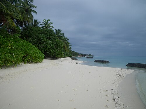
Kuramathi Strand (Lagunenseite)

Rasdhoo pier
Sources
Facts
Photographs
- Kuramathi Beach (Lagoon) 001. MBraun Germany / Public domain
- Rasdhoo pier - panoramio. georama / CC BY 3.0