Molucca SeaIndonesia
0°14′S 130°31′E
Raja Ampat Islands
Part of Indonesia
Raja Ampat (Indonesian pronunciation: [ˌrad͡ʒa ˈ(ʔ)ampat̪̚]), or the Four Kings, is an archipelago located off the northwest tip of Bird's Head Peninsula (on the island of New Guinea), Southwest Papua province, Indonesia.

Chart
Overview
Raja Ampat (Indonesian pronunciation: [ˌrad͡ʒa ˈ(ʔ)ampat̪̚]), or the Four Kings, is an archipelago located off the northwest tip of Bird's Head Peninsula (on the island of New Guinea), Southwest Papua province, Indonesia. It comprises over 1,500 small islands, cays, and shoals around the four main islands of Misool, Salawati, Batanta, and Waigeo, and the smaller island of Kofiau. The Raja Ampat archipelago is just south of the equator and forms part of the Coral Triangle, an area of Southeast Asian seas containing the richest marine biodiversity on earth. The Coral Triangle itself is an approximate area west-southwest of the Philippines, east-northeast and southeast of the island of Borneo, and north, east, and west of the island of New Guinea, including the seas in between. Thousands of species of marine organisms, from the tiniest cleaner shrimp and camouflaged pygmy seahorses to the majestic cetaceans and whale sharks, thrive in these waters. Since 2024, the archipelago is part of the province of Southwest Papua (formerly West Papua (province)). Most of the islands constitute the Raja Ampat Regency, which was separated from Sorong Regency in 2004. The regency encompasses around 70,000 square kilometres (27,000 mi2) of land and sea, of which 8,034.44 km2 constitutes the land area and has a population of 64,141 at the 2020 census; the official estimate as at mid 2022 was 66,839. This excludes the southern half of Salawati Island, which is not part of this regency but instead constitutes the Salawati Selatan and Salawati Tengah Districts of Sorong Regency. From 2019 onwards, the natural conservation in the islands has been endangered by illegal mining (e.g. nickel) that has caused widespread criticism from the Indonesian public.
From Wikipedia, CC BY-SA 4.0
Census, cataloged
- Major islands4
- Minor islands39
- Islets293
- Rocks & skerries103
Major islands
Waigeo
- Area
- 2,996 km²
- High point
- 990 m
Waigeo is an island in the Southwest Papua province of eastern Indonesia. The island is also known as Amberi or Waigiu. It is the largest of the four main islands in the Raja Ampat Islands archipelago, between Halmahera and New Guinea, and about 65 kilometres (40 miles) from the northwest coast of the latter. a.
Misool
- Area
- 2,067 km²
- High point
- 523 m
Misool (Indonesian: Pulau Misool; Matbat: Batan Mee; Dutch: Misool-eiland), formerly spelled Mysol or Misol, is one of the four major islands in the Raja Ampat Islands in Southwest Papua, Indonesia.


Salawati
- Area
- 1,655 km²
- High point
- 808 m
Salawati (Indonesian pronunciation: [salaˈwat̪i]) is one of the four major islands in the Raja Ampat Islands in Southwest Papua (formerly West Papua), Indonesia. 1 km2 (including smaller offshore islands). a. a. Sagewin Strait).
Batanta
- Area
- 447 km²
- High point
- 1,184 m
Batanta is the smallest of the four major islands in the Raja Ampat Islands in Southwest Papua province, Indonesia. 52 km2 (including smaller offshore islands) and its highest point is 1184 m. The Pitt Strait separates it from Salawati Island, while the Dampier Strait separates it from Waigeo Island.
Minor islands

Gam Island
- Area
- 181 km²
- High point
- 405 m
Gag Island
- Area
- 60.4 km²
- High point
- 346 m
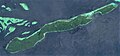
Mansuar Island
- Area
- 14.1 km²
- High point
- 368 m
Yarweser Island
- Area
- 8 km²
- High point
- 249 m
Runi Island
- Area
- 5.7 km²
- High point
- 76 m
Birie Island
- Area
- 5.4 km²
- High point
- 254 m
Sagawin Island
- Area
- 2.8 km²
- High point
- 149 m
Unnamed island
- Area
- 2.7 km²
- High point
- 118 m
Gam Island
- Area
- 2.6 km²
- High point
- 23 m

Kri Island
- Area
- 1.7 km²
- High point
- 197 m
Pulau Reni
- Area
- 0.93 km²
- High point
- 11 m
Pulau Ura
- Area
- 0.88 km²
- High point
- 103 m
Arefi Island
- Area
- 0.82 km²
- High point
- 123 m
Abidon Island
- Area
- 0.8 km²
- High point
- 79 m
Lawat Island
- Area
- 0.73 km²
- High point
- 33 m
Yankisi Island
- Area
- 0.59 km²
- High point
- 109 m
Kanober Island
- Area
- 0.54 km²
- High point
- 39 m
Unnamed island
- Area
- 0.52 km²
- High point
- 10 m
Kalis Island
- Area
- 0.5 km²
- High point
- 26 m
Sopoon Island
- Area
- 0.45 km²
- High point
- 28 m
Weslu Island
- Area
- 0.38 km²
- High point
- 28 m
Kabu Island
- Area
- 0.38 km²
- High point
- 25 m
Yef Gawie
- Area
- 0.37 km²
- High point
- 23 m
Kainok Island
- Area
- 0.31 km²
- High point
- 74 m
Kayerepop Island
- Area
- 0.3 km²
- High point
- 70 m
Rutum Island
- Area
- 0.27 km²
- High point
- 10 m
Augusta Island
- Area
- 0.23 km²
- High point
- 17 m
Mesellu Pale Island
- Area
- 0.21 km²
- High point
- 14 m
Isi Island
- Area
- 0.21 km²
- High point
- 21 m
Friwin Island
- Area
- 0.2 km²
- High point
- 50 m
Meos Bun Iba
- Area
- 0.19 km²
- High point
- 32 m
Mios Bekwan
- Area
- 0.18 km²
- High point
- 8 m
Meos Trai
- Area
- 0.17 km²
- High point
- 66 m
Friwin Bonda Island
- Area
- 0.14 km²
- High point
- 68 m
Yef Tonu
- Area
- 0.12 km²
- High point
- 43 m
Mesenllu Pale Island
- Area
- 0.11 km²
- High point
- 19 m
Apop Uray Island
- Area
- —
size unknown
Mios Kamasan
- Area
- —
size unknown
Mios Mandun
- Area
- —
size unknown
Rocks & skerries
On the chart above, at its closest zooms.
Listing 43 of 439; the rest are on the chart.
Figures
Comparative heights
To the same scale
Islands by area
| Waigeo | 2,996 km² |
| Misool | 2,067 km² |
| Salawati | 1,655 km² |
| Batanta | 447 km² |
| Gam Island | 181 km² |
| Gag Island | 60.4 km² |
| Mansuar Island | 14.1 km² |
| Yarweser Island | 8 km² |
| Runi Island | 5.7 km² |
| Birie Island | 5.4 km² |
| Sagawin Island | 2.8 km² |
| Unnamed island | 2.7 km² |
| Gam Island | 2.6 km² |
| Kri Island | 1.7 km² |
| Pulau Reni | 0.93 km² |
| Pulau Ura | 0.88 km² |
| Arefi Island | 0.82 km² |
| Abidon Island | 0.8 km² |
| Lawat Island | 0.73 km² |
| Yankisi Island | 0.59 km² |
| Kanober Island | 0.54 km² |
| Unnamed island | 0.52 km² |
| Kalis Island | 0.5 km² |
| Sopoon Island | 0.45 km² |
| Weslu Island | 0.38 km² |
| Kabu Island | 0.38 km² |
| Yef Gawie | 0.37 km² |
| Kainok Island | 0.31 km² |
| Kayerepop Island | 0.3 km² |
| Rutum Island | 0.27 km² |
| Augusta Island | 0.23 km² |
| Mesellu Pale Island | 0.21 km² |
| Isi Island | 0.21 km² |
| Friwin Island | 0.2 km² |
| Meos Bun Iba | 0.19 km² |
| Mios Bekwan | 0.18 km² |
| Meos Trai | 0.17 km² |
| Friwin Bonda Island | 0.14 km² |
| Yef Tonu | 0.12 km² |
| Mesenllu Pale Island | 0.11 km² |
Groups within
Photographs

one of the charms of the world, Raja Ampat. Thousand of islands with a million charms, and millions of underwater biota. Always look brilliant in the eyes of tourists

Kri island beach in Raja Ampat

kampung fafanlap. misool selatan. papua barat

Lumba lumba homestay in Raja Ampat

Warimpurem homestay in Raja Ampat

Kordiris homestay

A view of Waigeo coast near Waisai

Annette White taking in the view from the top of Piaynemo Island in Raja Ampat

Pada pagi hari ketika libur sekolah, mereka pergi bersama ke pinggir pantai untuk bersiap memancing. Selain hiburan, ini juga hobi dan pelajaran hidup bagi mereka.

DCIM\104GOPRO

DCIM\104GOPRO

The villagers have a business making and selling extra virgin coconut oil at Kampung Saukabu, Pam Island, Raja Ampat, West Papua. Here two ladies prepare the coconuts.
Sources
Facts
Photographs
- Majestic Raja Ampat. Nickoasmara / CC BY-SA 4.0
- 20170909 Kri island beach. Lasthib / CC BY-SA 4.0
- Fafanlap Village. Lefaan / CC BY-SA 4.0
- 20170909 Lumba lumba homestay. Lasthib / CC BY-SA 4.0
- 20170906 Warimpurem homestay. Lasthib / CC BY-SA 4.0
- 20170908 Kordiris homestay. Lasthib / CC BY-SA 4.0
- Waigeo view-2. Lord Mountbatten / CC BY-SA 4.0
- Annette White on Piaynemo Island in Raja Ampat. Annette White / CC BY-SA 4.0
- Bersiap Memancing. Rian Tatuwo / CC BY-SA 4.0
- Kabui Bay - Gam Island - Raja Ampat - 32506325635. prilfish / CC BY 2.0
- Kabui Bay - Gam Island view - Raja Ampat. prilfish / CC BY 2.0
- Making Coconut Oil, Pam Island. KitHamilton / CC BY-SA 4.0