East China SeaJapan
26°20′N 127°45′E
Okinawa Islands
Part of Ryukyu Islands
The Okinawa Islands are an island group in Okinawa Prefecture, Japan, and are the principal island group of the prefecture.

Chart
Overview
The Okinawa Islands are an island group in Okinawa Prefecture, Japan, and are the principal island group of the prefecture. The Okinawa Islands are part of the larger Ryukyu Islands group and are located between the Amami Islands of Kagoshima Prefecture to the northeast and the Sakishima Islands of Okinawa Prefecture to the southwest. The Okinawa Islands, apart from the main island, contain three smaller island groups: the Kerama, Yokatsu and Iheya-Izena island groups. The Okinawa Islands are the political, cultural and population center of Okinawa Prefecture. The prefectural capital of Naha is within the island group. 90% of the population of the prefecture reside within the Okinawa Islands, primarily on the largest island of the group, Okinawa Island. Access to the various Okinawa Islands is primarily via small airports which connect to Naha Airport. Additionally, the islands are connected via ferry service to the Port of Naha in the prefectural capital. The Okinawa Islands are within the subtropical climate zone, which supports the production of sugarcane, pineapples and cut flowers. The military bases of the United States in Okinawa Prefecture are located on the Okinawa Islands. Historically, the rule of the Ryukyu Kingdom, centered on Okinawa Island, consolidated the Okinawa Islands before spreading south to the Miyako and Yaeyama Islands and north to Amami Ōshima.
From Wikipedia, CC BY-SA 4.0
Census, cataloged
- Major islands3
- Minor islands51
- Islets222
- Rocks & skerries964
Major islands
Okinawa Island
- Area
- 1,207 km²
- High point
- 503 m
Okinawa Island (Japanese: 沖縄島, Hepburn: Okinawa-jima; Okinawan: 沖縄 / うちなー, romanized: Uchinā; Kunigami: ふちなー, romanized: Fuchináa), also known as Okinawa Main Island (沖縄本島, Okinawa-hontō), is the largest of the Okinawa Islands and the Ryukyu (Nansei) Islands of Japan in the Kyushu region. 02 sq mi).
Kume Island
- Area
- 59.6 km²
- High point
- 310 m
Kume Island (久米島, Kumejima; Okinawan: クミジマ Kumijima) is an island, part of the Okinawa Islands and administratively part of the town of Kumejima, Okinawa Prefecture, Japan. It has an area of 59.11 square kilometres (22.82 mi2). The island had a population of 8,713 (2010).
Kerama Islands
- Area
- 0.49 km²
- High point
- 106 m
The Kerama Islands (慶良間諸島, Kerama-shotō; Okinawan: キラマ Kirama) are a subtropical island group 32 kilometres (20 mi) southwest of Okinawa Island in Japan.


Minor islands

Iejima
- Area
- 22.8 km²
- High point
- 172 m

Iheya Island
- Area
- 20.7 km²
- High point
- 294 m

Tokashiki Island
- Area
- 15.3 km²
- High point
- 226 m

Izena Island
- Area
- 14.2 km²
- High point
- 121 m

Yagaji Island
- Area
- 7.8 km²
- High point
- 58 m
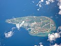
Aguni Island
- Area
- 7.6 km²
- High point
- 96 m

Zamami Island
- Area
- 6.7 km²
- High point
- 161 m

Miyagi Island
- Area
- 5.6 km²
- High point
- 124 m

Henza Island
- Area
- 5.2 km²
- High point
- 112 m

Aka Island
- Area
- 3.8 km²
- High point
- 187 m

Tonaki Island
- Area
- 3.6 km²
- High point
- 179 m

Kouri Island
- Area
- 3.2 km²
- High point
- 107 m

Sesoko Island
- Area
- 3 km²
- High point
- 78 m

Iōtorishima
- Area
- 2.5 km²
- High point
- 212 m

Hamahiga Island
- Area
- 2.1 km²
- High point
- 79 m

Tsuken Island
- Area
- 1.9 km²
- High point
- 39 m
Ikei Island
- Area
- 1.7 km²
- High point
- 42 m

Mae Island
- Area
- 1.6 km²
- High point
- 133 m
Kuba Island
- Area
- 1.5 km²
- High point
- 270 m

Kudaka Island
- Area
- 1.4 km²
- High point
- 23 m
Yakabi Island
- Area
- 1.3 km²
- High point
- 214 m

Geruma Island
- Area
- 1.2 km²
- High point
- 157 m

Noho Island
- Area
- 1.1 km²
- High point
- 43 m
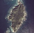
Fukaji Island
- Area
- 0.83 km²
- High point
- 78 m
Yanaha Island
- Area
- 0.8 km²
- High point
- 16 m
Amuro Island
- Area
- 0.71 km²
- High point
- 98 m

Ōjima
- Area
- 0.65 km²
- High point
- 20 m
Yabuchi Island
- Area
- 0.61 km²
- High point
- 39 m

Minnajima
- Area
- 0.47 km²
- High point
- 17 m
Gushikawa Island
- Area
- 0.47 km²
- High point
- 23 m
Ōha Island
- Area
- 0.37 km²
- High point
- 13 m
Nakanshi
- Area
- 0.33 km²
Ukibaru Island
- Area
- 0.3 km²
- High point
- 11 m

Ou Island
- Area
- 0.3 km²
- High point
- 22 m
Kuroshima
- Area
- 0.27 km²
- High point
- 126 m
Ōjima
- Area
- 0.27 km²
- High point
- 35 m
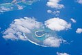
Irisuna-jima
- Area
- 0.26 km²
- High point
- 29 m
Unjima Island
- Area
- 0.26 km²
- High point
- 81 m
Miyagi Island
- Area
- 0.24 km²
- High point
- 70 m
Yanoshita Island
- Area
- 0.23 km²
- High point
- 8 m
Unnamed island
- Area
- 0.2 km²
- High point
- 4 m
Kamiyama Island
- Area
- 0.19 km²
- High point
- 10 m
Unnamed island
- Area
- 0.19 km²
- High point
- 10 m
Nagannu Island
- Area
- 0.18 km²
- High point
- 8 m
Nakashima Island
- Area
- 0.18 km²
- High point
- 94 m
Senaga Island
- Area
- 0.18 km²
- High point
- 33 m
Hatejima Island
- Area
- 0.14 km²
- High point
- 55 m
Gahi Island
- Area
- 0.13 km²
- High point
- 52 m
Gushikujima Island
- Area
- 0.11 km²
- High point
- 80 m
Unnamed island
- Area
- 0.11 km²
- High point
- 12 m

Hanarijima
- Area
- 0.1 km²
- High point
- 55 m
Rocks & skerries
On the chart above, at its closest zooms.
Listing 54 of 1240; the rest are on the chart.
Figures
Comparative heights
To the same scale
Islands by area
Groups within
Photographs

Nago, Okinawa, Japan: Rock formation at Kouri Bridge

Abu-Oru Island seen from Cape Ban in Nago, Okinawa Prefecture, Japan

An island off Cape Ban, Nago, Okinawa Prefecture, Japan

Ou Island, Ōha Island and Hate-no-hama Beach seen from Tounnaha-jō, Kumejima, Okinawa Prefecture, Japan.

Erabu Iwa, off Kudaka Island, Nanjo, Okinawa Prefecture, Japan

Erabu Iwa and a worship site, off Kudaka Island, Nanjo, Okinawa Prefecture, Japan

Okinawa Islands, Okinawa, Japan.

Okinawa Islands, Okinawa Prefecture, Japan.

An island off Teniya Coast, Nago, Okinawa Prefecture, Japan

An island off Yubuku Hama, Tonaki Island, Okinawa Prefecture, Japan

An island off Yubuku Hama, Tonaki Island, Okinawa Prefecture, Japan

A rock off Yubuku Hama, Tonaki Island, Okinawa Prefecture, Japan
Sources
Facts
Photographs
- Nago Okinawa Kouri-Rock-Formation-01. CEphoto, Uwe Aranas / CC BY-SA 3.0
- Abu-Oru Island seen from Cape Ban in Nago 202609. Kugel~commonswiki / CC BY-SA 4.0
- Island off Cape Ban at Nago 202609. Kugel~commonswiki / CC BY-SA 4.0
- Tounnahajou-Kumejima, Okinawa(登武那覇城からみる奥武島、はての浜)DSCF6530. 松岡明芳 / CC BY-SA 3.0
- Erabu Iwa Kudaka Island 202401 01. Kugel~commonswiki / CC BY-SA 4.0
- Erabu Iwa Kudaka Island 202401 02. Kugel~commonswiki / CC BY-SA 4.0
- Okinawa Islands NASA. NASA, Aqua / MODIS / Public domain
- Okinawa Islands ISS042. Image Science and Analysis Laboratory, NASA-Johnson Space Center. "The Gateway to Astronaut Photography of Earth." / Public domain
- Island off Teniya Coast at Nago 202609. Kugel~commonswiki / CC BY-SA 4.0
- Island off Yubuku Hama, Tonaki Island 202407 01. Kugel~commonswiki / CC BY-SA 4.0
- Island off Yubuku Hama, Tonaki Island 202407 02-01. Kugel~commonswiki / CC BY-SA 4.0
- Rock off Yubuku Hama, Tonaki Island 202407 02. Kugel~commonswiki / CC BY-SA 4.0