Pacific OceanUnited States
20°45′N 156°09′W
Hawaiian Islands
Southeastern Hawaiʻian Islands
The Hawaiian Islands (Hawaiian: Mokupuni Hawaiʻi) are an archipelago of eight major volcanic islands, several atolls, and numerous smaller islets in the North Pacific Ocean, extending some 1,500 miles (2,400 kilometers) from the island of Hawaiʻi in the south to northernmost Kure Atoll.

Chart
Overview
The Hawaiian Islands (Hawaiian: Mokupuni Hawaiʻi) are an archipelago of eight major volcanic islands, several atolls, and numerous smaller islets in the North Pacific Ocean, extending some 1,500 miles (2,400 kilometers) from the island of Hawaiʻi in the south to northernmost Kure Atoll. Formerly called the Sandwich Islands, the present name for the archipelago is derived from the name of its largest island, Hawaiʻi. The archipelago sits on the Pacific plate. The islands are exposed peaks of a great undersea mountain range known as the Hawaiian–Emperor seamount chain, formed by volcanic activity over the Hawaiian hotspot. The islands are about 1,860 miles (3,000 km) from the nearest continent and are part of the Polynesia subregion of Oceania. The U.S. state of Hawaii occupies the archipelago almost in its entirety (including the mostly uninhabited Northwestern Hawaiian Islands), with the sole exception of Midway Atoll (a United States Minor Outlying Island). Hawaii is the only U.S. state that is situated entirely on an archipelago, and the only state not geographically connected with North America. The Northwestern islands (sometimes called the Leeward Islands) and surrounding seas are protected as a national monument and World Heritage Site.
From Wikipedia, CC BY-SA 4.0
Census, cataloged
- Major islands7
- Minor islands24
- Islets72
- Rocks & skerries48
Major islands
Hawaii
- Area
- 10,435 km²
- High point
- 4,205 m
Hawaiʻi, sometimes written Hawaii, is the largest island in the United States, located in the state of Hawaii. It is the southeasternmost of the Hawaiian Islands, a chain of volcanic islands in the North Pacific Ocean.
Maui
- Area
- 1,884 km²
- High point
- 3,055 m
Maui is the second-largest island in the Hawaiian archipelago, at 727.2 square miles (1,883 km2). It is the 17th-largest in the United States. Maui is one of Maui County's four sizable islands, along with Molokaʻi, Lānaʻi, and Kahoʻolawe.
Oahu
- Area
- 1,550 km²
- High point
- 1,229 m
S. state of Hawaii. The state capital, Honolulu, is on Oʻahu's southeastern coast. The island of Oʻahu and the uninhabited Northwestern Hawaiian Islands constitute the City and County of Honolulu.
Kauaʻi
- Area
- 1,439 km²
- High point
- 1,587 m
Kauaʻi, sometimes written Kauai, is one of the main Hawaiian Islands. 4 km2), making it the fourth largest of the islands and the 21st largest island in the United States. Kauaʻi is 73 mi (117 km) northwest of Oʻahu, across the Kauaʻi Channel. The island's 2020 population was 73,298.
Molokaʻi
- Area
- 675 km²
- High point
- 1,506 m
Molokaʻi or Molokai is the fifth most populated of the eight major islands that make up the Hawaiian Islands archipelago in the middle of the Pacific Ocean. 40 km2), making it the fifth largest in size of the main Hawaiian Islands and the 27th-largest island in the United States.
Lanai
- Area
- 365 km²
- High point
- 1,026 m
Lānaʻi, sometimes written Lanai, is the sixth-largest of the Hawaiian Islands and the smallest publicly accessible inhabited island in the chain. It is colloquially known as the Pineapple Island because of its past as an island-wide pineapple plantation.
Niʻihau
- Area
- 186 km²
- High point
- 381 m
Niʻihau, sometimes written Niihau, is the seventh largest island in Hawaii and the westernmost of the main islands. 2 km) southwest of Kauaʻi across the Kaulakahi Channel. 5 square miles (180 km2).


Minor islands

Kahoolawe
- Area
- 115 km²
- High point
- 79 m

Sand Island
- Area
- 4.5 km²
- High point
- 30 m

Laysan
- Area
- 4.1 km²
- High point
- 10 m
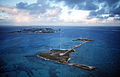
Johnston Atoll
- Area
- 2.5 km²
- High point
- 17 m

Sand Island
- Area
- 2.1 km²
- High point
- 10 m

Ford Island
- Area
- 1.8 km²
- High point
- 19 m

Lisianski Island
- Area
- 1.4 km²
- High point
- 7 m
Eastern Island
- Area
- 1.3 km²
- High point
- 6 m

Lehua
- Area
- 1.1 km²
- High point
- 213 m
Green Island
- Area
- 0.9 km²
- High point
- 6 m
Kure Atoll
- Area
- 0.88 km²

Nīhoa
- Area
- 0.7 km²
- High point
- 277 m

Kaʻula
- Area
- 0.49 km²
- High point
- 167 m
Pearl and Hermes Atoll
- Area
- 0.36 km²

Mānana
- Area
- 0.25 km²
- High point
- 110 m
French Frigate Shoals
- Area
- 0.25 km²
- High point
- 36 m

Necker Island
- Area
- 0.18 km²
- High point
- 84 m
Southeast Island
- Area
- 0.17 km²
- High point
- 2 m
Seal Kittery Island
- Area
- 0.12 km²

Tern Island
- Area
- 0.12 km²
- High point
- 4 m
Unnamed island
- Area
- 0.12 km²

Coconut Island
- Area
- 0.12 km²
- High point
- 15 m
Mokuʻōeo Island
- Area
- 0.11 km²
- High point
- 1 m
Mokuhuki
- Area
- —
size unknown
Islets
- Molokini33 m · 0.07 km²
- North Island4 m · 0.07 km²
- Moku Manu39 m · 0.06 km²
- Goat Island2 m · 0.06 km²
- Spit Island4 m · 0.05 km²
- Big Mokolua17 m · 0.05 km²
- Puukoae Islet118 m · 0.05 km²
- Laulaunui Island6 m · 0.04 km²
- Mokuhooniki6 m · 0.04 km²
- Kāohikaipu9 m · 0.04 km²
- Mokapu55 m · 0.04 km²
- Little Mokolua16 m · 0.04 km²
Rocks & skerries
- Mokeehia32 m · 0.02 km²
- Keōpuka Rock4 m · 0.5 ha
- Kanaha Rock2 m · 0.3 ha
- Mōkōlea Rock0.3 ha
- Pulemoku Rock0.2 ha
- Unnamed island<0.1 ha
- Unnamed island<0.1 ha
- Unnamed island<0.1 ha
- Unnamed island<0.1 ha
- Unnamed island<0.1 ha
- Kakalaioa Rock<0.1 ha
- Unnamed island<0.1 ha
Figures
Comparative heights
To the same scale
Islands by area
| Hawaii | 10,435 km² |
| Maui | 1,884 km² |
| Oahu | 1,550 km² |
| Kauaʻi | 1,439 km² |
| Molokaʻi | 675 km² |
| Lanai | 365 km² |
| Niʻihau | 186 km² |
| Kahoolawe | 115 km² |
| Sand Island | 4.5 km² |
| Laysan | 4.1 km² |
| Johnston Atoll | 2.5 km² |
| Sand Island | 2.1 km² |
| Ford Island | 1.8 km² |
| Lisianski Island | 1.4 km² |
| Eastern Island | 1.3 km² |
| Lehua | 1.1 km² |
| Green Island | 0.9 km² |
| Kure Atoll | 0.88 km² |
| Nīhoa | 0.7 km² |
| Kaʻula | 0.49 km² |
| Pearl and Hermes Atoll | 0.36 km² |
| Mānana | 0.25 km² |
| French Frigate Shoals | 0.25 km² |
| Necker Island | 0.18 km² |
| Southeast Island | 0.17 km² |
| Seal Kittery Island | 0.12 km² |
| Tern Island | 0.12 km² |
| Unnamed island | 0.12 km² |
| Coconut Island | 0.12 km² |
| Mokuʻōeo Island | 0.11 km² |
| Molokini | 0.07 km² |
| North Island | 0.07 km² |
| Moku Manu | 0.06 km² |
| Goat Island | 0.06 km² |
| Spit Island | 0.05 km² |
| Big Mokolua | 0.05 km² |
| Puukoae Islet | 0.05 km² |
| Laulaunui Island | 0.04 km² |
| Mokuhooniki | 0.04 km² |
| Kāohikaipu | 0.04 km² |
| Mokapu | 0.04 km² |
| Little Mokolua | 0.04 km² |
| Grass Island | 0.03 km² |
| Mokauea Island | 0.03 km² |
| Kapapa Island | 0.03 km² |
| Mokuʻaeʻae | 0.02 km² |
| Gin Island | 0.02 km² |
| ʻĀlau Island | 0.02 km² |
| Okala | 0.02 km² |
| Gardner Pinnacles | 0.02 km² |
| Mokoliʻi | 0.02 km² |
| Little Gin Island | 0.02 km² |
| East Island | 0.02 km² |
| Mokeehia | 0.02 km² |
| Little North Island | 0.02 km² |
| Popoia | 0.01 km² |
| Unnamed island | 0.01 km² |
| Unnamed island | 0.01 km² |
| Sand Island | 0.01 km² |
| Kuakamoku Islet | 0.01 km² |
| Coconut Island | 0.01 km² |
| Unnamed island | 1 ha |
| Unnamed island | 0.9 ha |
| Unnamed island | 0.9 ha |
| Poʻopoʻo | 0.7 ha |
| Unnamed island | 0.7 ha |
| Kaemi | 0.6 ha |
| Kahakaʻaulana Island | 0.6 ha |
| Kukuiho'olua | 0.6 ha |
| Unnamed island | 0.6 ha |
| Bird Island | 0.6 ha |
| Keōpuka Rock | 0.5 ha |
| Puukii Island | 0.5 ha |
| Unnamed island | 0.5 ha |
| Disappearing Island | 0.5 ha |
| Puupehe Islet | 0.5 ha |
| Shark Island | 0.5 ha |
| Unnamed island | 0.4 ha |
| Unnamed island | 0.4 ha |
| Huelo | 0.4 ha |
| Unnamed island | 0.4 ha |
| Unnamed island | 0.4 ha |
| Unnamed island | 0.4 ha |
| Unnamed island | 0.4 ha |
| Unnamed island | 0.4 ha |
| Keaoi | 0.4 ha |
| Kanaha Rock | 0.3 ha |
| Mōkōlea Rock | 0.3 ha |
| Unnamed island | 0.3 ha |
| La Perouse Pinnacle | 0.3 ha |
| Unnamed island | 0.3 ha |
| Unnamed island | 0.3 ha |
| Mokuālai | 0.2 ha |
| Pulemoku Rock | 0.2 ha |
| Puukole Islet | 0.2 ha |
| Unnamed island | 0.2 ha |
| Kekepa Island | 0.2 ha |
| Unnamed island | 0.2 ha |
| Unnamed island | 0.2 ha |
| Unnamed island | 0.2 ha |
| Kīhewamoku | 0.2 ha |
| Unnamed island | 0.2 ha |
| Mokumana | 0.2 ha |
| Unnamed island | 0.2 ha |
| Unnamed island | 0.1 ha |
| Unnamed island | 0.1 ha |
| Unnamed island | 0.1 ha |
| Unnamed island | <0.1 ha |
| Unnamed island | <0.1 ha |
| Unnamed island | <0.1 ha |
| Unnamed island | <0.1 ha |
| Unnamed island | <0.1 ha |
| Kakalaioa Rock | <0.1 ha |
| Unnamed island | <0.1 ha |
| Unnamed island | <0.1 ha |
| Unnamed island | <0.1 ha |
| Unnamed island | <0.1 ha |
| Unnamed island | <0.1 ha |
| Kaulaʻināiwi Island | <0.1 ha |
| Unnamed island | <0.1 ha |
| Unnamed island | <0.1 ha |
| Unnamed island | <0.1 ha |
| Wānanapaoa Island | <0.1 ha |
| Unnamed island | <0.1 ha |
| Unnamed island | <0.1 ha |
| Unnamed island | <0.1 ha |
| Unnamed island | <0.1 ha |
| Unnamed island | <0.1 ha |
| Unnamed island | <0.1 ha |
| Unnamed island | <0.1 ha |
| Unnamed island | <0.1 ha |
| Unnamed island | <0.1 ha |
| Unnamed island | <0.1 ha |
| Unnamed island | <0.1 ha |
| Unnamed island | <0.1 ha |
| Unnamed island | <0.1 ha |
| Mokunui | <0.1 ha |
| Unnamed island | <0.1 ha |
| Unnamed island | <0.1 ha |
| Unnamed island | <0.1 ha |
| Unnamed island | <0.1 ha |
| Unnamed island | <0.1 ha |
| Unnamed island | <0.1 ha |
| Moku Naio | <0.1 ha |
| Unnamed island | <0.1 ha |
| Unnamed island | <0.1 ha |
| Unnamed island | <0.1 ha |
| Unnamed island | <0.1 ha |
| Unnamed island | <0.1 ha |
| Unnamed island | <0.1 ha |
Groups within
Photographs

Aerial view of Niʻihau Island in Hawaiʻi, looking southwestward from the north. Taken by Christopher P. Becker (polihale.com) on 25 Sep 2007 from a helicopter.

Cocos nucifera (Coconut palm, niu) Aerial view at Kapahulu, Oahu, Hawaii. September 24, 2013 #130924-2331 Image Use Policy

Cocos nucifera (Coconut palm, niu) Aerial view at East End, Molokai, Hawaii. October 25, 2014 #141025-2337 Image Use Policy

The Hawaiian islands as seen from the International Space Station.


A view from a moving car of Mauna Kea

Prosopis pallida (Kiawe, keawe, algaroba, mesquite) Aerial view Molokini and rainbow over ocean beyong Makena at Above Kihei, Maui, Hawaii. March 26, 2018 #180326-2802 Image Use Policy

Mass Communication Specialist 1st Class Daniel N. Woods (US Navy) / Public domain


Map created by www.piece-of-earth.net

Hurricane Lowell is a Category 2 storm as it barrels towards Kauai.

Satellite composition of the Hawaiian island chain.
Sources
Facts
Photographs
- Niihau sep 2007. Christopher P. Becker (Polihale) / CC BY-SA 3.0
- Starr-130924-2331-Cocos nucifera-aerial view-Kapahulu-Oahu (24931558840). Forest and Kim Starr / CC BY 3.0 us
- Starr-141025-2337-Cocos nucifera-aerial view-East End-Molokai (24879856299). Forest and Kim Starr / CC BY 3.0 us
- ISS-38 Hawaiian Island chain. NASA / Public domain
- Hawaje-NoRedLine. Jacques Descloitres / Public domain
- Mauna Kea prairies. Maplemoths / CC BY 4.0
- Starr-180326-2802-Prosopis pallida-aerial view Molokini and rainbow over ocean beyong Makena-Above Kihei-Maui (40527932074). Forest and Kim Starr / CC BY 3.0 us
- PPCLI boarding American Helicopter in Hawaii 2008. Mass Communication Specialist 1st Class Daniel N. Woods (US Navy) / Public domain
- Death of Captain Cook by John Cleveley the Younger, Aquatint Francis Jukes HMA I259817 TePapa. Francis Jukes / John Cleveley the Younger / Public domain
- 140620791316255 final. PieceOfEarth / CC BY-SA 4.0
- Lowell Advances Towards the Hawaiian Islands (CIRA 2026-09-07). GOES imagery: CSU/CIRA & NOAA / Public domain
- NASA Hawaiian Islands full quality. NASA/Goddard Space Flight Center / Public domain