Aegean SeaGreece
36°27′N 27°18′E
Dodecanese
Δωδεκάνησα
Part of Southern Sporades
The Dodecanese (UK: , US: ; Greek: Δωδεκάνησα, Dodekánisa [ðoðeˈkanisa], lit. 'twelve islands') are a group of 15 larger and 150 smaller Greek islands in the southeastern Aegean Sea and Eastern Mediterranean, off the coast of Anatolia, of which 26 are inhabited.

Chart
Overview
The Dodecanese (UK: , US: ; Greek: Δωδεκάνησα, Dodekánisa [ðoðeˈkanisa], lit. 'twelve islands') are a group of 15 larger and 150 smaller Greek islands in the southeastern Aegean Sea and Eastern Mediterranean, off the coast of Anatolia, of which 26 are inhabited. This island group generally defines the eastern limit of the Sea of Crete. They belong to the wider Southern Sporades island group. Rhodes has been the area's dominant island since antiquity. Of the others, Kos and Patmos are historically the most important; the remaining 12 are Agathonisi, Astypalaia, Halki, Kalymnos, Karpathos, Kasos, Leipsoi, Leros, Nisyros, Symi, Tilos, and Megisti. Other islands in the chain include Alimia, Arkoi, Farmakonisi, Gyali, Kinaros, Levitha, Marathos, Nimos, Pserimos, Saria, Strongyli and Syrna.
From Wikipedia, CC BY-SA 4.0
Census, cataloged
- Major islands5
- Minor islands95
- Islets188
- Rocks & skerries1,479
Major islands
Rhodes
- Area
- 1,400 km²
- High point
- 1,213 m
Rhodes ( ; Greek: Ρόδος, romanized: Ródos [ˈroðos]) is the largest of Greece's Dodecanese islands and their historical capital, as well as the ninth largest island in the Mediterranean Sea.
Karpathos
- Area
- 300 km²
- High point
- 1,215 m
Karpathos, also Carpathos, is the second largest of the Greek Dodecanese islands, in the southeastern Aegean Sea. Together with the neighboring smaller Saria Island it forms the municipality of Karpathos, which is part of the regional unit Karpathos-Kasos.
Kos
- Area
- 287 km²
- High point
- 846 m
Kos or Cos (; Greek: Κως [kos]) is a Greek island, part of the Dodecanese island chain in the southeastern Aegean Sea. Kos is the third largest island of the Dodecanese, after Rhodes and Karpathos; it has a population of 37,089 (2021 census), making it the second most populous of the Dodecanese after Rhodes.
Kalymnos
- Area
- 110 km²
- High point
- 676 m
Kalymnos (Greek: Κάλυμνος; Modern Greek pronunciation: [ˈkalimnos]) is a Greek island and municipality in the southeastern Aegean Sea.
Astypalaia
- Area
- 96.5 km²
- High point
- 482 m
Astypalaia, is a Greek island with 1,376 residents (2021 census). It belongs to the Dodecanese, an archipelago of fifteen major islands in the southeastern Aegean Sea.


Minor islands

Kasos
- Area
- 65.8 km²
- High point
- 597 m

Tilos
- Area
- 61.5 km²
- High point
- 654 m

Symi
- Area
- 57.5 km²
- High point
- 617 m

Leros
- Area
- 53.9 km²
- High point
- 331 m

Nisyros
- Area
- 41.1 km²
- High point
- 698 m

Patmos
- Area
- 33.9 km²
- High point
- 264 m

Halki
- Area
- 27.4 km²
- High point
- 593 m

Saria Island
- Area
- 20.5 km²
- High point
- 620 m
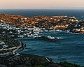
Leipsoi
- Area
- 15.8 km²
- High point
- 277 m

Pserimos
- Area
- 14.5 km²
- High point
- 268 m

Agathonisi
- Area
- 13.4 km²
- High point
- 208 m

Levitha
- Area
- 9.1 km²
- High point
- 141 m
Syrna
- Area
- 8.3 km²
- High point
- 321 m

Alimia
- Area
- 7.4 km²
- High point
- 268 m

Arkoi
- Area
- 6.7 km²
- High point
- 112 m
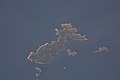
Skantzoura
- Area
- 6.3 km²
- High point
- 104 m

Telendos
- Area
- 4.6 km²
- High point
- 457 m

Nimos
- Area
- 4.6 km²
- High point
- 363 m

Gyali
- Area
- 4.6 km²
- High point
- 179 m
Kinaros
- Area
- 4.5 km²
- High point
- 287 m

Farmakonisi
- Area
- 3.9 km²
- High point
- 108 m
Sarakino
- Area
- 3.3 km²
- High point
- 132 m

Armathia
- Area
- 2.5 km²
- High point
- 109 m
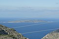
Kalolimnos
- Area
- 1.9 km²
- High point
- 106 m

Seskli
- Area
- 1.8 km²
- High point
- 122 m
Ofidoussa
- Area
- 1.8 km²
- High point
- 133 m
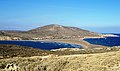
Prasonisi
- Area
- 1.5 km²
- High point
- 80 m
Archangelos
- Area
- 1.5 km²
- High point
- 132 m
Kandelioussa
- Area
- 1.4 km²
- High point
- 104 m
Kounoupi
- Area
- 1.4 km²
- High point
- 90 m
Agreloussa
- Area
- 1.3 km²
- High point
- 118 m

Zaforas
- Area
- 1.3 km²
- High point
- 220 m

Pergousa
- Area
- 1.2 km²
- High point
- 75 m
Pachia
- Area
- 1.2 km²
- High point
- 138 m

Astakida
- Area
- 0.98 km²
- High point
- 139 m
Pontikoussa
- Area
- 0.98 km²
- High point
- 227 m

Gaidouronisi
- Area
- 0.75 km²
- High point
- 155 m
Plati Pserimou
- Area
- 0.68 km²
- High point
- 42 m
Agios Theodoros
- Area
- 0.66 km²
- High point
- 96 m
Platia
- Area
- 0.62 km²
- High point
- 39 m
Megalo Fokionisi
- Area
- 0.61 km²
- High point
- 53 m
Makry
- Area
- 0.61 km²
- High point
- 96 m
Plakida
- Area
- 0.57 km²
- High point
- 76 m
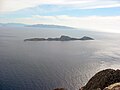
Antitilos
- Area
- 0.5 km²
- High point
- 119 m
Mesonisi
- Area
- 0.49 km²
- High point
- 42 m
Koutsomytis
- Area
- 0.48 km²
- High point
- 66 m
Nera
- Area
- 0.48 km²
- High point
- 50 m
Nero
- Area
- 0.44 km²
- High point
- 63 m

Chamili
- Area
- 0.44 km²
- High point
- 36 m
Chondro
- Area
- 0.38 km²
- High point
- 90 m
Tragonisi
- Area
- 0.36 km²
- High point
- 102 m
Piganousa
- Area
- 0.35 km²
- High point
- 139 m
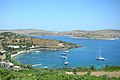
Marathos Island
- Area
- 0.34 km²
- High point
- 50 m
Nisos
- Area
- 0.33 km²
- High point
- 48 m
Megalo Liadi
- Area
- 0.32 km²
- High point
- 50 m
Anydros
- Area
- 0.31 km²
- High point
- 100 m
Makronisi
- Area
- 0.3 km²
- High point
- 20 m
Tragousa
- Area
- 0.3 km²
- High point
- 58 m
Kalovolos
- Area
- 0.29 km²
- High point
- 60 m
Kalavros
- Area
- 0.29 km²
- High point
- 99 m
Agia Kyriaki islets
- Area
- 0.28 km²
- High point
- 23 m
Chiliomódi
- Area
- 0.27 km²
- High point
- 107 m
Divounia 1
- Area
- 0.26 km²
- High point
- 95 m
Makronisi
- Area
- 0.26 km²
- High point
- 41 m
Frangkos
- Area
- 0.24 km²
- High point
- 72 m
Praso Skantzouras
- Area
- 0.24 km²
- High point
- 44 m
Glyno
- Area
- 0.24 km²
- High point
- 39 m
Kouneli
- Area
- 0.22 km²
- High point
- 51 m
Megalos Adelfos islet
- Area
- 0.22 km²
- High point
- 129 m
Strogyli
- Area
- 0.21 km²
- High point
- 71 m

Strongylí
- Area
- 0.21 km²
- High point
- 120 m
Makronisi
- Area
- 0.21 km²
- High point
- 34 m
Strongyli
- Area
- 0.21 km²
- High point
- 88 m
Divounia 2
- Area
- 0.21 km²
- High point
- 95 m
Faradonisia
- Area
- 0.2 km²
- High point
- 60 m
Gaidaros
- Area
- 0.19 km²
- High point
- 72 m
Glaros
- Area
- 0.19 km²
- High point
- 33 m
Chondrós
- Area
- 0.18 km²
- High point
- 98 m
Unnamed island
- Area
- 0.18 km²
- High point
- 28 m
Strongyli
- Area
- 0.16 km²
- High point
- 84 m
Arefousa
- Area
- 0.16 km²
- High point
- 46 m
Stefania
- Area
- 0.15 km²
- High point
- 25 m
Safonidi
- Area
- 0.15 km²
- High point
- 44 m
Unnamed island
- Area
- 0.14 km²
- High point
- 84 m
Agia Kyriaki
- Area
- 0.14 km²
- High point
- 56 m
Pitta
- Area
- 0.13 km²
- High point
- 15 m
Mesos Adelfos islet
- Area
- 0.13 km²
- High point
- 67 m
Astakidopoulo
- Area
- 0.12 km²
- High point
- 42 m
Megalo Glaronisi
- Area
- 0.12 km²
- High point
- 32 m
Gialesino
- Area
- 0.11 km²
- High point
- 43 m
Polemika
- Area
- 0.11 km²
- High point
- 42 m
Agia Kyriaki
- Area
- 0.11 km²
- High point
- 67 m

Sokastro
- Area
- 0.11 km²
- High point
- 84 m
Mikro Fokionisi
- Area
- 0.1 km²
- High point
- 23 m
Megalonisi
- Area
- 0.1 km²
- High point
- 40 m
Rocks & skerries
On the chart above, at its closest zooms.
Listing 100 of 1767; the rest are on the chart.
Figures
Comparative heights
To the same scale
Islands by area
Groups within
Overlapping groups
Photographs

Αστυπάλαια - Astipalea Island

Berth of fishing boats in Lefkos. Karpathos, Greece

Greek islands near Rhodes


Rhodes harbour, Greece.

The coastal relief of Rhodes. Greece

This is a photograph of a Natura 2000 protected area with ID

This is a photograph of a Natura 2000 protected area with ID

This is a photograph of a Natura 2000 protected area with ID

This is a photograph of a Natura 2000 protected area with ID

Islands of Makry and Alimia Chalki Island in the background, W of Rhodes, Dodecanese, Greece

500px provided description: 38161156511 Jpg []
Sources
Facts
Photographs
- Αστυπάλαια - Astipalea Island - panoramio. INDALOMANIA / CC BY-SA 3.0
- Berth of fishing boats in Lefkos. Karpathos, Greece. Ввласенко / CC BY-SA 3.0
- Greek islands near Rhodes. Ввласенко / CC BY-SA 3.0
- Kalymnos. Unknown author / CC BY-SA 3.0
- Rhodes harbour. Wojsyl / CC BY-SA 3.0
- The coastal relief of Rhodes. Greece. Ввласенко / CC BY-SA 3.0
- Ερηπωμένο εκκλησάκι. Asthenoforos / CC BY-SA 4.0
- Κάλυμνος. Iria1344 / CC BY-SA 4.0
- Σπηλάδι. Asthenoforos / CC BY-SA 4.0
- Μαρμαρωμένο καράβι!. Foteini mpakalidou / CC BY-SA 4.0
- Makry and Alimia. Shadowgate / CC BY 2.0
- 38161156511 Jpg (234359891). Pierre Vorpuni / CC BY 3.0