United Kingdom
60°22′N 1°49′W
Ve Skerries
8 km) north west of Papa Stour, on the west coast of Shetland, Scotland. They define the southwest perimeter of St Magnus Bay. They are notorious for shipwrecks, which led to the construction of a lighthouse in 1979. In local folklore, they are said to be a retreat for selkies.
Chart
Overview
The Ve Skerries or Vee Skerries (Shaetlan pronunciation: [də 'viː skɛriz] də VEE skeh-reez; Old Norse: Vestan sker, West Skerries) are a group of low skerries (rocky islands) three miles (4.8 km) north west of Papa Stour, on the west coast of Shetland, Scotland. They define the southwest perimeter of St Magnus Bay. They are notorious for shipwrecks, which led to the construction of a lighthouse in 1979. In local folklore, they are said to be a retreat for selkies. The lighthouse was built following the loss of the trawler Elinor Viking and to serve increased shipping for the Sullom Voe oil terminal.
From Wikipedia, CC BY-SA 4.0
Census, cataloged
- Major islands0
- Minor islands0
- Islets2
- Rocks & skerries9
Islets
- Helligoblo0.7 ha
- Reaverack0.6 ha
Rocks & skerries
- North Skerry3 m · 0.06 km²
- Ormal2 m · 0.05 km²
- South Skerry1 m · 0.03 km²
- The Clubb1 m · 0.4 ha
- Unnamed island<0.1 ha
- Unnamed island<0.1 ha
- Unnamed island<0.1 ha
- Unnamed island<0.1 ha
- Snarra Stane<0.1 ha
Figures
Comparative heights
- North Skerry: 3 m
- Ormal: 2 m
- South Skerry: 1 m
- The Clubb: 1 m
To the same scale
Islands by area
| North Skerry | 0.06 km² |
| Ormal | 0.05 km² |
| South Skerry | 0.03 km² |
| Helligoblo | 0.7 ha |
| Reaverack | 0.6 ha |
| The Clubb | 0.4 ha |
| Unnamed island | <0.1 ha |
| Unnamed island | <0.1 ha |
| Unnamed island | <0.1 ha |
| Unnamed island | <0.1 ha |
| Snarra Stane | <0.1 ha |
Sources
Facts
Photographs
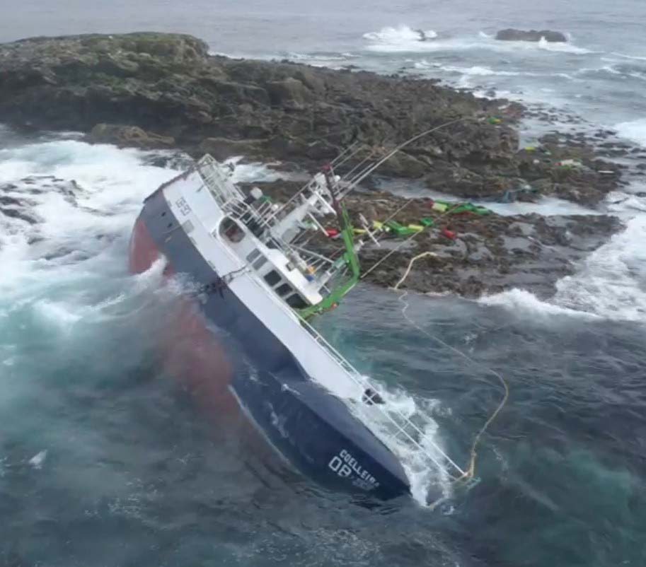
- Coelleira wrecked on the Clubb, Ve Skerries post salvage attempt. Uncredited / OGL 3