Vanuatu
16°38′S 168°01′E
Vanuatu
Part of Melanesia
Vanuatu, officially the Republic of Vanuatu (French: République de Vanuatu; Bislama: Ripablik blong Vanuatu), is an archipelagic country in the Melanesia region of Oceania located in the South Pacific Ocean.

Chart
Overview
Vanuatu, officially the Republic of Vanuatu (French: République de Vanuatu; Bislama: Ripablik blong Vanuatu), is an archipelagic country in the Melanesia region of Oceania located in the South Pacific Ocean. The archipelago, which is of volcanic origin, is 1,750 km (1,090 mi) east of northern Australia, 540 km (340 mi) northeast of New Caledonia, east of New Guinea, southeast of Solomon Islands, and west of Fiji. Vanuatu was first inhabited by Melanesian people. The first Europeans to visit the islands were a Spanish expedition led by Portuguese navigator Fernandes de Queirós, who arrived on the largest island, Espíritu Santo, in 1606. Queirós claimed the archipelago for Spain, as part of the colonial Spanish East Indies and named it La Austrialia del Espíritu Santo. In the 1880s, France and the United Kingdom claimed parts of the archipelago, and in 1906, they agreed on a framework for jointly managing the archipelago as the New Hebrides – through an Anglo-French condominium. In the 1970s, an independence movement arose, and the Republic of Vanuatu was founded in 1980. Since its independence, the country has become a member of the United Nations, the Commonwealth of Nations, the Organisation internationale de la Francophonie, and the Pacific Islands Forum.
From Wikipedia, CC BY-SA 4.0
Census, cataloged
- Major islands8
- Minor islands120
- Islets102
- Rocks & skerries55
Major islands
Espiritu Santo
- Area
- 3,940 km²
- High point
- 1,879 m
2 sq mi), although Efate, on which the capital city of Port Vila is located, has a larger population. As of 2020, the population of Santo was 37,328. Luganville is the only true town on the island.
Malakula Island
- Area
- 2,041 km²
- High point
- 877 m
Malekula, also spelled Malakula, is the second-largest island in the nation of Vanuatu, an archipelago of Melanesia in the South Pacific.
Efate
- Area
- 894 km²
- High point
- 647 m
Efate (French: Éfaté), originally named Sandwich Island and also known as Île Vate (French: [il vat]) or just Vate, is an island in the Pacific Ocean. It is part of the Shefa Province in Vanuatu, and the capital city, Port Vila, is located on the island.
Erromango
- Area
- 890 km²
- High point
- 850 m
Erromango is the fourth largest island in the Vanuatu archipelago. With a land area of 891.9 square kilometres (344.4 sq mi), it is the largest island in Tafea Province, the southernmost of Vanuatu's six administrative regions.
Ambrym
- Area
- 672 km²
- High point
- 1,270 m
Ambrym is a volcanic island in Malampa Province in the archipelago of Vanuatu. It is located near the center of the archipelago of Vanuatu, and also hosts one of the most active volcanoes in the world, which includes lava lakes in two craters near the summit. It is currently the least populous island in the country.
Tanna
- Area
- 563 km²
- High point
- 1,084 m
Tanna (sometimes misspelled Tana) is an island in southern Vanuatu. Tanna is the most populous island of Tafea Province, and the third most populous in the country (after Efate and Espiritu Santo).
Pentecost
- Area
- 490 km²
- High point
- 947 m
Pentecost is one of the 83 islands that make up the South Pacific nation of Vanuatu.


Epi
- Area
- 443 km²
- High point
- 833 m
Epi (or Épi, Api; formerly known as Tasiko or Volcano Island) is an island in Shefa Province, Vanuatu, at the north end of the Shepherd Islands.
Minor islands

Aoba Island
- Area
- 403 km²
- High point
- 1,496 m

Vanua Lava
- Area
- 332 km²
- High point
- 958 m

Gaua
- Area
- 308 km²
- High point
- 797 m
Maewo
- Area
- 302 km²
- High point
- 811 m

Malo
- Area
- 182 km²
- High point
- 328 m

Aneityum
- Area
- 160 km²
- High point
- 804 m

Aore
- Area
- 58.1 km²
- High point
- 140 m
Hiw
- Area
- 47.3 km²
- High point
- 335 m
Tongoa
- Area
- 40.1 km²
- High point
- 494 m
Ureparapara
- Area
- 39 km²
- High point
- 684 m
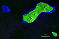
Emae
- Area
- 33 km²
- High point
- 644 m
Mota Lava
- Area
- 32.2 km²
- High point
- 428 m
Tegua
- Area
- 32.1 km²
- High point
- 239 m

Paama
- Area
- 31.6 km²
- High point
- 538 m
Tegua
- Area
- 30.7 km²
- High point
- 139 m
Lopevi
- Area
- 28.5 km²
- High point
- 1,430 m
Nguna
- Area
- 27.4 km²
- High point
- 599 m
Moso
- Area
- 24.9 km²
- High point
- 117 m
Nguna
- Area
- 24.5 km²
- High point
- 160 m
Toga
- Area
- 19.1 km²
- High point
- 250 m
Merelava
- Area
- 17.6 km²
- High point
- 1,009 m
Tutuba Island
- Area
- 12.9 km²
- High point
- 68 m
Sakao Island
- Area
- 11.5 km²
- High point
- 130 m

Futuna
- Area
- 10.6 km²
- High point
- 664 m
Lo
- Area
- 10.1 km²
- High point
- 138 m
Mota
- Area
- 10.1 km²
- High point
- 411 m

Aniwa
- Area
- 8.5 km²
- High point
- 55 m
Emao
- Area
- 7.6 km²
- High point
- 411 m

Lelepa
- Area
- 7.5 km²
- High point
- 202 m
Haiite Island
- Area
- 7.5 km²
- High point
- 38 m
Tongariki
- Area
- 5.4 km²
- High point
- 523 m
Mavéa
- Area
- 4.6 km²
- High point
- 71 m
Sakao Island
- Area
- 4.1 km²
- High point
- 91 m

Pele
- Area
- 4.1 km²
- High point
- 196 m
Lataro
- Area
- 3.2 km²
- High point
- 88 m
Metoma
- Area
- 3.1 km²
- High point
- 129 m
Le-tharo
- Area
- 3 km²
- High point
- 105 m
Thion
- Area
- 2.8 km²
- High point
- 213 m
Tomman
- Area
- 2.6 km²
- High point
- 80 m
Araki
- Area
- 2.5 km²
- High point
- 255 m
Linua
- Area
- 2.4 km²
- High point
- 30 m

Makura
- Area
- 1.8 km²
- High point
- 296 m
Mataso
- Area
- 1.7 km²
- High point
- 407 m
Lathu
- Area
- 1.6 km²
- High point
- 187 m
Île Koivou
- Area
- 1.6 km²
- High point
- 44 m
Rano Island
- Area
- 1.5 km²
- High point
- 28 m
Uri
- Area
- 1.4 km²
- High point
- 27 m
Le-theroa
- Area
- 1.4 km²
- High point
- 78 m
Buninga
- Area
- 1.3 km²
- High point
- 221 m
Vao Island
- Area
- 1.2 km²
- High point
- 42 m
Qaké
- Area
- 1.2 km²
- High point
- 23 m
Ewose
- Area
- 1.1 km²
- High point
- 318 m
Urpiv
- Area
- 0.98 km²
- High point
- 29 m
Lamen
- Area
- 0.96 km²
- High point
- 51 m
Vulaï
- Area
- 0.91 km²
- High point
- 73 m
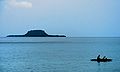
Eretoka
- Area
- 0.88 km²
- High point
- 95 m
Malokilikili
- Area
- 0.87 km²
- High point
- 17 m
Wala Island
- Area
- 0.77 km²
- High point
- 38 m
Atchin Island
- Area
- 0.73 km²
- High point
- 38 m
Ratua Island
- Area
- 0.68 km²
- High point
- 20 m
Urelapa
- Area
- 0.67 km²
- High point
- 25 m
Bokissa Island
- Area
- 0.66 km²
- High point
- 28 m
Tangoa
- Area
- 0.62 km²
- High point
- 43 m
Unnamed island
- Area
- 0.56 km²
- High point
- 17 m
Ra
- Area
- 0.55 km²
- High point
- 49 m
Unnamed island
- Area
- 0.48 km²
- High point
- 79 m
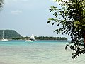
Ifira
- Area
- 0.47 km²
- High point
- 25 m
Unnamed island
- Area
- 0.45 km²
- High point
- 9 m
Merig
- Area
- 0.45 km²
- High point
- 119 m
Unnamed island
- Area
- 0.44 km²
- High point
- 172 m
Raven̄a
- Area
- 0.42 km²
- High point
- 23 m
Unnamed island
- Area
- 0.42 km²
- High point
- 79 m
Unnamed island
- Area
- 0.39 km²
- High point
- 27 m
Nawila
- Area
- 0.37 km²
- High point
- 20 m
Kakula
- Area
- 0.37 km²
- High point
- 20 m
Unnamed island
- Area
- 0.36 km²
- High point
- 10 m
Île Faroun
- Area
- 0.35 km²
- High point
- 12 m
Unnamed island
- Area
- 0.31 km²
- High point
- 12 m
Laika
- Area
- 0.31 km²
- High point
- 95 m
Oyster Island
- Area
- 0.31 km²
- High point
- 28 m
Anouit
- Area
- 0.28 km²
- High point
- 21 m
Asuleka
- Area
- 0.28 km²
- High point
- 22 m
Falea
- Area
- 0.27 km²
- High point
- 103 m
Unnamed island
- Area
- 0.22 km²
- High point
- 10 m
Norsup
- Area
- 0.22 km²
- High point
- 21 m
Malotina
- Area
- 0.19 km²
- High point
- 18 m
Unnamed island
- Area
- 0.18 km²
- High point
- 12 m
Unnamed island
- Area
- 0.18 km²
- High point
- 24 m
Iririki
- Area
- 0.18 km²
- High point
- 47 m
Unnamed island
- Area
- 0.17 km²
- High point
- 12 m
Unnamed island
- Area
- 0.16 km²
- High point
- 8 m
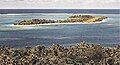
Inyeug
- Area
- 0.16 km²
- High point
- 12 m
Iriwiti Lep
- Area
- 0.15 km²
- High point
- 15 m
Unnamed island
- Area
- 0.14 km²
- High point
- 18 m
Unnamed island
- Area
- 0.13 km²
- High point
- 17 m
Unnamed island
- Area
- 0.13 km²
- High point
- 14 m
Vot Tande
- Area
- 0.12 km²
- High point
- 43 m
Malvanua
- Area
- 0.11 km²
- High point
- 28 m
Unnamed island
- Area
- 0.11 km²
- High point
- 44 m
Unnamed island
- Area
- 0.11 km²
- High point
- 70 m
Ngwel
- Area
- 0.1 km²
- High point
- 8 m
Avock
- Area
- —
size unknown
Awei
- Area
- —
- High point
- 1 m
size unknown
Ekapum Lep
- Area
- —
size unknown
Elephant Island
- Area
- —
size unknown
Erueti Lep
- Area
- —
size unknown
Fatumiala
- Area
- —
size unknown
Kwakéa
- Area
- —
- High point
- 13 m
size unknown
Lataroa
- Area
- —
size unknown
Leneu
- Area
- —
size unknown
Malparavu
- Area
- —
- High point
- 15 m
size unknown
Maltinerava
- Area
- —
- High point
- 38 m
size unknown
Namuka
- Area
- —
size unknown
Ravenga
- Area
- —
size unknown
Rowa
- Area
- —
- High point
- 6 m
size unknown
Sowan
- Area
- —
- High point
- 177 m
size unknown
Tefala
- Area
- —
size unknown
Uluveo
- Area
- —
size unknown
Uripiv
- Area
- —
size unknown
Vete Manung
- Area
- —
size unknown
Rocks & skerries
On the chart above, at its closest zooms.
Listing 128 of 285; the rest are on the chart.
Figures
Comparative heights
To the same scale
Islands by area
| Espiritu Santo | 3,940 km² |
| Malakula Island | 2,041 km² |
| Efate | 894 km² |
| Erromango | 890 km² |
| Ambrym | 672 km² |
| Tanna | 563 km² |
| Pentecost | 490 km² |
| Epi | 443 km² |
| Aoba Island | 403 km² |
| Vanua Lava | 332 km² |
| Gaua | 308 km² |
| Maewo | 302 km² |
| Malo | 182 km² |
| Aneityum | 160 km² |
| Aore | 58.1 km² |
| Hiw | 47.3 km² |
| Tongoa | 40.1 km² |
| Ureparapara | 39 km² |
| Emae | 33 km² |
| Mota Lava | 32.2 km² |
| Tegua | 32.1 km² |
| Paama | 31.6 km² |
| Tegua | 30.7 km² |
| Lopevi | 28.5 km² |
| Nguna | 27.4 km² |
| Moso | 24.9 km² |
| Nguna | 24.5 km² |
| Toga | 19.1 km² |
| Merelava | 17.6 km² |
| Tutuba Island | 12.9 km² |
| Sakao Island | 11.5 km² |
| Futuna | 10.6 km² |
| Lo | 10.1 km² |
| Mota | 10.1 km² |
| Aniwa | 8.5 km² |
| Emao | 7.6 km² |
| Lelepa | 7.5 km² |
| Haiite Island | 7.5 km² |
| Tongariki | 5.4 km² |
| Mavéa | 4.6 km² |
| Sakao Island | 4.1 km² |
| Pele | 4.1 km² |
| Lataro | 3.2 km² |
| Metoma | 3.1 km² |
| Le-tharo | 3 km² |
| Thion | 2.8 km² |
| Tomman | 2.6 km² |
| Araki | 2.5 km² |
| Linua | 2.4 km² |
| Makura | 1.8 km² |
| Mataso | 1.7 km² |
| Lathu | 1.6 km² |
| Île Koivou | 1.6 km² |
| Rano Island | 1.5 km² |
| Uri | 1.4 km² |
| Le-theroa | 1.4 km² |
| Buninga | 1.3 km² |
| Vao Island | 1.2 km² |
| Qaké | 1.2 km² |
| Ewose | 1.1 km² |
| Urpiv | 0.98 km² |
| Lamen | 0.96 km² |
| Vulaï | 0.91 km² |
| Eretoka | 0.88 km² |
| Malokilikili | 0.87 km² |
| Wala Island | 0.77 km² |
| Atchin Island | 0.73 km² |
| Ratua Island | 0.68 km² |
| Urelapa | 0.67 km² |
| Bokissa Island | 0.66 km² |
| Tangoa | 0.62 km² |
| Unnamed island | 0.56 km² |
| Ra | 0.55 km² |
| Unnamed island | 0.48 km² |
| Ifira | 0.47 km² |
| Unnamed island | 0.45 km² |
| Merig | 0.45 km² |
| Unnamed island | 0.44 km² |
| Raven̄a | 0.42 km² |
| Unnamed island | 0.42 km² |
| Unnamed island | 0.39 km² |
| Nawila | 0.37 km² |
| Kakula | 0.37 km² |
| Unnamed island | 0.36 km² |
| Île Faroun | 0.35 km² |
| Unnamed island | 0.31 km² |
| Laika | 0.31 km² |
| Oyster Island | 0.31 km² |
| Anouit | 0.28 km² |
| Asuleka | 0.28 km² |
| Falea | 0.27 km² |
| Unnamed island | 0.22 km² |
| Norsup | 0.22 km² |
| Malotina | 0.19 km² |
| Unnamed island | 0.18 km² |
| Unnamed island | 0.18 km² |
| Iririki | 0.18 km² |
| Unnamed island | 0.17 km² |
| Unnamed island | 0.16 km² |
| Inyeug | 0.16 km² |
| Iriwiti Lep | 0.15 km² |
| Unnamed island | 0.14 km² |
| Unnamed island | 0.13 km² |
| Unnamed island | 0.13 km² |
| Vot Tande | 0.12 km² |
| Malvanua | 0.11 km² |
| Unnamed island | 0.11 km² |
| Unnamed island | 0.11 km² |
| Ngwel | 0.1 km² |
Groups within
Overlapping groups
Photographs

breakas beach resort vanuatu

chantillys_1072

Sunset long Vanuatu

chantillys_1070

Lava lake in Marum Crater in Vanuatu (Ambrim Island)

coco beach_0875

Coconut plantation

Boats still washed ashore by Cyclone Pam in 2015

Dany Island Beach - amazing private tropical island


Wood bundles to cook > Port Vila Vanuatu
Sources
Facts
Photographs
- Breakas beach resort vanuatu (16556247960). Simon_sees from Australia / CC BY 2.0
- Chantillys 1072 (16556231410). Simon_sees from Australia / CC BY 2.0
- All is Red. Rowena.millon / CC BY-SA 4.0
- Chantillys 1070 (16121341584). Simon_sees from Australia / CC BY 2.0
- Marum sept 2009. Geophile71 / CC0
- Coco beach 0875 (16557519359). Simon_sees from Australia / CC BY 2.0
- Coconut plantation (29203169861). Simon_sees from Australia / CC BY 2.0
- Cyclone damage Vanuatu (28660778993). Simon_sees from Australia / CC BY 2.0
- DanyIslandBeach. WikiEditAuth / CC BY-SA 4.0
- Diving Operations - Underwater Recovery Operations 150303-N-CG436-171. Petty Officer 2nd Class Michael Scichilone / Public domain
- Diving Operations - Underwater Recovery Operations 150304-N-CG436-068. Petty Officer 2nd Class Michael Scichilone / Public domain
- Fagots de bois pour cuisiner (25010994637). gérard from Nouméa, (Nouvelle-Calédonie) / CC BY-SA 2.0