Tuvalu
7°28′S 178°00′E
Tuvalu
Part of Polynesia
Tuvalu ( too-VAH-loo) is an archipelagic country in the Polynesian sub-region of Oceania in the Pacific Ocean, about midway between Hawaii and Australia.

Chart
Overview
Tuvalu ( too-VAH-loo) is an archipelagic country in the Polynesian sub-region of Oceania in the Pacific Ocean, about midway between Hawaii and Australia. It lies east-northeast of the Santa Cruz Islands (which belong to Solomon Islands), northeast of Vanuatu, southeast of Nauru, south of Kiribati, west of Tokelau, northwest of Samoa and Wallis and Futuna, and north of Fiji. Tuvalu is composed of three reef islands and six atolls spread out between the latitude of 5° and 10° south and between the longitude of 176° and 180°. They lie west of the International Date Line. The 2022 census determined that Tuvalu had a population of 10,643, making it the 2nd least populated country in the United Nations, exceeding only Niue and the Vatican City in population. Tuvalu's total land area is 25.14 square kilometres (9.71 sq mi). It is the 4th smallest country in the world, the only smaller nations being Monaco, Naoero and Vatican City. The first inhabitants of Tuvalu were Polynesians arriving as part of the migration of Polynesians into the Pacific that began about three thousand years ago. Scholars believe that the Polynesians spread out from Samoa and Tonga into the Tuvaluan atolls, which then served as a stepping stone for further migration into the Polynesian outliers in Melanesia and Micronesia. In 1568, Spanish explorer Álvaro de Mendaña became the first European known to sail through the archipelago, sighting the island of Nui during an expedition he was making in search of Terra Australis. The island of Funafuti, currently serving as the capital, was named Ellice's Island in 1819, with the islands later known collectively as the Ellice Islands. In 1892, a British protectorate was proclaimed over the islands and the nearby Gilbert Islands. They were incorporated into the Gilbert and Ellice Islands Colony in 1916, subject to a resident commissioner based in the Gilbert Islands. A referendum was held in 1974 to determine whether the Gilbert Islands and Ellice Islands should each have their own administration. As a result, the Gilbert and Ellice Islands colony legally ceased to exist on 1 October 1975; on 1 January 1976, the old administration was officially separated, and two separate British colonies, Kiribati and Tuvalu, were formed. On 1 October 1978, Tuvalu became fully independent as a sovereign state within the Commonwealth, and is a constitutional monarchy with Charles III as King of Tuvalu. On 5 September 2000, Tuvalu became the 189th member of the United Nations. The islands do not have a significant amount of soil, so the country relies heavily on imports and fishing for food. Licensing fishing permits to international companies, grants and aid projects, and remittances to their families from Tuvaluan seafarers who work on cargo ships are important parts of the economy. Because it is a low-lying island nation, Tuvalu is extremely vulnerable to sea level rise due to climate change. It is active in international climate negotiations as part of the Alliance of Small Island States.
From Wikipedia, CC BY-SA 4.0
Census, cataloged
- Major islands14
- Minor islands32
- Islets71
- Rocks & skerries6
Major islands
Vaitupu
- Area
- 5.5 km²
- High point
- 25 m
Vaitupu is the largest atoll of the nation of Tuvalu. It is located at 7.48 degrees south and 178.83 degrees east. There are 1,077 people (2022 Census) living on 5.6 square kilometres (2.2 square miles) with the main village being Asau.
Niutao
- Area
- 2.5 km²
- High point
- 19 m
Niutao is a reef island in the northern part of Tuvalu. It is one of the nine districts (islands) of Tuvalu. It is also one of the three districts that consist of only one island — not counting the three islets inside the closed lagoon. Niutao has a population of 550 (2022 census).
Nanumea
- Area
- 2.4 km²
- High point
- 21 m
Nanumea is the northwesternmost atoll in the Polynesian nation of Tuvalu, a group of nine coral atolls and islands spread over about 400 miles (640 km) of the Pacific Ocean just south of the equator and west of the International Date Line. Nanumea is 4 km2 (1.5 sq mi) with a population of 610 people (2022 census).
Lakena
- Area
- 1.2 km²
- High point
- 25 m
Lake na or Lakina is an islet of Nanumea atoll, Tuvalu. Nanumean traditions describe Lakena as being formed when sand spilled from the baskets of two women, Pai and Vau, when they were forced off Nanumea by Tefolaha, the Tongan warrior who became the ancestor of the people of Nanumea.

Nui
- Area
- 3.4 km²
Nui is an atoll and one of nine districts of the Pacific Ocean state of Tuvalu. It has a land area of 3.37 km2 (1.31 sq mile)and a population of 514 (2022 Census).
Nanumanga
- Area
- 3.2 km²
- High point
- 19 m
Nanumanga or Nanumaga is a reef island and a district of the Oceanian island nation of Tuvalu. It has a surface area of about 3 km2 with a population of 391 (2022 census).
Nukufetau
- Area
- 3 km²
Nukufetau is an atoll that is part of the nation of Tuvalu. The atoll was claimed by the US under the Guano Islands Act some time in the 19th century and was ceded in a treaty of friendship concluded in 1979 and coming into force in 1983. It has a population of 581 who live on Savave islet (2022 Census).
Funafuti
- Area
- 2.4 km²
Funafuti is an atoll, comprising numerous islets, that is the capital of Tuvalu. As of the 2017 census, it has a population of 6,320 people. More people live in Funafuti than the rest of Tuvalu combined, with it containing approximately 60% of the nation's population.
Fongafale
- Area
- 1.9 km²
- High point
- 12 m
Fongafale (also spelled Fogale or Fagafale) is the largest and most populated of Funafuti's islets in Tuvalu. 46 miles long and between 10 and 400 metres (11 and 438 yd) wide, with the South Pacific Ocean and reef on the east and the protected lagoon on the west.
Nukulaelae
- Area
- 1.8 km²
Nukulaelae is an atoll that is part of the nation of Tuvalu, and it has a population of 300 (2017 census). The largest settlement is Pepesala on Fangaua islet with a population of 341 people (2022 Census). It has the form of an oval and consists of at least 15 islets.
Motulalo
- Area
- 1.4 km²
- High point
- 25 m
Motulalo is the largest islet of Nukufetau, Tuvalu. The traditional history of Nukufetau recalls that in order to protect the atoll from raiders from Tonga, Tauasa, an aliki (chief), was given Motulalo. Tauasa would pull up coconut trees and throw them at the raiders.
Fenua Tapu
- Area
- 1.4 km²
- High point
- 18 m
Fenua Tapu is an islet of Nui atoll in the Pacific Ocean state of Tuvalu.
Telikiai
- Area
- 0.91 km²
- High point
- 22 m
Telikiai (or Meang) is an islet of Nui atoll in the Pacific Ocean state of Tuvalu. Meang means "west". The islet features in the legends of the Tekaunibiti family, whose members went to catch birds on the islet and found three teanti-ma-aomata (half-spirit and half-human creatures) and captured two.
Niuoko
- Area
- 0.87 km²
- High point
- 18 m
Minor islands
Lafanga
- Area
- 0.71 km²
- High point
- 20 m
Tokinivae
- Area
- 0.59 km²
- High point
- 20 m
Tumiloto
- Area
- 0.53 km²
- High point
- 16 m
Niulakita
- Area
- 0.44 km²
- High point
- 5 m

Funafala
- Area
- 0.44 km²
- High point
- 15 m
Savave
- Area
- 0.41 km²
- High point
- 19 m
Kongo Loto Lafanga
- Area
- 0.3 km²
- High point
- 21 m
Pongalei
- Area
- 0.29 km²
- High point
- 18 m
Fagaua
- Area
- 0.29 km²
- High point
- 12 m
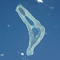
Temotufoliki
- Area
- 0.24 km²
- High point
- 11 m
Savave
- Area
- 0.24 km²
- High point
- 12 m
Funaota
- Area
- 0.17 km²
- High point
- 16 m
Fetuatasi
- Area
- 0.17 km²
- High point
- 16 m
Talalolae
- Area
- 0.17 km²
- High point
- 18 m
Avalau
- Area
- 0.15 km²
- High point
- 18 m
Papa Elise
- Area
- 0.15 km²
- High point
- 17 m
Telele
- Area
- 0.13 km²
- High point
- 12 m
Tepuka
- Area
- 0.13 km²
- High point
- 14 m
Motumua
- Area
- 0.12 km²
- High point
- 19 m
Faiava Lasi
- Area
- —
size unknown
Luamotu
- Area
- —
size unknown
Mateika
- Area
- —
size unknown
Motufetau
- Area
- —
size unknown
Motuloa
- Area
- —
size unknown
Niualuka
- Area
- —
size unknown
Nukusavalevale
- Area
- —
size unknown
Pukasavilivili
- Area
- —
size unknown
Te Afuafou
- Area
- —
size unknown
Te Motu Olepa
- Area
- —
size unknown
Temotu
- Area
- —
size unknown
Tengasu
- Area
- —
size unknown
Tepuka Vili Vili
- Area
- —
size unknown
Islets
Rocks & skerries
- Unnamed island<0.1 ha
- Unnamed island<0.1 ha
- Unnamed island<0.1 ha
- Unnamed island<0.1 ha
- Unnamed island<0.1 ha
- Unnamed island<0.1 ha
Figures
Comparative heights
To the same scale
Islands by area
| Vaitupu | 5.5 km² |
| Nui | 3.4 km² |
| Nanumanga | 3.2 km² |
| Nukufetau | 3 km² |
| Niutao | 2.5 km² |
| Funafuti | 2.4 km² |
| Nanumea | 2.4 km² |
| Fongafale | 1.9 km² |
| Nukulaelae | 1.8 km² |
| Motulalo | 1.4 km² |
| Fenua Tapu | 1.4 km² |
| Lakena | 1.2 km² |
| Telikiai | 0.91 km² |
| Niuoko | 0.87 km² |
| Lafanga | 0.71 km² |
| Tokinivae | 0.59 km² |
| Tumiloto | 0.53 km² |
| Niulakita | 0.44 km² |
| Funafala | 0.44 km² |
| Savave | 0.41 km² |
| Kongo Loto Lafanga | 0.3 km² |
| Pongalei | 0.29 km² |
| Fagaua | 0.29 km² |
| Temotufoliki | 0.24 km² |
| Savave | 0.24 km² |
| Funaota | 0.17 km² |
| Fetuatasi | 0.17 km² |
| Talalolae | 0.17 km² |
| Avalau | 0.15 km² |
| Papa Elise | 0.15 km² |
| Telele | 0.13 km² |
| Tepuka | 0.13 km² |
| Motumua | 0.12 km² |
| Amatuku | 0.1 km² |
| Fualefeke | 0.08 km² |
| Fatato | 0.07 km² |
| Motuloa | 0.07 km² |
| Motala | 0.07 km² |
| Sakalua | 0.07 km² |
| Temotuloto | 0.07 km² |
| Teafatule | 0.06 km² |
| Pakantou | 0.06 km² |
| Fale Fatu | 0.05 km² |
| Funamanu | 0.05 km² |
| Piliaieve | 0.05 km² |
| Unimai | 0.05 km² |
| Fualopa | 0.05 km² |
| Moliteatua | 0.04 km² |
| Motukatuli Foliki | 0.04 km² |
| Fuafatu | 0.04 km² |
| Niuatui | 0.04 km² |
| Mulitefala | 0.03 km² |
| Unnamed island | 0.03 km² |
| Teafuone | 0.03 km² |
| Fenualago | 0.03 km² |
| Teafuaniua | 0.02 km² |
| Motulua | 0.02 km² |
| Motupuakaka | 0.02 km² |
| Motuloa | 0.02 km² |
| Fuagea | 0.02 km² |
| Paava | 0.02 km² |
| Tutanga | 0.02 km² |
| Falaoigo | 0.02 km² |
| Temotutafa | 0.02 km² |
| Motugie | 0.02 km² |
| Unnamed island | 0.02 km² |
| Oua | 0.01 km² |
| Tefala | 0.01 km² |
| Kalilaia | 0.01 km² |
| Unnamed island | 0.01 km² |
| Teafuanonu | 0.01 km² |
| Unnamed island | 0.9 ha |
| Unnamed island | 0.8 ha |
| Kavutu | 0.8 ha |
| Matanukulaelae | 0.8 ha |
| Asia | 0.7 ha |
| Teafatule | 0.7 ha |
| Te Afualiku | 0.7 ha |
| Teatua a Taepoa | 0.7 ha |
| Tapuaelani | 0.6 ha |
| Unnamed island | 0.6 ha |
| Unnamed island | 0.5 ha |
| Vasafua | 0.5 ha |
| Unnamed island | 0.5 ha |
| Temututoto | 0.5 ha |
| Unnamed island | 0.5 ha |
| Unnamed island | 0.4 ha |
| Unnamed island | 0.4 ha |
| Unnamed island | 0.4 ha |
| Motualama | 0.4 ha |
| Unnamed island | 0.3 ha |
| Unnamed island | 0.3 ha |
| Unnamed island | 0.3 ha |
| Unnamed island | 0.3 ha |
| Unnamed island | 0.3 ha |
| Lefogaki | 0.3 ha |
| Unnamed island | 0.3 ha |
| Unnamed island | 0.3 ha |
| Luasamotu | 0.3 ha |
| Unnamed island | 0.2 ha |
| Unnamed island | 0.2 ha |
| Aula | 0.2 ha |
| Unnamed island | 0.1 ha |
| Unnamed island | 0.1 ha |
| Unnamed island | <0.1 ha |
| Unnamed island | <0.1 ha |
| Unnamed island | <0.1 ha |
| Unnamed island | <0.1 ha |
| Unnamed island | <0.1 ha |
| Unnamed island | <0.1 ha |
Groups within
Photographs

President Lai attends state banquet hosted by Prime Minister Feleti Penitala Teo of Tuvalu in Niutao Hall on 4 December 2024 (Official Photo by Shufu Liu / Office of the President)


Nanumea atoll, Tuvalu, from space

Nui atoll, Tuvalu, from space

Tuvalu Women for Change

A water tank for Nuitau Primary School in Tuvalu being delivered, October 2011. Photo: DFAT

Australian High Commission in Vaiaku

Parliament. Government building in Funafuti

Tuvalu Women for Change en Vaiaku

USP - Tuvalu Campus

Demonstration for Tuvalu & binding treaty in Copenhagen, inside the Bella Center
https://www.flickr.com/people/greenpeacefinland/ Lauri Myllyvirta / / CC BY 2.0

Tuvalu
Sources
Facts
Photographs
- 12.04 「繁榮南島 智慧永續」總統出席吐瓦魯國戴斐立總理國宴 (54183207219). 總統府 / CC BY 2.0
- Tuvalu Land Reclamation Program 2025. JialiangGao / CC BY-SA 4.0
- Nanumea. NASA / Public domain
- Nui atoll. NASA / Public domain
- Tuvalu Women for Change. Rosodo / CC BY-SA 4.0
- A water tank for Nuitau Primary School in Tuvalu being delivered, October 2011. Photo- DFAT (12779671793). Department of Foreign Affairs and Trade / CC BY 2.0
- Australian High Commission in Vaiaku. Rosodo / CC BY-SA 4.0
- Parliament. Government building in Funafuti. Rosodo / CC BY-SA 4.0
- Tuvalu Women for Change en Vaiaku. Rosodo / CC BY-SA 4.0
- USP - Tuvalu Campus. Michael Coghlan from Adelaide, Australia / CC BY-SA 2.0
- Tuvalu demonstration COP15. https://www.flickr.com/people/greenpeacefinland/ Lauri Myllyvirta / / CC BY 2.0
- Tuvalu Inaba-10. INABA Tomoaki / CC BY-SA 2.0