Northern Baltic SeaSweden
59°23′N 18°44′E
Stockholm Archipelago
Stockholms Skärgård
The Stockholm Archipelago (Swedish: Stockholms skärgård) is the largest archipelago in Sweden, and the second-largest archipelago in the Baltic Sea (the largest being the Archipelago Sea across the Baltic in Finland). Part of the archipelago has been designated as a Ramsar site since 1989.

Chart
Overview
The Stockholm Archipelago (Swedish: Stockholms skärgård) is the largest archipelago in Sweden, and the second-largest archipelago in the Baltic Sea (the largest being the Archipelago Sea across the Baltic in Finland). Part of the archipelago has been designated as a Ramsar site since 1989. Stockholm Archipelago has been found to have slightly over 24,000 islands, islets and skerries and covers approximately 1,700 km² of which approximately 530 km² is land. There are around 10,000 permanent residences and 50,000 holiday homes in the archipelago. Residents are found on all the larger islands closest to the coast that have fixed bridges or ferry connections with road ferries, such as Vaxholm, Ingarö, Värmdö, Yxlan, Blidö, Ljusterö and Väddö, but also on many of the larger islands farther out from the coast, as Ingmarsö, Möja, Runmarö, Nämdö, Ornö and Utö, which are served by passenger ships with fixed itineraries.
From Wikipedia, CC BY-SA 4.0
Census, cataloged
- Major islands29
- Minor islands162
- Islets271
- Rocks & skerries703
Major islands
Värmdö
- Area
- 183 km²
- High point
- 70 m
Värmdö is an island in the innermost region of the Stockholm archipelago and covers an area of 181.40 km2, making it the largest island in the archipelago. Värmdö is after Gotland and Öland the third largest island on the eastern coast of Sweden.
Ingarö
- Area
- 63.7 km²
- High point
- 51 m
Ingarö is an island in Värmdö Municipality, Stockholm County. The chief settlement is called Brunn. 26 km2, it is the 16th biggest island in Sweden. Petroglyphs indicate that the island has been inhabited since the Nordic Bronze Age.
Ornö
- Area
- 49.4 km²
- High point
- 61 m
Ornö is the largest island in the southern half of the Stockholm archipelago, situated just north of the island of Utö. It belongs to the municipality of Haninge. The island is approx. 15 km long and 3–4 km wide.
Vätö
- Area
- 34.7 km²
- High point
- 49 m
Muskö
- Area
- 32.6 km²
- High point
- 69 m
Muskö is an island in the southern part of Stockholm archipelago, which forms part of Haninge Municipality, Stockholm County, Sweden. It is best known for the Muskö Naval Base. There are also two urban areas (tätort) on the island: Muskö and Hoppet.
Lidingö
- Area
- 30.6 km²
- High point
- 63 m
Fågelbrolandet
- Area
- 24.1 km²
- High point
- 46 m
Utö
- Area
- 23.9 km²
- High point
- 46 m
Utö is a small island in the southwestern part of the Stockholm archipelago, known for its nature. Utö means "outer island" in Swedish. It is a part of Haninge Municipality.
Blidö
- Area
- 22.9 km²
- High point
- 36 m
Blidö is an island in the northern Stockholm Archipelago "roslagen" and a part of the Norrtälje Municipality. Its northernmost point is called Kråknäset. There is a car ferry to neighboring Yxlan and ferries to Stockholm, as well as an ICA grocery store.
Torö
- Area
- 18.9 km²
- High point
- 46 m
Vindö
- Area
- 18.8 km²
- High point
- 38 m
Vindö is a large, fairly densely populated island in Stockholm County, Svealand, Sweden, in the Stockholm archipelago, between Värmdö and Kanholmsfjärden. The island is cut into by several deep bays, and linked by isthmus to Djurö to the south and Skarpö to the east.
Yxlan
- Area
- 17.3 km²
- High point
- 44 m
Yxlan is an island in the north of Stockholm archipelago and Norrtälje municipality. The island is reachable from the mainland by car ferries. Yxlan is located between the islands of Furusund and Blidö. There is a school and a little store on the island, other services are found on Blidö.
Runmarö
- Area
- 14.4 km²
- High point
- 42 m
Runmarö is an island located in the Stockholm archipelago in Sweden. The island is known for its many species of orchids (at least 27 different kinds) and 9 marshy lakes.
Möja
- Area
- 13.2 km²
- High point
- 39 m
Möja is an island in the Stockholm archipelago in Sweden. Möja is one of the most popular islands in the archipelago for travelers and boaters, and is also fairly large.
Nämdö
- Area
- 10.6 km²
- High point
- 45 m
Svartsö
- Area
- 7.8 km²
- High point
- 39 m
Svartsö is an island located in the Stockholm archipelago in Värmdö Municipality in Sweden. In the summer the island is a popular destination for visitors. The landscape is relatively flat and there are several small lakes located on the island.
Yxlö
- Area
- 6.8 km²
- High point
- 44 m
Yxlö is an island in the southern part of Stockholm archipelago, which forms part of Nynäshamn Municipality, Stockholm County, Sweden.
Järflotta
- Area
- 6.7 km²
- High point
- 36 m
1 miles) south of Nynäshamn. Once separated from the mainland by a natural sound, this navigable route was rendered unusable in more modern times by post-glacial rebound and has been replaced by the artificial Draget Canal. The island is a nature reserve.
Herrö
- Area
- 6.2 km²
- High point
- 50 m
Herrö, or Herrön, is an island in the southern part of Stockholm archipelago, which forms part of Nynäshamn Municipality, Stockholm County, Sweden.
Ingmarsö
- Area
- 6.2 km²
- High point
- 32 m
Ingmarsö is an island located in the Stockholm archipelago in Sweden. The westernmost part of Ingmarsö consists of the Brottö peninsula.
Nåttarö
- Area
- 5.9 km²
- High point
- 40 m
Djurö
- Area
- 5.7 km²
- High point
- 33 m
Resarö
- Area
- 5.7 km²
- High point
- 55 m
Resarö is an island in the Stockholm archipelago and a locality in Vaxholm Municipality, Stockholm County, Sweden. The island is divided into four populated areas: Överby, Ytterby, Storäng, Engarn and Ladvik, of which Ytterby notably is the most famous one because of its local mine. It had 3,212 inhabitants in 2020.
Rånö
- Area
- 5.5 km²
- High point
- 42 m
Gällno
- Area
- 5.5 km²
- High point
- 41 m
Arholma
- Area
- 5.4 km²
- High point
- 28 m
Arholma is an island in the northeastern part of the Stockholm archipelago in Norrtälje Municipality. 2 mi) wide. It is the northernmost island in the archipelago before the Sea of Åland. The island is characterised by a picturesque combination of traditional wooden buildings, farmland, forests and rocky shorelines.


Ljusterö
- Area
- 62.1 km²
Ljusterö is an island in Sweden.
Bockö-Storö
- Area
- 6.9 km²
- High point
- 28 m
Hälsingholmarna
- Area
- 5.4 km²
Minor islands
Svartnö
- Area
- 5 km²
- High point
- 31 m

Tynningö
- Area
- 4.8 km²
- High point
- 47 m

Rindö
- Area
- 4.8 km²
- High point
- 46 m
Lökaön
- Area
- 4.6 km²
- High point
- 25 m

Östra Lagnö
- Area
- 4.4 km²
- High point
- 31 m
Fjärdlång
- Area
- 3.6 km²
- High point
- 35 m

Gisslingö
- Area
- 3.5 km²
- High point
- 24 m

Svartlöga
- Area
- 3.5 km²
- High point
- 19 m
Svärdsö
- Area
- 3.2 km²
- High point
- 45 m
Tjockö
- Area
- 3 km²
- High point
- 26 m
Södermöja
- Area
- 3 km²
- High point
- 31 m
Harö
- Area
- 2.8 km²
- High point
- 31 m

Lidö
- Area
- 2.8 km²
- High point
- 33 m
Storö
- Area
- 2.8 km²
- High point
- 37 m
Vitsgarn
- Area
- 2.7 km²
- High point
- 58 m
Idö
- Area
- 2.2 km²
- High point
- 28 m

Vaxön
- Area
- 2 km²
- High point
- 45 m
Högmarsö
- Area
- 2 km²
- High point
- 34 m

Norröra
- Area
- 2 km²
- High point
- 26 m
Uvön
- Area
- 1.9 km²
- High point
- 31 m

Kymmendö
- Area
- 1.9 km²
- High point
- 22 m
Bedarön
- Area
- 1.9 km²
- High point
- 36 m
Mörtö
- Area
- 1.9 km²
- High point
- 49 m
Fifång
- Area
- 1.8 km²
- High point
- 44 m

Eknö
- Area
- 1.8 km²
- High point
- 33 m
Skarp-Runmarn
- Area
- 1.8 km²
- High point
- 32 m

Löparö
- Area
- 1.8 km²
- High point
- 35 m
Södra Stavsudda
- Area
- 1.8 km²
- High point
- 24 m

Siarö
- Area
- 1.8 km²
- High point
- 42 m

Skarpö
- Area
- 1.7 km²
- High point
- 45 m

Öja
- Area
- 1.7 km²
- High point
- 19 m
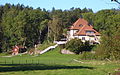
Grinda
- Area
- 1.6 km²
- High point
- 35 m

Själbottna
- Area
- 1.6 km²
- High point
- 29 m

Husarö
- Area
- 1.6 km²
- High point
- 24 m
Edö
- Area
- 1.5 km²
- High point
- 30 m
Lådna
- Area
- 1.5 km²
- High point
- 31 m

Ägnö
- Area
- 1.5 km²
- High point
- 65 m

Träskö-Storö
- Area
- 1.5 km²
- High point
- 29 m
Björnholmen
- Area
- 1.5 km²
- High point
- 63 m
Söderöra
- Area
- 1.4 km²
- High point
- 23 m
Ängsön-Marskär
- Area
- 1.4 km²
- High point
- 19 m
Himmelsö
- Area
- 1.3 km²
- High point
- 33 m
Furusund
- Area
- 1.3 km²
- High point
- 24 m

Mörtö-Bunsön
- Area
- 1.3 km²
- High point
- 45 m

Örsö
- Area
- 1.3 km²
- High point
- 44 m
Villinge
- Area
- 1.3 km²
- High point
- 22 m
Orrön
- Area
- 1.3 km²
- High point
- 29 m
Väringsö
- Area
- 1.2 km²
- High point
- 37 m

Tyvö
- Area
- 1.2 km²
- High point
- 25 m

Gräskö
- Area
- 1.2 km²
- High point
- 26 m
Äpplarö
- Area
- 1.2 km²
- High point
- 25 m
Hjälmö
- Area
- 1.1 km²
- High point
- 33 m
Stomnarö
- Area
- 1.1 km²
- High point
- 15 m
Södra Lagnö
- Area
- 1.1 km²
- High point
- 53 m

Ramsö
- Area
- 1.1 km²
- High point
- 40 m
Jungfruskär
- Area
- 1.1 km²
- High point
- 16 m

Vidinge
- Area
- 1 km²
- High point
- 20 m
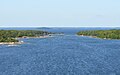
Sundskär
- Area
- 1 km²
- High point
- 18 m

Granholmen
- Area
- 0.97 km²
- High point
- 26 m
Härsö
- Area
- 0.94 km²
- High point
- 44 m

Älvsnabben
- Area
- 0.93 km²
- High point
- 58 m

Kullö
- Area
- 0.93 km²
- High point
- 42 m

Finnhamn
- Area
- 0.92 km²
- High point
- 19 m

Rödlöga
- Area
- 0.86 km²
- High point
- 17 m

Vindalsö
- Area
- 0.81 km²
- High point
- 31 m
Björnö
- Area
- 0.81 km²
- High point
- 51 m
Ängsö
- Area
- 0.8 km²
- High point
- 31 m

Biskopsön
- Area
- 0.79 km²
- High point
- 17 m

Korsö
- Area
- 0.79 km²
- High point
- 28 m
Hasselö
- Area
- 0.78 km²
- High point
- 30 m

Vårholma
- Area
- 0.77 km²
- High point
- 42 m
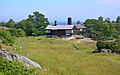
Bullerön
- Area
- 0.77 km²
- High point
- 14 m

Fiversätra island
- Area
- 0.76 km²
- High point
- 33 m

Fejan
- Area
- 0.76 km²
- High point
- 21 m
Kudoxa
- Area
- 0.76 km²
- High point
- 19 m
Gillinge
- Area
- 0.74 km²
- High point
- 21 m

Långviksskär
- Area
- 0.74 km²
- High point
- 14 m

Skogsön
- Area
- 0.74 km²
- High point
- 38 m
Stora Timrarö
- Area
- 0.74 km²
- High point
- 49 m
Aspön
- Area
- 0.73 km²
- High point
- 29 m

Fåglarö
- Area
- 0.71 km²
- High point
- 28 m

Mjölkö
- Area
- 0.71 km²
- High point
- 33 m

Hemholmen
- Area
- 0.69 km²
- High point
- 18 m
Granö
- Area
- 0.65 km²
- High point
- 28 m

Sollenkroka ö
- Area
- 0.64 km²
- High point
- 29 m
Karklö
- Area
- 0.62 km²
- High point
- 40 m
Munkö
- Area
- 0.6 km²
- High point
- 35 m
Aspön
- Area
- 0.58 km²
- High point
- 25 m
Hästholmen
- Area
- 0.56 km²
- High point
- 37 m
Mefjärd
- Area
- 0.55 km²
- High point
- 26 m
Gränö
- Area
- 0.55 km²
- High point
- 29 m

Edholma
- Area
- 0.54 km²
- High point
- 26 m

Edesön
- Area
- 0.53 km²
- High point
- 40 m
Stora Björn
- Area
- 0.53 km²
- High point
- 42 m
Storön
- Area
- 0.53 km²
- High point
- 16 m

Norra Stavsudda
- Area
- 0.5 km²
- High point
- 21 m
Kallskär
- Area
- 0.47 km²
- High point
- 8 m

Tegelön
- Area
- 0.47 km²
- High point
- 35 m
Stabbo
- Area
- 0.45 km²
- High point
- 13 m
Gränö
- Area
- 0.45 km²
- High point
- 33 m
Stora Tornö
- Area
- 0.44 km²
- High point
- 22 m
Nedergårdsö
- Area
- 0.44 km²
- High point
- 35 m
Stora Skramsö
- Area
- 0.43 km²
- High point
- 53 m
Trångholmen
- Area
- 0.43 km²
- High point
- 27 m
Ålön
- Area
- 0.42 km²
- High point
- 45 m
Stor-Saxaren
- Area
- 0.42 km²
- High point
- 37 m
Aspön
- Area
- 0.42 km²
- High point
- 33 m

Tranholmen
- Area
- 0.42 km²
- High point
- 31 m

Märsgarn
- Area
- 0.42 km²
- High point
- 38 m
Nässlingen
- Area
- 0.41 km²
- High point
- 28 m
Brännskär
- Area
- 0.41 km²
- High point
- 16 m

Svavelsön
- Area
- 0.41 km²
- High point
- 35 m
Kålö
- Area
- 0.4 km²
- High point
- 23 m
Mällsten
- Area
- 0.39 km²
- High point
- 35 m
Ängsön
- Area
- 0.39 km²
- High point
- 34 m
Storholmen
- Area
- 0.36 km²
- High point
- 23 m
Huvön
- Area
- 0.35 km²
- High point
- 42 m
Ekholmen
- Area
- 0.34 km²
- High point
- 18 m
Sadelöga
- Area
- 0.33 km²
- High point
- 24 m
Stora Hästnacken
- Area
- 0.32 km²
- High point
- 27 m

Stegesund-Hästholmen
- Area
- 0.31 km²
- High point
- 31 m
Bodskär
- Area
- 0.31 km²
- High point
- 18 m
Kalvholmen
- Area
- 0.3 km²
- High point
- 28 m

Munkholmen
- Area
- 0.3 km²
- High point
- 26 m
Horssten
- Area
- 0.29 km²
- High point
- 8 m
Inra Hamnskär
- Area
- 0.28 km²
- High point
- 16 m
Boskapsön
- Area
- 0.28 km²
- High point
- 20 m
Stora Sandön
- Area
- 0.27 km²
- High point
- 26 m
Stora and Lilla Husarn
- Area
- 0.27 km²
- High point
- 23 m

Marö
- Area
- 0.26 km²
- High point
- 23 m

Ålandet
- Area
- 0.26 km²
- High point
- 27 m
Viggsö
- Area
- 0.25 km²
- High point
- 26 m
Yttra Hamnskär
- Area
- 0.25 km²
- High point
- 21 m
Hasselkobben
- Area
- 0.25 km²
- High point
- 30 m

Edlunda
- Area
- 0.24 km²
- High point
- 24 m
Karskär
- Area
- 0.23 km²
- High point
- 17 m
Vidingsöra
- Area
- 0.23 km²
- High point
- 17 m
Långholmen
- Area
- 0.21 km²
- High point
- 28 m
Stora Fjärdholmen
- Area
- 0.18 km²
- High point
- 22 m

Ådskär
- Area
- 0.18 km²
- High point
- 12 m
Stora Sandböte
- Area
- 0.17 km²
- High point
- 35 m

Rögrund
- Area
- 0.16 km²
- High point
- 16 m
Bullerholmen
- Area
- 0.15 km²
- High point
- 26 m
Bergholmen
- Area
- 0.15 km²
- High point
- 29 m
Stora Kalholmen
- Area
- 0.14 km²
- High point
- 23 m
Bockholmen
- Area
- 0.14 km²
- High point
- 21 m
Granhamn
- Area
- 0.13 km²
- High point
- 20 m
Hamnskär
- Area
- 0.13 km²
- High point
- 15 m
Getholmen
- Area
- 0.12 km²
- High point
- 23 m
Unnamed island
- Area
- 0.11 km²
- High point
- 12 m
Rosenön
- Area
- 0.11 km²
- High point
- 22 m
Kalvholmen
- Area
- 0.11 km²
- High point
- 27 m
Västra Båtskäret
- Area
- 0.1 km²
- High point
- 10 m
Klövholmen
- Area
- 0.1 km²
- High point
- 17 m
Edö Tallholme
- Area
- 0.1 km²
- High point
- 25 m
Stor-Hummelskär
- Area
- 0.1 km²
- High point
- 11 m
Unnamed island
- Area
- —
size unknown
Gåsö
- Area
- —
size unknown
Getholmen
- Area
- —
size unknown
Högskär
- Area
- —
size unknown
Kråknäsgrundet
- Area
- —
size unknown
Vättersö
- Area
- —
size unknown
Rocks & skerries
On the chart above, at its closest zooms.
Listing 191 of 1165; the rest are on the chart.
Figures
Comparative heights
- Värmdö: 70 m
- Muskö: 69 m
- Ägnö: 65 m
- Lidingö: 63 m
- Björnholmen: 63 m
- Ornö: 61 m
- Vitsgarn: 58 m
- Älvsnabben: 58 m
- Resarö: 55 m
- Södra Lagnö: 53 m
- Stora Skramsö: 53 m
- Ingarö: 51 m
- Björnö: 51 m
- Herrö: 50 m
To the same scale
Islands by area
Groups within
Photographs

Udden vid Bruksholmen söder om Arbottna, Muskö

Frachtschiffreise MS Dornbusch in Stockholms Schärengarten

Björkvik Ingarö Stockholm

Ornö kyrka (church) on the island of Ornö, Sweden.

Lövskog och ängsmark med ekdunge vid Västra Långängskärret, Lidingö, Sweden.

Stavsnäs by

U.S. Marine Corps photo by 1st Lt. Paul Ortiz / Public domain

Frachtschiffreise MS Dornbusch in Stockholms Schärengarten

Arholma-Rödlöga-Vaxholm, Sweden, August 2019

Arholma, Sweden, August 2019

Notholmarna Stockholm Sweden

Husaröleden mellan Östra Lagnö och Husarö.
Sources
Facts
Photographs
- Arbottna, Bruksholmen, 2017. Holger.Ellgaard / CC BY-SA 4.0
- 2016-08 Frachtschiffreise MS Dornbusch in Stockholms Schärengarten 0750. Eduard47 / CC BY-SA 4.0
- Björkvik Ingarö Stockholm archipelago. Pererikjohan / Public domain
- Ornö kyrka. Dick Rochester / CC BY-SA 2.0
- Västra Långängskärret oct 2008. Lidingo / CC BY-SA 3.0
- Stavsnäs by. Ankara / CC BY-SA 3.0
- 1-6 Hit the Sea’s (6853609). U.S. Marine Corps photo by 1st Lt. Paul Ortiz / Public domain
- 2016-08 Frachtschiffreise MS Dornbusch in Stockholms Schärengarten 0754. Eduard47 / CC BY-SA 4.0
- Archipelago D81 4530 (48475161707). Bengt Nyman from Vaxholm, Sweden / CC BY 2.0
- Archipelago EM1B0467 (48463219197). Bengt Nyman from Vaxholm, Sweden / CC BY 2.0
- Backyard View - Flickr - Kenneth Vetter. Kenneth Vetter from Sweden / CC BY 2.0
- Husaröleden 2017. Esquilo / CC BY-SA 3.0