Gulf of CarpentariaAustralia
17°04′S 139°31′E
South Wellesley Islands
The South Wellesley Islands is an island group and locality in the Gulf of Carpentaria within the Shire of Mornington, Queensland, Australia. The group is separate from the Wellesley Islands.

Chart
Overview
The South Wellesley Islands is an island group and locality in the Gulf of Carpentaria within the Shire of Mornington, Queensland, Australia. The group is separate from the Wellesley Islands. Bentinck Island is the only one known to have been inhabited in the past. In the 2021 census, South Wellesley Islands had "no people or a very low population".
From Wikipedia, CC BY-SA 4.0
Census, cataloged
- Major islands1
- Minor islands8
- Islets5
- Rocks & skerries1
Major islands
Bentinck Island
- Area
- 138 km²
- High point
- 22 m
Bentinck Island is one of the South Wellesley Islands, in Queensland's Gulf of Carpentaria. The traditional home of the Kaiadilt people, the island was the site of a brutal massacre in 1918 known as the McKenzie massacre, in which many Indigenous inhabitants died.

Minor islands
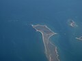
Sweers Island
- Area
- 11.5 km²
- High point
- 29 m
Allen Island
- Area
- 10.3 km²
- High point
- 11 m
Horseshoe Island
- Area
- 1.7 km²
- High point
- 9 m
Fowler Island
- Area
- 0.99 km²
- High point
- 7 m
Albinia Island
- Area
- 0.82 km²
- High point
- 9 m
Bessie Island
- Area
- 0.16 km²
- High point
- 8 m
Douglas Island
- Area
- 0.16 km²
- High point
- 8 m
Little Allen Island
- Area
- 0.12 km²
- High point
- 4 m
Islets
- Unnamed island7 m · 0.07 km²
- Unnamed island8 m · 0.05 km²
- Margaret Island5 m · 0.04 km²
- Unnamed island5 m · 0.03 km²
- Ivis Island0.02 km²
Rocks & skerries
- Locust Rock0.8 ha
Figures
Comparative heights
To the same scale
Islands by area
| Bentinck Island | 138 km² |
| Sweers Island | 11.5 km² |
| Allen Island | 10.3 km² |
| Horseshoe Island | 1.7 km² |
| Fowler Island | 0.99 km² |
| Albinia Island | 0.82 km² |
| Bessie Island | 0.16 km² |
| Douglas Island | 0.16 km² |
| Little Allen Island | 0.12 km² |
| Unnamed island | 0.07 km² |
| Unnamed island | 0.05 km² |
| Margaret Island | 0.04 km² |
| Unnamed island | 0.03 km² |
| Ivis Island | 0.02 km² |
| Locust Rock | 0.8 ha |
Sources
Facts
Photographs
- Bentinck Island 05. J Brew / CC BY-SA 2.0