Scotia Sea
62°00′S 58°00′W
South Shetland Islands
The South Shetland Islands are a group of Antarctic islands located in the Drake Passage with a total area of 3,687 km2 (1,424 sq mi).

Chart
Overview
The South Shetland Islands are a group of Antarctic islands located in the Drake Passage with a total area of 3,687 km2 (1,424 sq mi). They lie about 120 kilometres (65 nautical miles) north of the Antarctic Peninsula, and between 430 and 900 km (230 and 485 nmi) southwest of the nearest point of the South Orkney Islands. By the Antarctic Treaty of 1959, the islands' sovereignty is neither recognized nor disputed by the signatories. According to British government language on the topic, "the whole of Antarctica is protected in the interests of peace and science." The islands have been claimed by three countries, beginning with the United Kingdom since 1908 (since 1962 as part of the equally unrecognized British Antarctic Territory). The islands are also claimed by the governments of Chile (since 1940, as part of the Antártica Chilena province), and by Argentina (since 1943, as part of Argentine Antarctica, Tierra del Fuego Province), both equally unrecognized. Several countries maintain research stations on the islands. Most of them are situated on King George Island, benefitting from the airfield of the Chilean base Eduardo Frei. Sixteen research stations are in different parts of the islands, with Chilean stations being the greatest in number.
From Wikipedia, CC BY-SA 4.0
Census, cataloged
- Major islands6
- Minor islands89
- Islets189
- Rocks & skerries166
Major islands
King George Island
- Area
- 1,134 km²
- High point
- 679 m
King George Island (Argentinian Spanish: Isla 25 de Mayo, Brazilian Portuguese: Ilha do Rei George, Chilean Spanish: Isla Rey Jorge, Russian: Ватерло́о Vaterloo) is the largest of the South Shetland Islands, lying 120 km (75 miles) off the coast of Antarctica in the Southern Ocean.
Livingston Island
- Area
- 798 km²
- High point
- 1,700 m
Livingston Island (Russian name Smolensk, 62°36′S 60°30′W) is an Antarctic island in the Southern Ocean, part of the South Shetlands Archipelago, a group of Antarctic islands north of the Antarctic Peninsula.
Elephant Island
- Area
- 457 km²
- High point
- 973 m
Elephant Island is an ice-covered, mountainous island off the coast of Antarctica in the outer reaches of the South Shetland Islands, in the Southern Ocean.
Nelson Island
- Area
- 155 km²
- High point
- 150 m
Nelson Island (historical names Leipzig Island, O'Cain's Island and Strachans Island) is an island 22 kilometres (12 nmi) long and 13 kilometres (7 nmi) wide, lying southwest of King George Island in the South Shetland Islands, Antarctica.
Smith Island
- Area
- 150 km²
- High point
- 2,105 m
Smith Island is 20 miles (32 km) long and 5 miles (8 kilometres) wide, lying 49 miles (79 km) west of Deception Island in the South Shetland Islands of the British Antarctic Territory.
Greenwich Island
- Area
- 147 km²
- High point
- 623 m
25 mi) wide, lying between Robert Island and Livingston Island in the South Shetland Islands, Antarctica. 1 sq mi). The name Greenwich Island dates back to at least 1821 and is now established in international usage.


Minor islands

Robert Island
- Area
- 138 km²
- High point
- 365 m

Low Island
- Area
- 133 km²
- High point
- 395 m
Snow Island
- Area
- 122 km²
- High point
- 306 m

Clarence Island
- Area
- 116 km²
- High point
- 1,950 m
Deception Island
- Area
- 98.2 km²
- High point
- 680 m
Gibbs Island
- Area
- 20.3 km²
- High point
- 738 m
Rugged Island
- Area
- 10.9 km²
- High point
- 256 m

Aspland Island
- Area
- 4.7 km²
- High point
- 511 m
Desolation Island
- Area
- 2.7 km²
- High point
- 132 m
Ridley Island
- Area
- 2.6 km²
- High point
- 229 m

Dee Island
- Area
- 1.9 km²
- High point
- 138 m

Penguin Island
- Area
- 1.8 km²
- High point
- 160 m
O'Brien Island
- Area
- 1.7 km²
- High point
- 399 m
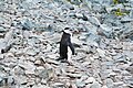
Half Moon Island
- Area
- 1.6 km²
- High point
- 96 m
Eadie Island
- Area
- 1.3 km²
- High point
- 401 m

Ardley Island
- Area
- 1.2 km²
- High point
- 65 m
Cornwallis Island
- Area
- 0.99 km²
- High point
- 470 m
Table Island
- Area
- 0.92 km²
- High point
- 166 m
Heywood Island
- Area
- 0.75 km²
- High point
- 59 m

Barrientos Island
- Area
- 0.67 km²
- High point
- 51 m
Esperanto Island
- Area
- 0.61 km²

Dufayel Island
- Area
- 0.49 km²
- High point
- 205 m
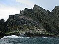
Rowett Island
- Area
- 0.49 km²
- High point
- 114 m

Ongley Island
- Area
- 0.48 km²
Zverino Island
- Area
- 0.46 km²
Kellick Island
- Area
- 0.45 km²
- High point
- 53 m

Cecilia Island
- Area
- 0.44 km²
- High point
- 56 m
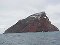
Bridgeman Island
- Area
- 0.38 km²
- High point
- 240 m
Tirizis Island
- Area
- 0.31 km²
- High point
- 35 m
Lesidren Island
- Area
- 0.3 km²
San Telmo Island
- Area
- 0.29 km²
- High point
- 15 m
Prisad Island
- Area
- 0.26 km²
- High point
- 41 m
Emeline Island
- Area
- 0.26 km²
Express Island
- Area
- 0.25 km²
- High point
- 50 m
Sierra Island
- Area
- 0.23 km²
Unnamed island
- Area
- 0.23 km²
- High point
- 84 m
Unnamed island
- Area
- 0.22 km²
Balsha Island
- Area
- 0.21 km²

Miladinovi Islets
- Area
- 0.21 km²
Kilifarevo Island
- Area
- 0.21 km²
- High point
- 8 m
Borceguí Island
- Area
- 0.21 km²
Window Island
- Area
- 0.2 km²
- High point
- 59 m
Phanagoria Island
- Area
- 0.17 km²
Unnamed island
- Area
- 0.17 km²
- High point
- 48 m
Wood Island
- Area
- 0.16 km²
Stoker Island
- Area
- 0.16 km²
Romeo Island
- Area
- 0.15 km²
Cave Island
- Area
- 0.14 km²
Unnamed island
- Area
- 0.14 km²
- High point
- 31 m
Trowbridge Island
- Area
- 0.13 km²
- High point
- 106 m
Lientur Rocks
- Area
- 0.13 km²
- High point
- 46 m
Unnamed island
- Area
- 0.13 km²
Rogozen Island
- Area
- 0.13 km²
- High point
- 66 m
Unnamed island
- Area
- 0.13 km²
Boatin Island
- Area
- 0.13 km²
- High point
- 11 m
Cornwall Island
- Area
- 0.12 km²
- High point
- 30 m
Long Rock
- Area
- 0.12 km²
- High point
- 14 m

Låvebrua Island
- Area
- 0.11 km²
- High point
- 28 m
Jorge Island
- Area
- 0.11 km²
- High point
- 38 m
Unnamed island
- Area
- 0.11 km²
Makresh Rocks
- Area
- 0.1 km²

Zavala Island
- Area
- 0.1 km²
Unnamed island
- Area
- —
size unknown
Basso
- Area
- —
size unknown
Bonert, Islote
- Area
- —
size unknown
Churicheni Island
- Area
- —
size unknown
Craggy Island
- Area
- —
size unknown
Dinea Island
- Area
- —
size unknown
Figueroa Point
- Area
- —
size unknown
Glumche Island
- Area
- —
size unknown
González Island
- Area
- —
size unknown
Grod Island
- Area
- —
size unknown
Kabile Island
- Area
- —
size unknown
Kaliman Island
- Area
- —
size unknown
Kovach Island
- Area
- —
size unknown
Lambert Island
- Area
- —
size unknown
Leeve Island
- Area
- —
size unknown
Oescus Island
- Area
- —
size unknown
Osenovlag Island
- Area
- —
size unknown
Owen Island
- Area
- —
size unknown
Penola Island
- Area
- —
size unknown
Prosechen Island
- Area
- —
size unknown
Redina Island
- Area
- —
size unknown
Tartar Island
- Area
- —
size unknown
Toledo Island
- Area
- —
size unknown
Treklyano Island
- Area
- —
size unknown
Vilare Island
- Area
- —
size unknown
World's End
- Area
- —
size unknown
Zebil Island
- Area
- —
size unknown
Rocks & skerries
On the chart above, at its closest zooms.
Listing 95 of 450; the rest are on the chart.
Figures
Comparative heights
- Smith: 2,105 m
- Clarence: 1,950 m
- Livingston: 1,700 m
- Elephant: 973 m
- Gibbs: 738 m
- Deception: 680 m
- King George: 679 m
- Greenwich: 623 m
- Aspland: 511 m
- Cornwallis: 470 m
- Eadie: 401 m
- O'Brien: 399 m
- Low: 395 m
- Robert: 365 m
To the same scale
Islands by area
Groups within
Photographs

Antarctica - Deception Island: The island is a collapsed volcano and today consists of the annular remnant of a caldera with a diameter of about 14 kilometers. The picture shows the secondary crater created at the last outbreak in 1970.

Stanice Eco-Nelson, únor 2019

Greenwich Island, South Shetland Islands, Antarctica

Iceberg, Point Wild, Elephant Island, South Shetland Islands


Pavlikeni Point from English Strait.

Razlog Cove on the far side of Greenwich Island in the background.

Shopski Cove from Camp Academia, with Huron Glacier and McFarlane Strait in the foreground.
Sources
Facts
Photographs
- 00 2445 Antarctica - Deception Island. W. Bulach / CC BY-SA 4.0
- Eco Nelson 2019. Grýn McSkalpeel / CC BY-SA 4.0
- Greenwich Island Antarctica Dec06A. PhilWolpe / CC BY 2.0
- South Shetland-2016-Elephant Island (Point Wild)–Iceberg 01. Godot13 / CC BY-SA 4.0
- Bransfield-Strait. Lyubomir Ivanov / GPL
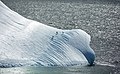
- Striated iceberg, South Shetland Islands. NOAA Photo Library / Public domain
- Chinstrap penguins on a striated iceberg, South Shetland Islands, Antarctica. NOAA Photo Library / Public domain
- Kabile. Lyubomir Ivanov / CC BY-SA 3.0
- Osogovo. Lyubomir Ivanov / CC BY-SA 3.0
- Pavlikeni. Lyubomir Ivanov / CC BY-SA 3.0
- Razlog. Lyubomir Ivanov / CC BY-SA 3.0
- Shopski. Lyubomir Ivanov / CC BY-SA 3.0