Onega BayRussia
65°01′N 35°43′E
Solovetsky Islands
Соловецкие острова
The Solovetsky Islands, or Solovki, are an archipelago located in the Onega Bay of the White Sea, Russia. As an administrative division, the islands are incorporated as Solovetsky District of Arkhangelsk Oblast, Russia.

Chart
Overview
The Solovetsky Islands, or Solovki, are an archipelago located in the Onega Bay of the White Sea, Russia. As an administrative division, the islands are incorporated as Solovetsky District of Arkhangelsk Oblast, Russia. Within the framework of municipal divisions, they are incorporated as Solovetskoye Rural Settlement within Primorsky Municipal District. The administrative center of both divisions is the settlement of Solovetsky, located on Bolshoy Solovetsky Island. Almost all of the population of the islands lives in Solovetsky. As of the 2010 Census, the district had a population of 861 inhabitants. The Solovetsky Monastery (founded in 1436), in 1923 became the site of the first Gulag establishment, the Solovki prison camp.
From Wikipedia, CC BY-SA 4.0
Census, cataloged
- Major islands2
- Minor islands7
- Islets112
- Rocks & skerries42
Major islands
Solovetsky Island
- Area
- 242 km²
- High point
- 80 m
Bolshoy Solovetsky Island (Russian: Большой Соловецкий остров), or simply Solovetsky Island (Russian: Соловецкий остров) is the biggest island of the Solovetsky Islands archipelago in the White Sea, northern Russia.
Anzersky Island
- Area
- 47.7 km²
- High point
- 64 m
Anzersky (Russian: А́нзерский) is one of the Solovetsky Islands.

Minor islands
Bolshaya Muksalma
- Area
- 19 km²
- High point
- 40 m
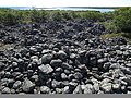
Bolshoy Zayatsky Island
- Area
- 1.3 km²
- High point
- 30 m
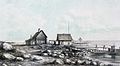
Malaya Muksalma
- Area
- 1.2 km²
- High point
- 5 m
Small Zayatsky Island
- Area
- 1.1 km²
- High point
- 23 m
Parusniy Island
- Area
- 0.19 km²
- High point
- 10 m
Unnamed island
- Area
- 0.13 km²
- High point
- 4 m
Parusny
- Area
- —
size unknown
Rocks & skerries
On the chart above, at its closest zooms.
Listing 9 of 163; the rest are on the chart.
Figures
Comparative heights
- Solovetsky: 80 m
- Anzersky: 64 m
- Bolshaya Muksalma: 40 m
- Bolshoy Zayatsky: 30 m
- Small Zayatsky: 23 m
- Parusniy: 10 m
- Malaya Muksalma: 5 m
To the same scale
Islands by area
| Solovetsky Island | 242 km² |
| Anzersky Island | 47.7 km² |
| Bolshaya Muksalma | 19 km² |
| Bolshoy Zayatsky Island | 1.3 km² |
| Malaya Muksalma | 1.2 km² |
| Small Zayatsky Island | 1.1 km² |
| Parusniy Island | 0.19 km² |
| Unnamed island | 0.13 km² |
Photographs

Бухта Кислая

Pohled na vesnice z dálky a z výšky

Триангуляционный пункт на Соловках, предположительно в районе острова Большая Муксалма

Острів Анзерський. Поблизу Голгофо-Розп’ятського скита

Solovki. July 2014
Sources
Facts
Photographs
- Бухта Кислая. Trasprd / CC BY-SA 4.0
- Solovetsky village from far. Trasprd / CC BY-SA 4.0
- Триангуляционный пункт на Соловках. Borealex / CC BY-SA 4.0
- Anzer 095. Visem / CC BY-SA 3.0
- Solovki. July 2014 - panoramio (2). Impi / CC BY-SA 3.0
- Banner1 Соловецкий монастырь. Original work: Алексей Задонский, Derived work: Ludvig14 / CC BY-SA 4.0