Seychelles
7°06′S 52°46′E
Seychelles
Seychelles ( , ; French: [sɛʃɛl] or [seʃɛl]), officially the Republic of Seychelles (French: République des Seychelles; Seychellois Creole: Repiblik Sesel), is an archipelagic country consisting of 115 islands in the Indian Ocean.

Chart
Overview
Seychelles ( , ; French: [sɛʃɛl] or [seʃɛl]), officially the Republic of Seychelles (French: République des Seychelles; Seychellois Creole: Repiblik Sesel), is an archipelagic country consisting of 115 islands in the Indian Ocean. Its capital and largest city, Victoria, is 1,500 kilometres (800 nautical miles) east of mainland Africa. Nearby island countries and territories include the Maldives, Comoros, Madagascar, Mauritius, and the French overseas departments of Mayotte and Réunion to the south; and the Chagos Archipelago to the east. Seychelles is the smallest country in Africa as well as the least populated sovereign African country, with an estimated population of 100,600 in 2022. The Seychelles archipelago was uninhabited prior to sustained external contact. Arab sailors knew of the islands by the 15th century through Indian Ocean trade routes and they are described in medieval Arabic books. Later, in the 16th century, Europeans described the islands, but they remained without permanent settlement until the 18th century, when France formally claimed them. During the period of French colonization, enslaved Africans were brought to the islands for plantation labor; many had already been captured and enslaved through existing African-Arab slave trade or Indian Ocean slave trade. It faced competing French and British interests until it came under full British control in the early 19th century. After Britain assumed control in the early 19th century, slavery was abolished and later replaced in part by indentured laborers from India. Since proclaiming independence from the United Kingdom in 1976, it has developed from a largely agricultural society to a market-based diversified economy, characterized by service, public sector, and tourism activities. From 1976 to 2015, nominal GDP grew nearly 700%, and purchasing power parity nearly 1600%. Since the late 2010s, the government has taken steps to encourage foreign investment. As of the early 21st century, Seychelles has the highest nominal per capita GDP and the highest Human Development Index ranking of any African country. According to the 2024 V-Dem Democracy indices, Seychelles is the 43rd-ranked electoral democracy worldwide, the 1st-ranked liberal democracy in Africa, and the 2nd-ranked electoral democracy on the continent. Seychellois culture and society is an eclectic mix of French, British, Indian and African influences, with infusions of Chinese elements. The country is a member of the United Nations, the African Union, the Southern African Development Community, and the Commonwealth of Nations.
From Wikipedia, CC BY-SA 4.0
Census, cataloged
- Major islands9
- Minor islands69
- Islets119
- Rocks & skerries49
Major islands
Mahé
- Area
- 155 km²
- High point
- 905 m
7 sq mi), lying in the northeast of the Seychellois nation in the Somali Sea part of the Indian Ocean. The population of Mahé was 77,000, as of the 2010 census. It contains the capital city of Victoria and accommodates 86% of the country's total population.
Praslin
- Area
- 38.2 km²
- High point
- 350 m
5 km2) of the Inner Seychelles, lying 44 km (27 mi) northeast of Mahé. Praslin has a population of around 7,533 people and comprises two administrative districts: Baie Sainte Anne and Grand' Anse. The main settlements are the Baie Ste Anne, Anse Volbert and Grand' Anse.
Silhouette Island
- Area
- 20 km²
- High point
- 725 m
Silhouette Island lies 20 km (12 mi) northwest of Mahé in the Seychelles. It is the third largest granitic island in the Seychelles. 1 km2 and has a population of 200, mostly workers on the island. The main settlement is La Passe, where Hilton Hotel is located.
Assumption Island
- Area
- 11.5 km²
- High point
- 31 m
Assumption Island is a small island in the Outer Islands of Seychelles north of Madagascar, 1,135 km (705 mi) southwest of the capital, Victoria.
La Digue
- Area
- 10 km²
- High point
- 333 m
La Digue is the third most populated island of the Seychelles, and fourth largest by land area, lying east of Praslin and west of Felicite Island. In size, it is the fourth-largest granitic island of Seychelles after Mahé, Praslin, and Silhouette Island. It has a population of 2,800 people.
Aldabra
- Area
- 9.3 km²
- High point
- 16 m
Aldabra, the world's second-largest coral atoll (the largest is Kiritimati), is located east of the continent of Africa.
Coëtivy Island
- Area
- 9.3 km²
- High point
- 24 m
Coëtivy Island is a small coral island in the Seychelles 290 km (180 mi) south of Mahé, at 07°08′S 56°16′E.


South Island
- Area
- 112 km²
- High point
- 16 m
Middle island
- Area
- 26.6 km²
- High point
- 16 m
Minor islands

Astove Island
- Area
- 9.1 km²
- High point
- 18 m
Farquhar Atoll
- Area
- 8.4 km²
- High point
- 84 m
Cosmoledo
- Area
- 5.1 km²
- High point
- 17 m
Ile du Sud
- Area
- 4.2 km²
- High point
- 20 m

Desroches Island
- Area
- 4 km²
- High point
- 29 m
Ile du Nord
- Area
- 3.6 km²
- High point
- 17 m

Curieuse Island
- Area
- 2.9 km²
- High point
- 172 m
Providence Atoll
- Area
- 2.8 km²
- High point
- 0 m

Félicité Island
- Area
- 2.7 km²
- High point
- 207 m
Menai Island
- Area
- 2.5 km²
- High point
- 16 m

Ste. Anne Island
- Area
- 2.3 km²
- High point
- 253 m

Frégate Island
- Area
- 2.1 km²
- High point
- 125 m

North Island
- Area
- 2 km²
- High point
- 180 m
Polymnie
- Area
- 1.9 km²
- High point
- 12 m

D'Arros Island
- Area
- 1.7 km²
- High point
- 22 m

Alphonse Atoll
- Area
- 1.6 km²
- High point
- 25 m
St. Joseph Atoll
- Area
- 1.6 km²

St. Pierre Island
- Area
- 1.6 km²
- High point
- 11 m
Providence Island
- Area
- 1.6 km²
- High point
- 19 m
Wizard Island
- Area
- 1.6 km²
- High point
- 15 m

Denis Island
- Area
- 1.4 km²
- High point
- 29 m
Île du Sud
- Area
- 1.4 km²
- High point
- 26 m

Cerf Island
- Area
- 1.3 km²
- High point
- 107 m

Poivre Atoll
- Area
- 1.1 km²
- High point
- 23 m
Saint Joseph Island
- Area
- 1 km²
- High point
- 23 m
Perseverance Island
- Area
- 0.96 km²
- High point
- 17 m
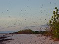
Bird Island
- Area
- 0.95 km²
- High point
- 14 m

Marianne Island
- Area
- 0.92 km²
- High point
- 113 m
Saint-François Island
- Area
- 0.87 km²
- High point
- 17 m

Grande Soeur
- Area
- 0.76 km²
- High point
- 86 m

Thérèse Island
- Area
- 0.76 km²
- High point
- 158 m
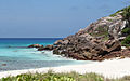
Aride Island
- Area
- 0.69 km²
- High point
- 135 m

Conception Island, Seychelles
- Area
- 0.6 km²
- High point
- 133 m
Unnamed island
- Area
- 0.59 km²
- High point
- 14 m
Unnamed island
- Area
- 0.58 km²
- High point
- 14 m

Marie Louise Island
- Area
- 0.56 km²
- High point
- 10 m
Unnamed island
- Area
- 0.55 km²
- High point
- 12 m
Unnamed island
- Area
- 0.52 km²
- High point
- 9 m
St. François Atoll
- Area
- 0.5 km²
- High point
- 0 m
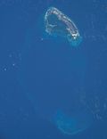
Île Platte
- Area
- 0.5 km²
- High point
- 17 m
Eden Island
- Area
- 0.46 km²
- High point
- 13 m
South Island
- Area
- 0.43 km²
- High point
- 4 m
Desnoeufs Island
- Area
- 0.41 km²
- High point
- 5 m
Unnamed island
- Area
- 0.4 km²
- High point
- 15 m
Euphrates Island
- Area
- 0.36 km²
- High point
- 11 m
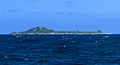
Cousin Island
- Area
- 0.36 km²
- High point
- 58 m
Goëlette
- Area
- 0.34 km²
- High point
- 3 m

Petite Soeur
- Area
- 0.34 km²
- High point
- 103 m
Coconut Island
- Area
- 0.31 km²
- High point
- 11 m
Rémire Island
- Area
- 0.3 km²
- High point
- 14 m
Unnamed island
- Area
- 0.3 km²
Unnamed island
- Area
- 0.29 km²
- High point
- 14 m
Grand Polyte
- Area
- 0.28 km²
- High point
- 7 m

Cousine Island
- Area
- 0.28 km²
- High point
- 69 m
Unnamed island
- Area
- 0.27 km²
- High point
- 9 m
Ile Cerf
- Area
- 0.24 km²
- High point
- 6 m

Long Island
- Area
- 0.22 km²
- High point
- 72 m
Unnamed island
- Area
- 0.2 km²
- High point
- 6 m

Round Island, Praslin
- Area
- 0.2 km²
- High point
- 75 m
Romainville Island
- Area
- 0.19 km²
- High point
- 13 m
Île aux Récifs
- Area
- 0.19 km²
- High point
- 45 m
Fouquet Island
- Area
- 0.17 km²
- High point
- 19 m
Île Florentin
- Area
- 0.15 km²
- High point
- 20 m
Unnamed island
- Area
- 0.13 km²
- High point
- 9 m
Unnamed island
- Area
- 0.13 km²
- High point
- 4 m
West North Island
- Area
- 0.11 km²
- High point
- 7 m
Ressource Island
- Area
- 0.11 km²
- High point
- 19 m

Anonyme Island
- Area
- 0.1 km²
- High point
- 39 m
Unnamed island
- Area
- —
size unknown
Rocks & skerries
On the chart above, at its closest zooms.
Listing 78 of 246; the rest are on the chart.
Figures
Comparative heights
To the same scale
Islands by area
Groups within
Photographs

Anse Patates beach (in the background: Félicité Island) on La Digue Island, Seychelles

The spectacular beach of Anse Lazio on the island of Praslin, Seychelles

View of La Digue Island from near Praslin Island, Seychelles

The Aldabra Islands form the largest lagoon in the Indian Ocean. The length is 34 km and the width is 14.5 km. The islands are a UN world heritage and not inhabited.

Assumption Island with its abandoned runway

Remote view from Beau Vallon to Silhouette Island, Seychelles
Sources
Facts
Photographs
- La Digue asv2024-10 img56 Anse Patates. A.Savin / FAL
- Anse Lazio-Praslin-Seychellen. Tobias Alt, Tobi 87 / CC BY-SA 4.0
- Remote view of La Digue asv2024-09. A.Savin / FAL
- Seychelles outer islands 25.08.2009 10-19-35. Simisa / CC BY-SA 3.0
- Seychelles outer islands 25.08.2009 10-17-46. Simisa / CC BY-SA 3.0
- Silhouette Island remote view asv2024-10. A.Savin / FAL
- 2005-03-13 08-55-02 Seychelles - Misere. NOTE: This image is a panorama of Seychelles consisting of multiple frames that were merged or stitched in Panorama Stud / CC BY-SA 3.0