Salish SeaUnited States
48°32′N 123°02′W
San Juan Islands
The San Juan Islands are part of an archipelago in the Pacific Northwest of the United States between the U.S. state of Washington and Vancouver Island in the Canadian province of British Columbia. The San Juan Islands are part of Washington state, and form the core of San Juan County.

Chart
Overview
The San Juan Islands are part of an archipelago in the Pacific Northwest of the United States between the U.S. state of Washington and Vancouver Island in the Canadian province of British Columbia. The San Juan Islands are part of Washington state, and form the core of San Juan County. In the archipelago, four islands are accessible to vehicular and foot traffic via the Washington State Ferries system.
From Wikipedia, CC BY-SA 4.0
Census, cataloged
- Major islands6
- Minor islands39
- Islets113
- Rocks & skerries163
Major islands
Orcas Island
- Area
- 150 km²
- High point
- 732 m
Orcas Island is the largest of the San Juan Islands of the Pacific Northwest, in northwestern Washington, United States.
San Juan Island
- Area
- 144 km²
- High point
- 331 m
San Juan Island is the second-largest and most populous of the San Juan Islands in northwestern Washington, United States. It has a land area of 142.59 km2 (55.053 sq mi) and a population of 8,632 as of the 2020 census.
Fidalgo Island
- Area
- 109 km²
- High point
- 385 m
Fidalgo Island is an island in Skagit County, Washington, located about 60 mi (97 km) north of Seattle. To the east, it is separated from the mainland by the Swinomish Channel, and from Whidbey Island to the south by Deception Pass.
Lopez Island
- Area
- 76.5 km²
- High point
- 148 m
Lopez Island is the third largest of the San Juan Islands and an unincorporated town in San Juan County, Washington, United States. 2 km2) in land area. The 2020 census population was 3,156, though the population swells in the summer, as second homes, rental houses, and campsites fill up.
Lummi Island
- Area
- 23.4 km²
- High point
- 101 m
Lummi Island lies at the southwest corner of Whatcom County, Washington, United States, between the mainland part of the county and offshore San Juan County. The Lummi Indian Reservation is situated on a peninsula east of the island, but it does not include Lummi Island.
Cypress Island
- Area
- 21.7 km²
- High point
- 182 m
Cypress Island is the westernmost part of Skagit County, Washington, and is about halfway between the mainland and offshore San Juan County. It is separated from Blakely Island to the west by Rosario Strait and from Guemes Island to the east by Bellingham Channel.


Minor islands

Guemes Island
- Area
- 21.2 km²
- High point
- 210 m

Shaw Island
- Area
- 19.8 km²
- High point
- 100 m

Blakely Island
- Area
- 17.4 km²
- High point
- 319 m
Waldron Island
- Area
- 11.7 km²
- High point
- 183 m

Decatur Island
- Area
- 9 km²
- High point
- 164 m
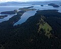
Stuart Island
- Area
- 7.5 km²
- High point
- 189 m
Henry Island
- Area
- 4.1 km²
- High point
- 114 m
Sinclair Island
- Area
- 4.1 km²
- High point
- 96 m

Sucia Island
- Area
- 2.3 km²
- High point
- 83 m

Spieden Island
- Area
- 2.1 km²
- High point
- 126 m
Burrows Island
- Area
- 1.9 km²
- High point
- 208 m
Allan Island
- Area
- 1.2 km²
- High point
- 90 m
Crane Island
- Area
- 0.96 km²
- High point
- 66 m
Patos Island
- Area
- 0.94 km²
- High point
- 51 m
Johns Island
- Area
- 0.9 km²
- High point
- 34 m
Vendovi Island
- Area
- 0.88 km²
- High point
- 103 m
Obstruction Island
- Area
- 0.86 km²
- High point
- 99 m
Jones Island
- Area
- 0.77 km²
- High point
- 75 m
Center Island
- Area
- 0.68 km²
- High point
- 68 m
Matia Island
- Area
- 0.63 km²
- High point
- 70 m

Eliza Island
- Area
- 0.55 km²
- High point
- 55 m

James Island
- Area
- 0.47 km²
- High point
- 97 m
Satellite Island
- Area
- 0.47 km²
- High point
- 82 m
Hat Island
- Area
- 0.44 km²
- High point
- 107 m
Frost Island
- Area
- 0.28 km²
- High point
- 84 m
Unnamed island
- Area
- 0.25 km²
- High point
- 61 m
Long Island
- Area
- 0.23 km²
- High point
- 26 m
Flattop Island
- Area
- 0.22 km²
- High point
- 66 m
Clark Island
- Area
- 0.22 km²
- High point
- 36 m
Canoe Island
- Area
- 0.19 km²
- High point
- 55 m
Pearl Island
- Area
- 0.15 km²
- High point
- 31 m
North Finger Island
- Area
- 0.15 km²
- High point
- 43 m
Charles Island
- Area
- 0.15 km²
- High point
- 34 m
Turn Island
- Area
- 0.14 km²
- High point
- 51 m
Barnes Island
- Area
- 0.14 km²
- High point
- 45 m
Trump Island
- Area
- 0.13 km²
- High point
- 66 m
McConnell Island
- Area
- 0.12 km²
- High point
- 46 m
South Finger Island
- Area
- 0.11 km²
- High point
- 43 m
Cotton Point Island
- Area
- —
size unknown
Rocks & skerries
On the chart above, at its closest zooms.
Listing 45 of 321; the rest are on the chart.
Figures
Comparative heights
To the same scale
Islands by area
| Orcas Island | 150 km² |
| San Juan Island | 144 km² |
| Fidalgo Island | 109 km² |
| Lopez Island | 76.5 km² |
| Lummi Island | 23.4 km² |
| Cypress Island | 21.7 km² |
| Guemes Island | 21.2 km² |
| Shaw Island | 19.8 km² |
| Blakely Island | 17.4 km² |
| Waldron Island | 11.7 km² |
| Decatur Island | 9 km² |
| Stuart Island | 7.5 km² |
| Henry Island | 4.1 km² |
| Sinclair Island | 4.1 km² |
| Sucia Island | 2.3 km² |
| Spieden Island | 2.1 km² |
| Burrows Island | 1.9 km² |
| Allan Island | 1.2 km² |
| Crane Island | 0.96 km² |
| Patos Island | 0.94 km² |
| Johns Island | 0.9 km² |
| Vendovi Island | 0.88 km² |
| Obstruction Island | 0.86 km² |
| Jones Island | 0.77 km² |
| Center Island | 0.68 km² |
| Matia Island | 0.63 km² |
| Eliza Island | 0.55 km² |
| James Island | 0.47 km² |
| Satellite Island | 0.47 km² |
| Hat Island | 0.44 km² |
| Frost Island | 0.28 km² |
| Unnamed island | 0.25 km² |
| Long Island | 0.23 km² |
| Flattop Island | 0.22 km² |
| Clark Island | 0.22 km² |
| Canoe Island | 0.19 km² |
| Pearl Island | 0.15 km² |
| North Finger Island | 0.15 km² |
| Charles Island | 0.15 km² |
| Turn Island | 0.14 km² |
| Barnes Island | 0.14 km² |
| Trump Island | 0.13 km² |
| McConnell Island | 0.12 km² |
| South Finger Island | 0.11 km² |
Groups within
Photographs

Fidalgo Island Burrows Bay, Allan Island (right), Lopez Island (behind), and Olympic Mountains (upper left)

View eastward from Mount Constitution on Orcas Island

San Juans from Mt. Constitution (Orcas Island) looking towards Seattle with Mt. Rainier barely visible in the hazeIMG_0186_1_1


Looking across Guemes Channel from Railroad Avenue beach, Anacortes, Washington, U.S.A. toward Guemes Island.

View from Lummi Island

Battleship & Henry Islands of the San Juan Islands in the Haro Strait.

Looking across Guemes Channel from Railroad Avenue beach, Anacortes, Washington, U.S.A. toward Guemes Island.

Looking West/South West With Northern End of Governor's Point and Eastern Shore of Lummi Island

A composite lidar/sonar image of Sucia island and Patos Island in the San Juan archipelago. This image shows the folded sedimentary layers that these islands are composed of. Image by Daniel E. Coe, Washington Geological Survey

Doe Bay, Orcas Islands

Bureau of Land Management Oregon and Washington from Portland, America / Public domain
Sources
Facts
Photographs
- Fidalgo Island 28245. Walter Siegmund / CC BY 2.5
- MountConstitutionView. Shayborg / Public domain
- San Juans from Mt Constitution. David from Seattle / CC BY 2.0
- Iceberg Point Lopez Island Washington USA. Unknown author / CC BY-SA 3.0
- Anacortes - boat on Guemes Channel 02. Joe Mabel. / CC BY-SA 3.0
- View from Lummi Island. Emergency Brake from Your mom's house, USA / CC BY 2.0
- Battleship & Henry Islands 1284. Chris Light / CC BY-SA 4.0
- Anacortes - boat on Guemes Channel 03. Joe Mabel. / CC BY-SA 3.0
- Chuckanut Bay. Waterboy881 / CC BY-SA 4.0
- Folded Bedrock—Sucia Island and Patos Island. Washington DNR / CC BY-SA 2.0
- Here be Lions (38972997341). Los Paseos from Earth / CC BY-SA 2.0
- Island Transport (15517841420). Bureau of Land Management Oregon and Washington from Portland, America / Public domain