Pacific OceanMarshall Islands
9°00′N 171°00′E
Ratak Chain
Part of Marshall Islands
The Ratak Chain (Ratak [rˠɑːdˠɑk], Marshallese for 'sunrise') is a chain of islands and atolls within the island nation of the Marshall Islands. It lies to the east of the country's other island chain, the Ralik Chain. In 1999, the total population of the Ratak islands was 30,925.
Overview
The Ratak Chain (Ratak [rˠɑːdˠɑk], Marshallese for 'sunrise') is a chain of islands and atolls within the island nation of the Marshall Islands. It lies to the east of the country's other island chain, the Ralik Chain. In 1999, the total population of the Ratak islands was 30,925. The atolls and isolated islands in the chain are:
The Ratak Chain forms a continuous chain of seamounts with the Gilbert Islands to the south, which are part of Kiribati.
From Wikipedia, CC BY-SA 4.0
Census, cataloged
- Major islands7
- Minor islands27
- Islets22
- Rocks & skerries2
Major islands
Bokak Atoll
- Area
- 81.3 km²
- High point
- 3 m
Bokak Atoll (Marshallese: Bokaak or Bok-ak, [pˠɔɡwɑːk]) or Taongi Atoll is an uninhabited coral atoll in the Ratak Chain of the Marshall Islands, in the North Pacific Ocean. Due to its relative isolation from the main islands in the group, Bokak's flora and fauna has been able to exist in a pristine condition.
Mili Atoll
- Area
- 14.9 km²
- High point
- 3 m
Mili Atoll (Marshallese: Mile, [mʲilʲe]) is a coral atoll of 92 islands in the Pacific Ocean, and forms a legislative district of the Ratak Chain of the Marshall Islands. It is located approximately 78 kilometers (48 mi) southeast of Arno. 8 sq mi) making it the second-largest of the Marshall Islands after Kwajalein.
Arno Atoll
- Area
- 13 km²
- High point
- 3 m
Arno Atoll (Marshallese: Arņo, [ɑnnˠɔ]) is a coral atoll of 133 islands in the Pacific Ocean, and forms a legislative district of the Ratak Chain of the Marshall Islands. Its total land area is only 5 square miles (13 km2).
Likiep Atoll
- Area
- 10.3 km²
- High point
- 10 m
Likiep Atoll (Marshallese: Likiep, [lʲiɡiɛpʲ]) is a coral atoll of 65 islands in the Pacific Ocean, and forms a legislative district of the Ratak Chain of the Marshall Islands. It is approximately 55 kilometers (34 mi) northwest of Wotje.
Maloelap Atoll
- Area
- 9.8 km²
- High point
- 3 m
The Maloelap Atoll (Marshallese: M̧aļoeļap, [mˠɑlˠɔːɛlˠɑpʲ]) (also spelled Maleolap) is a coral atoll of 71 islands in the Pacific Ocean, and forms a legislative district of the Ratak Chain of the Marshall Islands. 8 sq mi), but that encloses a lagoon of 972 square kilometers (375 sq mi).
Wotje Atoll
- Area
- 8.2 km²
- High point
- 3 m
Wotje Atoll (Marshallese: Wōjjā, [wʌttʲæ]) is a coral atoll of 75 islands in the Pacific Ocean, and forms a legislative district of the Ratak Chain of the Marshall Islands.
Aur Atoll
- Area
- 5.6 km²
- High point
- 3 m
Aur Atoll (Marshallese: Aur [ɑurˠ]) is a coral atoll of 42 islands in the Pacific Ocean, and forms a legislative district of the Ratak Chain of the Marshall Islands. 6 sq mi), but it encloses a lagoon with an area of 620 square kilometers (240 sq mi). It is located south of Maloelap Atoll.
Minor islands
Unnamed island
- Area
- 5.5 km²
- High point
- 19 m
Ailuk Atoll
- Area
- 5.4 km²
- High point
- 3 m
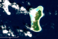
Mejit Island
- Area
- 3.5 km²
- High point
- 19 m
Utirik Atoll
- Area
- 2.4 km²
- High point
- 3 m
Kaben
- Area
- 2.3 km²
- High point
- 16 m
Utirik
- Area
- 1.9 km²
- High point
- 16 m
Erikub Atoll
- Area
- 1.5 km²
- High point
- 25 m
Likiep
- Area
- 1.3 km²
- High point
- 10 m
Knox Atoll
- Area
- 0.98 km²
- High point
- 3 m
Lado Island
- Area
- 0.7 km²
- High point
- 13 m
Toke Atoll
- Area
- 0.57 km²
- High point
- 0 m
Bikar Atoll
- Area
- 0.5 km²
- High point
- 6 m
Yarabaru Island
- Area
- 0.34 km²
- High point
- 20 m
Pigowak Island
- Area
- 0.28 km²
- High point
- 11 m
Bikar Island
- Area
- 0.25 km²
- High point
- 12 m
Unnamed island
- Area
- 0.24 km²
- High point
- 14 m
Arumenii Island
- Area
- 0.22 km²
- High point
- 11 m
Jemo Island
- Area
- 0.21 km²
- High point
- 20 m
Bwoknauo
- Area
- 0.21 km²
- High point
- 17 m
Unnamed island
- Area
- 0.14 km²
- High point
- 9 m
Biebi
- Area
- 0.12 km²
- High point
- 8 m
Kemmwan
- Area
- 0.11 km²
- High point
- 15 m
Enerouru Island
- Area
- 0.11 km²
- High point
- 19 m
Bikar
- Area
- —
size unknown
Majuro Island
- Area
- —
size unknown
Makar
- Area
- —
size unknown
Malle
- Area
- —
size unknown
Islets
- Anedoul11 m · 0.05 km²
- Unnamed island8 m · 0.05 km²
- Unnamed island16 m · 0.04 km²
- Unnamed island14 m · 0.04 km²
- Jaboerukku1 m · 0.03 km²
- Kire9 m · 0.03 km²
- Unnamed island5 m · 0.03 km²
- Unnamed island14 m · 0.03 km²
- Unnamed island16 m · 0.02 km²
- Aujaroj4 m · 0.02 km²
- Unnamed island5 m · 0.02 km²
- Anejaoeoe14 m · 0.02 km²
Rocks & skerries
- Unnamed island4 m · 0.2 ha
- Unnamed island<0.1 ha
Figures
Comparative heights
To the same scale
Islands by area
| Bokak Atoll | 81.3 km² |
| Mili Atoll | 14.9 km² |
| Arno Atoll | 13 km² |
| Likiep Atoll | 10.3 km² |
| Maloelap Atoll | 9.8 km² |
| Wotje Atoll | 8.2 km² |
| Aur Atoll | 5.6 km² |
| Unnamed island | 5.5 km² |
| Ailuk Atoll | 5.4 km² |
| Mejit Island | 3.5 km² |
| Utirik Atoll | 2.4 km² |
| Kaben | 2.3 km² |
| Utirik | 1.9 km² |
| Erikub Atoll | 1.5 km² |
| Likiep | 1.3 km² |
| Knox Atoll | 0.98 km² |
| Lado Island | 0.7 km² |
| Toke Atoll | 0.57 km² |
| Bikar Atoll | 0.5 km² |
| Yarabaru Island | 0.34 km² |
| Pigowak Island | 0.28 km² |
| Bikar Island | 0.25 km² |
| Unnamed island | 0.24 km² |
| Arumenii Island | 0.22 km² |
| Jemo Island | 0.21 km² |
| Bwoknauo | 0.21 km² |
| Unnamed island | 0.14 km² |
| Biebi | 0.12 km² |
| Kemmwan | 0.11 km² |
| Enerouru Island | 0.11 km² |
| Anedoul | 0.05 km² |
| Unnamed island | 0.05 km² |
| Unnamed island | 0.04 km² |
| Unnamed island | 0.04 km² |
| Jaboerukku | 0.03 km² |
| Kire | 0.03 km² |
| Unnamed island | 0.03 km² |
| Unnamed island | 0.03 km² |
| Unnamed island | 0.02 km² |
| Aujaroj | 0.02 km² |
| Unnamed island | 0.02 km² |
| Anejaoeoe | 0.02 km² |
| Kanaej | 0.02 km² |
| Bwokwentarinae | 0.02 km² |
| Unnamed island | 0.01 km² |
| Jaboero | 0.01 km² |
| Unnamed island | 0.01 km² |
| Allirik | 0.01 km² |
| Unnamed island | 0.7 ha |
| Maaje | 0.6 ha |
| Unnamed island | 0.4 ha |
| Unnamed island | 0.4 ha |
| Unnamed island | 0.2 ha |
| Unnamed island | <0.1 ha |
Groups within
Sources
Facts
Photographs
- WV banner Ratak Majuro. Petty Officer 1st Class Lowell Whitman / Public domain