Atlantic OceanPortugal
36°04′N 23°50′W
Portuguese Islands

José Luís Ávila Silveira/Pedro Noronha e Costa / Public domain
Chart
Major islands
São Miguel Island
- Area
- 745 km²
- High point
- 1,103 m
São Miguel Island, nicknamed "The Green Island" (Ilha Verde), is the largest and most populous island in the Portuguese archipelago of the Azores. The island covers 760 km2 (290 sq mi) and has around 140,000 inhabitants, with 45,000 people residing in Ponta Delgada, the archipelago's largest city.
Pico Island
- Area
- 445 km²
- High point
- 2,351 m
Pico Island (Ilha do Pico, Portuguese pronunciation: [ˈiʎɐ ðu ˈpiku]) is an island in the Central Group of the Portuguese Azores. The landscape features an eponymous volcano, Ponta do Pico, which is the highest mountain in Portugal, the Azores, and the highest elevation of the Mid-Atlantic Ridge.
Terceira Island
- Area
- 401 km²
- High point
- 1,019 m
Terceira (Portuguese pronunciation: [tɨɾˈsɐjɾɐ]) is a volcanic island in the Azores archipelago of Portugal, 1,181 km (734 mi) due west of Lisbon. It is one of the larger islands of the archipelago, with a population of 53,311 inhabitants in an area of approximately 396.75 km2 (153.19 sq mi).
São Jorge Island
- Area
- 244 km²
- High point
- 1,054 m
São Jorge (Portuguese pronunciation: [sɐ̃w ˈʒɔɾʒɨ]; Portuguese for 'Saint George') is an island in the central group of the Azores archipelago and part of the autonomous region of Portugal.
Faial Island
- Area
- 173 km²
- High point
- 1,043 m
Faial Island, also known as Fayal Island, is a Portuguese island contained within the Central Group or Grupo Central of the Azores, in the Atlantic Ocean.
Flores Island
- Area
- 141 km²
- High point
- 914 m
Flores Island (Portuguese: Ilha das Flores; Portuguese pronunciation: [ˈfloɾɨʃ]) is an island of the Western Group (Grupo Ocidental) of the Azores.


Minor islands

Santa Maria Island
- Area
- 96.9 km²
- High point
- 588 m

Graciosa
- Area
- 60.7 km²
- High point
- 405 m

Corvo Island
- Area
- 17.1 km²
- High point
- 719 m

Deserta Grande Island
- Area
- 10.2 km²
- High point
- 488 m
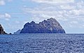
Bugio Island
- Area
- 3.1 km²
- High point
- 411 m
Cevada
- Area
- 0.46 km²
- High point
- 99 m

Ilhéu Chão
- Area
- 0.43 km²

Ilhéu de Ferro
- Area
- 0.26 km²
- High point
- 112 m
Ilhéus das Cabras
- Area
- 0.17 km²
- High point
- 143 m
Ilhéu do Topo
- Area
- 0.12 km²
- High point
- 19 m

Ilhéu do Farol
- Area
- 0.12 km²
- High point
- 73 m
Ilhéu da Praia
- Area
- 0.1 km²
- High point
- 52 m
Rocks & skerries
On the chart above, at its closest zooms.
Listing 18 of 729; the rest are on the chart.
Figures
Comparative heights
- Pico: 2,351 m
- São Miguel: 1,103 m
- São Jorge: 1,054 m
- Faial: 1,043 m
- Terceira: 1,019 m
- Flores: 914 m
- Corvo: 719 m
- Santa Maria: 588 m
- Deserta Grande: 488 m
- Bugio: 411 m
- Graciosa: 405 m
- Ilhéus das Cabras: 143 m
- Ilhéu de Ferro: 112 m
- Cevada: 99 m
To the same scale
Islands by area
| São Miguel Island | 745 km² |
| Pico Island | 445 km² |
| Terceira Island | 401 km² |
| São Jorge Island | 244 km² |
| Faial Island | 173 km² |
| Flores Island | 141 km² |
| Santa Maria Island | 96.9 km² |
| Graciosa | 60.7 km² |
| Corvo Island | 17.1 km² |
| Deserta Grande Island | 10.2 km² |
| Bugio Island | 3.1 km² |
| Cevada | 0.46 km² |
| Ilhéu Chão | 0.43 km² |
| Ilhéu de Ferro | 0.26 km² |
| Ilhéus das Cabras | 0.17 km² |
| Ilhéu do Topo | 0.12 km² |
| Ilhéu do Farol | 0.12 km² |
| Ilhéu da Praia | 0.1 km² |
Groups within
Photographs

Vista parcial da cidade da Horta apartir do Monte da Guia, Concelho da Horta, ilha do Faial, Açores, Portugal
José Luís Ávila Silveira/Pedro Noronha e Costa / Public domain

Achada Plateau.

The lighthouse of Ponta do Albernaz, Flores, Azores.

Pico da Esperança e Planalto Central

Lagoa das Sete Cidades, Miradouro da Vista do Rei, Sete Cidades, Ponta Delgada, ilha de São Miguel, Açores
José Luís Ávila Silveira/Pedro Noronha e Costa / Public domain
Sources
Facts
- Geometry, areas and high points: OpenStreetMap contributors (ODbL), Copernicus GLO-30, via Talus.
- Wikidata
Photographs
- Vista parcial da cidade da Horta apartir do Monte da Guia, Concelho da Horta, ilha do Faial, Açores, Portugal. José Luís Ávila Silveira/Pedro Noronha e Costa / Public domain
- Planalto da Achada 2023-03-03. The Cosmonaut / CC BY-SA 4.0
- Ponta do Albernaz Flores Azores. Angrense / Public domain
- Pico da Esperança 1. Samurai de Lisboa / CC BY-SA 4.0
- Lagoa das Sete Cidades, Miradouro da vista do Rei, Sete Cidades, Ponta Delgada, ilha de São Miguel, Açores. José Luís Ávila Silveira/Pedro Noronha e Costa / Public domain