South China SeaChina
16°39′N 112°45′E
Paracel Islands
西沙群岛
Part of South China Sea Islands
The Paracel Islands, also known as the Xisha Islands (simplified Chinese: 西沙群岛; traditional Chinese: 西沙群島; pinyin: xīshā qúndǎo; lit. 'West Sand Archipelago') and the Hoàng Sa Archipelago (Vietnamese: Quần đảo Hoàng Sa; Chữ Hán: 羣島黃沙, lit. 'Yellow Sand Archipelago'), are an archipelago in the South China Sea.

Chart
Overview
The Paracel Islands, also known as the Xisha Islands (simplified Chinese: 西沙群岛; traditional Chinese: 西沙群島; pinyin: xīshā qúndǎo; lit. 'West Sand Archipelago') and the Hoàng Sa Archipelago (Vietnamese: Quần đảo Hoàng Sa; Chữ Hán: 羣島黃沙, lit. 'Yellow Sand Archipelago'), are an archipelago in the South China Sea. It is under the control of the People's Republic of China, but its sovereignty in whole or in part is disputed by Taiwan and Vietnam. The word paracel is of Portuguese origin, meaning placer (a submerged bank or reef), and appears on 16th-century Portuguese maps. The archipelago includes about 130 small coral islands and reefs, most grouped into the northeastern Amphitrite Group or the western Crescent Group. They are distributed over a maritime area of around 15,000 square kilometers (5,800 sq mi), with a land area of approximately 7.75 square kilometers (2.99 sq mi). The archipelago is located about 220 miles (350 km) southeast of Hainan Island, equidistant from the coastlines of the People's Republic of China (PRC) and Vietnam, and approximately one-third of the way between central Vietnam and the northern Philippines. A feature of the Paracel Islands is Dragon Hole, the second deepest blue hole (underwater sinkhole) in the world. Sea turtles and seabirds are native to the islands, which have a hot and humid climate, abundant rainfall and may experience annual typhoons. The archipelago is surrounded by productive fishing grounds and a seabed potentially containing unexplored oil and gas reserves.
From Wikipedia, CC BY-SA 4.0
Census, cataloged
- Major islands5
- Minor islands17
- Islets18
- Rocks & skerries20
Major islands
Woody Island (SCS)
- Area
- 3.3 km²
- High point
- 13 m
Woody Island, also called Yongxing Island (simplified Chinese: 永兴岛; traditional Chinese: 永興島; pinyin: Yǒngxīng Dǎo; lit. 'Rich Forest Island') by Vietnam (and formerly French: Île Boisée, lit. 81 sq mi). As of 2014, it has a population of almost 1,500, with roads, banks and an air strip.
Triton Island
- Area
- 1.2 km²
- High point
- 9 m
Triton Island (Chinese: 中建岛; pinyin: Zhōngjiàn Dǎo; Vietnamese: đảo Tri Tôn) is the westernmost and southernmost of the Paracel Islands in the South China Sea. It is located on the southwest corner of Triton Reef and has an area of 7 hectares (17 acres) above sea-level.
Chenhang Island
- Area
- 0.61 km²
- High point
- 11 m

羚羊岛
- Area
- 5.5 km²
- High point
- 4 m
Lincoln Island
- Area
- 1.8 km²
- High point
- 14 m
Minor islands
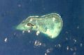
Money Island
- Area
- 0.44 km²
- High point
- 10 m
North Island
- Area
- 0.34 km²
- High point
- 12 m

Robert Island
- Area
- 0.34 km²
- High point
- 13 m
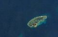
Pattle Island
- Area
- 0.34 km²
- High point
- 13 m

Tree Island
- Area
- 0.29 km²
- High point
- 9 m
Drummond Island
- Area
- 0.22 km²
- High point
- 11 m
金银东岛
- Area
- 0.16 km²
Middle Island
- Area
- 0.12 km²
- High point
- 11 m
South Island
- Area
- 0.12 km²
- High point
- 12 m
Palm Island
- Area
- 0.12 km²
- High point
- 9 m
Unnamed island
- Area
- —
size unknown
Unnamed island
- Area
- —
size unknown
Bombay Reef
- Area
- —
size unknown
Dongdao Reefs
- Area
- —
size unknown
Rocky Island, South China Sea
- Area
- —
size unknown
Xuande Atoll
- Area
- —
size unknown
Yongle Atoll
- Area
- —
size unknown
Islets
- Passu Keah0.08 km²
- Quanfu Island0.05 km²
- Observation Bank5 m · 0.02 km²
- Yagong Island6 m · 0.01 km²
- 金银东岛0.01 km²
- 老粗峙仔岛0.9 ha
- 筐仔北岛2 m · 0.4 ha
- 金银东岛0.3 ha
- Stone Islet0.3 ha
- 全富仔0.3 ha
- Unnamed island0.2 ha
- Unnamed island0.2 ha
Rocks & skerries
- 南沙洲9 m · 0.05 km²
- Middle Sand6 m · 0.03 km²
- North Sand6 m · 0.01 km²
- Yinyuzai0.3 ha
- Unnamed island<0.1 ha
- 金银东岛<0.1 ha
- 浪花礁<0.1 ha
- 银屿仔西岛<0.1 ha
- Unnamed island<0.1 ha
- Unnamed island<0.1 ha
- 广金西岛<0.1 ha
- Dongxin Shazhou<0.1 ha
Figures
Comparative heights
To the same scale
Islands by area
| 羚羊岛 | 5.5 km² |
| Woody Island (SCS) | 3.3 km² |
| Lincoln Island | 1.8 km² |
| Triton Island | 1.2 km² |
| Chenhang Island | 0.61 km² |
| Money Island | 0.44 km² |
| North Island | 0.34 km² |
| Robert Island | 0.34 km² |
| Pattle Island | 0.34 km² |
| Tree Island | 0.29 km² |
| Drummond Island | 0.22 km² |
| 金银东岛 | 0.16 km² |
| Middle Island | 0.12 km² |
| South Island | 0.12 km² |
| Palm Island | 0.12 km² |
| Passu Keah | 0.08 km² |
| 南沙洲 | 0.05 km² |
| Quanfu Island | 0.05 km² |
| Middle Sand | 0.03 km² |
| Observation Bank | 0.02 km² |
| Yagong Island | 0.01 km² |
| North Sand | 0.01 km² |
| 金银东岛 | 0.01 km² |
| 老粗峙仔岛 | 0.9 ha |
| 筐仔北岛 | 0.4 ha |
| 金银东岛 | 0.3 ha |
| Stone Islet | 0.3 ha |
| Yinyuzai | 0.3 ha |
| 全富仔 | 0.3 ha |
| Unnamed island | 0.2 ha |
| Unnamed island | 0.2 ha |
| 银屿东岛 | 0.2 ha |
| Unnamed island | 0.2 ha |
| 金银东岛 | 0.1 ha |
| 广金北一岛 | 0.1 ha |
| 金银东岛 | 0.1 ha |
| Xixin Shazhou | 0.1 ha |
| Unnamed island | <0.1 ha |
| 金银东岛 | <0.1 ha |
| 浪花礁 | <0.1 ha |
| 银屿仔西岛 | <0.1 ha |
| Unnamed island | <0.1 ha |
| Unnamed island | <0.1 ha |
| 广金西岛 | <0.1 ha |
| Dongxin Shazhou | <0.1 ha |
| Sanzhizai | <0.1 ha |
| 尾峙仔岛 | <0.1 ha |
| Unnamed island | <0.1 ha |
| 广金北二岛 | <0.1 ha |
| North Reef | <0.1 ha |
| North Reef | <0.1 ha |
Groups within
Photographs

Aerial photograph showing recent harbour developments on Duncan Island

中建岛景观


Bãi Bình Sơn

Đá Bông Bay

Đá Bắc

Đá Chim Én

Đảo Bạch Quy

Đảo Linh Côn

鸭公岛主权碑

Took this on my flight from Hong Kong to Singapore
Sources
Facts
Photographs
- Duncan Island - December 2012. Livewireshock / CC BY-SA 3.0
- 中建岛景观 04. China News Service / CC BY 4.0
- Show Your Stripes change in temperature graphic for Paracel Islands, China with bars. Professor Ed Hawkins / CC BY 4.0
- Show Your Stripes change in temperature graphic for Paracel Islands, China with labels. Professor Ed Hawkins / CC BY 4.0
- Bãi Bình Sơn. Sentinel Hub EO browser (ESA) / CC BY-SA 4.0
- Bombay Reef 2023-08-12. Sentinel Hub EO Browser (ESA) / CC BY-SA 4.0
- Da Bac 2023-08-12. Sentinel Hub EO Browser (ESA) / CC BY-SA 4.0
- Da Chim En 2023-08-12. Sentinel Hub EO Browser (ESA) / CC BY-SA 4.0
- Dao Bach Quy 2023-08-12. Sentinel Hub EO Browser (ESA) / CC BY-SA 4.0
- Dao Linh Con 2023-08-07. Sentinel Hub EO Browser (ESA) / CC BY-SA 4.0
- Yagong Island's monument. 千里走单骑 / CC BY-SA 4.0
- Crescent Group, Paracel Islands, 2007-08-11 retouched. Crescent_Group,_Paracel_Islands,_2007-08-11.jpg: Swaminathan derivative work: Teofilo (talk) / CC BY 2.0