Mediterranean SeaMalta
35°54′N 14°24′E
Maltese islands
Il-Gżejjer Maltin
The geography of Malta is dominated by water. Malta is an archipelago of coralline limestone, located in Southern Europe, but like most of Sicily sits on the African tectonic plate in the Mediterranean Sea.

Chart
Overview
The geography of Malta is dominated by water. Malta is an archipelago of coralline limestone, located in Southern Europe, but like most of Sicily sits on the African tectonic plate in the Mediterranean Sea. Malta is 81 kilometres (50 mi) south of Sicily, Italy, and nearly 300 km (190 mi) north (Libya) and northeast (Tunisia) of Africa. Although Malta is located farther south than Tunis and some other cities in North Africa, it is not the Southernmost point of Europe. Only the three largest islands – Malta, Gozo and Comino – are inhabited. Other (uninhabited) islands are: Cominotto, Filfla and the St. Paul's Islands. The country is approximately 316 km2 (122 sq mi) in area. Numerous bays along the indented coastline of the islands provide harbours. The landscape of the islands is characterised by high hills with terraced fields. The capital is Valletta.
From Wikipedia, CC BY-SA 4.0
Census, cataloged
- Major islands2
- Minor islands4
- Islets10
- Rocks & skerries19
Major islands
Malta
- Area
- 247 km²
- High point
- 253 m
Malta is an island in Southern Europe. It is the largest and most populous of the three major islands that constitute the Maltese Archipelago and the country of Malta. The island is situated in the Mediterranean Sea directly south of Italy and north of Libya.
Gozo
- Area
- 66 km²
- High point
- 193 m
Gozo (Maltese: Għawdex [ˈɐːˤʊ̯dɛʃ]), known in antiquity as Gaulos, is an island in the Maltese archipelago in the Mediterranean Sea. The island is part of the Republic of Malta. After the island of Malta itself, it is the second-largest island in the archipelago.


Minor islands
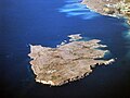
Comino
- Area
- 2.8 km²
- High point
- 70 m

Manoel Island
- Area
- 0.31 km²
- High point
- 28 m

St Paul's Island
- Area
- 0.1 km²
- High point
- 26 m

Cominotto
- Area
- 0.1 km²
- High point
- 27 m
Islets
- Filfla60 m · 0.04 km²
- Large Blue Lagoon Rock14 m · 0.9 ha
- Ħalfa Rock4 m · 0.5 ha
- Unnamed island0.4 ha
- Filfoletta0.2 ha
- Unnamed island0.2 ha
- Small Blue Lagoon Rock1 m · 0.2 ha
- Devil`s End Rock0.1 ha
- Fessej Rock3 m · 0.1 ha
- Comino Cliff Face Rock30 m · 0.1 ha
Rocks & skerries
- Fungus Rock9 m · 0.7 ha
- Unnamed island<0.1 ha
- Unnamed island<0.1 ha
- Unnamed island<0.1 ha
- Unnamed island<0.1 ha
- Unnamed island<0.1 ha
- Unnamed island<0.1 ha
- Unnamed island<0.1 ha
- Unnamed island<0.1 ha
- Unnamed island<0.1 ha
- Unnamed island<0.1 ha
- Unnamed island<0.1 ha
Also in the area
Inside the group's outline but not confirmed as members by any source.
- Unnamed island0.1 ha
- Unnamed island<0.1 ha
Figures
Comparative heights
- Malta: 253 m
- Gozo: 193 m
- Comino: 70 m
- Filfla: 60 m
- Comino Cliff Face Rock: 30 m
- Manoel: 28 m
- Cominotto: 27 m
- St Paul's: 26 m
- Large Blue Lagoon Rock: 14 m
- Fungus Rock: 9 m
- Ħalfa Rock: 4 m
- Fessej Rock: 3 m
- Small Blue Lagoon Rock: 1 m
To the same scale
Islands by area
| Malta | 247 km² |
| Gozo | 66 km² |
| Comino | 2.8 km² |
| Manoel Island | 0.31 km² |
| St Paul's Island | 0.1 km² |
| Cominotto | 0.1 km² |
| Filfla | 0.04 km² |
| Large Blue Lagoon Rock | 0.9 ha |
| Fungus Rock | 0.7 ha |
| Ħalfa Rock | 0.5 ha |
| Unnamed island | 0.4 ha |
| Filfoletta | 0.2 ha |
| Unnamed island | 0.2 ha |
| Small Blue Lagoon Rock | 0.2 ha |
| Unnamed island | 0.1 ha |
| Devil`s End Rock | 0.1 ha |
| Fessej Rock | 0.1 ha |
| Comino Cliff Face Rock | 0.1 ha |
| Unnamed island | <0.1 ha |
| Unnamed island | <0.1 ha |
| Unnamed island | <0.1 ha |
| Unnamed island | <0.1 ha |
| Unnamed island | <0.1 ha |
| Unnamed island | <0.1 ha |
| Unnamed island | <0.1 ha |
| Unnamed island | <0.1 ha |
| Unnamed island | <0.1 ha |
| Unnamed island | <0.1 ha |
| Unnamed island | <0.1 ha |
| Unnamed island | <0.1 ha |
| Unnamed island | <0.1 ha |
| Unnamed island | <0.1 ha |
| Unnamed island | <0.1 ha |
| Unnamed island | <0.1 ha |
| Unnamed island | <0.1 ha |
| Unnamed island | <0.1 ha |
| Unnamed island | <0.1 ha |
Photographs

Marsalforn Coastal Line == Licensing ==

Satellitenbild Malta Aufnahmedatum: 29. Juli 2001

The Ta' Pinu National Shrine in Għarb, Gozo is a Marian pilgrimage site dedicated to Our Lady of Ta' Pinu, a revered image said to have miraculous powers.
Sources
Facts
Photographs
- Marsalforn Coastal Line. Paultrahearn at English Wikipedia / CC BY-SA 3.0
- Malta Luftbild. Unknown author / Public domain
- The majestic ta' Pinu national shrine Gharb Gozo. Patrickfarrugia / CC BY-SA 4.0