Tablas StraitPhilippines
12°55′N 121°54′E
Maghali Islands
Part of Romblon
Maghali Islands in the province of Romblon in the Philippines includes the main islands of Banton, Simara, and Sibale, also known as Maestre de Campo, as well as smaller uninhabited islands such as Bantoncillo, and the Dos Hermanas Islands, which is composed of Isabel and Carlota islands.

Chart
Overview
Maghali Islands in the province of Romblon in the Philippines includes the main islands of Banton, Simara, and Sibale, also known as Maestre de Campo, as well as smaller uninhabited islands such as Bantoncillo, and the Dos Hermanas Islands, which is composed of Isabel and Carlota islands. The island group constitute the municipalities of Banton, Concepcion, and Corcuera. In June 1940, the three municipalities of Concepcion, Corcuera, and Jones (now Banton), were merged to form the Special Municipality of Maghali. The special municipality lasted until October 1946, along with three other special municipalities, when the province of Romblon was reestablished and separated from Capiz.
From Wikipedia, CC BY-SA 4.0
Census, cataloged
- Major islands3
- Minor islands3
- Islets3
- Rocks & skerries1
Major islands
Banton Island
- Area
- 28.6 km²
- High point
- 596 m
Banton, officially the Municipality of Banton (Bantoanon: Banwa it Banton, Filipino: Bayan ng Banton, formerly known as Jones), is a municipality in the province of Romblon, Philippines. According to the 2024 census, it has a population of 5,848 people.
Simara Island
- Area
- 20.6 km²
- High point
- 229 m
Corcuera, officially the Municipality of Corcuera (Bantoanon: Banwa it Corcuera, Filipino: Bayan ng Corcuera), is a municipality in the province of Romblon, Philippines. According to the 2024 census, it has a population of 9,021 people.


Maestre de Campo Island
- Area
- 20.2 km²
- High point
- 340 m
Concepcion, officially the Municipality of Concepcion (Bantoanon: Banwa it Concepcion, Filipino: Bayan ng Concepcion), is a municipality in the province of Romblon, Philippines. According to the 2024 census, it has a population of 3,427 people.
Minor islands
Carlota Island
- Area
- 1.2 km²
- High point
- 49 m
Isabel Island
- Area
- 1.2 km²
- High point
- 72 m
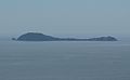
Bantoncillo Island
- Area
- 0.22 km²
- High point
- 86 m
Islets
- Kamiligan Island6 m · 0.05 km²
- Polloc Islet0.02 km²
- Tinagong Puyo Islet4 m · 0.9 ha
Rocks & skerries
- Gakot Rock0.6 ha
Figures
Comparative heights
- Banton: 596 m
- Maestre de Campo: 340 m
- Simara: 229 m
- Bantoncillo: 86 m
- Isabel: 72 m
- Carlota: 49 m
- Kamiligan: 6 m
- Tinagong Puyo: 4 m
To the same scale
Islands by area
| Banton Island | 28.6 km² |
| Simara Island | 20.6 km² |
| Maestre de Campo Island | 20.2 km² |
| Carlota Island | 1.2 km² |
| Isabel Island | 1.2 km² |
| Bantoncillo Island | 0.22 km² |
| Kamiligan Island | 0.05 km² |
| Polloc Islet | 0.02 km² |
| Tinagong Puyo Islet | 0.9 ha |
| Gakot Rock | 0.6 ha |
Groups within
Sources
Facts
Photographs
- Corcuera, Romblon. Lawrence Ruiz / CC BY-SA 4.0