Atlantic OceanPortugal
32°48′N 16°40′W
Madeira Archipelago
Madeira
Madeira, officially the Autonomous Region of Madeira, is an autonomous region of Portugal, in the Atlantic Ocean about 805 km (500 miles) southwest of mainland Portugal. Together with the Azores, it is one of the two autonomous regions of Portugal and a special territory of the European Union.

Chart
Overview
Madeira, officially the Autonomous Region of Madeira, is an autonomous region of Portugal, in the Atlantic Ocean about 805 km (500 miles) southwest of mainland Portugal. Together with the Azores, it is one of the two autonomous regions of Portugal and a special territory of the European Union. It is the southernmost point and region of Portugal. Madeira is an archipelago situated in the North Atlantic Ocean, in the region of Macaronesia, just under 400 kilometres (250 mi) north of the Canary Islands, Spain, 520 kilometres (320 mi) west of Morocco and 805 kilometres (500 mi) southwest of mainland Portugal. Madeira sits on the African tectonic plate, but is culturally, politically and ethnically associated with Europe, with its population predominantly descended from Portuguese settlers. Its population was 251,060 in 2021. The capital of Madeira is Funchal, on the main island's south coast. The archipelago includes the islands of Madeira, Porto Santo, and the Desertas, administered together with the separate archipelago of the Savage Islands. Roughly half of the population lives in Funchal. The region has political and administrative autonomy through the Administrative Political Statute of the Autonomous Region of Madeira provided for in the Portuguese Constitution. The region is an integral part of the European Union as an outermost region. Madeira generally has a mild/moderate subtropical climate with Mediterranean summer droughts and winter rain. Many microclimates are found at different elevations. Madeira, uninhabited at the time, was claimed by Portuguese sailors in the service of Prince Henry the Navigator in 1419 and settled after 1420. The archipelago is the first territorial discovery of the exploratory period of the Age of Discovery. In the late 15th century, it was a major exporter of slave-cultivated sugar, and in the 18th century, of wine. A tourist trade developed from the late 19th century, but was insufficient to stem a pattern of emigration from the island to Africa and to the Americas. Madeira today is a year-round resort, particularly for Portuguese, British (148,000 visits in 2021), and German tourists (113,000). It is by far the most populous and densely populated Portuguese island. The region is noted for its Madeira wine, flora, and fauna, with its pre-historic laurel forest, classified as a UNESCO World Heritage Site. The destination is certified by EarthCheck. The main harbour in Funchal has long been the leading Portuguese port in cruise ship dockings, an important stopover for Atlantic passenger cruises between Europe, the Caribbean and North Africa. In addition, the International Business Centre of Madeira, also known as the Madeira Free Trade Zone, was established in the 1980s. It includes mainly tax-related incentives.
From Wikipedia, CC BY-SA 4.0
Census, cataloged
- Major islands1
- Minor islands12
- Islets87
- Rocks & skerries408
Major islands
Madeira Island
- Area
- 741 km²
- High point
- 1,862 m
Madeira is a Portuguese island, and is the largest and most populous of the Madeira Archipelago. It has an area of 740.7 km2 (286 sq mi), including Ilhéu de Agostinho, Ilhéu de São Lourenço, Ilhéu Mole (northwest). As of 2021, Madeira had a total population of 245,595.
Minor islands

Porto Santo
- Area
- 40.5 km²
- High point
- 516 m

Deserta Grande Island
- Area
- 10.2 km²
- High point
- 488 m
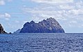
Bugio Island
- Area
- 3.1 km²
- High point
- 411 m

Selvagem Grande Island
- Area
- 2.4 km²
- High point
- 154 m

Cal Islet
- Area
- 1.4 km²
- High point
- 173 m
Cevada
- Area
- 0.46 km²
- High point
- 99 m

Ilhéu Chão
- Area
- 0.43 km²

Ilhéu de Cima
- Area
- 0.3 km²
- High point
- 105 m

Ilhéu de Ferro
- Area
- 0.26 km²
- High point
- 112 m

Selvagem Pequena Island
- Area
- 0.2 km²
- High point
- 49 m

Ilhéu do Farol
- Area
- 0.12 km²
- High point
- 73 m
Isleta Grande
- Area
- —
size unknown
Rocks & skerries
On the chart above, at its closest zooms.
Listing 13 of 508; the rest are on the chart.
Figures
Comparative heights
- Madeira: 1,862 m
- Porto Santo: 516 m
- Deserta Grande: 488 m
- Bugio: 411 m
- Cal: 173 m
- Selvagem Grande: 154 m
- Ilhéu de Ferro: 112 m
- Ilhéu de Cima: 105 m
- Cevada: 99 m
- Ilhéu do Farol: 73 m
- Selvagem Pequena: 49 m
To the same scale
Islands by area
| Madeira Island | 741 km² |
| Porto Santo | 40.5 km² |
| Deserta Grande Island | 10.2 km² |
| Bugio Island | 3.1 km² |
| Selvagem Grande Island | 2.4 km² |
| Cal Islet | 1.4 km² |
| Cevada | 0.46 km² |
| Ilhéu Chão | 0.43 km² |
| Ilhéu de Cima | 0.3 km² |
| Ilhéu de Ferro | 0.26 km² |
| Selvagem Pequena Island | 0.2 km² |
| Ilhéu do Farol | 0.12 km² |
Groups within
Photographs

iPhone photos from our first afternoon/evening on Madeira. We like it!

Porto Santo island as seen from Madeira. This photograph was taken by excellent weather from Santo António da Serra.


Pico das Torres mountain as seen from the west near Fajã dos Cardos in Curral das Freiras, Câmara de Lobos, Madeira, Portugal in 2023 May. The valley is carved by the river Ribeira dos Socorridos.


2026 (365 Challenge) - Day 39 - Breaking waves, Ponta do Sol, Madeira, Portugal 2013

Aussichtsplattform über dem Tal der Ribeira da Janela

Autumn On The Canal

Miradouro Winston Churchill

Ponta do Sol pier, Madeira, Portugal in January 2024.

Ponta do Sol pier, Madeira, Portugal in January 2024.

Calheta
Sources
Facts
Photographs
- Apparently this is an old castle but it looked like a run down building that was fenced off. Canico, Madeira (54023606337). Frank Kovalchek from USA / CC BY 2.0
- Porto Santo from Madeira. Coeli / Public domain
- Awesome landscape and a bunch of rock cairns on the north coast of Madeira (54027054127). Frank Kovalchek from USA / CC BY 2.0
- Pico das Torres from the west, Curral das Freiras, Câmara de Lobos, Madeira, 2023 May. Ximonic (Simo Räsänen) / CC BY-SA 4.0
- A fixer-upper on the north coast of Madeira? (54038414554). Frank Kovalchek from USA / CC BY 2.0
- 2026 (365 Challenge) - Day 39 - Breaking waves, Ponta do Sol, Madeira, Portugal 2013 (55084088971). Forbes Johnston from Winchester, UK / CC BY 4.0
- Aussichtsplattform über dem Tal der Ribeira da Janela. Rudolphu / CC BY-SA 4.0
- Autumn On The Canal (53830357434). Michael Gaylard from Horsham, UK / CC BY 2.0
- Baía de Câmara de Lobos (53327326145). Michael Gaylard from Horsham, UK / CC BY 2.0
- Cais da Ponta do Sol, Madeira, Portugal 2024 03. Celsoazevedo / CC BY 4.0
- Cais da Ponta do Sol, Madeira, Portugal 2024 04. Celsoazevedo / CC BY 4.0
- Calheta (54297559109). Michael Gaylard from Horsham, UK / CC BY 2.0