Strait of BonifacioItaly
41°13′N 9°23′E
Maddalena archipelago
Arcipelago di La Maddalena
The Maddalena Archipelago is a group of islands in the Strait of Bonifacio between Corsica (France) and Sardinia (Italy). The whole archipelago makes the territory of the La Maddalena comune in Sardinia.

Chart
Overview
The Maddalena Archipelago is a group of islands in the Strait of Bonifacio between Corsica (France) and Sardinia (Italy). The whole archipelago makes the territory of the La Maddalena comune in Sardinia.
From Wikipedia, CC BY-SA 4.0
Census, cataloged
- Major islands4
- Minor islands9
- Islets98
- Rocks & skerries239
Major islands
Maddalena Island
- Area
- 19.7 km²
- High point
- 155 m
La Maddalena (Sardinian: Sa Madalena, Corsican: A Madalena) is a town and comune (municipality) located on the islands of the Maddalena archipelago in the Province of Gallura North-East Sardinia in the autonomous island region of Sardinia in Italy. It has 10,449 inhabitants.
Caprera
- Area
- 15.5 km²
- High point
- 212 m
Caprera is an island in the Maddalena archipelago off the coast of Sardinia, Italy. In the area of La Maddalena island in the Strait of Bonifacio, it is a tourist destination and the place to which Giuseppe Garibaldi retired from 1854 until his death in 1882.
Spargi
- Area
- 4.2 km²
- High point
- 126 m
Spargi is an island of Italy. It is situated in the Maddalena archipelago, in the Strait of Bonifacio between Corsica and Sardinia. It is the third largest island in the archipelago, and is uninhabited. It is within the Arcipelago di La Maddalena National Park.
Santo Stefano
- Area
- 3 km²
- High point
- 100 m
Santo Stefano (Santu Stefanu in Gallurese; Santu Istèvene in Sardinian) is an island in the Maddalena archipelago of northern Sardinia, Italy, and part of the Maddalena National Park.


Minor islands

Santa Maria
- Area
- 1.9 km²
- High point
- 46 m

Budelli
- Area
- 1.7 km²
- High point
- 79 m

Razzoli
- Area
- 1.7 km²
- High point
- 58 m

Mortorio
- Area
- 0.57 km²
- High point
- 71 m
Isola Giardinelli
- Area
- 0.46 km²
- High point
- 13 m
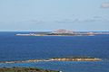
Isola di Soffi
- Area
- 0.43 km²
- High point
- 29 m
Corcelli
- Area
- 0.12 km²
- High point
- 27 m

Spargiotto
- Area
- 0.11 km²
- High point
- 39 m
Unnamed island
- Area
- —
size unknown
Rocks & skerries
On the chart above, at its closest zooms.
Listing 13 of 350; the rest are on the chart.
Figures
Comparative heights
- Caprera: 212 m
- Maddalena: 155 m
- Spargi: 126 m
- Santo Stefano: 100 m
- Budelli: 79 m
- Mortorio: 71 m
- Razzoli: 58 m
- Santa Maria: 46 m
- Spargiotto: 39 m
- Isola di Soffi: 29 m
- Corcelli: 27 m
- Isola Giardinelli: 13 m
To the same scale
Islands by area
| Maddalena Island | 19.7 km² |
| Caprera | 15.5 km² |
| Spargi | 4.2 km² |
| Santo Stefano | 3 km² |
| Santa Maria | 1.9 km² |
| Budelli | 1.7 km² |
| Razzoli | 1.7 km² |
| Mortorio | 0.57 km² |
| Isola Giardinelli | 0.46 km² |
| Isola di Soffi | 0.43 km² |
| Corcelli | 0.12 km² |
| Spargiotto | 0.11 km² |
Groups within
Photographs


La Maddalena

Parco nazionale dell'arcipelago di La Maddalena (Q536703)

Arcipelago di La Maddalena

L'arcipelago della Maddalena nel Nord della Sardegna

a maddalena

Parco nazionale dell'arcipelago di La Maddalena (Q536703)

Isola di Caprera

Parco nazionale dell'arcipelago di La Maddalena (Q536703)

Parco nazionale dell'arcipelago della Maddalena , laguna salustre

Parco Nazionale Arcipelago della Maddalena - Zona della crocetta

Parco nazionale dell'arcipelago di La Maddalena (Q536703)
Sources
Facts
Photographs
- La Maddalena Archipel Aerial view. Unknown author / CC BY-SA 3.0
- La Maddalena - Il porto (01). Gianni Careddu / CC BY-SA 3.0
- Acqua stupenda. Floriana Fotografa / CC BY-SA 4.0
- La Maddalena - Isola di Spargi (09). Gianni Careddu / CC BY-SA 3.0
- 3A4A3254. Eppa00 / CC0
- A maddalena - panoramio - brunobarbato (1). brunobarbato / CC BY 3.0
- Aspargi. Floriana Fotografa / CC BY-SA 4.0
- La Maddalena, isola di Caprera (000). Gianni Careddu / CC BY-SA 3.0
- Caletta aspargi. Floriana Fotografa / CC BY-SA 4.0
- LAGUNA BLU. Assoo84 / CC BY-SA 4.0
- Lamaddalena002. Daniele Marcello / CC BY-SA 3.0
- Meraviglia aspargi. Floriana Fotografa / CC BY-SA 4.0