Gulf of HondurasBelize
17°18′N 87°33′W
Lighthouse Reef
Lighthouse Reef is an atoll in the Caribbean Sea, the easternmost part of the Belize Barrier Reef and one of its three atolls, the other two being Turneffe Atoll and Glover's Reef. Lighthouse Reef is located about 80 kilometres (50 mi) southeast of Belize City. 0 mi) wide.

Chart
Overview
Lighthouse Reef is an atoll in the Caribbean Sea, the easternmost part of the Belize Barrier Reef and one of its three atolls, the other two being Turneffe Atoll and Glover's Reef. Lighthouse Reef is located about 80 kilometres (50 mi) southeast of Belize City. The atoll is of oblong shape, approximately 35 kilometres (22 mi) long from north to south, and about 8 kilometres (5.0 mi) wide. It forms a shallow sandy lagoon with an area of 120 square kilometres (46 sq mi) and a depth between 2 and 6 metres (6 ft 7 in and 19 ft 8 in) deep. The reef is one of the best developed and healthiest reefs in the Caribbean, "with an emergent fringing reef, a sloping fore reef with a coral rimmed shelf edge, vertical coral walls, and numerous patch reefs in the shallow central lagoon." There are several islands, listed here from north to south:
Sandbore Caye Northern Caye Half Moon Caye Saddle Caye Long Caye Hat Caye Lighthouse Reef is known as a snorkelling and diving destination, considered one of the best dive sites in Belize and the whole Caribbean. Notable diving locations are Half Moon Caye Wall, Long Caye Aquarium ("The Aquarium"), Silver Caves, Tres Cocos, and West Point. In addition to these coral reefs, it is also home to the Great Blue Hole.
From Wikipedia, CC BY-SA 4.0
Census, cataloged
- Major islands2
- Minor islands1
- Islets3
- Rocks & skerries1
Major islands
Northern Caye
- Area
- 3.9 km²
- High point
- 9 m
Northern Caye is an island of the Lighthouse Reef Atoll 50 miles (80 km) off the coast of Belize. The former Lighthouse Reef Resort (closed 2005) catered to scuba diving enthusiasts. The caye is noted for its saltwater crocodiles and snowy egrets.
Long Caye
- Area
- 2.3 km²
- High point
- 7 m
Long Caye is an island 40 miles (64 km) off the coast of Belize. The Caye is only 8 miles (13 km) away from the Great Blue Hole and is located in the same atoll as Lighthouse Reef.
Minor islands
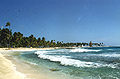
Half Moon Caye
- Area
- 0.17 km²
- High point
- 9 m
Islets
- Sandbore Caye5 m · 0.04 km²
- Unnamed island0.01 km²
- Unnamed island1 m · 0.4 ha
Rocks & skerries
- Unnamed island<0.1 ha
Figures
Comparative heights
- Northern Caye: 9 m
- Half Moon Caye: 9 m
- Long Caye: 7 m
- Sandbore Caye: 5 m
To the same scale
Islands by area
| Northern Caye | 3.9 km² |
| Long Caye | 2.3 km² |
| Half Moon Caye | 0.17 km² |
| Sandbore Caye | 0.04 km² |
| Unnamed island | 0.01 km² |
| Unnamed island | 0.4 ha |
| Unnamed island | <0.1 ha |
Photographs

Cricket is actually the island man living there. he watches over the lobster and crab traps in the ocean

Red ringspot lesions caused by narcissus mosaic virus (NMV) appeared in Gomphrena globosa after inoculation with tepal extracts from colour-broken flowers.
Donald A Hunter, John D Fletcher, Kevin M Davies, and Huaibi Zhang / CC BY 2.5

NASA image of Lighthouse Reef, Belize, which includes the Great Blue Hole roughly near its center.Created by Jesse Allen, using EO-1 ALI ,data provided courtesy of the NASA EO-1 Team.

Half moon Caye natural moment: Die Insel Half Moon Caye ist Teil des Lighthouseriffs in der Karibik.

Sources
Facts
Photographs
- On that island, lives a man named Cricket (4905971981). Serge Melki from Indianapolis, USA / CC BY 2.0
- Getting to lighthouse island (4905962577). Serge Melki from Indianapolis, USA / CC BY 2.0
- 12985 2011 1518 MOESM2 ESM. Donald A Hunter, John D Fletcher, Kevin M Davies, and Huaibi Zhang / CC BY 2.5
- Lighthouse Reef Belize. Jesse Allen / Public domain
- Beach in the Lighthouse Reef, Belize - Strand (19221624354). dronepicr / CC BY 2.0
- Koralle Im Lighthouse Reef Belize (125512749). Dronepicr / CC BY 3.0