Pacific OceanFiji
17°50′S 178°40′E
Lau Islands
Lau Group
Part of Fiji
The Lau Islands (also called the Lau Group, the Eastern Group, the Eastern Archipelago) of Fiji are situated in the southern Pacific Ocean, just east of the Koro Sea. Of this chain of about sixty islands and islets, about thirty are inhabited.

Chart
Overview
The Lau Islands (also called the Lau Group, the Eastern Group, the Eastern Archipelago) of Fiji are situated in the southern Pacific Ocean, just east of the Koro Sea. Of this chain of about sixty islands and islets, about thirty are inhabited. The Lau Group covers a land area of 188 square miles (487 square km), and had a population of 10,683 at the most recent census in 2007. While most of the northern Lau Group are high islands of volcanic origin, those of the south are mostly carbonate low islands. Administratively the islands belong to Lau Province.
From Wikipedia, CC BY-SA 4.0
Census, cataloged
- Major islands15
- Minor islands48
- Islets188
- Rocks & skerries74
Major islands
Vanua Balavu
- Area
- 52.5 km²
- High point
- 250 m
Vanua Balavu is the third-largest island in Fiji's Lau archipelago, and the main island of the Northern Lau Group.
Totoya
- Area
- 30.7 km²
- High point
- 340 m
Totoya is a volcanic island and tikina in the Moala subgroup of Fiji's Lau archipelago. It occupies an area of 28 km2, making it the smallest of the Yasayasa Moala Group. Its maximum elevation is 366 metres (1,201 feet) above sea level. The main economic activity is coconut farming.
Matuku Island
- Area
- 29.7 km²
- High point
- 370 m
Matuku is a volcanic island in the Moala subgroup of Fiji's Lau archipelago. Located at 19.18° South and 179.75° East, Matuku covers an area of 57 square kilometers. It has a maximum elevation of 385 meters. Matuku is part of a group of islands known as Yasayasa Moala.
Mago Island
- Area
- 21.9 km²
- High point
- 207 m
Mago Island is a volcanic island that lies in the northwest sector of Fiji's northern Lau Group of islands. One of the largest private islands in the southwestern Pacific Ocean, the island has an area of 22 square kilometres (8.5 sq mi). The island is privately owned by actor and director Mel Gibson.
Nayau
- Area
- 19.1 km²
- High point
- 191 m
Nayau is an island in Fiji, a tikina in and member of the Lau archipelago. It is the ancestral island of the Vuanirewa Clan, who were moved to the nearby island of Lakeba.
Fulaga
- Area
- 16.5 km²
- High point
- 240 m
Fulaga (proper name: Vulaga) is a crescent-shaped reef-limestone island in Fiji's Southern Lau Group.
Tuvuca
- Area
- 13.3 km²
- High point
- 180 m
Tuvuca is a small island off Vanua Balavu in Fiji's Lau archipelago. It is a densely wooded and inhabited island and rises 800 feet (240 metres) above sea level at the highest point. There is only one village on the island, which has a population of around 180 people. There is a primary school.
Kanacea
- Area
- 12.6 km²
- High point
- 255 m
Kanacea (Kanathea) is a volcanic island with seven peaks in Fiji's Lau archipelago. It is 15 kilometres (9.3 mi) west of Vanua Balavu. Covering an area of 12.48 square kilometres (3,084 acres), it has a maximum elevation of 259 metres (850 ft).
Moce Island
- Area
- 10.9 km²
- High point
- 176 m
Namuka-i-Lau
- Area
- 10.4 km²
- High point
- 79 m
Ogea Levu
- Area
- 10.3 km²
- High point
- 84 m
Ogea Levu is a coral island on a barrier reef in Fiji's Southern Lau archipelago. With an area of 13.3 square kilometres (3,300 acres), it is situated at 19.18° South and 178.47° West, 10 kilometres (6.2 miles) east of Fulaga. It has a maximum altitude of 82 metres (270 ft).


Moala Island
- Area
- 65.4 km²
- High point
- 460 m
Moala is a volcanic island in the Moala subgroup of Fiji's Lau archipelago. 1 sq mi), making it the ninth largest island of Fiji. The highest point on the island of Moala, at a maximum elevation of 468 meters (1,535 ft), is called Delaimoala which has rich vegetation and consists of dark thick forest.
Lakeba
- Area
- 58.8 km²
- High point
- 214 m
Lakeba is an island in Fiji’s Southern Lau Archipelago; the provincial capital of Lau is located here. The island is the tenth largest in Fiji, with a land area of nearly 60 square kilometres (23 sq mi). It is fertile and well-watered, and encircled by a 29-kilometre (18 mi) road.
Cicia
- Area
- 34.8 km²
- High point
- 183 m
Cicia is a Fijian island of the Lau Group. One of the Northern Lau Islands, Cicia is volcanic and is composed of raised coral. Its area is 34.6 square kilometres (13 sq mi).
Kabara
- Area
- 31.7 km²
- High point
- 135 m
Kabara is an island of Fiji, a member of the Lau archipelago. With a land area of 32.75 km2 (12.64 sq mi), its population of around 660 live in four villages.
Minor islands
Yacata
- Area
- 8.4 km²
- High point
- 225 m
Vuaqava
- Area
- 8.4 km²
- High point
- 80 m

Naitaba
- Area
- 7.3 km²
- High point
- 159 m

Ono-i-Lau
- Area
- 7.1 km²
- High point
- 104 m

Ogea Driki
- Area
- 5.1 km²
- High point
- 180 m
Munia Island
- Area
- 4.7 km²
- High point
- 240 m
Oneata Island
- Area
- 4.5 km²
- High point
- 46 m

Vanua Vatu
- Area
- 4.1 km²
- High point
- 98 m

Vatoa
- Area
- 4 km²
- High point
- 62 m
Susui Island
- Area
- 3.5 km²
- High point
- 117 m
Vatu Vara
- Area
- 3.4 km²
- High point
- 268 m
Thikombia-i-Lau
- Area
- 2.7 km²
- High point
- 149 m
Avea Island
- Area
- 2.3 km²
- High point
- 150 m
Doi
- Area
- 1.9 km²
- High point
- 78 m
Namalata Island
- Area
- 1.8 km²
- High point
- 121 m
Komo
- Area
- 1.7 km²
- High point
- 70 m
Unnamed island
- Area
- 1.7 km²
- High point
- 66 m
Kaibu
- Area
- 1.5 km²
- High point
- 160 m
Navutu-i-Loma
- Area
- 1.3 km²
- High point
- 59 m
Nggilanggila Island
- Area
- 0.89 km²
- High point
- 152 m
Navutu-i-Ra
- Area
- 0.8 km²
- High point
- 105 m

Tuvana-i-Ra
- Area
- 0.73 km²
- High point
- 19 m
Aiwa Island
- Area
- 0.68 km²
- High point
- 39 m
Unnamed island
- Area
- 0.61 km²
- High point
- 55 m
Udui
- Area
- 0.57 km²
- High point
- 15 m
Unnamed island
- Area
- 0.48 km²
- High point
- 11 m
Unnamed island
- Area
- 0.44 km²
- High point
- 70 m
Wailagi Lala
- Area
- 0.34 km²
- High point
- 16 m
Ndavura Island
- Area
- 0.31 km²
- High point
- 43 m
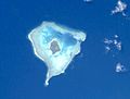
Olorua
- Area
- 0.3 km²
- High point
- 65 m
Nukutagasa Island
- Area
- 0.3 km²
- High point
- 49 m
Karoni Island
- Area
- 0.29 km²
- High point
- 31 m
Unnamed island
- Area
- 0.2 km²
- High point
- 82 m
Yanuca
- Area
- 0.15 km²
- High point
- 12 m
Unnamed island
- Area
- 0.14 km²
- High point
- 55 m
Unnamed island
- Area
- 0.13 km²
- High point
- 6 m
Unnamed island
- Area
- 0.12 km²
- High point
- 16 m
Unnamed island
- Area
- 0.11 km²
- High point
- 20 m
Unnamed island
- Area
- 0.11 km²
- High point
- 6 m
Bacon Island
- Area
- —
size unknown
Komo Ndriti
- Area
- —
size unknown
Late-i-Tonga
- Area
- —
size unknown
Loa Island
- Area
- —
size unknown
Mana Islands
- Area
- —
size unknown
Marambo Island
- Area
- —
size unknown
Ndoi Island
- Area
- —
size unknown
Tavunasithi
- Area
- —
size unknown
Undui Island
- Area
- —
size unknown
Rocks & skerries
On the chart above, at its closest zooms.
Listing 63 of 325; the rest are on the chart.
Figures
Comparative heights
To the same scale
Islands by area
| Moala Island | 65.4 km² |
| Lakeba | 58.8 km² |
| Vanua Balavu | 52.5 km² |
| Cicia | 34.8 km² |
| Kabara | 31.7 km² |
| Totoya | 30.7 km² |
| Matuku Island | 29.7 km² |
| Mago Island | 21.9 km² |
| Nayau | 19.1 km² |
| Fulaga | 16.5 km² |
| Tuvuca | 13.3 km² |
| Kanacea | 12.6 km² |
| Moce Island | 10.9 km² |
| Namuka-i-Lau | 10.4 km² |
| Ogea Levu | 10.3 km² |
| Yacata | 8.4 km² |
| Vuaqava | 8.4 km² |
| Naitaba | 7.3 km² |
| Ono-i-Lau | 7.1 km² |
| Ogea Driki | 5.1 km² |
| Munia Island | 4.7 km² |
| Oneata Island | 4.5 km² |
| Vanua Vatu | 4.1 km² |
| Vatoa | 4 km² |
| Susui Island | 3.5 km² |
| Vatu Vara | 3.4 km² |
| Thikombia-i-Lau | 2.7 km² |
| Avea Island | 2.3 km² |
| Doi | 1.9 km² |
| Namalata Island | 1.8 km² |
| Komo | 1.7 km² |
| Unnamed island | 1.7 km² |
| Kaibu | 1.5 km² |
| Navutu-i-Loma | 1.3 km² |
| Nggilanggila Island | 0.89 km² |
| Navutu-i-Ra | 0.8 km² |
| Tuvana-i-Ra | 0.73 km² |
| Aiwa Island | 0.68 km² |
| Unnamed island | 0.61 km² |
| Udui | 0.57 km² |
| Unnamed island | 0.48 km² |
| Unnamed island | 0.44 km² |
| Wailagi Lala | 0.34 km² |
| Ndavura Island | 0.31 km² |
| Olorua | 0.3 km² |
| Nukutagasa Island | 0.3 km² |
| Karoni Island | 0.29 km² |
| Unnamed island | 0.2 km² |
| Yanuca | 0.15 km² |
| Unnamed island | 0.14 km² |
| Unnamed island | 0.13 km² |
| Unnamed island | 0.12 km² |
| Unnamed island | 0.11 km² |
| Unnamed island | 0.11 km² |
Groups within
Overlapping groups
Photographs

Beach on Vanua Balavu

Naitaba (Lau-Islands)

NASA astronaut image of Matuku, Moala Group, Lau Archipelago, Fiji

Fulaga

NASA astronaut image of Navatu (or Tova) Reef, an atoll-shaped coral reef in the Lau Archipelago in Fiji

Harvard University. Museum of Comparative Zoology / No restrictions

NASA astronaut image of the Yagasa Cluster as part of the Lau Archipelago in Fiji

NASA astronaut image of Vanua Vatu, Lau Archipelago, Fiji

NASA astronaut image of Cakau Tabu (or Thakau Tambu), formerly known as „Gordon Reef of Wilkes“, an atoll-shaped coral reef in the Lau Islands, Fiji

NASA astronaut image of Vuata Ono, an atoll-shaped coral reef in the Lau Archipelago in Fiji

Thakau Vuite Reef

NASA astronaut image of Namuka-i-Lau, Lau Archipelago, Fiji
Sources
Facts
Photographs
- Beach on Vanua Balavu. Jaejay77 / CC BY-SA 4.0
- Naitaba Island. NASA / Public domain
- Matuku large ISS004-E-7880. Image courtesy of Earth Sciences and Image Analysis Laboratory, NASA Johnson Space Center / Public domain
- Fulaga. NASA / Public domain
- Navatu Reef ISS002. Image courtesy of Earth Sciences and Image Analysis Laboratory, NASA Johnson Space Center / Public domain
- Bulletin of the Museum of Comparative Zoology at Harvard College (1899) (20301629520). Harvard University. Museum of Comparative Zoology / No restrictions
- Lau Islands Yagasa highres STS098. Image courtesy of Earth Sciences and Image Analysis Laboratory, NASA Johnson Space Center / Public domain
- Vanua Vatu large ISS002 cropped. Image courtesy of Earth Sciences and Image Analysis Laboratory, NASA Johnson Space Center / Public domain
- Thakau Tambu ISS004. Image courtesy of Earth Sciences and Image Analysis Laboratory, NASA Johnson Space Center / Public domain
- Vuata Ono ISS002. Image courtesy of Earth Sciences and Image Analysis Laboratory, NASA Johnson Space Center / Public domain
- Thakau Vuite Reef. NASA / Public domain
- Namuka STS098-715B-81. Image courtesy of Earth Sciences and Image Analysis Laboratory, NASA Johnson Space Center / Public domain