Russia
61°36′N 30°50′E
Ladoga Skerries National Park
Ladoga Skerries National Park (Russian: Национальный парк «Ладожские шхеры») is located on the north and northwestern shores of Lake Ladoga in the Republic of Karelia, Russia. The park features numerous small rocky islands (skerries) on narrow bays and channels. The park was officially created in 2017.

Chart
Overview
Ladoga Skerries National Park (Russian: Национальный парк «Ладожские шхеры») is located on the north and northwestern shores of Lake Ladoga in the Republic of Karelia, Russia. The park features numerous small rocky islands (skerries) on narrow bays and channels. The park was officially created in 2017.
From Wikipedia, CC BY-SA 4.0
Census, cataloged
- Major islands4
- Minor islands4
- Islets0
- Rocks & skerries0
Major islands
Riekkalansaari
- Area
- 43.4 km²
- High point
- 102 m
Riekkalansaari (Russian: Риеккалансаари) is a 41-square-kilometer (16 sq mi) island in the northern part of Lake Ladoga in Sortavalsky District, Republic of Karelia, Russia. The island is located east of the town of Sortavala and is connected to the mainland by a bridge.
Kilpola
- Area
- 34.8 km²
- High point
- 60 m
Kilpola (Russian: Кильпола; Finnish: Kilpolansaari) is an island 6 x 8 km among the skerries in the northwestern part of the Lake Ladoga, in Lakhdenpokhsky District of Republic of Karelia, connected to the mainland by a bridge. It is composed of granite hills rising up to about 60 m.
Sorolansaari
- Area
- 16.7 km²
- High point
- 91 m
Kuhkaa
- Area
- 14.2 km²
- High point
- 55 m


Minor islands

Puutsaari
- Area
- 10.3 km²
- High point
- 101 m

Lauvatsaari
- Area
- 3.5 km²
- High point
- 54 m
Krestovy
- Area
- 0.85 km²
- High point
- 62 m
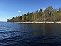
Selkämarjasaari
- Area
- 0.3 km²
- High point
- 29 m
Figures
Comparative heights
- Riekkalansaari: 102 m
- Puutsaari: 101 m
- Sorolansaari: 91 m
- Krestovy: 62 m
- Kilpola: 60 m
- Kuhkaa: 55 m
- Lauvatsaari: 54 m
- Selkämarjasaari: 29 m
To the same scale
Islands by area
| Riekkalansaari | 43.4 km² |
| Kilpola | 34.8 km² |
| Sorolansaari | 16.7 km² |
| Kuhkaa | 14.2 km² |
| Puutsaari | 10.3 km² |
| Lauvatsaari | 3.5 km² |
| Krestovy | 0.85 km² |
| Selkämarjasaari | 0.3 km² |
Photographs

Ладожские шхеры

Национальный парк «Ладожские шхеры»: Карелия

Mustasaari Island: Lake Ladoga, Sortavalsky District, Republic of Karelia.

Laadoga põhjakaldal Sorola saarel. Saar ja kogu Laadoga põhjaosa asuvad Fennoskandia (Balti) kilbi avamusalal, kus paljanduvad Proterosoikumi kristalsed kivimid. Pildil olevad kivimid on migmatiidid ja granitoidsed pegmatiidid.

Кухка — небольшой скалистый остров в Ладожском озере.


Pormestarinsaari Island: Lyappäjärvi Lake, Sortavalsky District, Republic of Karelia.

Category "Specially protected natural territories of Russia". Ladoga skerries national Park. Sortavalsky district. View from the highway

Aerial view of Kuivalahti, Pitkärantsky District, Karelia, Russia

Aerial view of Kuivalahti, Pitkärantsky District, Karelia, Russia

Summer morning on Ladoga skerries

Summer sunrise in Ladoga Skerries National Park
Sources
Facts
Photographs
- Шхеры, Ладога, северная часть. Grozovsky / CC BY-SA 4.0
- "Ладожские шхеры" в августе. Consider me jealous / CC BY-SA 4.0
- 9614.1. Mustasaari Island. GAlexandrova / CC BY-SA 4.0
- Laadoga pkallas 2005. Siim Sepp / CC BY-SA 3.0
- Kukhka island in Ladoga. Andrey Pashkevich / CC BY-SA 3.0
- Остров Риеккалансаари 20210706 111932. Lesless / CC BY-SA 4.0
- 9593. Порместаринсаари остров. GAlexandrova / CC BY-SA 4.0
- Ladoga skerries national Park. Sortavalsky district. View from the highway. Александр Байдуков / CC BY-SA 4.0
- Aerial view of Kuivalahti (1). 基日島 / CC BY-SA 4.0
- Aerial view of Kuivalahti (2). 基日島 / CC BY-SA 4.0
- Ladoga skerries. Yuriy Stolypin / CC BY 4.0
- Summer, August, morning, skerries. Yuriy Stolypin / CC BY 4.0