Sea of OkhotskRussia
47°00′N 152°06′E
Kuril Islands
Курильские острова
Part of islands of Sakhalin Oblast
The Kuril Islands or Kurile Islands are a volcanic archipelago administered as part of Sakhalin Oblast in the Russian Far East. The islands stretch approximately 1,300 km (810 mi) northeast from Hokkaido in Japan to Kamchatka Peninsula in Russia, separating the Sea of Okhotsk from the north Pacific Ocean.

Chart
Overview
The Kuril Islands or Kurile Islands are a volcanic archipelago administered as part of Sakhalin Oblast in the Russian Far East. The islands stretch approximately 1,300 km (810 mi) northeast from Hokkaido in Japan to Kamchatka Peninsula in Russia, separating the Sea of Okhotsk from the north Pacific Ocean. There are 56 islands and many minor islets. The Kuril Islands consist of the Greater Kuril Chain and, at the southwest end, the parallel Lesser Kuril Chain. The group termed the 'South Kurils' consists of those of the Lesser Kuril Chain together with Kunashir and Iturup in the Greater Kuril Chain. The Vries Strait between Iturup and Urup forms the Miyabe Line dividing the North and South Kurils. The Kuril Islands cover an area of around 10,503.2 square kilometres (4,055.3 sq mi), with a population of roughly 20,000. The islands have been under Russian administration since their 1945 invasion by the Soviet Union near the end of World War II. Japan claims the four southernmost islands, including two of the three largest (Iturup and Kunashir), as part of its territory, as well as Shikotan and the unpopulated Habomai islets, which has led to the ongoing Kuril Islands dispute. The disputed islands are known in Japan as the country's "Northern Territories".
From Wikipedia, CC BY-SA 4.0
Census, cataloged
- Major islands5
- Minor islands34
- Islets291
- Rocks & skerries588
Major islands
Iturup
- Area
- 3,163 km²
- High point
- 1,634 m
Iturup (Russian: Итуру́п), known in Japan as Etorofu (Japanese: 択捉島, Hepburn: Etorofu-tō), is the largest of the Kuril Islands separating the Sea of Okhotsk from the North Pacific Ocean. It is the largest and northernmost of the southern Kurils, in far-east Russia. The island is claimed by Japan.
Paramushir
- Area
- 2,031 km²
- High point
- 1,816 m
Paramushir (Russian: Парамушир, romanized: Paramushir; Japanese: 幌筵島, romanized: Paramushiru-tō) is a volcanic island in the northern portion of the Kuril Islands chain in the Sea of Okhotsk in the northwest Pacific Ocean.
Kunashir
- Area
- 1,485 km²
- High point
- 1,819 m
Kunashir (Russian: Кунаши́р, romanized: Kunashír), known in Japan as Kunashiri (Japanese: 国後島, Hepburn: Kunashiri-tō), is the southernmost island of the Kuril Islands. The island has been under Russian administration since the end of World War II, when Soviet forces took possession of the Kurils.
Urup
- Area
- 1,419 km²
- High point
- 1,348 m
Urup (Russian: Уру́п, romanized: Urúp, Japanese: 得撫島, romanized: Uruppu-tō, Ainu: ウルㇷ゚, romanized: Urup) is a volcanic island in the Kuril Islands chain in the south of the Sea of Okhotsk, northwest Pacific Ocean. Its name is derived from the Ainu language word urup, meaning "sockeye salmon".
Onekotan
- Area
- 428 km²
- High point
- 1,325 m
Onekotan (Russian: Онекотан; Japanese: 温禰古丹島, romanized: Onekotan-tō, occasionally Onnekotan-tō; Ainu: オネコタン / オネコタㇴ) is an uninhabited volcanic island located near the northern end of the Kuril Islands chain in the Sea of Okhotsk in the northwest Pacific Ocean.


Minor islands

Shumshu
- Area
- 382 km²
- High point
- 189 m

Simushir
- Area
- 336 km²
- High point
- 1,540 m

Shikotan
- Area
- 246 km²
- High point
- 405 m

Atlasov Island
- Area
- 153 km²
- High point
- 2,339 m
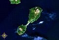
Shiashkotan
- Area
- 117 km²
- High point
- 925 m
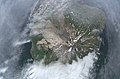
Kharimkotan
- Area
- 76.5 km²
- High point
- 1,145 m

Ketoy
- Area
- 71.5 km²
- High point
- 1,172 m

Rasshua
- Area
- 62.6 km²
- High point
- 956 m

Zelyony Island
- Area
- 58.1 km²
- High point
- 27 m
Matua
- Area
- 52 km²
- High point
- 1,446 m
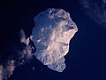
Makanrushi
- Area
- 50.1 km²
- High point
- 1,169 m

Ekarma
- Area
- 32.5 km²
- High point
- 1,170 m

Chirpoy
- Area
- 19.9 km²
- High point
- 691 m
Brat Chirpoev
- Area
- 12.9 km²
- High point
- 742 m

Tanfiliev Island
- Area
- 12.1 km²
- High point
- 23 m

Polonsky Island
- Area
- 10.8 km²
- High point
- 18 m
Yuri Island
- Area
- 9.7 km²
- High point
- 43 m

Antsiferov Island
- Area
- 9 km²
- High point
- 761 m

Broutona
- Area
- 8.4 km²
- High point
- 800 m

Chirinkotan
- Area
- 5.9 km²
- High point
- 742 m

Raikoke
- Area
- 4.7 km²
- High point
- 551 m

Yankicha
- Area
- 3.3 km²
- High point
- 401 m
Anuchina
- Area
- 2 km²
- High point
- 40 m
Ryponkicha
- Area
- 1.6 km²
- High point
- 131 m
Grieg Island
- Area
- 1.3 km²
- High point
- 62 m
Toporkovy
- Area
- 1.1 km²
- High point
- 67 m
Ayvazovskogo
- Area
- 0.77 km²
- High point
- 55 m
острова Дёмина
- Area
- 0.47 km²
- High point
- 38 m
Taira Islands
- Area
- 0.21 km²
- High point
- 23 m
Morskaya Vydra
- Area
- 0.14 km²
- High point
- 98 m
Bliznetsy
- Area
- 0.12 km²
- High point
- 107 m
Dal'niy
- Area
- 0.12 km²
- High point
- 54 m
Pon-harukaru-shima
- Area
- 0.12 km²
- High point
- 36 m
Unnamed island
- Area
- —
size unknown
Rocks & skerries
On the chart above, at its closest zooms.
Listing 39 of 918; the rest are on the chart.
Figures
Comparative heights
- Atlasov: 2,339 m
- Kunashir: 1,819 m
- Paramushir: 1,816 m
- Iturup: 1,634 m
- Simushir: 1,540 m
- Matua: 1,446 m
- Urup: 1,348 m
- Onekotan: 1,325 m
- Ketoy: 1,172 m
- Ekarma: 1,170 m
- Makanrushi: 1,169 m
- Kharimkotan: 1,145 m
- Rasshua: 956 m
- Shiashkotan: 925 m
To the same scale
Islands by area
| Iturup | 3,163 km² |
| Paramushir | 2,031 km² |
| Kunashir | 1,485 km² |
| Urup | 1,419 km² |
| Onekotan | 428 km² |
| Shumshu | 382 km² |
| Simushir | 336 km² |
| Shikotan | 246 km² |
| Atlasov Island | 153 km² |
| Shiashkotan | 117 km² |
| Kharimkotan | 76.5 km² |
| Ketoy | 71.5 km² |
| Rasshua | 62.6 km² |
| Zelyony Island | 58.1 km² |
| Matua | 52 km² |
| Makanrushi | 50.1 km² |
| Ekarma | 32.5 km² |
| Chirpoy | 19.9 km² |
| Brat Chirpoev | 12.9 km² |
| Tanfiliev Island | 12.1 km² |
| Polonsky Island | 10.8 km² |
| Yuri Island | 9.7 km² |
| Antsiferov Island | 9 km² |
| Broutona | 8.4 km² |
| Chirinkotan | 5.9 km² |
| Raikoke | 4.7 km² |
| Yankicha | 3.3 km² |
| Anuchina | 2 km² |
| Ryponkicha | 1.6 km² |
| Grieg Island | 1.3 km² |
| Toporkovy | 1.1 km² |
| Ayvazovskogo | 0.77 km² |
| острова Дёмина | 0.47 km² |
| Taira Islands | 0.21 km² |
| Morskaya Vydra | 0.14 km² |
| Bliznetsy | 0.12 km² |
| Dal'niy | 0.12 km² |
| Pon-harukaru-shima | 0.12 km² |
Groups within
Overlapping groups
Photographs

Остров Уруп: Курильский городской округ, Сахалинская область

知理保以島の火山活動

Kuril Islands

Onekotan Island (center) in the Kuril Islands, with Makanrushi Island at left and Kharimkotan Island at bottom. North at top.
NASA Space Shuttle image STS068-231-54, http://eol.jsc.nasa.gov/ / Public domain

Fumarole field of Baransky volcano on Iturup Island.

О территориальных уступках

О разделе Курильских островов

Ebeko volcano, Paramushir island

Iturup Island nature, fall 2019

View in Rausu Kunashiri Observatory Deck. It is Kunashir Island.

Kuril Islands

One of the Kuril Islands, Russia
Sources
Facts
Photographs
- Остров Уруп. Фото Алексей Романов / CC BY-SA 4.0
- 知理保以島. 敷香 / CC BY-SA 3.0
- Kuril Islands-81. acidka / CC BY 2.0
- OnekotanNASA. NASA Space Shuttle image STS068-231-54, http://eol.jsc.nasa.gov/ / Public domain
- Фумарольная активность. Ted.ns / CC BY 4.0
- Из Портсмутского мирного договора. Анастасия Иван / CC BY-SA 4.0
- Из симодского Трактата. Анастасия Иван / CC BY-SA 4.0
- Ebeko1. Eugene Kaspersky / CC BY-SA 4.0
- Iturup Canyon. Vera.vvo / CC BY-SA 4.0
- Rausu Kunashiri Observatory Deck 3. Tzu-hsun, Hsu / CC BY-SA 4.0
- Kuril Islands-10. acidka / CC BY 2.0
- Kuril Island. Anatoly Gruzevich, VNIRO Russia / Public domain