Southern Ocean
63°15′S 55°45′W
Joinville Island group
Joinville Island group is a group of antarctic islands, lying off the northeastern tip of the Antarctic Peninsula, from which Joinville Island group is separated by the Antarctic Sound.

Chart
Overview
Joinville Island group is a group of antarctic islands, lying off the northeastern tip of the Antarctic Peninsula, from which Joinville Island group is separated by the Antarctic Sound.
From Wikipedia, CC BY-SA 4.0
Census, cataloged
- Major islands3
- Minor islands9
- Islets5
- Rocks & skerries4
Major islands
Joinville Island
- Area
- 1,479 km²
- High point
- 835 m
Joinville Island (63°15′S 55°45′W) is the largest island of the Joinville Island group, about 40 nautical miles (74 km; 46 mi) long in an east–west direction and 12 nautical miles (22 km; 14 mi) wide, lying off the northeastern tip of the Antarctic Peninsula, from which it is separated by the Antarctic Sound.
Dundee Island
- Area
- 357 km²
- High point
- 621 m
Dundee Island (63°30′S 55°55′W) is an ice-covered island lying east of the northeastern tip of the Antarctic Peninsula and south of Joinville Island, Antarctica.

D'Urville Island
- Area
- 433 km²
- High point
- 394 m
D'Urville Island (63°05′S 56°20′W) is the northernmost island of the Joinville Island group in Antarctica.
Minor islands
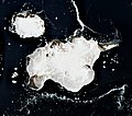
Andersson Island
- Area
- 55.1 km²
- High point
- 436 m

Bransfield Island
- Area
- 37.6 km²
- High point
- 194 m

Paulet Island
- Area
- 2.6 km²
- High point
- 350 m
Brash Island
- Area
- 0.63 km²
Patella Island
- Area
- 0.33 km²
- High point
- 104 m
Unnamed island
- Area
- 0.24 km²
Unnamed island
- Area
- 0.24 km²
Diana Reef
- Area
- —
size unknown
Papua Island
- Area
- —
size unknown
Islets
- Unnamed island0.03 km²
- Unnamed island0.03 km²
- Unnamed island0.02 km²
- Unnamed island0.02 km²
- Unnamed island0.01 km²
Rocks & skerries
- Gaviotín Rock—
- Harris Rock—
- Puget Rock—
- Southtrap Rock—
Figures
Comparative heights
To the same scale
Islands by area
| Joinville Island | 1,479 km² |
| D'Urville Island | 433 km² |
| Dundee Island | 357 km² |
| Andersson Island | 55.1 km² |
| Bransfield Island | 37.6 km² |
| Paulet Island | 2.6 km² |
| Brash Island | 0.63 km² |
| Patella Island | 0.33 km² |
| Unnamed island | 0.24 km² |
| Unnamed island | 0.24 km² |
| Unnamed island | 0.03 km² |
| Unnamed island | 0.03 km² |
| Unnamed island | 0.02 km² |
| Unnamed island | 0.02 km² |
| Unnamed island | 0.01 km² |
Photographs

The Madder Cliffs are the reddish rock cliffs which form the north side of the entrance to Suspiros Bay, at the west end of Joinville Island, Antarctica

Joinville Island is the largest island of the Joinville Island group, lying off the northeastern tip of the Antarctic Peninsula

en route to Paulet Island, a tiny blip just S of Dundee Island...
Sources
Facts
Photographs
- Madder Cliffs, Joinville Island. *christopher* / CC BY 2.0
- Joinville Island. Antarctica. Christopher Michel / CC BY 2.0
- En route to Paulet Island, a tiny blip just S of Dundee Island. (25370171313). Murray Foubister / CC BY-SA 2.0