Mediterranean SeaFrance
43°01′N 6°24′E
Îles d'Hyères
The Îles d'Hyères, also known as Îles d'Or ([il dɔʁ]), are a group of four Mediterranean islands off Hyères in the Var department of Southeastern France. Their old name is the Stoechades Islands from Greek: Στοιχάδες Stoikhádes from στοιχάς stoikhás meaning “in a row one behind another”.

Chart
Overview
The Îles d'Hyères, also known as Îles d'Or ([il dɔʁ]), are a group of four Mediterranean islands off Hyères in the Var department of Southeastern France. Their old name is the Stoechades Islands from Greek: Στοιχάδες Stoikhádes from στοιχάς stoikhás meaning “in a row one behind another”. A unique species of lavender named Lavandula stoechas was discovered here by Pedanius Dioscorides.
From Wikipedia, CC BY-SA 4.0
Census, cataloged
- Major islands3
- Minor islands2
- Islets15
- Rocks & skerries62
Major islands
Porquerolles
- Area
- 12.8 km²
- High point
- 128 m
Porquerolles (French pronunciation: [pɔʁkəʁɔl]; Occitan: Porcairòlas), also known as the Île de Porquerolles, is an island in the Îles d'Hyères, Var, Provence-Alpes-Côte d'Azur, France. Its land area is 1,254 hectares (12.54 km2; 4.84 sq mi) and in 2004, its population was about 200.
Levant Island
- Area
- 10 km²
- High point
- 138 m
Île du Levant, sometimes referred to as Le Levant, is a French island in the Mediterranean off the coast of the Riviera, near Toulon. It is one of the four that constitute the Îles d'Hyères. Part of the island is occupied by the naturist resort of Heliopolis and the rest is under military control.
Port-Cros
- Area
- 6.3 km²
- High point
- 199 m
Port-Cros (French pronunciation: [pɔʁ kʁo]) is a French island in the Mediterranean island group known as the Îles d'Hyères. It is part of the commune of Hyères, in the department of Var in the region of Provence-Alpes-Côte d'Azur.


Minor islands
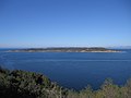
Île de Bagaud
- Area
- 0.59 km²
- High point
- 59 m

île du Grand Ribaud
- Area
- 0.16 km²
- High point
- 45 m
Islets
- Îlot de la Gabinière51 m · 0.04 km²
- Le Grand Sarranier15 m · 0.02 km²
- Île du Petit Langoustier9 m · 0.02 km²
- Île Longue8 m · 0.01 km²
- île du Petit Ribaud8 m · 0.9 ha
- Le Petit Sarranier5 m · 0.5 ha
- Île de la Ratonnière2 m · 0.5 ha
- île de la Redonne2 m · 0.4 ha
- Les Fourmigues1 m · 0.3 ha
- Îlot du Ribaudon0.2 ha
- Île Longue0.2 ha
- Unnamed island14 m · 0.2 ha
Rocks & skerries
- Rocher du Rascas9 m · 0.7 ha
- Rocher des Mèdes0.1 ha
- Unnamed island<0.1 ha
- Unnamed island<0.1 ha
- Unnamed island<0.1 ha
- Unnamed island<0.1 ha
- Unnamed island<0.1 ha
- Rocher de la Croix<0.1 ha
- Unnamed island<0.1 ha
- Îlot la Fourmigue<0.1 ha
- Rocher à la Voile<0.1 ha
- Unnamed island<0.1 ha
Figures
Comparative heights
- Port-Cros: 199 m
- Levant: 138 m
- Porquerolles: 128 m
- Île de Bagaud: 59 m
- Îlot de la Gabinière: 51 m
- île du Grand Ribaud: 45 m
- Le Grand Sarranier: 15 m
- Île du Petit Langoustier: 9 m
- Rocher du Rascas: 9 m
- Île Longue: 8 m
- île du Petit Ribaud: 8 m
- Le Petit Sarranier: 5 m
- Île de la Ratonnière: 2 m
- île de la Redonne: 2 m
To the same scale
Islands by area
| Porquerolles | 12.8 km² |
| Levant Island | 10 km² |
| Port-Cros | 6.3 km² |
| Île de Bagaud | 0.59 km² |
| île du Grand Ribaud | 0.16 km² |
| Îlot de la Gabinière | 0.04 km² |
| Le Grand Sarranier | 0.02 km² |
| Île du Petit Langoustier | 0.02 km² |
| Île Longue | 0.01 km² |
| île du Petit Ribaud | 0.9 ha |
| Rocher du Rascas | 0.7 ha |
| Le Petit Sarranier | 0.5 ha |
| Île de la Ratonnière | 0.5 ha |
| île de la Redonne | 0.4 ha |
| Les Fourmigues | 0.3 ha |
| Îlot du Ribaudon | 0.2 ha |
| Île Longue | 0.2 ha |
| Unnamed island | 0.2 ha |
| Unnamed island | 0.1 ha |
| Rocher des Mèdes | 0.1 ha |
| Îlot Jean de Maureigne | 0.1 ha |
| Unnamed island | 0.1 ha |
| Unnamed island | <0.1 ha |
| Unnamed island | <0.1 ha |
| Unnamed island | <0.1 ha |
| Unnamed island | <0.1 ha |
| Unnamed island | <0.1 ha |
| Rocher de la Croix | <0.1 ha |
| Unnamed island | <0.1 ha |
| Îlot la Fourmigue | <0.1 ha |
| Rocher à la Voile | <0.1 ha |
| Unnamed island | <0.1 ha |
| Unnamed island | <0.1 ha |
| Unnamed island | <0.1 ha |
| Unnamed island | <0.1 ha |
| Unnamed island | <0.1 ha |
| Unnamed island | <0.1 ha |
| Le Fourmigon | <0.1 ha |
| Unnamed island | <0.1 ha |
| Unnamed island | <0.1 ha |
| Unnamed island | <0.1 ha |
| Unnamed island | <0.1 ha |
| Unnamed island | <0.1 ha |
| Unnamed island | <0.1 ha |
| Unnamed island | <0.1 ha |
| Unnamed island | <0.1 ha |
| Unnamed island | <0.1 ha |
| Unnamed island | <0.1 ha |
| Unnamed island | <0.1 ha |
| Unnamed island | <0.1 ha |
| Unnamed island | <0.1 ha |
| Unnamed island | <0.1 ha |
| Unnamed island | <0.1 ha |
| Unnamed island | <0.1 ha |
| Unnamed island | <0.1 ha |
| Unnamed island | <0.1 ha |
| Unnamed island | <0.1 ha |
| Unnamed island | <0.1 ha |
| Unnamed island | <0.1 ha |
| Unnamed island | <0.1 ha |
| Unnamed island | <0.1 ha |
| Unnamed island | <0.1 ha |
| Unnamed island | <0.1 ha |
| Unnamed island | <0.1 ha |
| Unnamed island | <0.1 ha |
| Unnamed island | <0.1 ha |
| Unnamed island | <0.1 ha |
| Unnamed island | <0.1 ha |
| Unnamed island | <0.1 ha |
| Unnamed island | <0.1 ha |
| Unnamed island | <0.1 ha |
| Unnamed island | <0.1 ha |
| Unnamed island | <0.1 ha |
| Unnamed island | <0.1 ha |
| Unnamed island | <0.1 ha |
| Unnamed island | <0.1 ha |
| Unnamed island | <0.1 ha |
| Unnamed island | <0.1 ha |
| Unnamed island | <0.1 ha |
| Unnamed island | <0.1 ha |
| Unnamed island | <0.1 ha |
| Unnamed island | <0.1 ha |
Photographs

Porquerolles island (France)


Vue de la côte ouest de l'île du Levant (îles d'Hyères, Var, France).

Vue sur Cap Sicié, Giens, Porquerolles, île du Levant en fond, depuis Notre-Dame du Mai, Six-Fours-les-Plages, Var.

Lever de soleil sur le golfe de Giens depuis la chapelle Notre-Dame-du-Mai, La Seyne-sur-Mer, Var, France

Port Man bay on Port-Cros Island, Îles d’Hyères, France

Lever de soleil sur le golfe de Giens depuis la chapelle Notre-Dame-du-Mai, La Seyne-sur-Mer, Var, France

Île du Petit Ribaud, Île du Ribaudon, Hyères, Provence-Alpes-Côte d'Azur, France

Île du Ribaudon ; Île du Petit Ribaud ; Hyères, Provence-Alpes-Côte d'Azur, France.

Lever de soleil sur les îles d'Hyères depuis la chapelle Notre-Dame-du-Mai, La Seyne-sur-Mer, Var, France

Lever de soleil sur les îles d'Hyères depuis la chapelle Notre-Dame-du-Mai, La Seyne-sur-Mer, Var, France

Rade de Giens; Hyères, Provence-Alpes-Côte d'Azur, France
Sources
Facts
Photographs
- Porquerolles 1. Roloff / CC BY-SA 3.0
- Porquerolles, Îles d'Hyères. Jjpetite / CC BY-SA 4.0
- Ile du Levant (83) - Côte ouest. Patrub01 / CC BY-SA 3.0
- Cap Sicié, Giens, Porquerolles, Levant en fond, depuis Notre-Dame du Mai, Six-Fours-les-Plages, Var. Gnrc / CC BY-SA 4.0
- Golfe de Giens sunrise @ Chapelle Notre-Dame-du-Mai 01. Rémih / CC BY-SA 4.0
- Port Cros 2013 01. VT98Fan / CC BY-SA 3.0
- Golfe de Giens sunrise @ Chapelle Notre-Dame-du-Mai 02. Rémih / CC BY-SA 4.0
- Île du Petit Ribaud, Île du Ribaudon, Hyères, Provence-Alpes-Côte d'Azur, France - panoramio. M.Strīķis / CC BY-SA 3.0
- Île du Ribaudon, Île du Petit Ribaud, Hyères, Provence-Alpes-Côte d'Azur, France - panoramio. M.Strīķis / CC BY-SA 3.0
- Îles d'Hyères sunrise @ Chapelle Notre-Dame-du-Mai 01. Rémih / CC BY-SA 4.0
- Îles d'Hyères sunrise @ Chapelle Notre-Dame-du-Mai 02. Rémih / CC BY-SA 4.0
- Rade de Giens, Hyères, Provence-Alpes-Côte d'Azur, France - panoramio (3). M.Strīķis / CC BY-SA 3.0