Indian OceanAustralia
28°43′S 113°47′E
Houtman Abrolhos
The Houtman Abrolhos (often called the Abrolhos Islands) is a chain of 122 islands and associated coral reefs in the Indian Ocean off the west coast of Australia about 80 kilometres (50 mi) west of Geraldton.

Chart
Overview
The Houtman Abrolhos (often called the Abrolhos Islands) is a chain of 122 islands and associated coral reefs in the Indian Ocean off the west coast of Australia about 80 kilometres (50 mi) west of Geraldton. It is the southernmost true coral reef in the Indian Ocean, and one of the highest latitude reef systems in the world. It is one of the world's most important seabird breeding sites, and the centre of Western Australia's largest single-species fishery, the western rock lobster fishery. It has a small seasonal population of fishermen, and a limited number of tourists are permitted for day trips, but most of the land area is off-limits as a conservation habitat. It is the site of numerous shipwrecks, the most famous being two Dutch ships: Batavia, which was wrecked in 1629 (followed by massacre of over 100 survivors by mutineers), and Zeewijk, wrecked in 1727. The islands are an unincorporated area with no municipal government, subject to direct administration of the Government of Western Australia. In July 2019, the Houtman Abrolhos was declared a national park by the state government.
From Wikipedia, CC BY-SA 4.0
Census, cataloged
- Major islands3
- Minor islands12
- Islets38
- Rocks & skerries22
Major islands
West Wallabi Island
- Area
- 6.1 km²
- High point
- 14 m
West Wallabi Island is an island in the Wallabi Group of the Houtman Abrolhos, in the Indian Ocean off the west coast of mainland Australia.
East Wallabi Island
- Area
- 3.3 km²
- High point
- 15 m
East Wallabi Island is an island in the Wallabi Group of the Houtman Abrolhos in the Indian Ocean off the west coast of mainland Australia.
North Island
- Area
- 1.9 km²
- High point
- 11 m
North Island is the northernmost island in the Houtman Abrolhos, a coral reef archipelago in the Indian Ocean off the coast of Mid West Western Australia. Located about 14 km (9 mi) from the nearest island group, it is one of the largest islands in the Houtman Abrolhos, and one of the few to support dune systems.

Minor islands

Rat Island
- Area
- 0.65 km²
- High point
- 6 m
Middle Island
- Area
- 0.21 km²
- High point
- 3 m
Wooded Island
- Area
- 0.2 km²
- High point
- 4 m
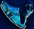
Gun Island
- Area
- 0.19 km²
- High point
- 3 m
Suomi Island
- Area
- 0.19 km²
- High point
- 4 m
Unnamed island
- Area
- 0.13 km²
- High point
- 5 m

Alexander Island
- Area
- 0.12 km²
- High point
- 5 m
Long Island
- Area
- 0.11 km²
- High point
- 5 m
Crake Island
- Area
- 0.11 km²
- High point
- 4 m
Morley Island
- Area
- —
- High point
- 4 m
size unknown
Pelsaert Island
- Area
- —
- High point
- 2 m
size unknown
Traitors Island
- Area
- —
size unknown
Islets
- Campbell Island3 m · 0.09 km²
- Unnamed island4 m · 0.08 km²
- Unnamed island7 m · 0.08 km²
- Unnamed island6 m · 0.05 km²
- Pigeon Island7 m · 0.04 km²
- Keru Island3 m · 0.04 km²
- Beacon Island4 m · 0.03 km²
- Unnamed island3 m · 0.02 km²
- Unnamed island2 m · 0.02 km²
- 1 Island1 m · 0.02 km²
- Alcatraz Island7 m · 0.02 km²
- Unnamed island1 m · 0.02 km²
Rocks & skerries
- Unnamed island<0.1 ha
- Unnamed island<0.1 ha
- Unnamed island<0.1 ha
- Unnamed island<0.1 ha
- Unnamed island<0.1 ha
- Unnamed island<0.1 ha
- Unnamed island<0.1 ha
- Unnamed island<0.1 ha
- Unnamed island<0.1 ha
- Unnamed island<0.1 ha
- Unnamed island<0.1 ha
- Unnamed island<0.1 ha
Figures
Comparative heights
To the same scale
Islands by area
| West Wallabi Island | 6.1 km² |
| East Wallabi Island | 3.3 km² |
| North Island | 1.9 km² |
| Rat Island | 0.65 km² |
| Middle Island | 0.21 km² |
| Wooded Island | 0.2 km² |
| Gun Island | 0.19 km² |
| Suomi Island | 0.19 km² |
| Unnamed island | 0.13 km² |
| Alexander Island | 0.12 km² |
| Long Island | 0.11 km² |
| Crake Island | 0.11 km² |
| Campbell Island | 0.09 km² |
| Unnamed island | 0.08 km² |
| Unnamed island | 0.08 km² |
| Unnamed island | 0.05 km² |
| Pigeon Island | 0.04 km² |
| Keru Island | 0.04 km² |
| Beacon Island | 0.03 km² |
| Unnamed island | 0.02 km² |
| Unnamed island | 0.02 km² |
| 1 Island | 0.02 km² |
| Alcatraz Island | 0.02 km² |
| Unnamed island | 0.02 km² |
| Dry Island | 0.01 km² |
| Unnamed island | 0.01 km² |
| Unnamed island | 0.01 km² |
| Unnamed island | 0.9 ha |
| Unnamed island | 0.7 ha |
| Unnamed island | 0.7 ha |
| Unnamed island | 0.7 ha |
| Unnamed island | 0.5 ha |
| Unnamed island | 0.5 ha |
| Unnamed island | 0.5 ha |
| 7 Island | 0.4 ha |
| Unnamed island | 0.3 ha |
| Unnamed island | 0.3 ha |
| Unnamed island | 0.3 ha |
| Unnamed island | 0.3 ha |
| Unnamed island | 0.3 ha |
| Unnamed island | 0.3 ha |
| Unnamed island | 0.2 ha |
| Unnamed island | 0.2 ha |
| Unnamed island | 0.2 ha |
| Unnamed island | 0.2 ha |
| Unnamed island | 0.1 ha |
| Unnamed island | 0.1 ha |
| Unnamed island | 0.1 ha |
| Unnamed island | 0.1 ha |
| Unnamed island | 0.1 ha |
| Unnamed island | <0.1 ha |
| Unnamed island | <0.1 ha |
| Unnamed island | <0.1 ha |
| Unnamed island | <0.1 ha |
| Unnamed island | <0.1 ha |
| Unnamed island | <0.1 ha |
| Unnamed island | <0.1 ha |
| Unnamed island | <0.1 ha |
| Unnamed island | <0.1 ha |
| Unnamed island | <0.1 ha |
| Unnamed island | <0.1 ha |
| Unnamed island | <0.1 ha |
| Unnamed island | <0.1 ha |
| Unnamed island | <0.1 ha |
| Unnamed island | <0.1 ha |
| Unnamed island | <0.1 ha |
| Unnamed island | <0.1 ha |
| Unnamed island | <0.1 ha |
| Unnamed island | <0.1 ha |
| Unnamed island | <0.1 ha |
| Unnamed island | <0.1 ha |
Groups within
Photographs

This is a photograph of a beach informally known as "Cave Beach", located on one of the Wallabi Islands in the Wallabi Group of the Houtman Abrolhos.

Beacon Island in the Wallabi Group, Abrolhos Islands, Western Australia, site of the Batavia mutiny


This is an aerial photograph of Rat Island in the Easter Group of the Houtman Abrolhos. The photograph was taken looking south-east from the north-west corner of the island.

This is an aerial photograph of Rat Island in the Easter Group of the Houtman Abrolhos. The photograph was taken looking south-east from the north-west corner of the island.

This is an aerial photograph of Beacon Island in the Wallabi Group of the Houtman Abrolhos.

Zuchinni or corgette fruit and spent flower on plant

View of Western Australia taken during ISS Expedition 2.
Earth Science and Remote Sensing Unit, Lyndon B. Johnson Space Center / Public domain

Australian craypots. Making & using. Corfes

Australian craypots. Making & using. Corfes

Wiebbe Hayes Fort, West Wallabi Island, WA. Oldest European built structure in Australia.
Sources
Facts
Photographs
- Beacon Island Abrolhos. Guy de la Bedoyere / CC BY-SA 4.0
- Houman Abrolhos bay. Ernie Dingo / CC BY-SA 2.0
- Sea View and Firebeacon - West Wallabi Island. Rupert Gerritsen / CC BY-SA 3.0
- Houtman Abrolhos coral (Saville-Kent). William Saville-Kent (1845-1908) / Public domain
- Rat Island (Houtman Abrolhos) photo 1. Ernie Dingo / CC BY-SA 2.0
- Rat Island (Houtman Abrolhos) photo 2. Ernie Dingo / CC BY-SA 2.0
- Unidentified island 2 (Houtman Abrolhos). Ernie Dingo / CC BY-SA 2.0
- Zuchinni 1107. Pollinator at English Wikipedia / CC BY 2.5
- ISS002-E-6811 - View of Western Australia. Earth Science and Remote Sensing Unit, Lyndon B. Johnson Space Center / Public domain
- Crayfisherman's shack with big kerosene fridge & little else. North Island Abrolhos W.A. north of Geraldton. Coral Island. (26539019529). Dr Mary Gillham Archive Project / CC BY 2.0
- North Island Abrolhos Group Table where abbatoir offal is cut up for crayfish bait. Gets stolen by sea eagles. W.A 1959 (24442344748). Dr Mary Gillham Archive Project / CC BY 2.0
- Wiebbe Hayes Fort, West Wallabi Island, WA. Vunz / CC BY-SA 4.0