St. Lawrence RiverCanada
45°33′N 73°39′W
Hochelaga Archipelago
Archipel d'Hochelaga
The Hochelaga Archipelago (French: Archipel d'Hochelaga), also known as the Montreal Islands, is a group of approximately 320 islands at the confluence of the Saint Lawrence and Ottawa rivers in the southwestern part of the province of Quebec, Canada.

Denis Tremblay - Parcours riverain - Ville de Montréal / CC BY 2.0
Chart
Overview
The Hochelaga Archipelago (French: Archipel d'Hochelaga), also known as the Montreal Islands, is a group of approximately 320 islands at the confluence of the Saint Lawrence and Ottawa rivers in the southwestern part of the province of Quebec, Canada.
From Wikipedia, CC BY-SA 4.0
Census, cataloged
- Major islands2
- Minor islands53
- Islets39
- Rocks & skerries5
Major islands
Island of Montreal
- Area
- 470 km²
- High point
- 233 m
The Island of Montreal (French: Île de Montréal, [il d(ə) mɔ̃ʁeal]) is an island in southwestern Quebec, Canada, which is the site of a number of municipalities, including most of the city of Montreal, and is the most populous island in Canada as well as the world's most populous freshwater island.
Île Jésus
- Area
- 243 km²
- High point
- 82 m
Île Jésus (French: [il ʒezy], Jesus Island) is a river island in southwestern Quebec, separated from the mainland to the north by the Rivière des Mille Îles, and from the Island of Montreal to the south by the Rivière des Prairies.

Minor islands

Île Perrot
- Area
- 40.8 km²
- High point
- 82 m

Île Bizard
- Area
- 22.8 km²
- High point
- 62 m

Sainte-Thérèse Island
- Area
- 5.9 km²
- High point
- 31 m
Grande-Île
- Area
- 5.7 km²

Île des Soeurs
- Area
- 3.8 km²
- High point
- 40 m
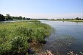
Île Grosbois
- Area
- 2.5 km²
- High point
- 36 m

Île de la Commune
- Area
- 1.7 km²
- High point
- 20 m

Île Sainte-Marguerite
- Area
- 1.6 km²
- High point
- 35 m

Notre Dame Island
- Area
- 1.3 km²
- High point
- 29 m
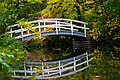
Saint Helen's Island
- Area
- 1.3 km²
- High point
- 41 m
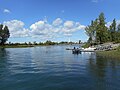
Charron Island
- Area
- 0.9 km²
- High point
- 33 m

Grandes battures Tailhandier
- Area
- 0.82 km²
- High point
- 28 m

Île à Pinard
- Area
- 0.73 km²
- High point
- 25 m
Île Saint-Jean
- Area
- 0.63 km²
- High point
- 30 m

Bourdon Island
- Area
- 0.58 km²
- High point
- 17 m
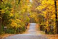
Île Cadieux
- Area
- 0.57 km²
- High point
- 51 m

Dowker Island
- Area
- 0.55 km²
- High point
- 48 m

Grande Île island
- Area
- 0.51 km²
- High point
- 16 m
Île à l'Aigle
- Area
- 0.49 km²
- High point
- 15 m

Île aux Hérons
- Area
- 0.48 km²
- High point
- 21 m
Île Dufault
- Area
- 0.4 km²
- High point
- 30 m

Île Bigras
- Area
- 0.37 km²
- High point
- 47 m
Aux Fermiers island
- Area
- 0.32 km²
- High point
- 15 m
Île Avelle
- Area
- 0.22 km²
- High point
- 49 m
Îlot de la Baronnie
- Area
- 0.21 km²
- High point
- 17 m
Île aux Asperges
- Area
- 0.2 km²
- High point
- 15 m

Île Paton
- Area
- 0.2 km²
- High point
- 41 m

Île aux Raisins
- Area
- 0.2 km²
- High point
- 25 m
Île Morris
- Area
- 0.2 km²
- High point
- 44 m

Dorval Island
- Area
- 0.18 km²
- High point
- 45 m
Île de Mai
- Area
- 0.18 km²
- High point
- 40 m
Île Lafontaine
- Area
- 0.17 km²
- High point
- 8 m
Île aux Canards
- Area
- 0.16 km²
- High point
- 12 m
Île Saint-Jean
- Area
- 0.15 km²
- High point
- 27 m

Île de la Visitation
- Area
- 0.14 km²
- High point
- 32 m
Île Tourte Blanche
- Area
- 0.14 km²
- High point
- 23 m

Île Bonfoin
- Area
- 0.13 km²
- High point
- 17 m
Île Pariseau
- Area
- 0.11 km²
- High point
- 34 m
St Patrice island
- Area
- 0.11 km²
- High point
- 10 m
Île à Tambault
- Area
- —
size unknown
Île à Thomas
- Area
- —
size unknown
Île au Beurre
- Area
- —
size unknown
Île au Diable
- Area
- —
size unknown
Île aux Cabanes
- Area
- —
size unknown
Île aux Plaines
- Area
- —
size unknown
Île Bradford
- Area
- —
size unknown
Île Brodeur
- Area
- —
size unknown
Île Cardinal
- Area
- —
size unknown
Île des Cruisers
- Area
- —
size unknown
Île des Faubert
- Area
- —
size unknown
Île du Docteur
- Area
- —
size unknown
Île Ronde
- Area
- —
size unknown
Île Saint-Pierre
- Area
- —
size unknown
Islets
- Île Ducharme34 m · 0.09 km²
- Île de Varennes0.08 km²
- Masta island9 m · 0.08 km²
- Île Lapierre27 m · 0.08 km²
- Île Verte39 m · 0.07 km²
- Île au Veau20 m · 0.04 km²
- Île Montbrun8 m · 0.04 km²
- Île aux Moutons16 m · 0.04 km²
- Île Verte36 m · 0.03 km²
- Île aux Fraises43 m · 0.03 km²
- Île Saint-Jean9 m · 0.03 km²
- Île De Grandmont35 m · 0.03 km²
Rocks & skerries
- Unnamed island<0.1 ha
- Île au Boeuf<0.1 ha
- Île Drouin<0.1 ha
- Unnamed island<0.1 ha
- Unnamed island<0.1 ha
Figures
Comparative heights
- Island of Montreal: 233 m
- Île Jésus: 82 m
- Île Perrot: 82 m
- Île Bizard: 62 m
- Île Cadieux: 51 m
- Île Avelle: 49 m
- Dowker: 48 m
- Île Bigras: 47 m
- Dorval: 45 m
- Île aux Moutons: 45 m
- Île Morris: 44 m
- Île aux Fraises: 43 m
- Saint Helen's: 41 m
- Île Paton: 41 m
To the same scale
Islands by area
Groups within
Overlapping groups
Photographs

Vue sur l'île Bouchard ou île Bushy (rattachée à la municipalité de Dorval) dans l'archipel d'Hochelaga
Denis Tremblay - Parcours riverain - Ville de Montréal / CC BY 2.0

Aerial view of (from left to right) Canal de Beauharnois, Grande-Île, Saint Lawrence River, Pointe-des-Cascades, Ottawa River, Perrot Island, on takeoff from Montreal

Vue sur l’île Roussin depuis l'île Bizard Photo : Denis Tremblay

Vue sur l'île Ménard depuis le parc Ménard à Pierrefonds Photo : Anne-Marie Dufour

Photo : Denis Tremblay
Parcours riverain - Ville de Montréal from Canada / CC BY 2.0

Vue sur l'île Bushy depuis le parc du Millénaire (Dorval, Montréal)

vue aérienne des rapides de Lachine sur le fleuve Saint-Laurent


Église Saint-Elzéar, Laval (vue est)

Montreal, Canada, as taken from the International Space Station Mission ISS014

La région montréalaise vue de l'espace

île du Montréal
Sources
Facts
Photographs
- Vue sur l'île Bouchard ou Bushy (Dorval). Denis Tremblay - Parcours riverain - Ville de Montréal / CC BY 2.0
- Canal de Beauharnois, Grande Ile, Saint Lawrence River, Pointe-des-Cascades, Ottawa River, Perrot Island. Dicklyon / CC BY-SA 4.0
- Île Roussin. Parcours riverain - Ville de Montréal / CC BY 2.0
- Vue sur l'île Ménard. Parcours riverain - Ville de Montréal / CC BY 2.0
- Parc du Bout-de-l'Île (Pointe-aux-Trembles) (8498186046). Parcours riverain - Ville de Montréal from Canada / CC BY 2.0
- Vue sur l'île Bushy, parc du Millénaire (Dorval). Parcours riverain - Ville de Montréal / CC BY 2.0
- Vue aerienne des rapides du saint laurent. Abxbay / Public domain
- Entering Ile de Montreal, Montreal, Quebec (29773237760). Ken Lund from Reno, Nevada, USA / CC BY-SA 2.0
- Église Saint-Elzéar, Laval (vue est) (5891766742). Emmanuel Huybrechts from Laval, Canada / CC BY 2.0
- Montreal Canada from ISS014. NASA / Public domain
- MontrealNasa. NASA / Public domain
- Montréal Satellite mask. NASA WorldWind / Public domain