Japan
26°40′N 142°09′E
Hahajima Islands
Part of Bonin Islands

Chart
Major islands
Hahajima
- Area
- 20.2 km²
- High point
- 462 m
Hahajima, Haha Jima, or Haha-jima (母島; meaning Mother Island) is the second-largest island within the Bonin or Ogasawara Islands south southeast of the Japanese Home Islands. The steeply-sloped island, which is about 21 km2 (8 sq mi) in area, has a population of 440.
Anejima
- Area
- 1.4 km²
- High point
- 113 m
Minor islands



Rocks & skerries
On the chart above, at its closest zooms.
Listing 6 of 380; the rest are on the chart.
Figures
Overlapping groups
Photographs

剣先山(東京都小笠原村 母島)より沖港を望む, Oki on Hahajima Island

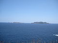
Katsuodorijima and Tairajima,Anejima in japan Bonin Island

妹島(小笠原村)

Meijima(Left) and Imotojima(Right) in Japan Bonin Islands

Imoutojima Island Aerial photograph.1978

Mei-Jima Island Aerial photograph.2013

Hirajima Island and peripheral reefs Aerial photograph.2013

Mukohjima Island and peripheral reefs Aerial photograph.2013

Anejima Island Aerial photograph.1978

Satellite photo of the Ogasawara Islands: Chichijima (north) and Hahajima (south). It is color adjusted, because the source photo is thermal infrared.
NASA/GSFC/METI/ERSDAC/JAROS, and U.S./Japan ASTER Science Team / Public domain
Sources
Facts
- Geometry, areas and high points: OpenStreetMap contributors (ODbL), Copernicus GLO-30, via Talus.
- Wikidata
Photographs
- Hahajima-oki. しんかわな / CC BY-SA 3.0
- Katsuodorijima and tairajima,Anejima. タクナワン / CC0
- Imouto island. ブルーノ・プラス / CC BY-SA 4.0
- Meijima and Imotojima. タクナワン / CC0
- Imoutojima Island Aerial photograph.1978. 国土交通省 / Attribution
- Mei-Jima Island Aerial photograph.2013. 国土地理院 / Attribution
- Hirajima Island and peripheral reefs Aerial photograph.2013. 国土地理院 / Attribution
- Mukohjima Island and peripheral reefs Aerial photograph.2013. 国土地理院 / Attribution
- Anejima Island Aerial photograph.1978. 国土交通省 / Attribution
- Ogasawara-Islands-Chichijima-Hahajima. NASA/GSFC/METI/ERSDAC/JAROS, and U.S./Japan ASTER Science Team / Public domain