Pacific OceanTonga
19°47′S 174°27′W
Haʻapai
Haʻapai is a group of islands, islets, reefs, and shoals in the central part of Tonga. 20 sq mi). The Tongatapu island group lies to its south, and the Vavaʻu group lies to its north. Seventeen of the Haʻapai islands are inhabited. Their combined population is 5,419.

Chart
Overview
Haʻapai is a group of islands, islets, reefs, and shoals in the central part of Tonga. It has a combined land area of 109.30 square kilometres (42.20 sq mi). The Tongatapu island group lies to its south, and the Vavaʻu group lies to its north. Seventeen of the Haʻapai islands are inhabited. Their combined population is 5,419. The highest point in the Ha‘apai group, and in all of Tonga, is on Kao, which rises almost 1,050 metres (3,440 ft) above sea level. The administrative capital village of Haʻapai District is Pangai, which is located on Lifuka.
From Wikipedia, CC BY-SA 4.0
Census, cataloged
- Major islands7
- Minor islands30
- Islets32
- Rocks & skerries7
Major islands
Tofua
- Area
- 54.1 km²
- High point
- 370 m
Tofua is a volcanic island in Tonga. Located in the Haʻapai island group, it is a steep-sided composite cone with a summit caldera.
Kao
- Area
- 11.5 km²
- High point
- 1,033 m
Kao is an island and stratovolcano in the Haʻapai island group of Tonga. It lies about 6 km (3.7 mi) north of Tofua island and reaches 1,030 m (3,379 ft) above sea level, the highest point in Tonga.
Lifuka
- Area
- 11.4 km²
- High point
- 22 m
Lifuka Island is an island in Tonga. It sits approximately 170 kilometres north-east of the capital, Nukuʻalofa, and covers an area of 12.2 square kilometres.


Foa
- Area
- 13.6 km²
- High point
- 27 m
Foa is an island in Tonga. It is located within the Haʻapai group in the centre of the country, to northeast of the national capital of Nukuʻalofa.
Vahe Mu'omu'a
- Area
- 7.5 km²
- High point
- 45 m
Nomuka
- Area
- 7.1 km²
Nomuka is a small island in the southern part of the Haʻapai group of islands in Tonga. It is part of the Nomuka Group of islands, also called the ʻOtu Muʻomuʻa. Among neighboring islands are Kelefesia, Nukutula, Tonumea, Fonoifua, Telekitonga.
Haʻano
- Area
- 6.7 km²
- High point
- 23 m
Haʻano is an island in the Haʻapai islands of Tonga. To the south are the islands of Foa and Lifuka.
Minor islands
ʻUiha
- Area
- 5.5 km²
- High point
- 17 m

Uoleva
- Area
- 3 km²
- High point
- 18 m
Haʻafeva
- Area
- 2 km²
- High point
- 22 m
Tungua
- Area
- 1.6 km²
- High point
- 24 m
Lofanga
- Area
- 1.4 km²
- High point
- 28 m
Moʻungaʻone
- Area
- 1.3 km²
- High point
- 26 m
Fotuhaʻa
- Area
- 1 km²
- High point
- 50 m
ʻOʻua
- Area
- 0.95 km²
- High point
- 34 m
Ofolanga
- Area
- 0.85 km²
- High point
- 16 m

Mango
- Area
- 0.78 km²
- High point
- 36 m
Nomuka iki
- Area
- 0.73 km²
- High point
- 27 m
Telekitonga
- Area
- 0.55 km²
- High point
- 15 m
Niniva
- Area
- 0.45 km²
- High point
- 15 m

Uonukuhahake
- Area
- 0.43 km²
- High point
- 13 m
Kotu Island
- Area
- 0.42 km²
- High point
- 22 m
Nukunamo
- Area
- 0.34 km²
- High point
- 15 m
Matuku
- Area
- 0.33 km²
- High point
- 18 m
Tatafa
- Area
- 0.3 km²
- High point
- 11 m
Lalona
- Area
- 0.27 km²
- High point
- 13 m
Tonumea
- Area
- 0.25 km²
- High point
- 35 m
Telekivavau
- Area
- 0.21 km²
- High point
- 14 m
Hunga Haʻapai
- Area
- 0.2 km²
- High point
- 118 m
Fetoa
- Area
- 0.2 km²
- High point
- 28 m
Kelefesia
- Area
- 0.19 km²
- High point
- 29 m
Teaupa
- Area
- 0.18 km²
- High point
- 25 m
Lekeleka
- Area
- 0.14 km²
- High point
- 16 m

Uonukuhihifo
- Area
- 0.1 km²
- High point
- 11 m
Fonoifua
- Area
- —
size unknown
Nuku
- Area
- —
size unknown
Telekivavaʻu
- Area
- —
size unknown
Islets
Rocks & skerries
- Unnamed island<0.1 ha
- Unnamed island<0.1 ha
- Unnamed island<0.1 ha
- Unnamed island<0.1 ha
- Unnamed island<0.1 ha
- Unnamed island<0.1 ha
- Unnamed island<0.1 ha
Figures
Comparative heights
- Kao: 1,033 m
- Tofua: 370 m
- Hunga Haʻapai: 118 m
- Hunga Tonga–Hunga Haʻapai: 86 m
- Fotuhaʻa: 50 m
- Vahe Mu'omu'a: 45 m
- Mango: 36 m
- Tonumea: 35 m
- ʻOʻua: 34 m
- Kelefesia: 29 m
- Lofanga: 28 m
- Fetoa: 28 m
- Foa: 27 m
- Nomuka iki: 27 m
To the same scale
Islands by area
| Tofua | 54.1 km² |
| Foa | 13.6 km² |
| Kao | 11.5 km² |
| Lifuka | 11.4 km² |
| Vahe Mu'omu'a | 7.5 km² |
| Nomuka | 7.1 km² |
| Haʻano | 6.7 km² |
| ʻUiha | 5.5 km² |
| Uoleva | 3 km² |
| Haʻafeva | 2 km² |
| Tungua | 1.6 km² |
| Lofanga | 1.4 km² |
| Moʻungaʻone | 1.3 km² |
| Fotuhaʻa | 1 km² |
| ʻOʻua | 0.95 km² |
| Ofolanga | 0.85 km² |
| Mango | 0.78 km² |
| Nomuka iki | 0.73 km² |
| Telekitonga | 0.55 km² |
| Niniva | 0.45 km² |
| Uonukuhahake | 0.43 km² |
| Kotu Island | 0.42 km² |
| Nukunamo | 0.34 km² |
| Matuku | 0.33 km² |
| Tatafa | 0.3 km² |
| Lalona | 0.27 km² |
| Tonumea | 0.25 km² |
| Telekivavau | 0.21 km² |
| Hunga Haʻapai | 0.2 km² |
| Fetoa | 0.2 km² |
| Kelefesia | 0.19 km² |
| Teaupa | 0.18 km² |
| Lekeleka | 0.14 km² |
| Uonukuhihifo | 0.1 km² |
| Luangahu | 0.06 km² |
| Luanamo | 0.06 km² |
| Fetokopunga | 0.06 km² |
| Tofanga | 0.06 km² |
| Fonuaika | 0.05 km² |
| Limu | 0.05 km² |
| Nukulei | 0.04 km² |
| Fakahiku | 0.04 km² |
| Hakauata | 0.04 km² |
| Mango Iki | 0.04 km² |
| Nukupule | 0.04 km² |
| Nukufaiau | 0.04 km² |
| Luahoko | 0.04 km² |
| Kito | 0.03 km² |
| Meama | 0.03 km² |
| Unnamed island | 0.03 km² |
| Unnamed island | 0.02 km² |
| Nukutula | 0.02 km² |
| Putuputua | 0.02 km² |
| Tokulu | 0.02 km² |
| Hunga Tonga–Hunga Haʻapai | 0.02 km² |
| Tanoa | 0.02 km² |
| Meama | 0.01 km² |
| Foua | 1 ha |
| Unnamed island | 0.9 ha |
| Fatumanongi | 0.8 ha |
| Pepea | 0.8 ha |
| Unnamed island | 0.7 ha |
| Unnamed island | 0.6 ha |
| Muifuiva | 0.6 ha |
| Unnamed island | 0.3 ha |
| Unnamed island | 0.1 ha |
| Unnamed island | <0.1 ha |
| Unnamed island | <0.1 ha |
| Unnamed island | <0.1 ha |
| Unnamed island | <0.1 ha |
| Unnamed island | <0.1 ha |
| Unnamed island | <0.1 ha |
| Unnamed island | <0.1 ha |
Groups within
Photographs

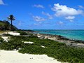
Ha'apai Islands near Tonga, South Pacific

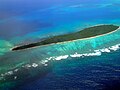
Mango island, Ha'apai, Tonga. The small islet at the top is Mango Iki

Mango island, Ha'apai group, Tonga

Nuku island in the ʻOtu Muʻomuʻa group of Ha'apai, in Tonga. The other island in the top right corner is Tonumeia.

Two very small islets on the barrier reef, south of the islets of Uonukuhihifo and Tofanga, Ha'apai group, in Tonga.

Faleloa, Foa Island, Haʻapai Islands, Tonga


Nuku island in the ʻOtu Muʻomuʻa group of Ha'apai, in Tonga

Plate from Dalrymple's An Account of the Discoveries Made in the South Pacifick Ocean, Previous to 1764, showing Anamocka, called by the Dutch Rotterdam Island, now known as Nomuka, one of the Haʻapai Islands

A small pass in the barrier reef of Ha'apai (Tonga), south of the islets of Uonukuhihifo and Tofanga.

A small pass in the barrier reef of Ha'apai (Tonga), south of the islets of Uonukuhihifo and Tofanga.

Aerial view of the South of Mango island, Ha'apai group, Tonga
Sources
Facts
Photographs
- Ha'apai Islands near Tonga, South Pacific - panoramio (2). David Broad / CC BY 3.0
- Mango island, Tonga. dr.scott.mills / CC BY-SA 2.0
- Mango island, Tonga 2. dr.scott.mills / CC BY-SA 2.0
- Nuku island (Tonga) 1. dr.scott.mills / CC BY-SA 2.0
- Ha'hapai barrier reef. dr.scott.mills / CC BY-SA 2.0
- Faleloa foa haapai tonga 3. Arne Müseler / CC BY-SA 3.0 de
- Faleloa foa haapai tonga 1. Arne Müseler / CC BY-SA 3.0 de
- Nuku island (Tonga) 2. dr.scott.mills / CC BY-SA 2.0
- Plate from Dalrymple Account of Discoveries in the South Pacifick Nla.obj-18696055-125. Alexander Dalrymple, 1737-1808 / Public domain
- Small pass in the barrier reef of Ha'apai (Tonga) 2. dr.scott.mills / CC BY-SA 2.0
- Small pass in the barrier reef of Ha'apai (Tonga). dr.scott.mills / CC BY-SA 2.0
- South of Mango island, Tonga. dr.scott.mills / CC BY-SA 2.0