Seto Inland SeaJapan
34°17′N 133°05′E
Geiyo Islands
芸予諸島
The Geiyo Islands (芸予諸島, Geiyo Shotō) are a group of islands in the Seto Inland Sea, under the administration of Hiroshima Prefecture and Ehime Prefecture.

Chart
Overview
The Geiyo Islands (芸予諸島, Geiyo Shotō) are a group of islands in the Seto Inland Sea, under the administration of Hiroshima Prefecture and Ehime Prefecture. Some of the largest islands in the archipelago are connected by the Nishiseto Expressway bridge system connecting Honshu and Shikoku, as well as the Akinada Tobishima Kaido from Kure, Hiroshima. The Geiyo Archipelago is roughly defined as lying in the western part of Seto Inland Sea, from Hiuchi-nada to Aki-nada. A narrower definition of the archipelago only includes the islands between the former provinces of Iyo and Bizen. The islands in Hiroshima Bay, most notably Etajima and Kurahashi-jima, are therefore excluded from the latter definition.
From Wikipedia, CC BY-SA 4.0
Census, cataloged
- Major islands14
- Minor islands80
- Islets129
- Rocks & skerries265
Major islands
Kurahashi-jima
- Area
- 68.7 km²
- High point
- 491 m
Kurahashi-jima (倉橋島), also called Nagato-jima (長門島) in ancient texts, is an island in Hiroshima Bay located in southwestern Hiroshima Prefecture, Japan.
Ōmishima Island
- Area
- 64.5 km²
- High point
- 436 m
Ōmishima Island (大三島, Ōmishima) is the largest island in the Geiyo Islands chain, and the westernmost island on which Japan's Nishiseto Expressway, which links Honshu and Shikoku via a number of islands, runs. It is located in the Seto Inland Sea.
Nōmijima
- Area
- 61.3 km²
- High point
- 542 m
Ōshima
- Area
- 41.9 km²
- High point
- 307 m
Ōshima (大島) is an inhabited island in the Geiyo Islands in the Seto Inland Sea of Japan, lying between the larger islands of Honshū and Shikoku.
Ōsakikamijima Island
- Area
- 38.3 km²
- High point
- 453 m
Ōsakikamijima Island (大崎上島, Ōsakikamijima) is an island in the Inland Sea of Japan which is administratively part of the town of Ōsakikamijima, Hiroshima Prefecture. As of 2020, the population was about 7,158.
Innoshima
- Area
- 34.9 km²
- High point
- 390 m
Innoshima (因島) is an island in Onomichi, Hiroshima Prefecture, Japan. Originally, there was a city of the same name on this island, but it was merged into Onomichi in 2016.
Ikuchijima
- Area
- 31.2 km²
- High point
- 472 m
Ikuchijima (生口島) is one of the Geiyo Islands in the Seto Inland Sea, belonging to Hiroshima Prefecture in Japan. Ikuchijima is administered as part of Onomichi city. There are bridges connecting Ikuchijima to the mainland (Honshū) via Innoshima and to Shikoku via Ōmishima Island. 3 m (1,550 ft).
Itsukushima
- Area
- 30.3 km²
- High point
- 535 m
Itsukushima (厳島) is an island in the western part of the Inland Sea of Japan, located in the northwest of Hiroshima Bay. It is popularly known as Miyajima (宮島), which in Japanese means "Shrine Island". The island is one of Hayashi Gahō's Three Views of Japan specified in 1643.
Etajima
- Area
- 30.1 km²
- High point
- 400 m
mä́, -dä́-]), also called Nōmi-jima, Nomijima, Nomi Island, or Etajima-Nōmijima (江田島・能美島) is an island in Hiroshima Bay located in southwestern Hiroshima Prefecture, Japan. The island name originates from the ancient (and possibly legendary) strait at now town Ōgaki-chō Hitonose (大柿町飛渡瀬).
Mukaishima
- Area
- 22.2 km²
- High point
- 283 m
Mukaishima (向島, Mukaishima) is the northernmost island in the Geiyo Islands chain accommodating Nishiseto Expressway connecting Honshu and Shikoku islands. Its coasts are washed by Seto Inland Sea. The island's highest peak is Takamiyama (高見山) 283.2 m (929 ft) high.
Hakatajima
- Area
- 20.4 km²
- High point
- 301 m
Hakata Island (伯方島, Hakatajima) is an island in the Inland Sea of Japan. Administratively, it is part of the city of Imabari, Ehime Prefecture. Originally, there was a town of the same name on this island, but it was merged into Imabari in 2005.
Kamikamagarijima
- Area
- 18.8 km²
- High point
- 457 m
Ōsakishimojima
- Area
- 17.4 km²
- High point
- 449 m
Ōsakishimojima (大崎下島) is an island in the Geiyo Islands of the Seto Inland Sea, off the southern coast of Honshu in the prefecture of Hiroshima in Japan. The island is best known for the town of Mitarai (御手洗), an important port of call for ships during the Edo era.
Iwagi islet
- Area
- 9 km²
- High point
- 370 m


Minor islands

Yuge Island
- Area
- 8.8 km²
- High point
- 325 m
Tashima
- Area
- 8.7 km²
- High point
- 328 m

Sagijima
- Area
- 8.4 km²
- High point
- 266 m

Shimokagarijima
- Area
- 8 km²
- High point
- 275 m

Ōkurokamishima
- Area
- 7.3 km²
- High point
- 460 m

Toyoshima
- Area
- 5.7 km²
- High point
- 317 m

Kōneshima
- Area
- 5.6 km²
- High point
- 310 m
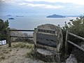
Yoko Island
- Area
- 4 km²
- High point
- 256 m
Ninoshima Island
- Area
- 3.9 km²
- High point
- 278 m

Ikinajima
- Area
- 3.7 km²
- High point
- 141 m

Okamura Island
- Area
- 3.1 km²
- High point
- 125 m

Momo Island
- Area
- 3.1 km²
- High point
- 184 m
Sa Island
- Area
- 2.7 km²
- High point
- 115 m
Kashima
- Area
- 2.6 km²
- High point
- 229 m
Iwashi Island
- Area
- 2.4 km²
- High point
- 130 m
Atatajima Island
- Area
- 2.4 km²
- High point
- 204 m

Ikunoshima
- Area
- 2.2 km²
- High point
- 159 m

Hashirijima
- Area
- 2.2 km²
- High point
- 179 m
Akahone Island
- Area
- 2.1 km²
- High point
- 171 m

Ōge Island
- Area
- 1.8 km²
- High point
- 203 m
Oshiba Iskand
- Area
- 1.7 km²
- High point
- 101 m
Tsushima Island
- Area
- 1.5 km²
- High point
- 176 m
Takaikami Island
- Area
- 1.4 km²
- High point
- 243 m
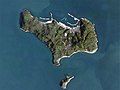
Uoshima
- Area
- 1.3 km²
- High point
- 147 m
Nagashima
- Area
- 1 km²
- High point
- 78 m

Kanawajima
- Area
- 1 km²
- High point
- 158 m
Okinoshima
- Area
- 0.95 km²
- High point
- 95 m
Karōto Island
- Area
- 0.91 km²
- High point
- 101 m

Sensuijima
- Area
- 0.84 km²
- High point
- 164 m

Ushima island
- Area
- 0.82 km²
- High point
- 89 m

Mikadoshima
- Area
- 0.81 km²
- High point
- 110 m
Hoso Shima
- Area
- 0.75 km²
- High point
- 66 m
Okubi Island
- Area
- 0.75 km²
- High point
- 98 m

Nasakejima
- Area
- 0.72 km²
- High point
- 130 m
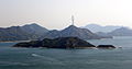
Ōkunoshima
- Area
- 0.72 km²
- High point
- 101 m

Itsuki Island
- Area
- 0.7 km²
- High point
- 89 m
Onasabi Island
- Area
- 0.67 km²
- High point
- 72 m

Kōge Island
- Area
- 0.65 km²
- High point
- 111 m
Abashima
- Area
- 0.53 km²
- High point
- 98 m
Ujinajima Island
- Area
- 0.51 km²
- High point
- 58 m
Uji Island
- Area
- 0.51 km²
- High point
- 117 m
Tsubajima
- Area
- 0.5 km²
- High point
- 92 m
Unnamed island
- Area
- 0.5 km²
- High point
- 22 m
Ōyoko Shima
- Area
- 0.49 km²
- High point
- 81 m
臼島
- Area
- 0.46 km²
- High point
- 69 m
Yokojima Island
- Area
- 0.45 km²
- High point
- 96 m

Oshima
- Area
- 0.45 km²
- High point
- 98 m
Toyoshima island
- Area
- 0.44 km²
- High point
- 98 m

Umashima
- Area
- 0.43 km²
- High point
- 83 m
明神島
- Area
- 0.43 km²
- High point
- 100 m
Kamiguroshima
- Area
- 0.42 km²
- High point
- 87 m
Mino Shima
- Area
- 0.42 km²
- High point
- 115 m
柏島
- Area
- 0.42 km²
- High point
- 138 m
Kashima
- Area
- 0.42 km²
- High point
- 109 m
小佐木島
- Area
- 0.42 km²
- High point
- 76 m
Unnamed island
- Area
- 0.34 km²
- High point
- 47 m
Sagumi Jima
- Area
- 0.3 km²
- High point
- 127 m
船島
- Area
- 0.29 km²
- High point
- 103 m

Shimoguroshima
- Area
- 0.28 km²
- High point
- 57 m
馬島
- Area
- 0.26 km²
- High point
- 69 m
Ieno Shima
- Area
- 0.25 km²
- High point
- 48 m
平市島
- Area
- 0.25 km²
- High point
- 99 m
Kashiwa Island
- Area
- 0.25 km²
- High point
- 76 m
Tougeshima Island
- Area
- 0.25 km²
- High point
- 129 m
梶島
- Area
- 0.24 km²
- High point
- 85 m
Hikijima island
- Area
- 0.23 km²
- High point
- 61 m
Kogurokami Island
- Area
- 0.19 km²
- High point
- 130 m
Nagashima Island
- Area
- 0.18 km²
- High point
- 81 m
Mitsugojima Island
- Area
- 0.16 km²
- High point
- 16 m
Hi Shima
- Area
- 0.15 km²
- High point
- 61 m

Nakanoshima
- Area
- 0.13 km²
- High point
- 94 m
Inokojima Island
- Area
- 0.13 km²
- High point
- 82 m
柏島
- Area
- 0.13 km²
- High point
- 54 m
Kuroshima
- Area
- 0.12 km²
- High point
- 72 m
Henajima
- Area
- 0.12 km²
- High point
- 38 m
小細島
- Area
- 0.12 km²
- High point
- 46 m
Aino Shima
- Area
- 0.11 km²
- High point
- 32 m

Kogunoshima
- Area
- 0.1 km²
- High point
- 84 m
来島
- Area
- 0.1 km²
- High point
- 68 m
Unnamed island
- Area
- —
size unknown
Rocks & skerries
On the chart above, at its closest zooms.
Listing 94 of 488; the rest are on the chart.
Figures
Comparative heights
- Nōmijima: 542 m
- Itsukushima: 535 m
- Kurahashi-jima: 491 m
- Ikuchijima: 472 m
- Ōkurokamishima: 460 m
- Kamikamagarijima: 457 m
- Ōsakikamijima: 453 m
- Ōsakishimojima: 449 m
- Ōmishima: 436 m
- Etajima: 400 m
- Innoshima: 390 m
- Iwagi: 370 m
- Tashima: 328 m
- Yuge: 325 m
To the same scale
Islands by area
Groups within
Overlapping groups
Photographs

因島大浜町 Innoshima-Ohama cho

Hakata-Oshima Suspension Bridge taken from Oshima

多々羅大橋から見た生口島と瀬戸内海。2014年3月中旬撮影。
redlegsfan21 from Vandalia, OH, United States / CC BY-SA 2.0

Omishima Bridge in Ehime prefecture, Japan

Hayase Bridge

128 Aijima, Matsuyama-shi, Ehime-ken 799-2433, Japan

Miyajima Island, Hiroshima Prefecture, Japan

沖美

休暇村大久野島付近より望む松島、生野島と小久野島

休暇村大久野島付近より望む松島、生野島と小久野島

休暇村大久野島付近より望む大崎上島方面

休暇村大久野島付近より望む大崎上島方面
Sources
Facts
Photographs
- 因島大浜町 Innoshima-Ohama cho - panoramio. OS6 / CC BY-SA 3.0
- Hakata-Oshima Bridge. Vickerman625 / Public domain
- Ikuchijima gezien vanaf de Tatara-brug, -16 maart 2014 a. redlegsfan21 from Vandalia, OH, United States / CC BY-SA 2.0
- Omishima Bridge. mukarin from Tokyo, Japan / CC BY-SA 2.0
- Hayase Bridge 319849. Hiroshi Nakai / CC BY 2.0
- 128 Aijima, Matsuyama-shi, Ehime-ken 799-2433, Japan - panoramio. YOSHIFUMI OGISO / CC BY-SA 3.0
- Miyajima Island. Bernard Gagnon / CC BY-SA 3.0
- 沖美 - panoramio (3). warabi hatogaya / CC BY 3.0
- Matsushima Island, Ikunoshima Island and Kokunoshima Island from Okunoshima Island 2. そらみみ / CC BY-SA 4.0
- Matsushima Island, Ikunoshima Island and Kokunoshima Island from Okunoshima Island. そらみみ / CC BY-SA 4.0
- Osaki-Kamijima Island from Okunoshima Island 2. そらみみ / CC BY-SA 4.0
- Osaki-Kamijima Island from Okunoshima Island. そらみみ / CC BY-SA 4.0