Norwegian SeaFaroe Islands
62°07′N 6°49′W
Faroe Islands
Føroyar
The Faroe Islands ( FAIR-oh), also known as the Faroes, are an archipelago in the North Atlantic Ocean and a rigsdel ('autonomous territory') of the Kingdom of Denmark.

Chart
Overview
The Faroe Islands ( FAIR-oh), also known as the Faroes, are an archipelago in the North Atlantic Ocean and a rigsdel ('autonomous territory') of the Kingdom of Denmark. Located between Iceland, Norway, and the Hebrides and Shetland isles of Scotland, the islands have a population of 55,466 as of July 2026 and a land area of 1,393 km2 (538 sq mi). The official language is Faroese, which is partially mutually intelligible with Icelandic. The terrain is rugged, dominated by fjords and cliffs with sparse vegetation and few trees. As a result of their proximity to the Arctic Circle, the islands experience perpetual civil twilight during summer nights and very short winter days; nevertheless, they experience a subpolar oceanic climate and mild temperatures year-round due to the Gulf Stream. The capital, Tórshavn, receives the fewest recorded hours of sunshine of any city in the world at only 840 hours per year. Færeyinga saga and the writings of Dicuil date initial Norse settlement in the early 9th century, with Grímur Kamban recorded as the first permanent settler. The islands were initially believed to be mainly settled by Norwegians and Norse-Gaels who also brought thralls (i.e. slaves or serfs) of Gaelic origin, as with Iceland; this was disproved by a 2024 study, which found the origins to be different. Initially governed as an independent commonwealth under the Løgting, the islands came under Norwegian rule in the early 11th century after the introduction of Christianity by Sigmundur Brestisson. The Faroe Islands followed Norway's integration into the Kalmar Union in 1397 and came under de facto Danish rule following that union's dissolution in 1523. Following the introduction of Lutheranism in 1538, the Faroese language was banned in public institutions and disappeared from writing for more than three centuries. The islands were formally ceded to Denmark in 1814 by the Treaty of Kiel along with Greenland and Iceland, and the Løgting was subsequently replaced by a Danish judiciary. Following the re-establishment of the Løgting and an official Faroese orthography, the Faroese language conflict saw Danish being gradually displaced by Faroese as the language of the church, public education, and law in the first half of the 20th century. The islands were occupied by the British during the Second World War, who refrained from governing Faroese internal affairs: inspired by this period of relative self-government and the declaration of Iceland as a republic in 1944, the islands held a referendum in 1946 that resulted in a narrow majority for independence. The results were annulled by King Christian X, and subsequent negotiations led to the Faroe Islands being granted home rule in 1948. Within the Kingdom of Denmark, the Faroe Islands are self-governing apart from defence, policing, justice and currency, with partial control over foreign affairs. Because the Faroe Islands are not part of the same customs area as Denmark, they have an independent trade policy and can establish their own trade agreements. The islands have an extensive bilateral free trade agreement with Iceland, known as the Hoyvík Agreement. In certain sports, the Faroe Islands field their own national teams. In the Nordic Council and Council of Europe, they are represented as part of the Danish delegation. The islands' fishing industry accounts for around 90% of their exports, with tourism becoming increasingly prominent since the 2010s. They did not become a part of the European Economic Community (EEC) in 1973, instead keeping autonomy over their own fishing waters; as a result, the Faroe Islands are not a part of the European Union (EU) today. The Løgting, although it was suspended between 1816 and 1852, claims to be one of the oldest continuously running parliaments in the world.
From Wikipedia, CC BY-SA 4.0
Census, cataloged
- Major islands6
- Minor islands15
- Islets63
- Rocks & skerries143
Major islands
Streymoy
- Area
- 375 km²
- High point
- 789 m
Streymoy (Faroese pronunciation: [ˈstɾeɪ̯mɔɪ̯], Danish: Strømø) is the largest and most populated island of the Faroe Islands. The capital, Tórshavn, is located on its southeast coast. The name means "island of currents".
Eysturoy
- Area
- 287 km²
- High point
- 880 m
Eysturoy (Faroese pronunciation: ['ɛstroi], meaning 'East Island') is a region and the second-largest of the Faroe Islands, both in size and population.
Vágar
- Area
- 177 km²
- High point
- 722 m
Vágar (Faroese pronunciation: [vɔːaɹ]; Danish: Vågø) is one of the 18 islands in the archipelago of the Faroe Islands and the most westerly of the large islands. With a size of 178 square kilometres (69 square miles), it ranks third in size, behind Streymoy and Eysturoy.
Suðuroy
- Area
- 165 km²
- High point
- 605 m
Suðuroy is the southernmost of the Faroe Islands. The island covers 163.7 square kilometres (63.2 sq mi). In 2018 the population was 4,601. Suðuroy region (sýsla) comprises this island and Lítla Dímun, the next isle northward in the Faroes, which is uninhabited.
Sandoy
- Area
- 111 km²
- High point
- 479 m
Sandoy (lit. "Sand Island" in Faroese) is the first of the five southern islands that make up the Faroe chain, the fifth largest of all the Faroe Islands, an autonomous region of the Kingdom of Denmark. It also refers to the region that includes this island along with Skúvoy and Stóra Dímun.
Borðoy
- Area
- 95.1 km²
- High point
- 772 m
Borðoy (Faroese pronunciation: [ˈbɔɹɔɪ], Danish: Bordø) is an island in the north-east of the Faroe Islands. Its name means 'headland island'. There are eight settlements: Klaksvík (the second largest town in the Faroes), Norðoyri, Ánir, Árnafjørður, Strond, Norðtoftir, Depil and Norðdepil.


Minor islands

Viðoy
- Area
- 40.8 km²
- High point
- 841 m

Kunoy
- Area
- 35.4 km²
- High point
- 830 m

Kalsoy
- Area
- 30.5 km²
- High point
- 788 m

Svínoy
- Area
- 27.3 km²
- High point
- 586 m
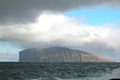
Fugloy
- Area
- 11 km²
- High point
- 621 m

Nólsoy
- Area
- 10.3 km²
- High point
- 372 m

Skúvoy
- Area
- 10.2 km²
- High point
- 392 m

Mykines
- Area
- 9.7 km²
- High point
- 560 m

Hestur
- Area
- 5.9 km²
- High point
- 421 m

Stóra Dímun
- Area
- 2.7 km²
- High point
- 396 m
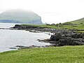
Koltur
- Area
- 2.3 km²
- High point
- 477 m

Lítla Dímun
- Area
- 0.82 km²
- High point
- 414 m
Tindhólmur
- Area
- 0.61 km²
- High point
- 186 m

Mykineshólmur
- Area
- 0.41 km²
- High point
- 139 m

Trøllhøvdi
- Area
- 0.19 km²
- High point
- 149 m
Rocks & skerries
On the chart above, at its closest zooms.
Listing 21 of 227; the rest are on the chart.
Figures
Comparative heights
To the same scale
Islands by area
| Streymoy | 375 km² |
| Eysturoy | 287 km² |
| Vágar | 177 km² |
| Suðuroy | 165 km² |
| Sandoy | 111 km² |
| Borðoy | 95.1 km² |
| Viðoy | 40.8 km² |
| Kunoy | 35.4 km² |
| Kalsoy | 30.5 km² |
| Svínoy | 27.3 km² |
| Fugloy | 11 km² |
| Nólsoy | 10.3 km² |
| Skúvoy | 10.2 km² |
| Mykines | 9.7 km² |
| Hestur | 5.9 km² |
| Stóra Dímun | 2.7 km² |
| Koltur | 2.3 km² |
| Lítla Dímun | 0.82 km² |
| Tindhólmur | 0.61 km² |
| Mykineshólmur | 0.41 km² |
| Trøllhøvdi | 0.19 km² |
Overlapping groups
Photographs


Sandur seen from a helicopter.


Faroe Islands

Wyspy Owcze

Date: 2018-06-21 Sensor: MSI on Sentinel-2A Resolution: 20m (Downsampled) RGB Composites: True color, Band 4-3-2

The Faroe Islands

Aerial view of Vágar, from a SAS-plane about land on Vágar Airport.

Faroe Islands

Wyspy Owcze

Wyspy Owcze

South of Haldarsvík, Faroe Islands.
Sources
Facts
Photographs
- Lopranseiði and Kirvi a Mountain in Suðuroy and the Cliff Beinisvørð. Eileen Sandá / CC BY-SA 3.0
- Sandoy aerial 2019 a. kallerna / CC BY-SA 4.0
- Skálafjørður. Renno Hokwerda / CC BY-SA 4.0
- Faroe Islands (Unsplash WbIEX9Hq-EI). Mike Kosiakov bldskr / CC0
- Faroe Islands general view. PanWoyteczek / CC BY 4.0
- Faroe Islands by Sentinel-2. Copernicus Sentinel-2, ESA / CC BY-SA 3.0 igo
- The Faroe Islands (45327070884). Joe deSousa / CC0
- Vágar aerial view 1. kallerna / CC BY-SA 4.0
- Is03260-Wyspy Owcze. PanWoyteczek / CC BY 4.0
- Is03237-Palec wiedźmy. PanWoyteczek / CC BY 4.0
- Is03233-Wyspy Owcze. PanWoyteczek / CC BY 4.0
- South of Haldarsvík view towards south. EileenSanda / CC BY-SA 3.0