Pacific OceanChile
42°36′S 73°57′W
Chiloé Archipelago
Archipiélago de Chiloé
The Chiloé Archipelago is a group of islands lying off the coast of Chile, in the Los Lagos Region. It is separated from mainland Chile by the Chacao Channel in the north, the Sea of Chiloé in the east and the Gulf of Corcovado in the southeast. All islands except the Desertores Islands form Chiloé Province.

Chart
Overview
The Chiloé Archipelago is a group of islands lying off the coast of Chile, in the Los Lagos Region. It is separated from mainland Chile by the Chacao Channel in the north, the Sea of Chiloé in the east and the Gulf of Corcovado in the southeast. All islands except the Desertores Islands form Chiloé Province. The main island is Chiloé Island. Of roughly rectangular shape, the southwestern half of this island is a wilderness of contiguous forests, wetlands and, in some places, mountains. The landscape of the northeastern sectors of Chiloé Island and the islands to the east is dominated by rolling hills, with a mosaic of pastures, forests and cultivated fields. The archipelago is known within Chile for its distinctive folklore, mythology, potatoes, cuisine and unique architecture. The culture of Chiloé is the result of mixing of Huilliche, Spanish and Chono influences in centuries of isolation without much contact with the rest of Chile or the Western World. Its cool temperate climate, abundance of sea resources and large and lush forests have also played a major role in shaping life in the islands. In colonial times, Chiloé was an important bulwark in the defence against Dutch and British incursions to Chile and Patagonia. The archipelago was the last Spanish possession in Chile, successfully repelling patriot invasions until 1826. In the 19th century, the archipelago was a starting point for the Chilean colonisation of Patagonia. Not only were major expeditions assembled in Chiloé, but thousands of Chilotes migrated to the sparsely populated mainland to work in sheep-raising estancias, as railway navvies, or to become independent settlers. Belief in witchcraft has been common in the archipelago, reaching such influence that in 1880 Chilean authorities put on trial warlocks said to rule the archipelago through a secret society. Once considered an isolated and backward part of Chile, today the archipelago retains its rural character despite increased connectivity and the growth of cities such as Ancud, Castro and Quellón. Since the 1990s, salmon aquaculture and tourism have been important sources of revenue in the archipelago, complementing traditional activities such as fishing and small-scale agriculture.
From Wikipedia, CC BY-SA 4.0
Census, cataloged
- Major islands1
- Minor islands63
- Islets138
- Rocks & skerries82
Major islands
Chiloé Island
- Area
- 8,282 km²
- High point
- 830 m
Chiloé Island, also known as Greater Island of Chiloé (Isla Grande de Chiloé), is the largest island of the Chiloé Archipelago off the west coast of Chile, in the Pacific Ocean. The island is located in southern Chile, in the Los Lagos Region.

Minor islands
Isla Guafo
- Area
- 190 km²
- High point
- 355 m
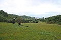
Quinchao Island
- Area
- 129 km²
- High point
- 195 m

Lemuy Island
- Area
- 95.8 km²
- High point
- 171 m
Isla Tranqui
- Area
- 77.8 km²
- High point
- 222 m
Isla San Pedro
- Area
- 64.1 km²
- High point
- 574 m
Isla Talcán
- Area
- 45.9 km²
- High point
- 125 m
Isla Butachauques
- Area
- 42.3 km²
- High point
- 123 m
Isla Caucahué
- Area
- 31.3 km²
- High point
- 118 m
Isla Coldita
- Area
- 28.6 km²
- High point
- 183 m
Isla Chaulinec
- Area
- 26.5 km²
- High point
- 176 m
Isla Quehui
- Area
- 26.3 km²
- High point
- 144 m
Isla Cailín
- Area
- 26.2 km²
- High point
- 140 m
Isla Laitec
- Area
- 23.9 km²
- High point
- 140 m
Isla Quenac
- Area
- 21 km²
- High point
- 81 m
Isla Quilán
- Area
- 20.4 km²
- High point
- 119 m
Isla Chulín
- Area
- 17 km²
- High point
- 84 m
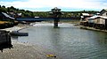
Mechuque
- Area
- 15.3 km²
- High point
- 177 m
Isla Meulín
- Area
- 13 km²
- High point
- 99 m
Isla Apiao
- Area
- 12.4 km²
- High point
- 79 m
Isla Chelín
- Area
- 11.6 km²
- High point
- 79 m
Linlín
- Area
- 9.8 km²
- High point
- 132 m
Isla Caguach
- Area
- 9.6 km²
- High point
- 108 m
Isla Alao
- Area
- 8.6 km²
- High point
- 105 m
Isla Tac
- Area
- 6.8 km²
- High point
- 52 m
Isla Cheniao
- Area
- 6.4 km²
- High point
- 85 m
Isla Nayahué
- Area
- 5.6 km²
- High point
- 76 m
Isla Añihué
- Area
- 5.2 km²
- High point
- 36 m
Isla Autení
- Area
- 3.4 km²
- High point
- 51 m
Isla Llingua
- Area
- 3.4 km²
- High point
- 148 m
Isla Taucolón
- Area
- 3.3 km²
- High point
- 151 m
Isla Chuit
- Area
- 3.2 km²
- High point
- 72 m
Isla Chaullín
- Area
- 2.1 km²
- High point
- 52 m
Isla Aulín
- Area
- 2 km²
- High point
- 69 m
Isla Yencouma
- Area
- 1.7 km²
- High point
- 59 m
Isla Imerquiña
- Area
- 1.4 km²
- High point
- 49 m
Isla Acuy
- Area
- 0.82 km²
- High point
- 78 m
Isla Redonda
- Area
- 0.82 km²
- High point
- 50 m
Isla Lacao
- Area
- 0.74 km²
- High point
- 14 m
Isla Teuquelín
- Area
- 0.65 km²
- High point
- 44 m
Isla Mauchil
- Area
- 0.56 km²
- High point
- 26 m
Isla Mayor
- Area
- 0.54 km²
- High point
- 48 m
Isla Quilque
- Area
- 0.52 km²
- High point
- 22 m
Isla Refugio
- Area
- 0.49 km²
- High point
- 59 m
Isla Linagua
- Area
- 0.45 km²
- High point
- 46 m
Isla Dolores
- Area
- 0.39 km²
- High point
- 46 m
Isla Salart
- Area
- 0.39 km²
- High point
- 47 m
Isla Diañ
- Area
- 0.38 km²
- High point
- 22 m
Isla Imelev
- Area
- 0.32 km²
- High point
- 39 m
Isla Leguas
- Area
- 0.31 km²
- High point
- 40 m
Isla Quetén
- Area
- 0.3 km²
- High point
- 38 m
Islote Metalqui
- Area
- 0.28 km²
- High point
- 85 m
Isla Puduguapi
- Area
- 0.25 km²
- High point
- 21 m
Isla Pelleulle
- Area
- 0.24 km²
- High point
- 18 m
Islote Omega
- Area
- 0.22 km²
- High point
- 39 m
Isla Cochinos
- Area
- 0.18 km²
- High point
- 51 m
Isla Linlinao
- Area
- 0.17 km²
- High point
- 39 m
Isla Surgidero
- Area
- 0.16 km²
- High point
- 34 m
Unnamed island
- Area
- 0.16 km²
- High point
- 7 m
Unnamed island
- Area
- 0.13 km²
- High point
- 24 m
Islote Beta
- Area
- 0.13 km²
- High point
- 19 m
Isla Observatorio
- Area
- 0.11 km²
- High point
- 36 m
Isla Alfa
- Area
- 0.1 km²
- High point
- 9 m
Unnamed island
- Area
- 0.1 km²
- High point
- 24 m
Rocks & skerries
On the chart above, at its closest zooms.
Listing 64 of 284; the rest are on the chart.
Figures
Comparative heights
- Chiloé: 830 m
- Isla San Pedro: 574 m
- Isla Guafo: 355 m
- Isla Tranqui: 222 m
- Quinchao: 195 m
- Isla Coldita: 183 m
- Mechuque: 177 m
- Isla Chaulinec: 176 m
- Lemuy: 171 m
- Isla Taucolón: 151 m
- Isla Llingua: 148 m
- Isla Quehui: 144 m
- Isla Cailín: 140 m
- Isla Laitec: 140 m
To the same scale
Islands by area
Groups within
Photographs

Brightly colored palafitos can be seen around Chiloe.

Puñihuil Penguin Farms Excursion.

day trip from Puerto Varas to Isla Grande de Chiloe...


Backpacker Van type vehicle.

day trip from Puerto Varas to Isla Grande de Chiloe...a market tour in Ancud, Chile, with our local guide...

Pink skies on Isla San Pedro.

Rebaño de ovejas de raza Chilota tomada en las instalaciones de INIA Butalcura (Chiloé, Chile)

Corral de rocas situado en isla Caguach, Chiloé, Chile.

caleta piñihuil, Ancud, Chiloe

An amasing landscape, cloudy, but blue sky, palafitos in different and happy colors reflected on the water...

Chiloe - X Region
Sources
Facts
Photographs
- Palafitos Chiloe. Cplandco / CC BY-SA 4.0
- Excursión Pinguineras de Puñihuil A74118920240109. Rjcastillo / CC BY-SA 4.0
- Day trip from Puerto Varas to Isla Grande de Chiloe - (24889168590). Murray Foubister / CC BY-SA 2.0
- Chiloé OnEarth WMS. Unknown author / Public domain
- Vehículo tipo Van de mochileros A74112320240108. Rjcastillo / CC BY-SA 4.0
- Day trip from Puerto Varas to Isla Grande de Chiloe - a market tour in Ancud, Chile, with our local guide - (24817357889). Murray Foubister / CC BY-SA 2.0
- Pink Skies Chiloe. Cplandco / CC BY-SA 4.0
- Rebaño de ovejas de raza Chilota. Rodrigo de la Barra / CC BY-SA 3.0
- Corral-isla-quenu-chiloe-ch. Taijataf / CC BY-SA 4.0
- Caleta piñihuil, Ancud, Chiloe - panoramio. Gillermo Adolfo / CC BY 3.0
- Palafitos- Chiloe. Liuvaa / CC BY-SA 3.0
- 076-365 - Ancud de Noche (13547930104). Gabriel Urrutia Galaz / CC BY-SA 2.0