Japan
27°05′N 142°13′E
Chichijima Islands
Part of Bonin Islands

Chart
Major islands
Chichijima
- Area
- 23.8 km²
- High point
- 320 m
Chichijima (Japanese: 父島) is the largest and most populous of the Bonin Islands. Chichijima is about 240 km (150 mi) north of Iwo Jima. 1 sq mi) in size, the island is home to about 2,120 people (2021).
Anijima
- Area
- 7.9 km²
- High point
- 254 m
Otōtojima
- Area
- 5.2 km²
- High point
- 299 m
Otōtojima, Otōto-jima, or Otōto Jima (弟島, meaning Younger Brother Island), is an uninhabited island in the Chichijima archipelago of Japan's Ogasawara Islands. During the Meiji and Taishō eras between 50 and 100 people lived on the island, but it was deserted in 1944. The island is off-limits for tourists.

Minor islands
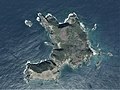
Nishijima
- Area
- 0.49 km²
- High point
- 100 m

Minamijima
- Area
- 0.29 km²
- High point
- 57 m

Higashijima
- Area
- 0.25 km²
- High point
- 92 m

Magojima
- Area
- 0.12 km²
- High point
- 91 m
Rocks & skerries
On the chart above, at its closest zooms.
Listing 7 of 862; the rest are on the chart.
Figures
Comparative heights
- Chichijima: 320 m
- Otōtojima: 299 m
- Anijima: 254 m
- Nishijima: 100 m
- Higashijima: 92 m
- Magojima: 91 m
- Minamijima: 57 m
To the same scale
Islands by area
| Chichijima | 23.8 km² |
| Anijima | 7.9 km² |
| Otōtojima | 5.2 km² |
| Nishijima | 0.49 km² |
| Minamijima | 0.29 km² |
| Higashijima | 0.25 km² |
| Magojima | 0.12 km² |
Overlapping groups
Photographs

Anijima as seen from the Nagasaki Observation Deck in Chichijima, Ogasawara Village, Tokyo, Japan

巽島(小笠原村)

傘山展望台より東島を望む

東島(小笠原村)

Nishijima Island, Ogasawara Aerial photograph.2014

Higashijima Island, Ogasawara Aerial photograph.2014

Magojima Island Aerial photograph.2014

Ministry of Land, Infrastructure, Transport and Tourism Ogasawara General Office in Chichijima, Ogasawara Village, Tokyo, Japan

Figure 5; Habitat of Ochthebius sasakii sp. n. A–C Chichi-jima D Otouto-jima E Ani-jima.

Otouto-Jima Island Aerial photograph.2013

Satellite photo of the Ogasawara Islands: Chichijima (north) and Hahajima (south). It is color adjusted, because the source photo is thermal infrared.
NASA/GSFC/METI/ERSDAC/JAROS, and U.S./Japan ASTER Science Team / Public domain
Sources
Facts
- Geometry, areas and high points: OpenStreetMap contributors (ODbL), Copernicus GLO-30, via Talus.
- Wikidata
Photographs
- Anisima. タクナワン / CC0
- Tatsumi island. ブルーノ・プラス / CC BY-SA 4.0
- Higashijima Island 2023. 皓月旗 / CC BY 4.0
- Higashijima in Ogasawara. ブルーノ・プラス / CC BY-SA 4.0
- Nishijima Island, Ogasawara Aerial photograph.2014. 国土地理院 / Attribution
- Higashijima Island, Ogasawara Aerial photograph.2014. 国土地理院 / Attribution
- Magojima Island Aerial photograph.2014. 国土地理院 / Attribution
- Ogasawara General Office. Yasu (talk) / CC BY-SA 3.0
- Habitat of Ochthebius sasakii (10.3897-zookeys.855.35677) Figure 5. Yoshitomi H, Karube H, Hayashi M (2019) A new species of the genus Ochthebius (Coleoptera, Hydraenidae) from the Ogasawa / CC BY 4.0
- Otouto-Jima Island Aerial photograph.2014. 国土地理院 / Attribution
- Ogasawara-Islands-Chichijima-Hahajima. NASA/GSFC/METI/ERSDAC/JAROS, and U.S./Japan ASTER Science Team / Public domain