Pacific OceanMicronesia and Palau
7°23′N 147°02′E
Caroline Islands
The Caroline Islands (or the Carolines) are a widely scattered archipelago of tiny islands in the western Pacific Ocean, to the north of New Guinea. Politically, they are divided between the Federated States of Micronesia (FSM) in the central and eastern parts of the group, and Palau at the extreme western end.

Chart
Overview
The Caroline Islands (or the Carolines) are a widely scattered archipelago of tiny islands in the western Pacific Ocean, to the north of New Guinea. Politically, they are divided between the Federated States of Micronesia (FSM) in the central and eastern parts of the group, and Palau at the extreme western end. Historically, this area was also called Nuevas Filipinas or New Philippines, because they were part of the Spanish East Indies and were governed from Manila in the Philippines. The Carolines are scattered across a distance of approximately 3,540 kilometers (2,200 mi; 1,910 nmi), from the westernmost island, Tobi, in Palau, to the easternmost island, Kosrae, a state of the FSM.
From Wikipedia, CC BY-SA 4.0
Census, cataloged
- Major islands9
- Minor islands233
- Islets842
- Rocks & skerries218
Major islands
Babeldaob
- Area
- 363 km²
- High point
- 242 m
Babeldaob (also Babelthuap) is the largest island in the island nation of Palau. It is in the western Caroline Islands, and the second largest island (after Guam) in the Micronesia region of Oceania. Palau's capital, Ngerulmud, is located on Babeldaob, in Melekeok State.
Pohnpei
- Area
- 345 km²
- High point
- 767 m
Pohnpei (formerly known as Ponape or Ascension, from Pohnpeian: "upon (pohn) a stone altar (pei)") is an island of the Senyavin Islands which are part of the larger Caroline Islands group. It belongs to Pohnpei State, one of the four states in the Federated States of Micronesia (FSM).
Kosrae
- Area
- 110 km²
- High point
- 559 m
Kosrae ( koh-SHY), formerly known as Kusaie or Strong's Island, is an island in the Caroline Islands archipelago, and state within the Federated States of Micronesia.
Yap Island
- Area
- 54.4 km²
- High point
- 170 m
Peleliu Island
- Area
- 19.4 km²
- High point
- 75 m
Peleliu (or Beliliou) is an island in the island nation of Palau. Peleliu, along with two small islands to its northeast, forms one of the sixteen states of Palau. The island is notable as the location of the Battle of Peleliu in World War II.
Weno
- Area
- 19.3 km²
- High point
- 370 m
Weno (Chuukese: Wééné), formerly Moen, is an island municipality in the Namoneas region of Chuuk Lagoon in Chuuk State, Federated States of Micronesia (FSM). 30 sq mi) and serves as the state capital and main commercial center.


Gagil-Tamil
- Area
- 27.2 km²
- High point
- 82 m
Tol
- Area
- 20.3 km²
- High point
- 448 m
Tol (Chuukese: Toon) is an island in the Faichuk region of Chuuk Lagoon in Chuuk State, Federated States of Micronesia. 91 sq mi), it is the largest island in the state and had a total population of 5,217 at the 2010 census.
Ngeruktabel
- Area
- 18.3 km²
- High point
- 180 m
Minor islands
Fefan
- Area
- 12 km²
- High point
- 125 m
Maap
- Area
- 10.5 km²
- High point
- 75 m

Koror Island
- Area
- 9.2 km²
- High point
- 65 m
Polle
- Area
- 9.1 km²
- High point
- 111 m

Eil Malk
- Area
- 8.9 km²
- High point
- 143 m

Tonowas
- Area
- 8.9 km²
- High point
- 114 m
Angaur
- Area
- 8 km²
- High point
- 32 m
Satawan
- Area
- 4.6 km²
Udot
- Area
- 4.6 km²
- High point
- 114 m
Ulithi
- Area
- 4.5 km²
Paata
- Area
- 4.4 km²
- High point
- 185 m
Ulebsechel
- Area
- 4 km²
- High point
- 187 m
Rumung
- Area
- 4 km²
- High point
- 86 m
Uman
- Area
- 3.9 km²
- High point
- 211 m
Dehpehk
- Area
- 3.4 km²
- High point
- 154 m
Unnamed island
- Area
- 3 km²

Pulusuk
- Area
- 2.8 km²
- High point
- 51 m

Fais Island
- Area
- 2.7 km²
- High point
- 28 m
Temwen
- Area
- 2.6 km²
- High point
- 77 m

Ngerekebesang
- Area
- 2.4 km²
- High point
- 90 m
Onoun Island
- Area
- 2.3 km²
- High point
- 24 m
Parempei
- Area
- 2.2 km²
- High point
- 82 m
Ant Atoll
- Area
- 1.9 km²
Alet
- Area
- 1.8 km²
- High point
- 32 m
Sapwuahfik
- Area
- 1.8 km²
Fala-Beguets
- Area
- 1.6 km²
- High point
- 41 m
Ngerduais
- Area
- 1.6 km²
- High point
- 90 m
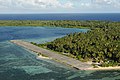
Pingelap
- Area
- 1.5 km²
- High point
- 24 m
Ifalik
- Area
- 1.5 km²

Woleai
- Area
- 1.4 km²
- High point
- 19 m

Satawal
- Area
- 1.4 km²
- High point
- 27 m
Fallap
- Area
- 1.3 km²
- High point
- 22 m
Puluwat
- Area
- 1.3 km²
- High point
- 25 m
Garreru
- Area
- 1.3 km²
- High point
- 125 m
Dongosaru
- Area
- 1.3 km²
- High point
- 31 m
Ta
- Area
- 1.3 km²
- High point
- 21 m
Lukunor
- Area
- 1.3 km²
- High point
- 21 m
Param, Chuuk
- Area
- 1.2 km²
- High point
- 1 m
Kayangel
- Area
- 1.2 km²
- High point
- 21 m
Satawan
- Area
- 1.2 km²
- High point
- 23 m
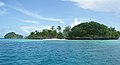
Carp Island
- Area
- 1.1 km²
- High point
- 54 m
Kapingamarangi
- Area
- 1.1 km²
Ngedbus
- Area
- 1.1 km²
- High point
- 27 m
Wikahlap
- Area
- 1.1 km²
- High point
- 20 m
Merir
- Area
- 1 km²
- High point
- 21 m
Lelu Island
- Area
- 1 km²
Lamotrek
- Area
- 0.98 km²
Ongael
- Area
- 0.98 km²
- High point
- 122 m
Ngatik
- Area
- 0.96 km²
- High point
- 23 m

Nama
- Area
- 0.92 km²
- High point
- 26 m
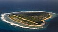
Falalop
- Area
- 0.89 km²
- High point
- 14 m
Unnamed island
- Area
- 0.88 km²
- High point
- 91 m
Romanum
- Area
- 0.85 km²
- High point
- 1 m

Malakal Island
- Area
- 0.85 km²
- High point
- 124 m
Tobi
- Area
- 0.81 km²
- High point
- 31 m
Pamuk Imwintiati
- Area
- 0.79 km²
- High point
- 25 m
Mwahnd Peidak
- Area
- 0.79 km²
- High point
- 85 m
Loal Island
- Area
- 0.77 km²
- High point
- 32 m
Utagal
- Area
- 0.76 km²
- High point
- 21 m
Nikalap Island
- Area
- 0.74 km²
- High point
- 19 m
Etal
- Area
- 0.73 km²
- High point
- 25 m
Mwahd Peidi
- Area
- 0.72 km²
- High point
- 84 m
Pulap
- Area
- 0.7 km²
- High point
- 17 m
Meseong
- Area
- 0.67 km²
- High point
- 24 m
Lamotrek Island
- Area
- 0.66 km²
- High point
- 15 m
Deke
- Area
- 0.64 km²
- High point
- 22 m
Mokil Atoll
- Area
- 0.61 km²
- High point
- 22 m

Sorol
- Area
- 0.61 km²
- High point
- 22 m
Ngerchaol
- Area
- 0.6 km²
- High point
- 81 m
Na
- Area
- 0.6 km²
- High point
- 23 m
Piagailoe
- Area
- 0.6 km²
Urak
- Area
- 0.54 km²
- High point
- 26 m
Oneop
- Area
- 0.54 km²
- High point
- 20 m
Ngurungor
- Area
- 0.54 km²

Ulong Island
- Area
- 0.54 km²
- High point
- 98 m

Nukuoro
- Area
- 0.54 km²
- High point
- 24 m
Fanna
- Area
- 0.53 km²
- High point
- 20 m
Elato
- Area
- 0.53 km²
Ngebedangel
- Area
- 0.52 km²
- High point
- 83 m
Toinom
- Area
- 0.51 km²
- High point
- 28 m
Siis
- Area
- 0.5 km²
- High point
- 65 m
Pisaras
- Area
- 0.49 km²
- High point
- 17 m
Totiw
- Area
- 0.49 km²
- High point
- 33 m
Etten
- Area
- 0.48 km²
- High point
- 1 m
Magur
- Area
- 0.48 km²
- High point
- 13 m
Unnamed island
- Area
- 0.47 km²
- High point
- 81 m
Ngerechong
- Area
- 0.47 km²
- High point
- 21 m
Bailechesengel
- Area
- 0.46 km²
- High point
- 36 m
Fananu
- Area
- 0.46 km²
- High point
- 12 m
Ngerukewid
- Area
- 0.45 km²
- High point
- 53 m
Elato Island
- Area
- 0.45 km²
- High point
- 17 m
Olngeuaol
- Area
- 0.45 km²
- High point
- 24 m
Gabert Island
- Area
- 0.44 km²
- High point
- 7 m
Apurashokoru
- Area
- 0.43 km²
- High point
- 109 m
Falalis
- Area
- 0.43 km²
- High point
- 16 m
Namoluk
- Area
- 0.42 km²
- High point
- 33 m
Faraulep
- Area
- 0.42 km²
Saliap
- Area
- 0.42 km²
- High point
- 19 m
Pones
- Area
- 0.42 km²
- High point
- 17 m
Ruo
- Area
- 0.42 km²
- High point
- 16 m
Pulo Anna
- Area
- 0.41 km²
- High point
- 21 m
Unnamed island
- Area
- 0.41 km²
- High point
- 28 m
Tamatam
- Area
- 0.4 km²
- High point
- 19 m
Euidelchol
- Area
- 0.4 km²
- High point
- 68 m
Asor
- Area
- 0.4 km²
- High point
- 16 m
Ngulu Atoll
- Area
- 0.4 km²
Igup Island
- Area
- 0.4 km²
- High point
- 19 m
Dmasech
- Area
- 0.4 km²
- High point
- 26 m
Kutu
- Area
- 0.39 km²
- High point
- 19 m
Wisas
- Area
- 0.38 km²
- High point
- 17 m
Amas
- Area
- 0.38 km²
- High point
- 29 m
Korak Island
- Area
- 0.38 km²
- High point
- 103 m
Eot
- Area
- 0.37 km²
- High point
- 1 m
Lenger
- Area
- 0.37 km²
- High point
- 70 m
Ngeriungs
- Area
- 0.36 km²
- High point
- 15 m
Hare
- Area
- 0.36 km²
- High point
- 22 m
Fassarai
- Area
- 0.35 km²
- High point
- 15 m
Fono
- Area
- 0.33 km²
- High point
- 1 m
More Island
- Area
- 0.33 km²
- High point
- 23 m
Raur
- Area
- 0.33 km²
- High point
- 11 m
Wat Island
- Area
- 0.33 km²
- High point
- 22 m
Unnamed island
- Area
- 0.32 km²
- High point
- 53 m
Numurus Island
- Area
- 0.32 km²
- High point
- 12 m
Nomwin Island
- Area
- 0.32 km²
- High point
- 16 m
Piis-Paneu
- Area
- 0.32 km²
- High point
- 18 m
Mwand
- Area
- 0.31 km²
- High point
- 22 m
Unnamed island
- Area
- 0.31 km²
- High point
- 16 m
Pis Island
- Area
- 0.31 km²
- High point
- 26 m
Manton
- Area
- 0.3 km²
- High point
- 23 m
Ngerechur
- Area
- 0.29 km²
- High point
- 47 m
Eor Island
- Area
- 0.29 km²
- High point
- 15 m
Parang Island
- Area
- 0.29 km²
- High point
- 27 m
Faraulep Island
- Area
- 0.29 km²
- High point
- 16 m
Unnamed island
- Area
- 0.28 km²
- High point
- 64 m
Malotel
- Area
- 0.28 km²
- High point
- 14 m
Sanat
- Area
- 0.28 km²
- High point
- 16 m
Ono Island
- Area
- 0.28 km²
- High point
- 12 m
Potangeras
- Area
- 0.27 km²
- High point
- 18 m
Cheleu
- Area
- 0.26 km²
- High point
- 30 m
Ngermalk
- Area
- 0.26 km²
- High point
- 94 m
Peina Island
- Area
- 0.26 km²
- High point
- 21 m
Sorlen
- Area
- 0.26 km²
- High point
- 15 m
Sopunur
- Area
- 0.26 km²
- High point
- 19 m
Unnamed island
- Area
- 0.26 km²
- High point
- 11 m
Feneppi
- Area
- 0.25 km²
- High point
- 23 m
Tagaulap
- Area
- 0.24 km²
- High point
- 20 m
Ocha
- Area
- 0.24 km²
- High point
- 28 m
Eauripik
- Area
- 0.24 km²
Onnang
- Area
- 0.23 km²
- High point
- 21 m
Losiep Island
- Area
- 0.23 km²
- High point
- 16 m
Unnamed island
- Area
- 0.22 km²
- High point
- 93 m
Unnamed island
- Area
- 0.22 km²
- High point
- 70 m
Bablomekang
- Area
- 0.22 km²
- High point
- 73 m
Paliau
- Area
- 0.22 km²
- High point
- 14 m
Onari Island
- Area
- 0.22 km²
- High point
- 17 m
Elin Island
- Area
- 0.22 km²
- High point
- 15 m
Unnamed island
- Area
- 0.21 km²
- High point
- 23 m
Peilepwil Island
- Area
- 0.21 km²
- High point
- 21 m
Osetik
- Area
- 0.21 km²
- High point
- 21 m
Alengarik Island
- Area
- 0.21 km²
- High point
- 27 m
Piasa
- Area
- 0.21 km²
- High point
- 26 m
Pahnwasank
- Area
- 0.21 km²
- High point
- 20 m
Pasa
- Area
- 0.2 km²
- High point
- 18 m
Mariaon
- Area
- 0.2 km²
- High point
- 20 m
Ngebedel
- Area
- 0.2 km²
- High point
- 71 m
Unnamed island
- Area
- 0.19 km²
- High point
- 23 m
Toas Island
- Area
- 0.19 km²
- High point
- 18 m
Pones
- Area
- 0.18 km²
- High point
- 19 m
Unnamed island
- Area
- 0.18 km²
- High point
- 11 m
Werua
- Area
- 0.18 km²
- High point
- 15 m
Ipis
- Area
- 0.17 km²
- High point
- 25 m
Unnamed island
- Area
- 0.17 km²
- High point
- 10 m
Lkes
- Area
- 0.17 km²
- High point
- 21 m
Lossau
- Area
- 0.17 km²
- High point
- 18 m
Fuasubukoru
- Area
- 0.17 km²
- High point
- 13 m
Pau Island
- Area
- 0.17 km²
- High point
- 18 m
Pugue Island
- Area
- 0.17 km²
- High point
- 14 m
Olimarao
- Area
- 0.17 km²
- High point
- 15 m
Etten
- Area
- 0.17 km²
- High point
- 16 m
Unnamed island
- Area
- 0.16 km²
- High point
- 61 m
Afarene Island
- Area
- 0.16 km²
- High point
- 23 m
Eate Island
- Area
- 0.16 km²
- High point
- 16 m
Ruo
- Area
- 0.16 km²
- High point
- 20 m
Saputik
- Area
- 0.16 km²
- High point
- 15 m
Magererik Island
- Area
- 0.15 km²
- High point
- 14 m
Unnamed island
- Area
- 0.15 km²
- High point
- 70 m
Ngulu
- Area
- 0.15 km²
- High point
- 17 m
Imwinyap
- Area
- 0.15 km²
- High point
- 18 m
Iilblau
- Area
- 0.15 km²
- High point
- 20 m
Unnamed island
- Area
- 0.14 km²
- High point
- 59 m
Kaujema Island
- Area
- 0.14 km²
- High point
- 23 m
Rocks & skerries
On the chart above, at its closest zooms.
Listing 200 of 1302; the rest are on the chart.
Figures
Comparative heights
To the same scale
Islands by area
| Babeldaob | 363 km² |
| Pohnpei | 345 km² |
| Kosrae | 110 km² |
| Yap Island | 54.4 km² |
| Gagil-Tamil | 27.2 km² |
| Tol | 20.3 km² |
| Peleliu Island | 19.4 km² |
| Weno | 19.3 km² |
| Ngeruktabel | 18.3 km² |
| Fefan | 12 km² |
| Maap | 10.5 km² |
| Koror Island | 9.2 km² |
| Polle | 9.1 km² |
| Eil Malk | 8.9 km² |
| Tonowas | 8.9 km² |
| Angaur | 8 km² |
| Satawan | 4.6 km² |
| Udot | 4.6 km² |
| Ulithi | 4.5 km² |
| Paata | 4.4 km² |
| Ulebsechel | 4 km² |
| Rumung | 4 km² |
| Uman | 3.9 km² |
| Dehpehk | 3.4 km² |
| Unnamed island | 3 km² |
| Pulusuk | 2.8 km² |
| Fais Island | 2.7 km² |
| Temwen | 2.6 km² |
| Ngerekebesang | 2.4 km² |
| Onoun Island | 2.3 km² |
| Parempei | 2.2 km² |
| Ant Atoll | 1.9 km² |
| Alet | 1.8 km² |
| Sapwuahfik | 1.8 km² |
| Fala-Beguets | 1.6 km² |
| Ngerduais | 1.6 km² |
| Pingelap | 1.5 km² |
| Ifalik | 1.5 km² |
| Woleai | 1.4 km² |
| Satawal | 1.4 km² |
| Fallap | 1.3 km² |
| Puluwat | 1.3 km² |
| Garreru | 1.3 km² |
| Dongosaru | 1.3 km² |
| Ta | 1.3 km² |
| Lukunor | 1.3 km² |
| Param, Chuuk | 1.2 km² |
| Kayangel | 1.2 km² |
| Satawan | 1.2 km² |
| Carp Island | 1.1 km² |
| Kapingamarangi | 1.1 km² |
| Ngedbus | 1.1 km² |
| Wikahlap | 1.1 km² |
| Merir | 1 km² |
| Lelu Island | 1 km² |
| Lamotrek | 0.98 km² |
| Ongael | 0.98 km² |
| Ngatik | 0.96 km² |
| Nama | 0.92 km² |
| Falalop | 0.89 km² |
| Unnamed island | 0.88 km² |
| Romanum | 0.85 km² |
| Malakal Island | 0.85 km² |
| Tobi | 0.81 km² |
| Pamuk Imwintiati | 0.79 km² |
| Mwahnd Peidak | 0.79 km² |
| Loal Island | 0.77 km² |
| Utagal | 0.76 km² |
| Nikalap Island | 0.74 km² |
| Etal | 0.73 km² |
| Mwahd Peidi | 0.72 km² |
| Pulap | 0.7 km² |
| Meseong | 0.67 km² |
| Lamotrek Island | 0.66 km² |
| Deke | 0.64 km² |
| Mokil Atoll | 0.61 km² |
| Sorol | 0.61 km² |
| Ngerchaol | 0.6 km² |
| Na | 0.6 km² |
| Piagailoe | 0.6 km² |
| Urak | 0.54 km² |
| Oneop | 0.54 km² |
| Ngurungor | 0.54 km² |
| Ulong Island | 0.54 km² |
| Nukuoro | 0.54 km² |
| Fanna | 0.53 km² |
| Elato | 0.53 km² |
| Ngebedangel | 0.52 km² |
| Toinom | 0.51 km² |
| Siis | 0.5 km² |
| Pisaras | 0.49 km² |
| Totiw | 0.49 km² |
| Etten | 0.48 km² |
| Magur | 0.48 km² |
| Unnamed island | 0.47 km² |
| Ngerechong | 0.47 km² |
| Bailechesengel | 0.46 km² |
| Fananu | 0.46 km² |
| Ngerukewid | 0.45 km² |
| Elato Island | 0.45 km² |
| Olngeuaol | 0.45 km² |
| Gabert Island | 0.44 km² |
| Apurashokoru | 0.43 km² |
| Falalis | 0.43 km² |
| Namoluk | 0.42 km² |
| Faraulep | 0.42 km² |
| Saliap | 0.42 km² |
| Pones | 0.42 km² |
| Ruo | 0.42 km² |
| Pulo Anna | 0.41 km² |
| Unnamed island | 0.41 km² |
| Tamatam | 0.4 km² |
| Euidelchol | 0.4 km² |
| Asor | 0.4 km² |
| Ngulu Atoll | 0.4 km² |
| Igup Island | 0.4 km² |
| Dmasech | 0.4 km² |
| Kutu | 0.39 km² |
| Wisas | 0.38 km² |
| Amas | 0.38 km² |
| Korak Island | 0.38 km² |
| Eot | 0.37 km² |
| Lenger | 0.37 km² |
| Ngeriungs | 0.36 km² |
| Hare | 0.36 km² |
| Fassarai | 0.35 km² |
| Fono | 0.33 km² |
| More Island | 0.33 km² |
| Raur | 0.33 km² |
| Wat Island | 0.33 km² |
| Unnamed island | 0.32 km² |
| Numurus Island | 0.32 km² |
| Nomwin Island | 0.32 km² |
| Piis-Paneu | 0.32 km² |
| Mwand | 0.31 km² |
| Unnamed island | 0.31 km² |
| Pis Island | 0.31 km² |
| Manton | 0.3 km² |
| Ngerechur | 0.29 km² |
| Eor Island | 0.29 km² |
| Parang Island | 0.29 km² |
| Faraulep Island | 0.29 km² |
| Unnamed island | 0.28 km² |
| Malotel | 0.28 km² |
| Sanat | 0.28 km² |
| Ono Island | 0.28 km² |
| Potangeras | 0.27 km² |
| Cheleu | 0.26 km² |
| Ngermalk | 0.26 km² |
| Peina Island | 0.26 km² |
| Sorlen | 0.26 km² |
| Sopunur | 0.26 km² |
| Unnamed island | 0.26 km² |
| Feneppi | 0.25 km² |
| Tagaulap | 0.24 km² |
| Ocha | 0.24 km² |
| Eauripik | 0.24 km² |
| Onnang | 0.23 km² |
| Losiep Island | 0.23 km² |
| Unnamed island | 0.22 km² |
| Unnamed island | 0.22 km² |
| Bablomekang | 0.22 km² |
| Paliau | 0.22 km² |
| Onari Island | 0.22 km² |
| Elin Island | 0.22 km² |
| Unnamed island | 0.21 km² |
| Peilepwil Island | 0.21 km² |
| Osetik | 0.21 km² |
| Alengarik Island | 0.21 km² |
| Piasa | 0.21 km² |
| Pahnwasank | 0.21 km² |
| Pasa | 0.2 km² |
| Mariaon | 0.2 km² |
| Ngebedel | 0.2 km² |
| Unnamed island | 0.19 km² |
| Toas Island | 0.19 km² |
| Pones | 0.18 km² |
| Unnamed island | 0.18 km² |
| Werua | 0.18 km² |
| Ipis | 0.17 km² |
| Unnamed island | 0.17 km² |
| Lkes | 0.17 km² |
| Lossau | 0.17 km² |
| Fuasubukoru | 0.17 km² |
| Pau Island | 0.17 km² |
| Pugue Island | 0.17 km² |
| Olimarao | 0.17 km² |
| Etten | 0.17 km² |
| Unnamed island | 0.16 km² |
| Afarene Island | 0.16 km² |
| Eate Island | 0.16 km² |
| Ruo | 0.16 km² |
| Saputik | 0.16 km² |
| Magererik Island | 0.15 km² |
| Unnamed island | 0.15 km² |
| Ngulu | 0.15 km² |
| Imwinyap | 0.15 km² |
| Iilblau | 0.15 km² |
| Unnamed island | 0.14 km² |
| Kaujema Island | 0.14 km² |
Groups within
Overlapping groups
Photographs

U.S. Marine Corps photo by Sgt. Dominic Clay / Public domain

Portion of a Pacific atoll (Ulithi) showing two islets (in front: Falalop) on the ribbon or barrier reef separated by a deep pass between the ocean and the lagoon.

Tonnachau Mountain, Iras Moen Photo Shoot by Daironnie John, Editior Leilani Noboru

Sunrise over Tomil Harbor in Colonia, with Tamil Municipality in the horizon

Kosrae Airport

Complete assignment is listed as: Subject: Pacific Islands Tour: Visit of Secretary Dirk Kempthorne [and aides] to Pohnpei Island, of the Federated States of Micronesia Photographer: Tami Heilemann--Interior Staff
Sources
Facts
Photographs
- 31st MEU Visits Peleliu (6547902). U.S. Marine Corps photo by Sgt. Dominic Clay / Public domain
- Mvey0290. Mr. Ben Mieremet, Senior Advisor OSD, NOAA / Public domain
- Weno Chuuk Mountain. Lnoboru / CC BY-SA 3.0
- Sunrise Over Tomil Harbor, Colonia. W1K1L1By4N / CC BY-SA 4.0
- KosraeAirport. Mike LaMonaca / CC BY-SA 2.0
- Assignment- 48-DPA-SOI K Pohnpei 6-10-11-07) Pacific Islands Tour- Visit of Secretary Dirk Kempthorne (and aides) to Pohnpei Island, of the Federated States of Micronesia (48-DPA-SO - DPLA - 83cea474a5aebabbfee333581682f01b. Department of the Interior. National Business Center. Administrative Operations Directorate. Division of Employee and Pu / Public domain