Atlantic OceanCape Verde
15°18′N 23°42′W
Cape Verde
Cape Verde, also referred to in English by its Portuguese name Cabo Verde, and known officially as the Republic of Cabo Verde, is an archipelagic country in the eastern Atlantic Ocean, off the coast of West Africa.

Chart
Overview
Cape Verde, also referred to in English by its Portuguese name Cabo Verde, and known officially as the Republic of Cabo Verde, is an archipelagic country in the eastern Atlantic Ocean, off the coast of West Africa. It consists of ten volcanic islands with a combined land area of about 4,033 square kilometres (1,557 sq mi). These islands lie between 600 and 850 kilometres (370 and 530 miles) west of Cap-Vert (i.e., Dakar), the westernmost point of continental Africa, after which they are named. Cape Verde forms part of the Macaronesia ecoregion, along with the Azores, the Canary Islands, Madeira and the Savage Islands. The archipelago was uninhabited until the 15th century, when Portuguese explorers settled the islands, establishing one of the first European settlements in the tropics. Its strategic position gave it a significant role in the transatlantic slave trade during the 16th and 17th centuries; the islands saw rapid economic growth driven by the trade of manufactured goods, rum, cloth for African slaves, ivory, and gold. By the mid 19th century, increased foreign competition, persistent drought, and the decline of the slave trade led to economic decline and emigration; Cape Verde gradually recovered as an important commercial centre and stopping point for major shipping routes. Cape Verde became independent in 1975. Since the early 1990s, it has been a stable representative democracy and has remained one of the most developed and democratic countries in Africa. Lacking natural resources, its developing economy is mostly service-oriented, with a growing focus on tourism and foreign investment. With a population of around 530,000 (as of 2026), Cape Verde is among the least populous countries in Africa. The Cape Verdean people trace their ancestry primarily to West African populations, with additional contributions from early Portuguese settlers and other groups who came to the islands. A sizeable diaspora exists across the world, especially in the United States and Portugal, considerably outnumbering the inhabitants on the islands. Cape Verde is a member state of the African Union. The official language is Portuguese, while the recognized national language is Cape Verdean Creole (Crioulo), which is spoken by the vast majority of the population. As of the 2021 census, the most populous islands were Santiago (269,370) – which hosts the country's capital and largest city, Praia; São Vicente (74,016); Santo Antão (36,632); Fogo (33,519); and Sal (33,347). The largest cities are Praia (137,868), Mindelo (69,013), Espargos (24,500) and Assomada (21,297).
From Wikipedia, CC BY-SA 4.0
Census, cataloged
- Major islands8
- Minor islands7
- Islets43
- Rocks & skerries130
Major islands
Santiago
- Area
- 1,001 km²
- High point
- 1,394 m
Santiago (Portuguese for “Saint James”) is the largest island of Cape Verde, its most important agricultural centre and home to half the nation's population. Part of the Sotavento Islands, it lies between the islands of Maio (26 km (16 mi) to the east) and Fogo (55 kilometres (34 miles) to the west).
Santo Antão
- Area
- 784 km²
- High point
- 1,979 m
Santo Antão (Portuguese for "Saint Anthony") is the northwesternmost island of Cape Verde. At 785 km2 (303 sq mi), it is the largest of the Barlavento Islands group, and the second largest island of Cape Verde. The nearest island is São Vicente to the southeast, separated by the sea channel Canal de São Vicente.
Boa Vista
- Area
- 631 km²
- High point
- 390 m
Boa Vista (Portuguese for "good view"), sometimes spelled Boavista, is a desert-like island that belongs to the Cape Verde Islands. At 631 km2 (244 sq mi), it is the third largest island of the Cape Verde archipelago.
Fogo
- Area
- 471 km²
- High point
- 2,829 m
Fogo (Portuguese pronunciation: [ˈfoɡu]; Portuguese for "fire") is an island in the Sotavento group of Cape Verde in the central Atlantic Ocean. Its population is 35,837 (2015), with an area of 476 km2 (184 sq mi).
São Nicolau
- Area
- 345 km²
- High point
- 1,312 m
São Nicolau (Portuguese for Saint Nicholas) is one of the Barlavento (Windward) islands of Cape Verde. It is located between the islands of Santa Luzia and Sal. Its population is 12,424 (2015), with an area of 343 km2 (132 sq mi). The main towns are Ribeira Brava and Tarrafal de São Nicolau.
Maio
- Area
- 273 km²
- High point
- 436 m
Maio (Portuguese for "May"), is the easternmost of the Sotavento islands of Cape Verde. Maio is located south of the island of Boa Vista and east of Santiago. Administratively, the island forms one concelho (municipality): Maio.
São Vicente
- Area
- 225 km²
- High point
- 750 m
São Vicente (Portuguese for "Saint Vincent"; Cape Verdean Creole: Sanvisenti) is one of the Barlavento Islands, the northern group within the Cape Verde archipelago in the Atlantic Ocean, off the West African coast.
Sal
- Area
- 220 km²
- High point
- 406 m
Sal (Portuguese for "salt") is an island in Cape Verde. Sal is a tourist destination with white sand beaches and over 350 days of sunshine a year. It is one of the three sandy eastern islands of the Cape Verde archipelago in the central Atlantic Ocean, 350 miles (560 km) off the west coast of Africa.


Minor islands

Brava
- Area
- 62.5 km²
- High point
- 976 m

Santa Luzia
- Area
- 34.5 km²
- High point
- 397 m

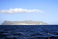
Ilhéu Raso
- Area
- 5.7 km²
- High point
- 140 m
Ilhéu Branco
- Area
- 2.7 km²
- High point
- 370 m

Ilhéu Grande
- Area
- 2 km²
- High point
- 92 m

Ilhéu de Sal Rei
- Area
- 0.89 km²
- High point
- 21 m

Ilhéu de Cima
- Area
- 0.89 km²
- High point
- 64 m
Islets
- Ilhéu Sapado16 m · 0.04 km²
- Unnamed island0.03 km²
- Ilhéu Rabo de Junco8 m · 0.03 km²
- Ilhéu dos Pássaros3 m · 0.02 km²
- Unnamed island4 m · 0.01 km²
- Unnamed island6 m · 0.9 ha
- Unnamed island0.9 ha
- Unnamed island1 m · 0.8 ha
- Unnamed island0.8 ha
- Unnamed island6 m · 0.7 ha
- Unnamed island0.7 ha
- Unnamed island0.7 ha
Rocks & skerries
- Ilhéu Luís Carneiro25 m · 0.07 km²
- Ilhéu de Santa Maria15 m · 0.06 km²
- Ilhéu do Rei22 m · 0.04 km²
- Ilheu do Roque5 m · 0.02 km²
- Ilhéu de Baluarte3 m · 0.01 km²
- Unnamed island<0.1 ha
- Unnamed island<0.1 ha
- Unnamed island<0.1 ha
- Unnamed island<0.1 ha
- Unnamed island<0.1 ha
- Unnamed island<0.1 ha
- Unnamed island<0.1 ha
Figures
Comparative heights
- Fogo: 2,829 m
- Santo Antão: 1,979 m
- Santiago: 1,394 m
- São Nicolau: 1,312 m
- Brava: 976 m
- São Vicente: 750 m
- Maio: 436 m
- Sal: 406 m
- Santa Luzia: 397 m
- Boa Vista: 390 m
- Ilhéu Branco: 370 m
- Ilhéu Raso: 140 m
- Ilhéu Grande: 92 m
- Ilhéu de Cima: 64 m
To the same scale
Islands by area
| Santiago | 1,001 km² |
| Santo Antão | 784 km² |
| Boa Vista | 631 km² |
| Fogo | 471 km² |
| São Nicolau | 345 km² |
| Maio | 273 km² |
| São Vicente | 225 km² |
| Sal | 220 km² |
| Brava | 62.5 km² |
| Santa Luzia | 34.5 km² |
| Ilhéu Raso | 5.7 km² |
| Ilhéu Branco | 2.7 km² |
| Ilhéu Grande | 2 km² |
| Ilhéu de Sal Rei | 0.89 km² |
| Ilhéu de Cima | 0.89 km² |
| Ilhéu Luís Carneiro | 0.07 km² |
| Ilhéu de Santa Maria | 0.06 km² |
| Ilhéu do Rei | 0.04 km² |
| Ilhéu Sapado | 0.04 km² |
| Unnamed island | 0.03 km² |
| Ilhéu Rabo de Junco | 0.03 km² |
| Ilhéu dos Pássaros | 0.02 km² |
| Ilheu do Roque | 0.02 km² |
| Ilhéu de Baluarte | 0.01 km² |
| Unnamed island | 0.01 km² |
| Unnamed island | 0.9 ha |
| Unnamed island | 0.9 ha |
| Unnamed island | 0.8 ha |
| Unnamed island | 0.8 ha |
| Unnamed island | 0.7 ha |
| Unnamed island | 0.7 ha |
| Unnamed island | 0.7 ha |
| Ilhéu dos Pássaros (Boa Vista) | 0.6 ha |
| Ilhéu dos Alcatrazes | 0.6 ha |
| Ilhéu Derrubado | 0.5 ha |
| Unnamed island | 0.5 ha |
| Ilhéu Holandês | 0.5 ha |
| Ilhéu de Curral Velho and adjacent coast Important Bird Area | 0.4 ha |
| Ilhéu Laja Branca | 0.4 ha |
| Unnamed island | 0.4 ha |
| Unnamed island | 0.4 ha |
| Unnamed island | 0.3 ha |
| Unnamed island | 0.3 ha |
| Ilheu do Porto Ferreira | 0.3 ha |
| Unnamed island | 0.3 ha |
| Unnamed island | 0.3 ha |
| Unnamed island | 0.3 ha |
| Unnamed island | 0.2 ha |
| Unnamed island | 0.2 ha |
| Unnamed island | 0.2 ha |
| Unnamed island | 0.2 ha |
| Unnamed island | 0.2 ha |
| Unnamed island | 0.2 ha |
| Ilhéu Zinho | 0.2 ha |
| Unnamed island | 0.2 ha |
| Unnamed island | 0.2 ha |
| Unnamed island | 0.2 ha |
| Unnamed island | 0.1 ha |
| Unnamed island | 0.1 ha |
| Unnamed island | 0.1 ha |
| Unnamed island | 0.1 ha |
| Unnamed island | 0.1 ha |
| Unnamed island | 0.1 ha |
| Unnamed island | <0.1 ha |
| Unnamed island | <0.1 ha |
| Unnamed island | <0.1 ha |
| Unnamed island | <0.1 ha |
| Unnamed island | <0.1 ha |
| Unnamed island | <0.1 ha |
| Unnamed island | <0.1 ha |
| Unnamed island | <0.1 ha |
| Unnamed island | <0.1 ha |
| Unnamed island | <0.1 ha |
| Unnamed island | <0.1 ha |
| Unnamed island | <0.1 ha |
| Unnamed island | <0.1 ha |
| Unnamed island | <0.1 ha |
| Unnamed island | <0.1 ha |
| Unnamed island | <0.1 ha |
| Unnamed island | <0.1 ha |
| Unnamed island | <0.1 ha |
| Unnamed island | <0.1 ha |
| Unnamed island | <0.1 ha |
| Unnamed island | <0.1 ha |
| Unnamed island | <0.1 ha |
| Unnamed island | <0.1 ha |
| Ilheú do Curral do Dadó | <0.1 ha |
| Unnamed island | <0.1 ha |
| Unnamed island | <0.1 ha |
| Unnamed island | <0.1 ha |
| Unnamed island | <0.1 ha |
| Unnamed island | <0.1 ha |
| Unnamed island | <0.1 ha |
| Unnamed island | <0.1 ha |
| Unnamed island | <0.1 ha |
| Unnamed island | <0.1 ha |
| Unnamed island | <0.1 ha |
| Unnamed island | <0.1 ha |
| Unnamed island | <0.1 ha |
| Unnamed island | <0.1 ha |
| Unnamed island | <0.1 ha |
| Unnamed island | <0.1 ha |
| Unnamed island | <0.1 ha |
| Unnamed island | <0.1 ha |
| Unnamed island | <0.1 ha |
| Unnamed island | <0.1 ha |
| Unnamed island | <0.1 ha |
| Unnamed island | <0.1 ha |
| Unnamed island | <0.1 ha |
| Unnamed island | <0.1 ha |
| Unnamed island | <0.1 ha |
| Unnamed island | <0.1 ha |
| Unnamed island | <0.1 ha |
| Unnamed island | <0.1 ha |
| Unnamed island | <0.1 ha |
| Unnamed island | <0.1 ha |
| Unnamed island | <0.1 ha |
| Unnamed island | <0.1 ha |
| Unnamed island | <0.1 ha |
| Unnamed island | <0.1 ha |
| Unnamed island | <0.1 ha |
| Unnamed island | <0.1 ha |
| Unnamed island | <0.1 ha |
| Unnamed island | <0.1 ha |
| Unnamed island | <0.1 ha |
| Unnamed island | <0.1 ha |
| Unnamed island | <0.1 ha |
| Unnamed island | <0.1 ha |
| Unnamed island | <0.1 ha |
| Unnamed island | <0.1 ha |
| Unnamed island | <0.1 ha |
| Unnamed island | <0.1 ha |
| Unnamed island | <0.1 ha |
| Unnamed island | <0.1 ha |
| Unnamed island | <0.1 ha |
| Unnamed island | <0.1 ha |
| Unnamed island | <0.1 ha |
| Unnamed island | <0.1 ha |
| Unnamed island | <0.1 ha |
| Unnamed island | <0.1 ha |
| Unnamed island | <0.1 ha |
| Unnamed island | <0.1 ha |
| Unnamed island | <0.1 ha |
| Unnamed island | <0.1 ha |
| Unnamed island | <0.1 ha |
| Unnamed island | <0.1 ha |
| Unnamed island | <0.1 ha |
| Unnamed island | <0.1 ha |
| Unnamed island | <0.1 ha |
| Unnamed island | <0.1 ha |
| Unnamed island | <0.1 ha |
| Unnamed island | <0.1 ha |
| Unnamed island | <0.1 ha |
| Unnamed island | <0.1 ha |
| Unnamed island | <0.1 ha |
| Unnamed island | <0.1 ha |
| Unnamed island | <0.1 ha |
| Unnamed island | <0.1 ha |
| Unnamed island | <0.1 ha |
| Unnamed island | <0.1 ha |
| Unnamed island | <0.1 ha |
| Unnamed island | <0.1 ha |
| Unnamed island | <0.1 ha |
| Unnamed island | <0.1 ha |
| Unnamed island | <0.1 ha |
| Unnamed island | <0.1 ha |
| Unnamed island | <0.1 ha |
| Unnamed island | <0.1 ha |
| Unnamed island | <0.1 ha |
| Unnamed island | <0.1 ha |
| Unnamed island | <0.1 ha |
| Unnamed island | <0.1 ha |
| Unnamed island | <0.1 ha |
| Unnamed island | <0.1 ha |
| Unnamed island | <0.1 ha |
| Unnamed island | <0.1 ha |
| Unnamed island | <0.1 ha |
| Unnamed island | <0.1 ha |
| Unnamed island | <0.1 ha |
| Unnamed island | <0.1 ha |
| Unnamed island | <0.1 ha |
| Unnamed island | <0.1 ha |
| Unnamed island | <0.1 ha |
| Unnamed island | <0.1 ha |
| Unnamed island | <0.1 ha |
| Unnamed island | <0.1 ha |
| Unnamed island | <0.1 ha |
| Unnamed island | <0.1 ha |
Groups within
Photographs

Blick auf die kapverdische Insel Sal von Süden. In der weiten Bucht in der linken unteren Bildhälfte liegt das Dorf Santa Maria.

Coastline Santo Antão

Aerial view of Maio

São Vicente Island, Cape Verde. The beach of Praia Grande and Monte Verde in the background Photo taken by Henryk Kotowski in November 2005.

satellite image of the Cape Verde Islands

Cape Verde, island of Santiago: landscape with gardens in the approximate center of the island.

U.S. Navy photo by Petty Officer 2nd Class Daemon Pellegran / Public domain

Le bar Cabala à Tantum au Cap-Vert.

Barragem de faveta

U.S. Navy photo by Chief Petty Officer Joseph Buliavac / Public domain

U.S. Navy photo by Chief Petty Officer Joseph Buliavac / Public domain

Blue sky with clouds above trees
Sources
Facts
Photographs
- Sal SantaMaria. Martikkk / CC BY-SA 3.0
- Coastline Santo Antao. Konstantin Krismer / CC BY 3.0
- V DSC00097. Xandu / Public domain
- Calhau. Kotoviski (Henryk Kotowski) / CC BY-SA 3.0
- Satellite image of Cape Verde in December 2002. NASA's Visible Earth / Public domain
- Cape Verde Santiago landscape 2011. Cayambe / CC BY-SA 3.0
- AMFS 2026 cultural gift exchange with Cabo Verde (9824310). U.S. Navy photo by Petty Officer 2nd Class Daemon Pellegran / Public domain
- Bar Cabala à Tantum - Cap-Vert 1. Alacoolwiki / CC BY-SA 4.0
- Barragem de faveta. Wilson Vaz Fernandes / CC BY-SA 4.0
- Cabo Verde Chief of Defense Visits Obangame Express 2025 Exercise Control Group (9037887). U.S. Navy photo by Chief Petty Officer Joseph Buliavac / Public domain
- Cabo Verde Chief of Defense Visits Obangame Express 2025 Exercise Control Group (9037888). U.S. Navy photo by Chief Petty Officer Joseph Buliavac / Public domain
- Céu de Anil com Nuvens sobre árvores. Lenilda Duarte / CC0