Atlantic OceanSpain
28°00′N 15°30′W
Canary Islands
Islas Canarias
The Canary Islands ( ; Spanish: Canarias [kaˈnaɾjas] ) or Canaries are an archipelago in the Atlantic Ocean and the southernmost autonomous community of Spain, located about 100 kilometres (60 mi) off the northwest coast of Africa.

Chart
Overview
The Canary Islands ( ; Spanish: Canarias [kaˈnaɾjas] ) or Canaries are an archipelago in the Atlantic Ocean and the southernmost autonomous community of Spain, located about 100 kilometres (60 mi) off the northwest coast of Africa. The archipelago has a population of over 2.2 million inhabitants, making it the most populous overseas special territory of the European Union. The seven main islands, listed from largest to smallest by area, are Tenerife, Fuerteventura, Gran Canaria, Lanzarote, La Palma, La Gomera, and El Hierro. The only other inhabited island is La Graciosa, which is administratively dependent on Lanzarote. The archipelago also includes numerous smaller islands and islets, such as Alegranza, Isla de Lobos, Montaña Clara, Roque del Oeste, and Roque del Este, as well as various rocks, including Garachico and Anaga. Historically, the island chain was referred to as "the Fortunate Isles". The Canary Islands are the southernmost and westernmost region of Spain as well as the largest and most populous archipelago of Macaronesia. They are also the largest and most populated archipelago in Spain. Owing to their strategic location, the Canary Islands have long been considered a link between Africa, Europe, and the Americas. As of 2025, the Canary Islands had a population of 2,258,866 an area of 7,445.58 square kilometres (2,874.75 sq mi), with a density of 303 inhabitants per km2, making them the 7th most populous autonomous community in Spain, the 13th-largest in area, and the 3rd-highest in population density, behind only Madrid and the Basque Country. The population is mostly concentrated on the two capital islands, with around 43% on Tenerife and 39% on Gran Canaria. In 2026, the Canary Islands are expected to have a nominal GDP of €64.123 billion, resulting in a GDP per capita of €28,272. The Canary Islands, especially Tenerife, Gran Canaria, Fuerteventura, and Lanzarote, are a major tourist destination, with over 14.1 million visitors in 2023. This is due to their beaches, subtropical climate, and important natural attractions, especially Maspalomas in Gran Canaria and Mount Teide, a World Heritage Site in Tenerife. Mount Teide is the highest peak in Spain and the 3rd tallest volcano in the world, measured from its base on the ocean floor. The islands have warm summers and winters warm enough for the climate to be technically tropical at sea level. The amount of precipitation and the level of maritime moderation vary depending on location and elevation. The archipelago includes green areas as well as semi-desert. The islands' high mountains are ideal for astronomical observation, because they lie above the temperature inversion layer. As a result, the archipelago has two professional astronomical observatories: the Teide Observatory on Tenerife, and Roque de los Muchachos Observatory on La Palma. In 1927, the Province of Canary Islands was split into two provinces, Santa Cruz de Tenerife and Las Palmas. In 1982, the autonomous community of the Canary Islands was established. The cities of Santa Cruz de Tenerife and Las Palmas de Gran Canaria are, jointly, the capitals of the islands. Those cities are also, respectively, the capitals of the provinces of Santa Cruz de Tenerife and Las Palmas. Las Palmas de Gran Canaria has been the largest city in the Canaries since 1768, except for a brief period in the 1910s. Between the 1833 territorial division of Spain and 1927, Santa Cruz de Tenerife was the sole capital of the Canary Islands. In 1927, it was ordered by decree that the capital of the Canary Islands would be shared between two cities, and this arrangement persists to the present day. The third largest city in the Canary Islands is San Cristóbal de La Laguna, another World Heritage Site on Tenerife. During the Age of Sail, the islands were the main stopover for Spanish galleons during the Spanish colonisation of the Americas, which sailed that far south in order to catch the prevailing northeasterly trade winds.
From Wikipedia, CC BY-SA 4.0
Census, cataloged
- Major islands8
- Minor islands3
- Islets81
- Rocks & skerries277
Major islands
Tenerife
- Area
- 2,035 km²
- High point
- 3,715 m
Tenerife ( TEN-ə-REEF-(ay); Spanish: [teneˈɾife] ; formerly spelled Teneriffe) is the largest and most-populous island of the Canary Islands, an autonomous community of Spain, located in the Atlantic Ocean off the northwestern coast of Africa.
Fuerteventura
- Area
- 1,655 km²
- High point
- 812 m
Fuerteventura (Spanish: [ˌfweɾteβenˈtuɾa] ) is one of the Canary Islands, in the Atlantic Ocean, geographically part of Macaronesia, and politically part of Spain. It is located 97 km (60 mi) away from the coast of North Africa. The island was declared a biosphere reserve by UNESCO in 2009.
Gran Canaria
- Area
- 1,563 km²
- High point
- 1,956 m
Gran Canaria (UK: , US: ; Spanish: [ɡɾaŋ kaˈnaɾja] ), also Grand Canary Island, is the third-largest and second-most-populous island of the Canary Islands, a Spanish archipelago off the Atlantic coast of Northwest Africa.
Lanzarote
- Area
- 807 km²
- High point
- 674 m
Lanzarote (UK: , US: , Spanish: [lanθaˈɾote] , locally [lansaˈɾote]) is a Spanish island, the easternmost of the Canary Islands, 125 kilometres (80 miles) off the north coast of Africa and 1,000 kilometres (600 miles) from the Iberian Peninsula.
La Palma
- Area
- 707 km²
- High point
- 2,426 m
La Palma (Spanish pronunciation: [la ˈpalma] , locally [lɐ ˈpɑ(l)mɐ]), also known as La isla bonita and historically San Miguel de La Palma, is the most northwesterly island of the Canary Islands, a Spanish autonomous community and archipelago in Macaronesia in the North Atlantic Ocean.
La Gomera
- Area
- 368 km²
- High point
- 1,484 m
La Gomera (Spanish: [la ɣoˈmeɾa] ) is one of Spain's Canary Islands, in the Atlantic Ocean off the coast of Africa. 87 sq mi), it is the third-smallest of the archipelago's eight main islands. It belongs to the province of Santa Cruz de Tenerife.
El Hierro
- Area
- 267 km²
- High point
- 1,501 m
El Hierro, nicknamed Isla del Meridiano, is the southernmost and westernmost of the Canary Islands (an autonomous community of Spain), in the Atlantic Ocean off the coast of Africa, with a population of 11,659 (2023). Its capital is Valverde.
Lobos Island
- Area
- 4.5 km²
- High point
- 127 m
Lobos is a small island of the Canary Islands (Spain) located just two kilometres (one nautical mile) north of the island of Fuerteventura. It belongs to the municipality of La Oliva on the island of Fuerteventura. 8 sq mi). It has been a nature reserve (Parque Natural del Islote de Lobos) since 1982.


Minor islands

Graciosa
- Area
- 26.9 km²
- High point
- 267 m
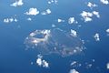
Alegranza
- Area
- 10.1 km²
- High point
- 293 m

Montaña Clara
- Area
- 1.3 km²
- High point
- 255 m
Rocks & skerries
On the chart above, at its closest zooms.
Listing 11 of 369; the rest are on the chart.
Figures
Comparative heights
- Tenerife: 3,715 m
- La Palma: 2,426 m
- Gran Canaria: 1,956 m
- El Hierro: 1,501 m
- La Gomera: 1,484 m
- Fuerteventura: 812 m
- Lanzarote: 674 m
- Alegranza: 293 m
- Graciosa: 267 m
- Montaña Clara: 255 m
- Lobos: 127 m
To the same scale
Islands by area
| Tenerife | 2,035 km² |
| Fuerteventura | 1,655 km² |
| Gran Canaria | 1,563 km² |
| Lanzarote | 807 km² |
| La Palma | 707 km² |
| La Gomera | 368 km² |
| El Hierro | 267 km² |
| Graciosa | 26.9 km² |
| Alegranza | 10.1 km² |
| Lobos Island | 4.5 km² |
| Montaña Clara | 1.3 km² |
Groups within
Photographs

Barranco de la Arena near Puerto de la Cruz

Viticulture near Tiagua, Municipio de Teguise, Lanzarote, Canary Islands, Spain.

NASA Goddard Space Flight Center from Greenbelt, MD, USA / Public domain

Roque de la Zarcita and Roque de Ojila, San Sebastián de La Gomera, La Gomera, Canary Islands, Spain.

Huevos del Teide with Cumbre Dorsal / Tenerife, Spain

Rock formation north of Ayacata, Tejeda, Gran Canaria, Canary Islands, Spain. On the right side the so called "El Monje" or "El Fraile" (The Monk).

Camino Natural de Anaga - Chasna

Camino Natural de Anaga - Chasna

Camino Natural por los senderos tradicionales de El Hierro

Vistas desde el Camino Natural por los senderos tradicionales de El Hierro.

Camino Natural de Fuerteventura

Manifestación del 18 de Mayo (18-M) en Canarias, en Santa Cruz de Tenerife
Sources
Facts
Photographs
- Barranco de la Arena. TenSob / CC BY 4.0
- Vineyard - Tiagua. H. Zell / CC BY-SA 3.0
- Canary Islands (6630087415). NASA Goddard Space Flight Center from Greenbelt, MD, USA / Public domain
- Roque de la Zarcita - Roque de Ojila - La Gomera 02. Llez / CC BY-SA 3.0
- Huevos del Teide, Cumbre Dorsal. Ingo Mehling / CC BY-SA 4.0
- Rocks - Ayacata. H. Zell / CC BY-SA 3.0
- Camino Natural de Anaga - Chasna09 0057. DivulgacionCCNN / CC BY-SA 4.0
- Camino Natural de Anaga - Chasna09 0149. DivulgacionCCNN / CC BY-SA 4.0
- Camino Natural de El Hierro 03 1929A. DivulgacionCCNN / CC BY-SA 4.0
- Camino Natural de El Hierro 03 2086A. DivulgacionCCNN / CC BY-SA 4.0
- Camino Natural de Fuerteventura11 0387A. DivulgacionCCNN / CC BY-SA 4.0
- Manifestación 18 de Mayo en Canarias. Soyneutral / CC BY-SA 4.0