Atlantic OceanIreland
52°05′N 10°33′W
Blasket Islands
The Blasket Islands (Irish: Na Blascaodaí) are an uninhabited group of islands off the west coast of the Dingle Peninsula in County Kerry, Ireland.

Chart
Overview
The Blasket Islands (Irish: Na Blascaodaí) are an uninhabited group of islands off the west coast of the Dingle Peninsula in County Kerry, Ireland. The last island to hold a significant population, Great Blasket Island, was abandoned in 1954 due to population decline and is best known for a number of Irish language writers who vividly described their way of life and who kept alive old Irish folk tales of the land.
From Wikipedia, CC BY-SA 4.0
Census, cataloged
- Major islands3
- Minor islands2
- Islets8
- Rocks & skerries30
Major islands
Great Blasket Island
- Area
- 4.5 km²
- High point
- 346 m
The Great Blasket (Irish: An Blascaod Mór) is the principal island of the Blaskets, County Kerry, Ireland. It was home to a small fishing community of Irish speakers until the island was evacuated in 1953 when living there became unsustainable.
Inishtooskert
- Area
- 0.97 km²
- High point
- 226 m
Inis Tuaisceart (sometimes spelled Inishtooshkert) (Inis Tuaisceart in Irish) is the northernmost of the Blasket Islands, County Kerry, Ireland.
Inishvickillane
- Area
- 0.81 km²
- High point
- 132 m
Inishvickillane or Inishvickillaun (from Irish Inis Mhic Aoibhleáin meaning 'Mac Killane's island') is one of the Blasket Islands of County Kerry, Ireland.


Minor islands

Inis na Bró
- Area
- 0.49 km²
- High point
- 229 m
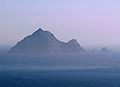
Tearaght Island
- Area
- 0.23 km²
- High point
- 254 m
Islets
- Thunder Rock0.02 km²
- Carrigduff6 m · 0.01 km²
- Inishvickillane Rocks1 m · 0.5 ha
- Minnaun Rock3 m · 0.2 ha
- Minnauncushaboy0.1 ha
- Unnamed island4 m · 0.1 ha
- Unnamed island0.1 ha
- Unnamed island2 m · 0.1 ha
Rocks & skerries
- Tearaght Rocks4 m · 0.01 km²
- Tearaght Rocks0.2 ha
- Puffin Rock0.1 ha
- Unnamed island<0.1 ha
- Unnamed island<0.1 ha
- Unnamed island<0.1 ha
- Unnamed island<0.1 ha
- Unnamed island<0.1 ha
- Unnamed island<0.1 ha
- Unnamed island<0.1 ha
- Unnamed island<0.1 ha
- Unnamed island<0.1 ha
Figures
Comparative heights
- Great Blasket: 346 m
- Tearaght: 254 m
- Inis na Bró: 229 m
- Inishtooskert: 226 m
- Inishvickillane: 132 m
- Carrigduff: 6 m
- Tearaght Rocks: 4 m
- Minnaun Rock: 3 m
- Inishvickillane Rocks: 1 m
To the same scale
Islands by area
| Great Blasket Island | 4.5 km² |
| Inishtooskert | 0.97 km² |
| Inishvickillane | 0.81 km² |
| Inis na Bró | 0.49 km² |
| Tearaght Island | 0.23 km² |
| Thunder Rock | 0.02 km² |
| Carrigduff | 0.01 km² |
| Tearaght Rocks | 0.01 km² |
| Inishvickillane Rocks | 0.5 ha |
| Tearaght Rocks | 0.2 ha |
| Minnaun Rock | 0.2 ha |
| Minnauncushaboy | 0.1 ha |
| Puffin Rock | 0.1 ha |
| Unnamed island | 0.1 ha |
| Unnamed island | 0.1 ha |
| Unnamed island | 0.1 ha |
| Unnamed island | <0.1 ha |
| Unnamed island | <0.1 ha |
| Unnamed island | <0.1 ha |
| Unnamed island | <0.1 ha |
| Unnamed island | <0.1 ha |
| Unnamed island | <0.1 ha |
| Unnamed island | <0.1 ha |
| Unnamed island | <0.1 ha |
| Unnamed island | <0.1 ha |
| Unnamed island | <0.1 ha |
| Milkaunmore | <0.1 ha |
| Minnaunatorney | <0.1 ha |
| Unnamed island | <0.1 ha |
| Unnamed island | <0.1 ha |
| Illaungarriff | <0.1 ha |
| Unnamed island | <0.1 ha |
| Black Rock | <0.1 ha |
| Unnamed island | <0.1 ha |
| Unnamed island | <0.1 ha |
| Unnamed island | <0.1 ha |
| Low Rock | <0.1 ha |
| Gull Rock | <0.1 ha |
| Unnamed island | <0.1 ha |
| Unnamed island | <0.1 ha |
| Unnamed island | <0.1 ha |
| Reennaweelaun Rock | <0.1 ha |
| Unnamed island | <0.1 ha |
Photographs


Slea Head Drive - Slea Head mit Blasket Islands

Blasket Island from Dingle Peninsula

Blasket Island from Dingle Peninsula

Photo of the Blasket Islands

Photo of the Blasket Islands


Clogher Head - taken during a road trip to Ireland in 2024 by Thomas Fuhrmann, SnowmanStudios - see more pictures on www.snowmanstudios.de

Clogher Head - taken during a road trip to Ireland in 2024 by Thomas Fuhrmann, SnowmanStudios - see more pictures on www.snowmanstudios.de

underway on Dingle Peninsula, County Kerry, Ireland

underway on Dingle Peninsula, County Kerry, Ireland
Sources
Facts
Photographs
- Dunmore-Head-and-Blasket-Islands. Bjørn Christian Tørrissen / CC BY-SA 3.0
- Cé Dhún Chaoin Dunquin Pier 02. Dieglop / CC BY-SA 4.0
- 2019-07-23-Slea Head-6612. Superbass / CC BY-SA 4.0
- Blasket Island from Dingle Peninsula 0003. Dieglop / CC BY-SA 4.0
- Blasket Island from Dingle Peninsula 0002. Dieglop / CC BY-SA 4.0
- Blasket Islands 0001. Dieglop / CC BY-SA 4.0
- Blasket Islands 0002. Dieglop / CC BY-SA 4.0
- Cé Dhún Chaoin Dunquin Pier. Dieglop / CC BY-SA 4.0
- Clogher Head 01. Thomas Fuhrmann / CC BY-SA 4.0
- Clogher Head 02. Thomas Fuhrmann / CC BY-SA 4.0
- Dingle Pensinsula Dingle Peninsula 15. Zairon / CC BY 4.0
- Dingle Pensinsula Dingle Peninsula 19. Zairon / CC BY 4.0