Mozambique
21°45′S 35°27′E
Bazaruto Archipelago
Arquipélago de Bazaruto
The Bazaruto Archipelago (Portuguese pronunciation: [bazaˈɾutu]) is a group of six islands in Mozambique, near the mainland city of Vilankulo. It comprises the islands of Bazaruto, Benguerra, Magaruque, Santa Carolina and Bangué.

Chart
Overview
The Bazaruto Archipelago (Portuguese pronunciation: [bazaˈɾutu]) is a group of six islands in Mozambique, near the mainland city of Vilankulo. It comprises the islands of Bazaruto, Benguerra, Magaruque, Santa Carolina and Bangué.
From Wikipedia, CC BY-SA 4.0
Census, cataloged
- Major islands2
- Minor islands3
- Islets0
- Rocks & skerries0
Major islands
Benguerra Island
- Area
- 23.9 km²
- High point
- 53 m
Bazaruto
- Area
- 96.2 km²
- High point
- 110 m
Minor islands
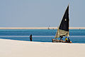
Magaruque Island
- Area
- 1.8 km²
- High point
- 50 m
Santa Carolina
- Area
- 0.57 km²
- High point
- 16 m
Ilha Bangue
- Area
- 0.17 km²
- High point
- 5 m
Figures
Comparative heights
- Bazaruto: 110 m
- Benguerra: 53 m
- Magaruque: 50 m
- Santa Carolina: 16 m
- Ilha Bangue: 5 m
To the same scale
Islands by area
| Bazaruto | 96.2 km² |
| Benguerra Island | 23.9 km² |
| Magaruque Island | 1.8 km² |
| Santa Carolina | 0.57 km² |
| Ilha Bangue | 0.17 km² |
Photographs

view from mainland (Vilankulos) at dawn. Bazaruto Island itself is to the left of the frame (north).

j-cornelius - Flickr


The Bazaruto Archipelago off the coast of Mozambique is pictured from the International Space Station as it orbited 265 miles above the African nation.


Zodiac back to Olympic Countess

Olympic Countess, the ship for the eclipse, from a Zodiac to Bazaruto Island, Mozambique
Sources
Facts
Photographs
- View east towards a Bazaruto Archipelago island. Brian DellBdell555 (talk) / Public domain
- Bazaruto - III (23846085349). Cornelius Kibelka from Berlin, Germany / CC BY-SA 2.0
- Bazaruto Archipelago National Park (154448 - oli2 20240803 lrg). NASA Earth Observatory images by Wanmei Liang, using Landsat data from the U.S. Geological Survey. Story by Kathryn Hans / Public domain
- ISS-65 Bazaruto Archipelago, Mozambique. NASA / Public domain
- Bazaruto Archipelago National Park, Mozambique. European Union, Copernicus Sentinel-2 imagery / Attribution
- Olympiccountess bazarutomozambique (3103644711). MeRyan / CC BY 2.0
- Olympiccountess bazarutomozambique (3103641945). MeRyan / CC BY 2.0